Trustindex verifies that the original source of the review is Google.
Desert Drones is fantastic to work with! They do an incredible job bringing our vision to life and capturing our projects in a way that truly showcases the work being done. Highly recommend their team. Thanks again, Desert Drones!
brooke ryan
Trustindex verifies that the original source of the review is Google.
Desert Drones is awesome to work with! They help bring our vision to life and showcase our work in the best way possible. Highly recommend them to anyone looking for quality drone services. Thanks, Desert Drones!
Frank Segarra
Trustindex verifies that the original source of the review is Google.
John and team are the consummate professionals! Very reliable, quick, and high quality deliverables!
Stephen Cook
Trustindex verifies that the original source of the review is Google.
Professional, efficient, and easy to work with. The team delivered clean, high-quality aerials and communicated clearly throughout the project. One of the best drone service providers we’ve worked with in the Phoenix area.
Greg DeMeritt Jr
Trustindex verifies that the original source of the review is Google.
Needed work done quickly for drone photography. They responded quickly and knew exactly what was required and explained it well. They provided great customer service and got me exactly what I needed, when I needed. Finally found my Drone guys!
Doug Fleming
Trustindex verifies that the original source of the review is Google.
John was a professional and very knowledgeable. He made the process of getting drone footage seamless and did an exceptional job. The speed of completion along with quality of his work was excellent. Highly recommend using them if...
Good JuJu Agency
Trustindex verifies that the original source of the review is Google.
John is true professional. Every time we need some drone photography or videography done John is excited to take on the project. From midnight fireworks displays to busy sections of the city with all kinds of obstacles, working with Desert Drones never fails to hit the mark.
Jesus Figueroa
Trustindex verifies that the original source of the review is Google.
Absolutely amazing experience with Desert Drones. They did a shoot for my business and I must say, they made my product really speak for itself! The aerial shots were stunning and perfectly captured every special moment. John was very professional, punctual, and easy to work with. Highly recommend them for any event coverage—you won’t be disappointed!
Eustolia Schau
Trustindex verifies that the original source of the review is Google.
Great company and amazing aerial photography!
Katie Schwertz
Trustindex verifies that the original source of the review is Google.
John took care of the interior and exterior drone footage for our manufacturing facility in Tucson. He was great to work with! Very knowledgeable, answered all our questions, and shot some great videos. He was also quick to respond to emails and calls throughout the whole process. I would definitely use Desert Drones again in the future.
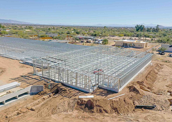
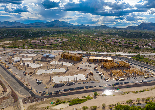
El Paso’s construction market is driven by three powerful forces: Fort Bliss military expansion, growth in the Medical District anchored by University Medical Center and Texas Tech Paso del Norte Health Sciences, and a surge in border logistics and manufacturing facilities serving USMCA trade corridors. At Desert Drones, we provide construction drone services throughout the El Paso metro — giving contractors, developers, and project managers the aerial intelligence they need to build efficiently in West Texas.
Our FAA-certified pilots capture high-resolution aerial photos, 4K video, and precision mapping that improve communication, enhance site safety, and keep your project moving — from the Westside to East El Paso, from Fort Bliss corridors to the Borderland Industrial Park.
Progress Monitoring & Site Documentation
El Paso’s multi-phase construction markets — Fort Bliss housing, Medical District hospital towers, and Westside master-planned communities — demand consistent progress documentation. Our drones make it easy to verify work, confirm subcontractor performance, and catch delays before they escalate. We provide:
Weekly or biweekly aerial site photography for every project phase
4K progress video for lender, owner, and investor updates
Before-and-after comparisons for compliance and RFI documentation
Whether you’re building military housing near Biggs Army Airfield, a commercial center on Transmountain Road, or a warehouse near the Zaragoza Port of Entry, Desert Drones keeps every stakeholder aligned.
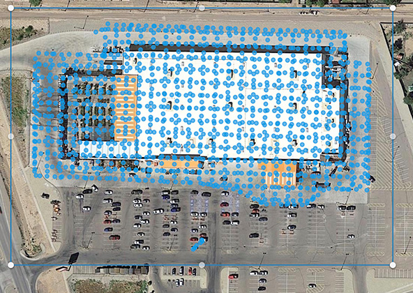
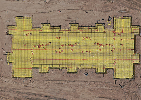
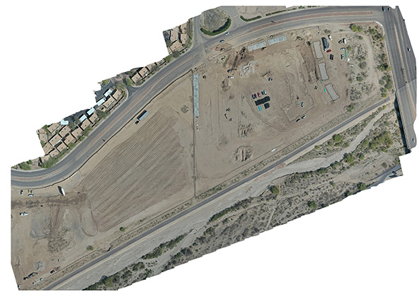
Mapping, Surveying & 3 D Modeling
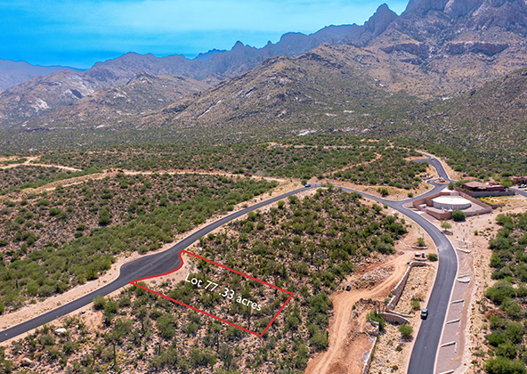
El Paso’s desert basin topography, Franklin Mountain terrain, and border proximity constraints make accurate mapping essential. A 10-foot grading error can derail drainage, violate easements, or create costly rework. Our drone mapping workflow delivers:
Orthomosaic and topographic maps accurate to a few centimeters
3D surface models for grading and drainage analysis
Cut-and-fill volumetric reports to verify earthwork quantities
Geo-referenced data compatible with Civil 3D, Revit, and GIS platforms
Contractors in Socorro, Anthony, and Canutillo rely on our aerial surveys to validate site conditions before breaking ground and during critical earthwork phases.
Safety Inspections & Risk Mitigation
El Paso construction sites face specific safety challenges: extreme desert heat exceeding 100°F, high-wind corridors through mountain passes, and the added complexity of operating near Fort Bliss airspace and international border zones. Desert Drones is fully FAA-certified and experienced with LAANC authorizations for controlled airspace near Biggs Army Airfield and El Paso International Airport.
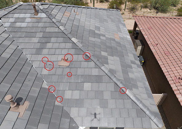
Remote roof, scaffold, and high-structure inspections — no personnel climbing required
Thermal imaging to detect heat-related structural hazards and electrical issues
OSHA compliance documentation for military installation contractors
By keeping crews on the ground during inspections, we reduce heat-related injuries and liability exposure on every site.
Time-Lapse Flights & Stakeholder Reporting
Fort Bliss housing phases, Medical District hospital expansions, and multi-year distribution park builds all benefit from consistent aerial time-lapse documentation. Investors, lenders, and city planners use our drone footage to:
Track construction milestones and deliver progress reports
Produce marketing videos for pre-leasing logistics and industrial facilities
Create city council and planning commission presentations
We fly consistent GPS-locked routes each visit so your time-lapse footage maintains identical framing across months or years — perfect for phased developments from the East Side to the Upper Valley.
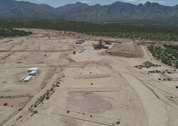
Pre-Construction Planning & Site Validation
Before a single footing is poured, aerial data reduces risk and improves planning in El Paso’s varied terrain — from desert basin flats in the Lower Valley to rocky hillside sites in the Upper Valley and Northeast. Our pre-construction services include:
Terrain slope and drainage analysis to prevent flooding issues
Vegetation, arroyo, and environmental overlay mapping
Easement and boundary visualization for border-adjacent parcels
Existing conditions documentation for permits and financing
El Paso’s proximity to the US-Mexico border creates unique infrastructure constraints — our pre-construction surveys help engineers and planners identify site issues before they become expensive problems.
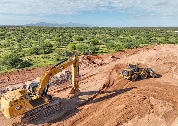
Infrastructure & Large-Scale Projects
El Paso is one of the most strategically important logistics hubs in North America — with border crossing facilities, USMCA manufacturing parks, and military infrastructure all driving large-scale construction demand. Desert Drones supports:
Border logistics warehouses near Tornillo, Fabens, and Santa Teresa ports of entry
Fort Bliss military housing and base expansion projects
Medical District hospital and research facility construction — UMC, The Hospitals of Providence, and Texas Tech Health Sciences
I-10 corridor industrial parks and distribution centers
For large footprint projects, we provide multi-flight mapping programs with scheduled deliverable cadences and dedicated pilot-project manager coordination.
Why Choose Desert Drones for Construction in El Paso, TX
El Paso contractors and developers choose Desert Drones because we understand the unique demands of Borderland construction — desert climate, military airspace, international logistics, and fast-moving federal and commercial development cycles. Here’s why we’re the trusted choice:
FAA Part 107-certified pilots and $2M liability insurance
Authorized to fly near Fort Bliss/Biggs AAF and El Paso International Airport (LAANC certified)
Deliverables within 24–48 hours — photos, 4K video, annotated maps
Familiarity with El Paso’s desert terrain, heat conditions, and airspace constraints
Experience serving the Medical District, East Side, Westside, Upper Valley, and border industrial corridors
Our mission: make your El Paso construction project safer, more efficient, and better documented — from pre-construction to final walkthrough.
Frequently Asked Questions — Construction Drones in El Paso, TX
Most projects benefit from weekly or biweekly flights. Fast-moving phases like Fort Bliss housing framing or Medical District foundation work may benefit from 2–3 flights per week to maintain accurate progress records.
Yes — we are FAA LAANC authorized for controlled airspace operations near Biggs Army Airfield and El Paso International Airport. We coordinate with air traffic authorities and meet all military installation access requirements.
Absolutely. We deliver 3D surface models and cut-and-fill volumetric analysis accurate to a few centimeters, compatible with Civil 3D, Revit, and GIS platforms used by El Paso’s engineering firms.
We schedule flights during optimal morning hours to avoid peak heat and high-wind events common in El Paso’s mountain pass corridors. Our pilots are experienced with West Texas conditions and adjust schedules to deliver safe, accurate data year-round.
Yes. Desert Drones carries $2 million in liability insurance and adheres to FAA Part 107 and OSHA safety standards — including requirements for commercial and military-adjacent construction projects in El Paso.
Licensed & Insured
Desert Drones, LLC is operated by a licensed pilot by the FAA (Federal Aviation Administration), Desert Drones, LLC is licensed & insured up to $2M.
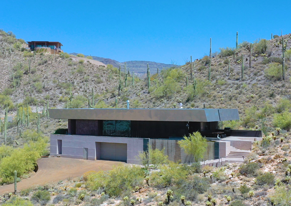
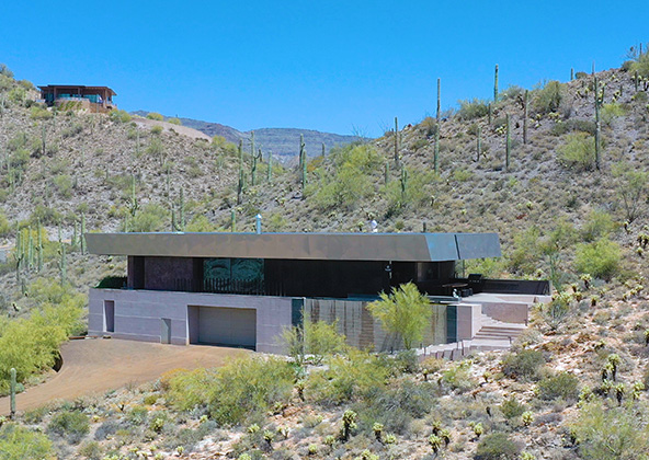
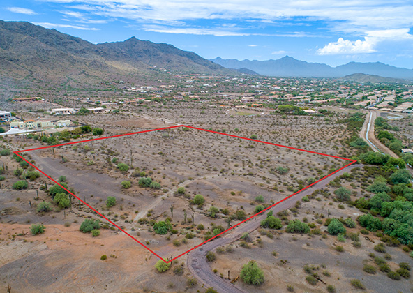
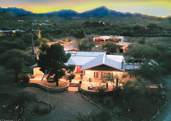
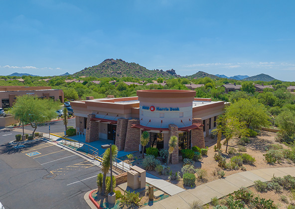
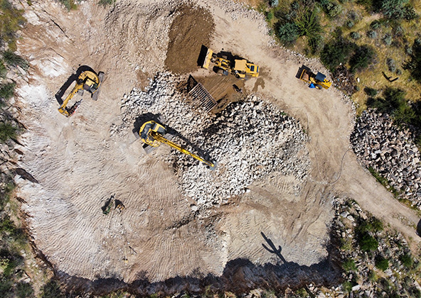
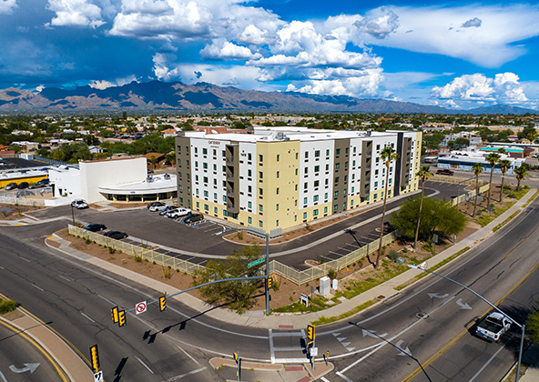
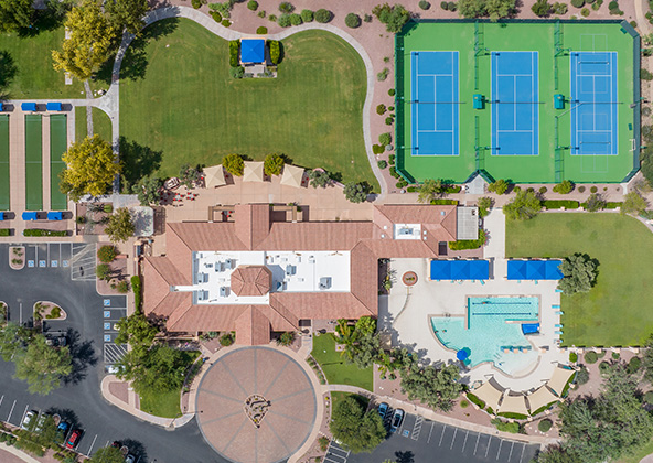
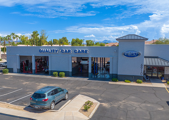
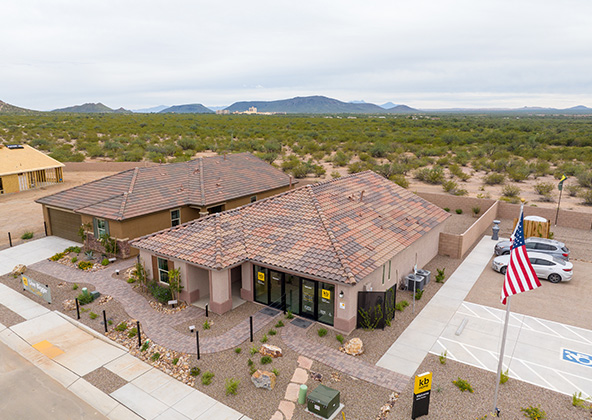
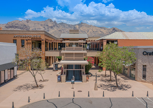
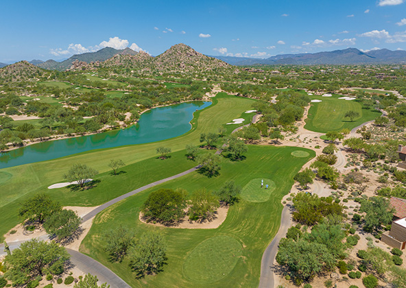
Aerial photography provides a unique perspective. Real estate listings, events, construction progress photos and site surveillance are just a few examples of where you need drones to do the job right.
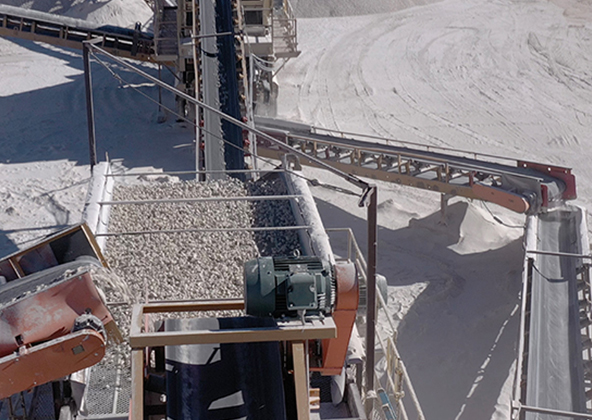
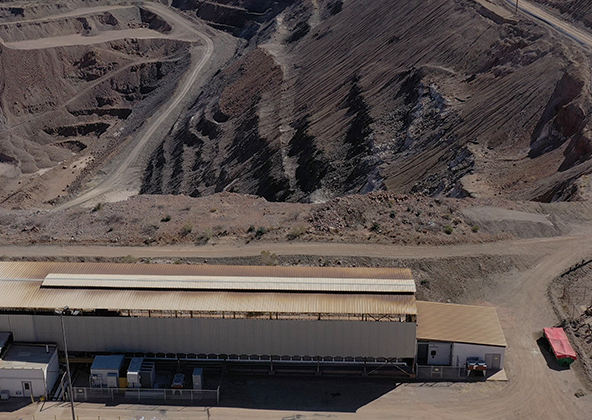
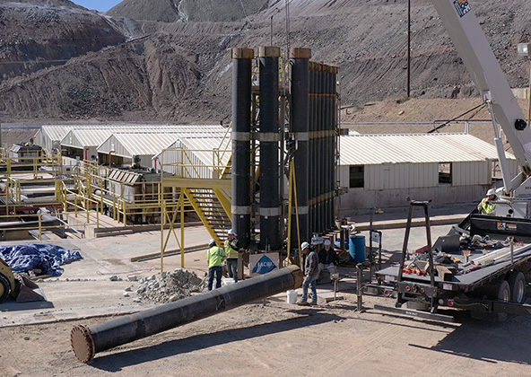
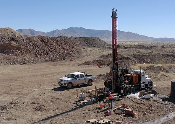
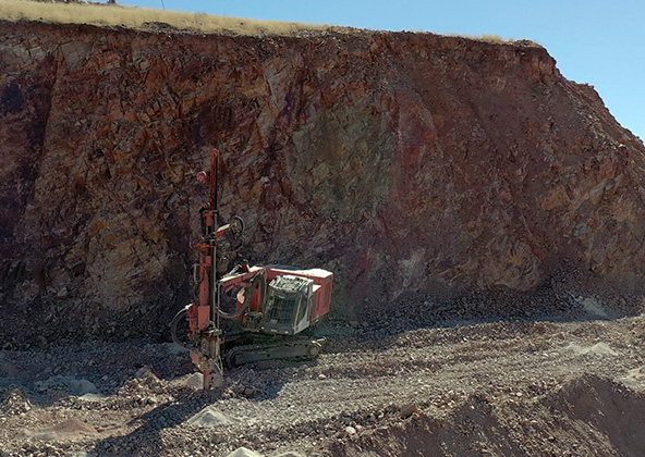
Mining
Aerial photography and videography provide fast and cost effective mapping, documentation, elevation and stockpile calculations to streamline your mining operations.
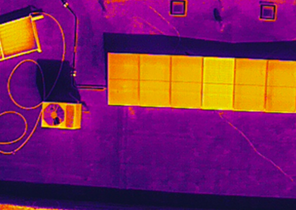
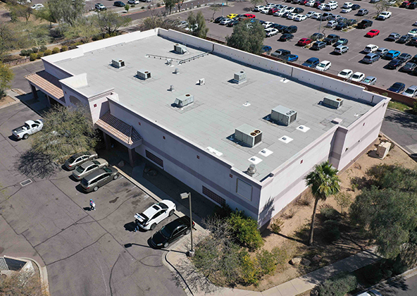
Industrial
Drones are uniquely qualified to capture aerial data for inspections of cellular, electrical, mining, solar and other industrial sites. Providing higher quality data at a lower risk rate than traditional inspections, makes drone services a must on your project.
Events
No matter what kind of event you are having, aerial photography and videography make your audience feel like they are there. Make your advertising, marketing campaign and website stand out with dramatic pictures and videos that only drones can capture.
Licensed & Insured
Desert Drones, LLC is operated by a FAA (Federal Aviation Administration) licensed pilots, Desert Drones, LLC is licensed & insured up to $2M.
Aerial photography and videography provide fast and cost effective mapping, documentation, elevation and stockpile calculations to streamline your mining operations.
Southwest Arizona is a great place for solar. In phoenix and tucson we get over 300 days of sun every year. Let us give you valuable information while your system is still under warranty. Make sure you are getting what you paid for in you PV system.
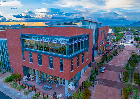
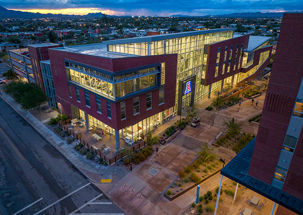
Gallery
MLS aerial drone photos for commercial and residential real estate
drone services for real estate
Aerial Drone Photography for Marketing and Advertising