
High-desert sun by day, hard radiative cooling by night — Albuquerque's climate is built for thermal imaging. Radiometric drone scans read flat roofs, building envelopes, and solar arrays in one flight, and show what's happening under the surface.
FAA Part 107 Certified · Fully Insured · LAANC Authorized · 5.0★ from 271 Google reviews
Desert Drones provides FAA Part 107–certified radiometric thermal drone inspections across the Albuquerque metro — flat-roof and membrane moisture surveys, building envelope and heat-loss scans, solar array anomaly detection, and equipment hot-spot documentation. Every scan is flown for true radiometric data, timed for delta-T conditions, and delivered as annotated imagery your engineer, roofer, or energy consultant can analyze.
Heat doesn't lie — here's what a radiometric scan shows that a walkthrough can't.
Radiometric data and readable findings — not just orange pictures.
Imagery from our radiometric inspection work — arrays, roofs, and the visual baselines that pair with them.
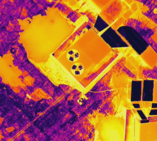
Hot cells, dead strings, and failing equipment across roofs and arrays — found from the air in minutes, not panel-by-panel on a ladder.
SOLAR · ELECTRICAL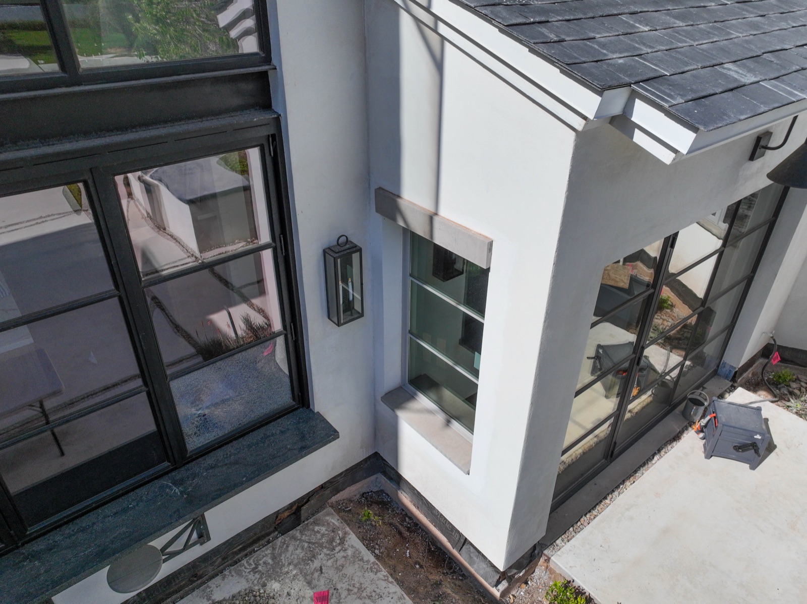
Every thermal frame ships with its visible-light twin — so a hot spot locates to a real penetration, seam, or unit instantly.
PAIRED CAPTURE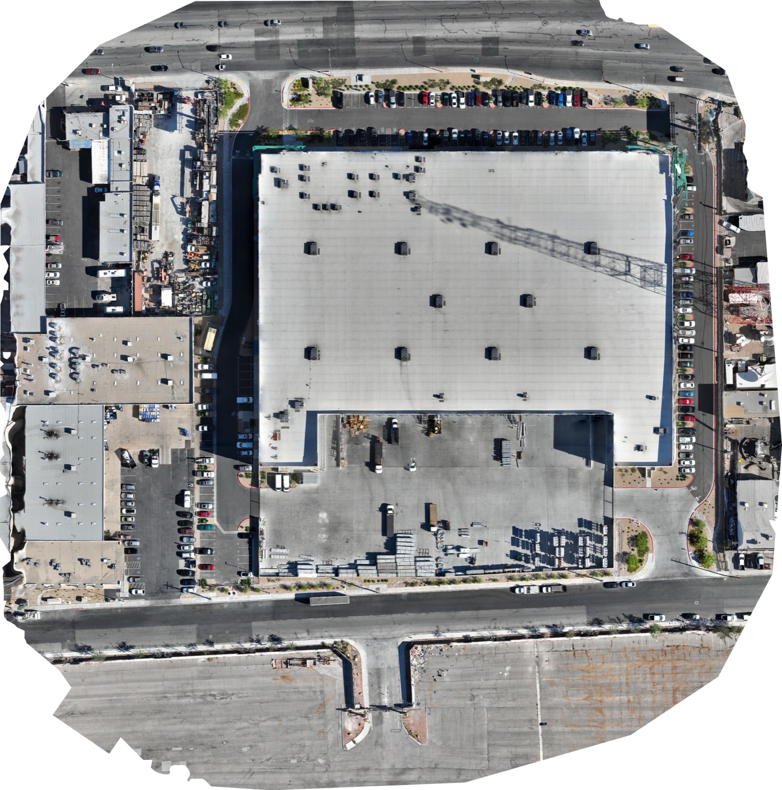
To-scale roof orthos as the baseline layer — the map your consultant marks findings on, flown in the same visit.
ORTHO · BASELINEThermal timing matters at altitude — Albuquerque's high-desert sun loads surfaces fast and sheds heat fast after sunset. We schedule scans for the delta-T window that makes anomalies readable.
Timed, flown, analyzed — here's the path.
Tell us the building, roof, or array and what you suspect — moisture, heat loss, array faults. We scope the flight and the delta-T window.
Radiometric thermal + visible-light capture, timed for conditions (often just after sunset for moisture surveys), LAANC pulled for controlled airspace.
Anomalies marked, imagery annotated, findings summarized — data your consultant can verify.
Radiometric files, paired visuals, and the findings summary by shared link.
The same climate that bakes Albuquerque buildings is what makes thermal so effective here.
Big day-night temperature swings make moisture and insulation defects light up — we fly the window when contrast peaks.
Summer storms drive moisture into flat roofs and envelopes. Thermal finds it before it's interior damage.
One of the sunniest metros in America runs a lot of panels — arrays here earn their thermal scans.
Thermal mass reads differently than frame construction — our pilots time and interpret scans accordingly.
A thermal image is only as good as the pilot's radiometric discipline — emissivity, delta-T timing, and altitude all change what the sensor sees.
Thermal pairs naturally with these — same flight when conditions allow.
Yes — we fly radiometric sensors (every pixel is a temperature measurement), time flights for delta-T conditions, and deliver files your engineer or thermographer can analyze.
Usually just after sunset — wet insulation holds the day's heat while dry roof cools, which is when moisture patterns light up.
It finds the trapped moisture storms leave behind — mapped across the roof before it becomes drywall damage.
Yes — hot cells, dead strings, and bypass-diode failures across residential and commercial arrays, flown in minutes per array.
It affects flight planning more than the sensor — we plan for density altitude and the fast surface-heating the high-desert sun drives.
FAA Part 107 certified and insured with $2M liability coverage, with LAANC authorization pulled for the Sunport/Kirtland Class C.
Rated 5.0★ from 271 verified Google reviews across our locations.
John and team are the consummate professionals! Very reliable, quick, and high quality deliverables!
Professional, efficient, and easy to work with. The team delivered clean, high-quality aerials and communicated clearly throughout the project.
Needed work done quickly for drone photography. They responded quickly, knew exactly what was required, and explained it well — great customer service.
John was a professional and very knowledgeable. He made the process of getting drone footage seamless and did an exceptional job.
Absolutely amazing experience with Desert Drones. They did a shoot for my business and made my product really speak for itself!
John is a true professional. Every time we need drone photography or videography done, he is excited to take on the project.
Tell us the building, roof, or array — we'll scope the scan, time the delta-T window, and get you findings you can act on.