
Phoenix is building faster than almost any metro in the country — and on an active site, the story changes every week. We fly FAA-certified missions that turn that change into a record your lenders and investors can actually read: monthly progress sets, orthomosaic site maps, and earthwork volumetrics.
FAA Part 107 Certified · Fully Insured · LAANC Authorized · 5.0★ from 271 Google reviews
Desert Drones is an FAA Part 107–certified drone services company providing construction progress documentation, orthomosaic site mapping, and earthwork volumetrics for builders, developers, and owners across metro Phoenix and Arizona. We fly active job sites on a recurring schedule — weekly, monthly, or by milestone — and deliver measurable maps, cut/fill volumes, and consistent progress sets within 48 hours.
Every mission is planned around your reporting needs and delivered fast, in formats your team and stakeholders already use.
Every mission comes back as usable data, not a shoebox of photos — formatted so your team, your subs, and your lenders can all work from the same set.
We're on active Phoenix-area construction sites every month — not a stock-photo drone company. A few of the builders and developers we fly for:
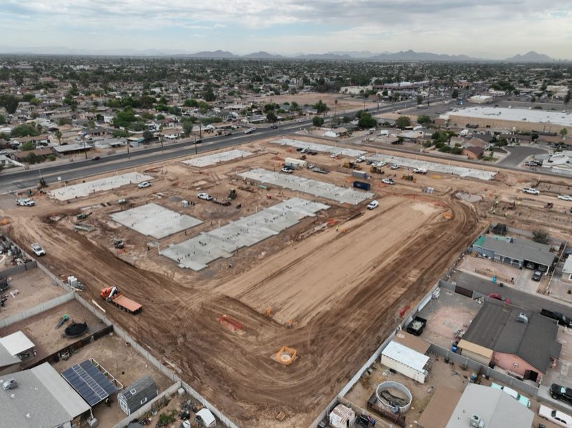
We document Phoenix apartment communities on a standing monthly cadence, from groundbreaking through lease-up, so lenders and equity partners can track progress at a glance.
MONTHLY · ONGOING 2026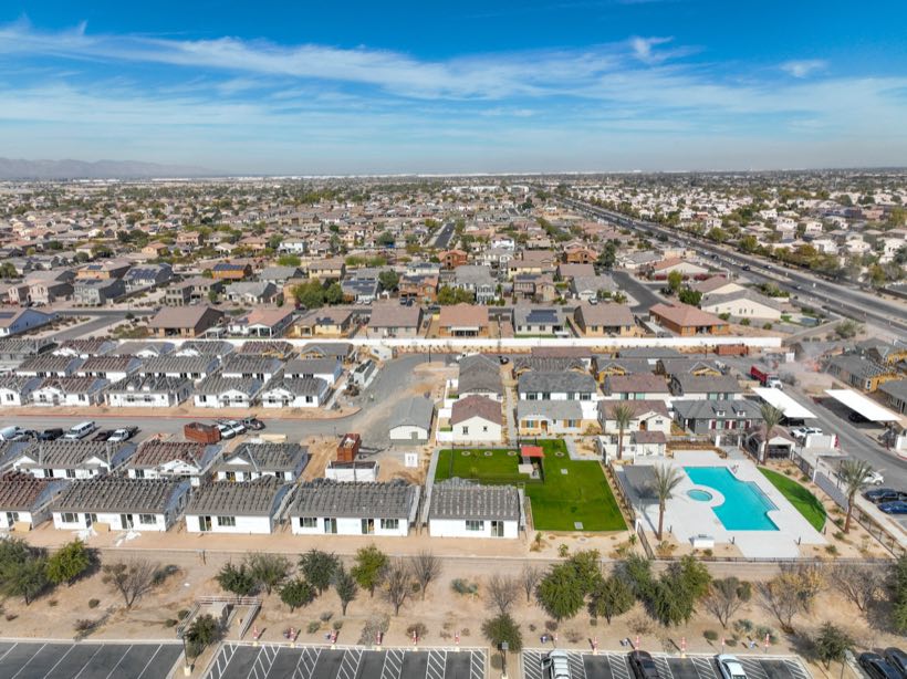
Progress and stakeholder documentation across the fast-growing West Valley — Goodyear, Litchfield Park, and surrounding communities — plus public works like a Tucson fire station on the same standards.
MULTI-SITE · COMMERCIAL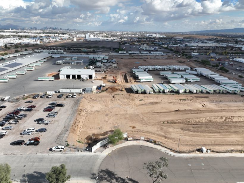
Large-footprint commercial construction across Phoenix and Albuquerque — the kind of sprawling site where an aerial map beats a ground walk. See industrial drone services.
COMMERCIAL · MULTI-STATEOn one multifamily community we've flown every month since groundbreaking, the developer pulls our same-angle sets straight into their lender draw packages — the consistency is what makes a capture useful a year later, not just the week it's shot.
Most builders set us up once and let it run — here's the path from first call to a standing cadence.
We confirm the site boundary, what you need documented, and a cadence — weekly, monthly, or by milestone. You get a quote and a first flight date on that call.
We fly the same repeatable pattern every visit, pull the LAANC authorization ahead of time, and coordinate around your crews and the Phoenix heat.
Imagery is processed the day of the flight — maps stitched, volumes calculated, highlights flagged for your team.
You get the full set within 48 hours by shared link, and every prior capture stays archived for draws, disputes, and closeout.
Flying construction in Phoenix isn't the same as anywhere else. Here's how we plan around it.
Before storm season we lock in a dated baseline of site conditions — protection, grading, materials. If a haboob or flash flood hits, you have evidence for insurance and delay claims instead of a he-said argument.
We fly Phoenix sites in early-morning windows to beat afternoon heat and thermal turbulence — keeping imagery sharp and crews out of your way during peak working hours.
Much of the Valley's ground-up work is pushing west and southeast. We know the Goodyear, Buckeye, and Gateway corridors — access, staging, and the sightlines that make a clean progress set.
Most Valley sites sit under Sky Harbor, Deer Valley, or Mesa Gateway airspace. We pull the LAANC authorization before every flight so your project never has a compliance gap.
On a Valley job, the difference between a licensed pro and a hobbyist is legal, insurable, and visible in the deliverables.
Construction clients often bundle these — flown by the same Part 107 team, same day when it makes sense.
Yes. Most Phoenix-area sites are in controlled airspace, and we obtain the LAANC authorization for each flight before we launch. If a site needs a further authorization, we handle that paperwork too.
Weekly, monthly, or milestone-based — whatever your reporting cadence requires. Our multifamily communities run on a standing monthly schedule; some GC sites we fly at each major phase.
Absolutely, and we recommend it. A dated pre-monsoon baseline is one of the most valuable things you can have if wind or flooding later triggers an insurance or delay claim.
Yes — orthomosaic maps plus cut/fill and stockpile volumetrics with measured reports, suitable for coordination and pay-app support.
FAA Part 107 certified and fully insured. We provide a certificate of insurance on request and can add your entity as additional insured when a project requires it.
Most construction work is quoted per flight, with a lower per-visit rate on a standing schedule since recurring sites are faster to fly and process. Tell us the site size and cadence and we'll give you a flat number — no surprises.
Yes — the large majority of our jobs are flown over active sites with crews working. We plan flight paths and timing to stay clear of personnel and cranes, and we carry full liability coverage for it.
All three — plus owner's reps and lenders who want an independent visual record. We're used to delivering one set that every party on a project can work from.
Rated 5.0★ from 271 verified Google reviews across our locations.
John and team are the consummate professionals! Very reliable, quick, and high quality deliverables!
Professional, efficient, and easy to work with. The team delivered clean, high-quality aerials and communicated clearly throughout the project.
Needed work done quickly for drone photography. They responded quickly, knew exactly what was required, and explained it well — great customer service.
John was a professional and very knowledgeable. He made the process of getting drone footage seamless and did an exceptional job.
Absolutely amazing experience with Desert Drones. They did a shoot for my business and made my product really speak for itself!
John is a true professional. Every time we need drone photography or videography done, he is excited to take on the project.
Tell us the location and your reporting cadence — we'll get you a quote and a first flight date.