
DFW has been called the most complex airspace in the nation — with Dallas/Fort Worth International (Class B), Dallas Love Field (Class D), and more than a dozen smaller towered airports spread across the metroplex. Commercial drone operations in DFW require a team that understands multi-airport coordination, LAANC authorization systems, and the professional standards that Texas’s largest commercial market demands. For airspace authorization near DFW International Airport and Dallas Love Field, we handle all FAA Part 107 LAANC coordination so you don’t have to.
DFW's construction and development projects often span hundreds of acres across multiple municipalities. We’ve documented large-scale projects from Fort Worth to Frisco, Allen to Arlington — with consistent delivery standards regardless of jurisdiction.
DFW International’s Class B airspace, Love Field’s Class D, and a dense network of smaller airports make every Dallas-area project require airspace coordination. We use LAANC for instant authorizations and FAADroneZone for areas not covered by LAANC — so your project never stalls.
Dallas’s commercial real estate market spans Uptown, Victory Park, Legacy, and the Legacy West corridor in Plano. Aerial photography is standard practice for commercial listings, development marketing, and land acquisition documentation. We meet the visual standards DFW brokers and developers expect.
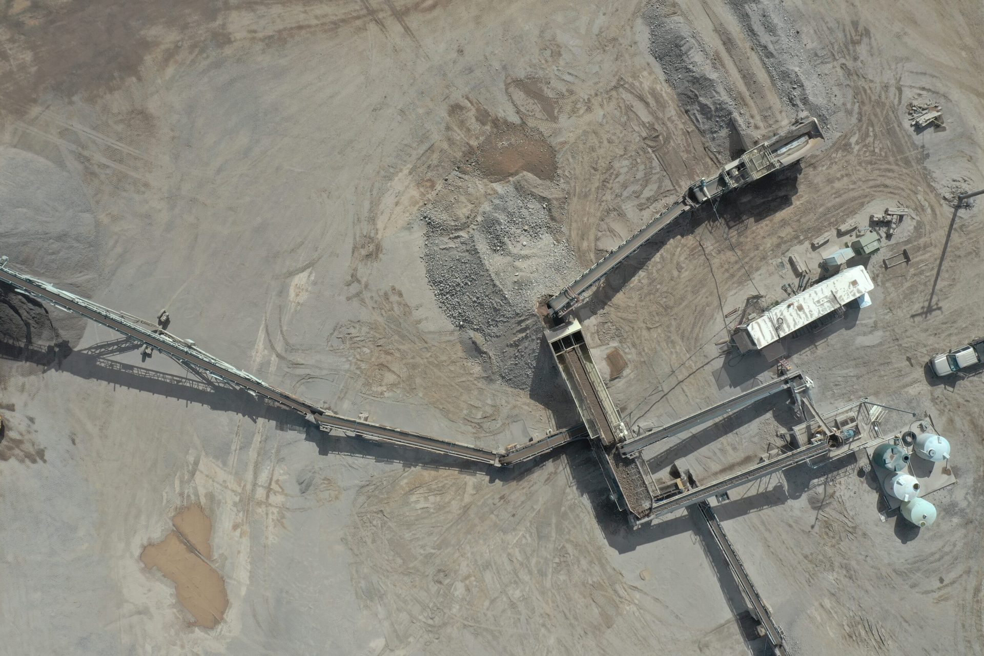
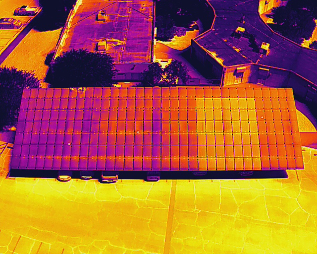
The greater Dallas area is a hub for oil & gas midstream infrastructure, chemical plants, pipeline corridors, and large-scale industrial facilities. We provide aerial inspection photography, facility documentation, and thermal FLIR services for industrial clients in the Dallas-Fort Worth area.
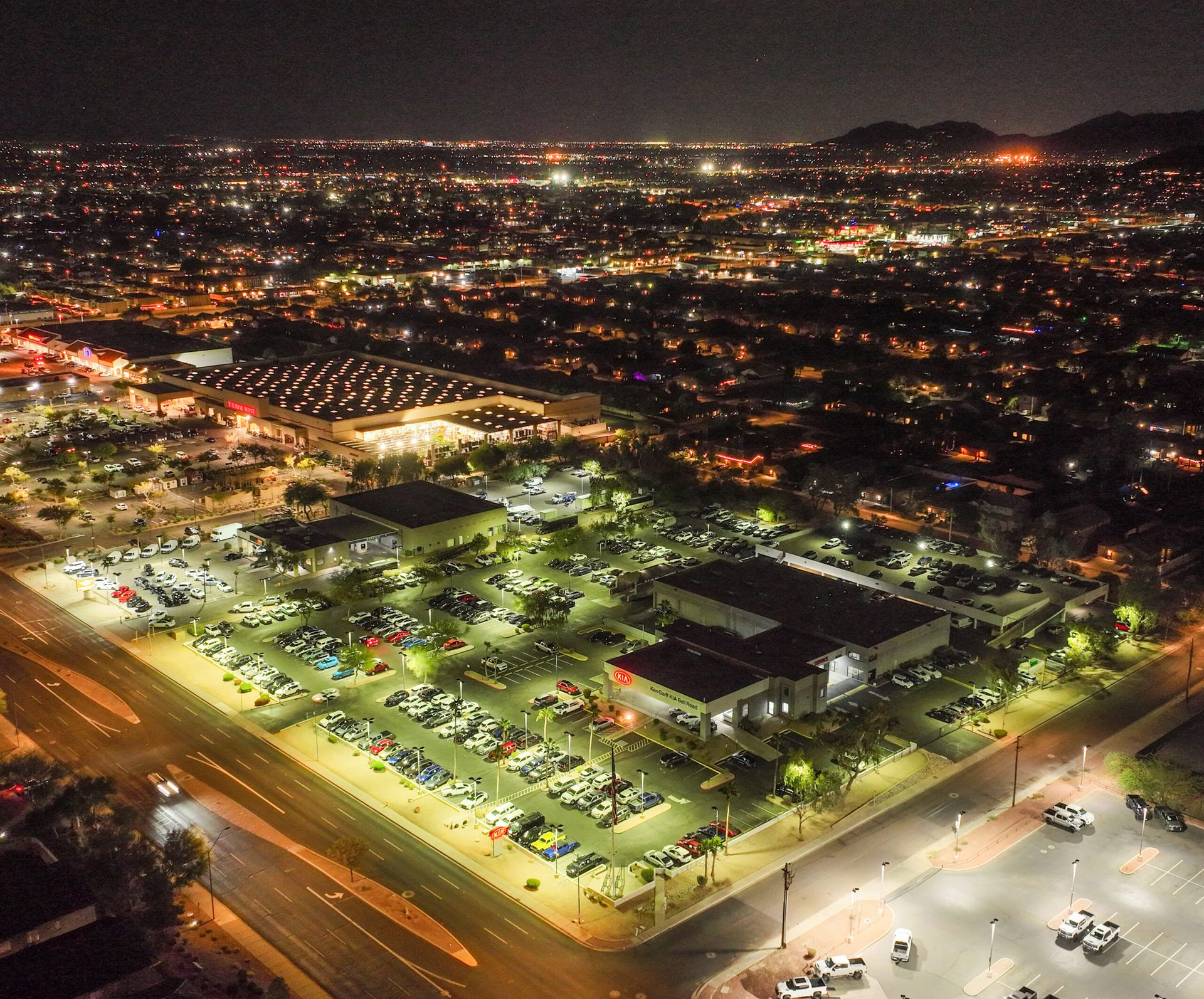
The Dallas-Fort Worth metroplex is one of the most economically active regions in the country — with construction, real estate, energy, logistics, and technology all driving significant aerial services demand. Desert Drones serves commercial clients across DFW with FAA-certified aerial photography, construction documentation, thermal inspections, and video production.
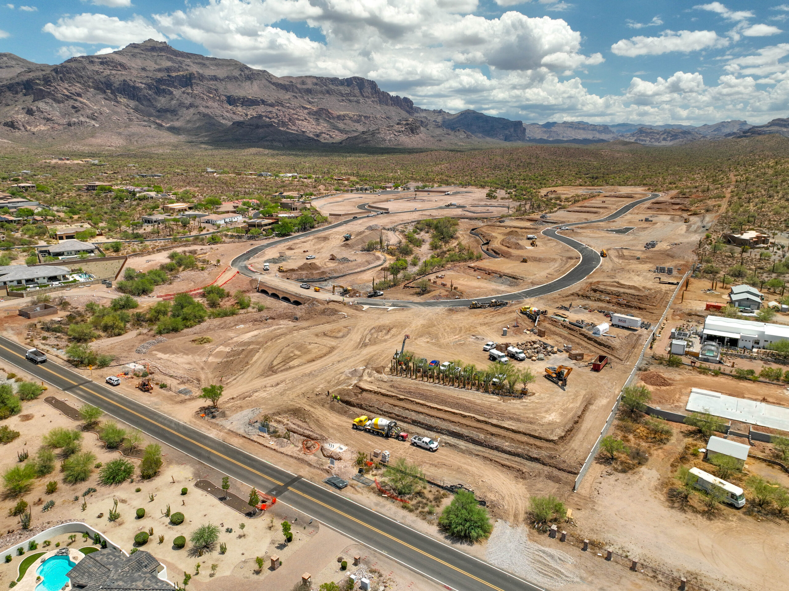
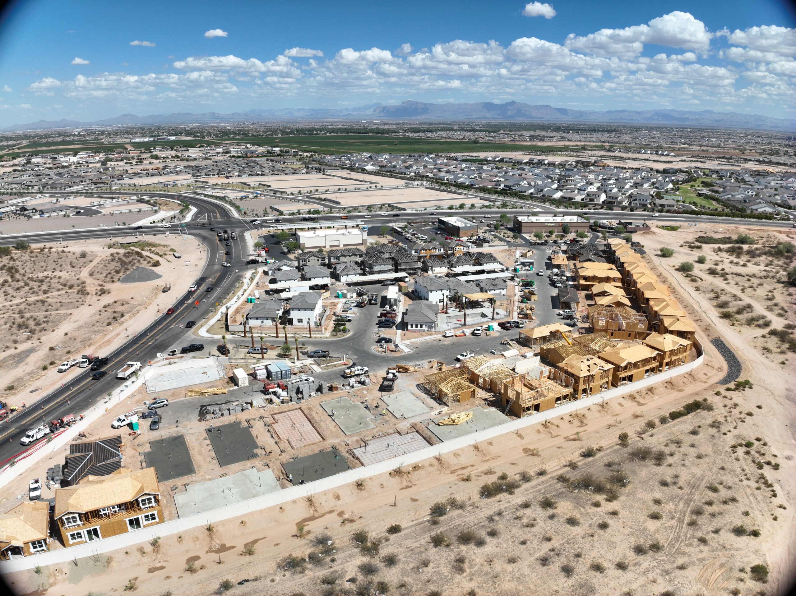
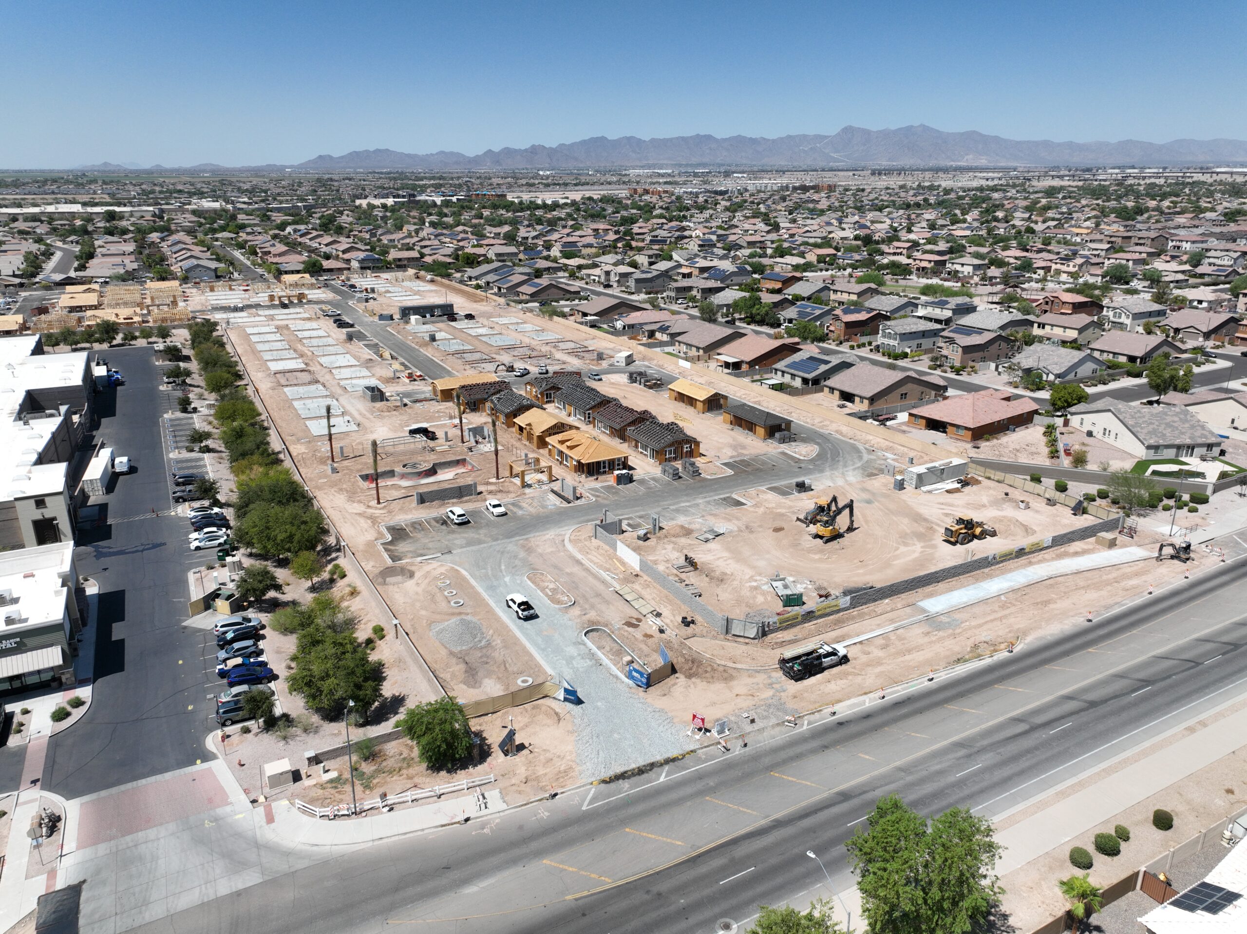
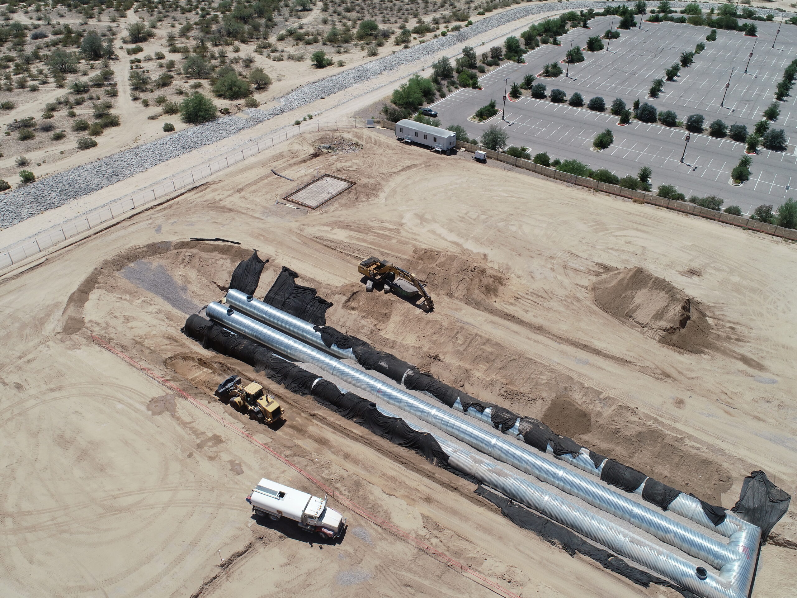
DFW is in a sustained construction boom, with major residential developments in Frisco, McKinney, Allen, Prosper, and Celina, and commercial development concentrated around the Legacy corridor, Las Colinas, and Fort Worth’s Panther Island. We provide construction progress photography and orthomosaic mapping for GCs and developers who need reliable, recurring aerial documentation for project reporting, lender updates, and marketing.
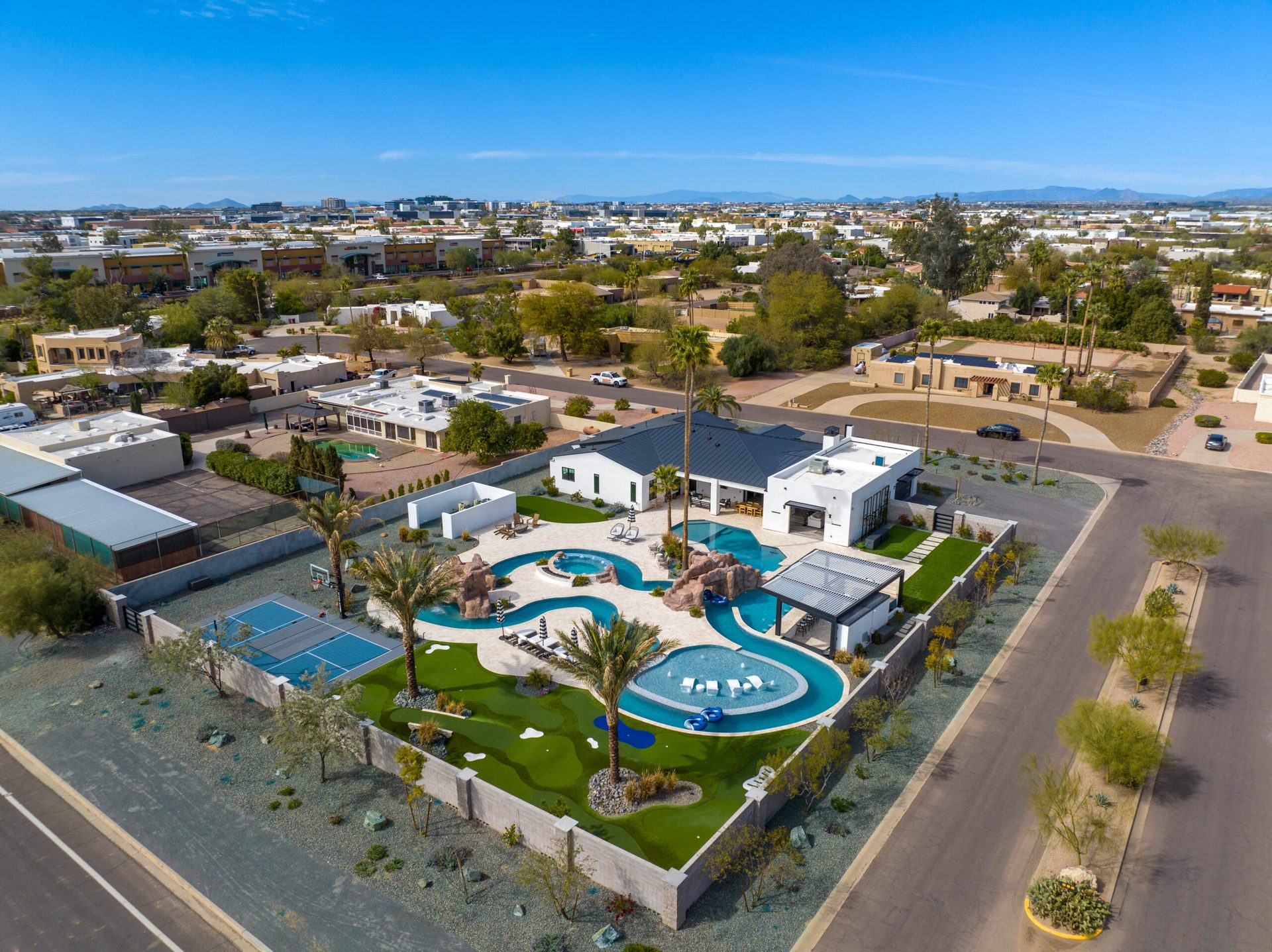
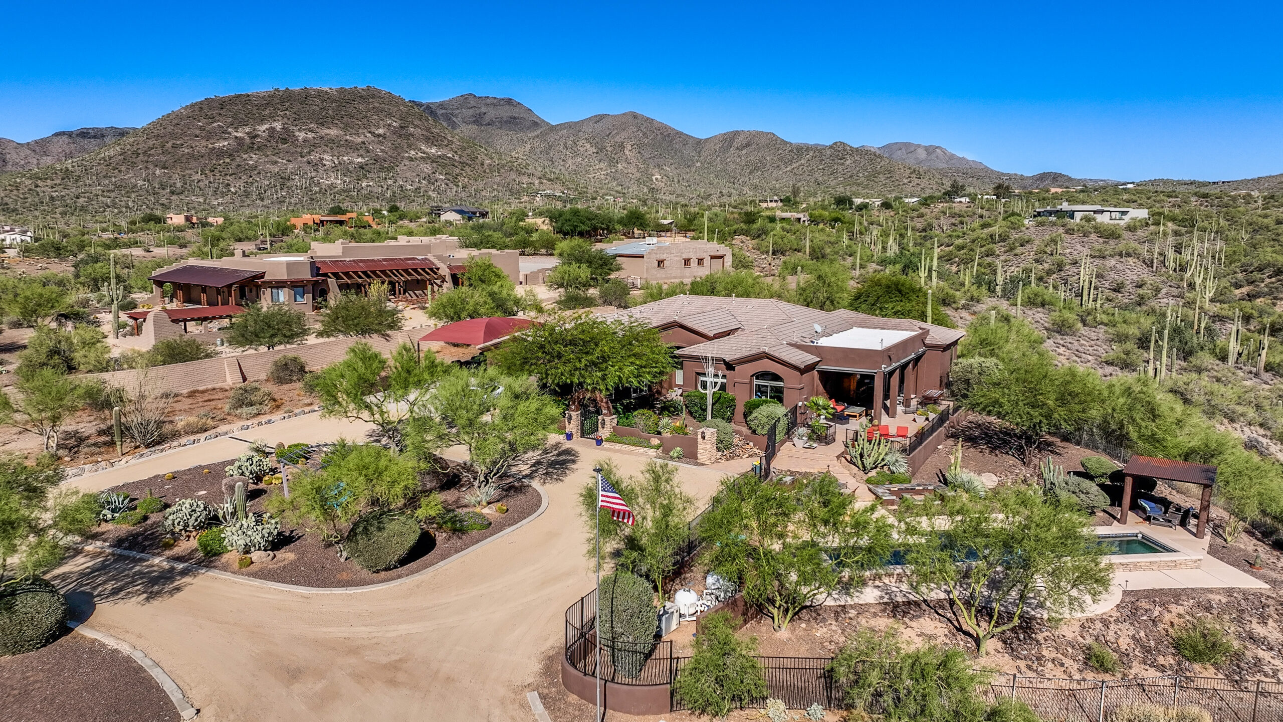
Commercial and luxury residential real estate in Dallas demands high-quality aerial imagery to compete in an active market. From high-rise condo developments in Uptown to luxury ranch properties in Collin County, aerial photography communicates the scale, setting, and quality of properties that ground-level photography cannot capture alone. We work with listing agents, luxury home builders, and commercial real estate firms across the metroplex.
Texas law prohibits local governments from regulating commercial drone operations (except during special events), which simplifies permit requirements compared to some other markets. All Desert Drones DFW work includes FAA Part 107 certified pilots, LAANC airspace authorization for DFW’s complex airspace, and $2 million in liability insurance — the standard expected by most commercial clients in the Texas construction and real estate sectors.
Dallas-Fort Worth has one of the most active residential and commercial real estate markets in the country. Aerial photography is a standard listing tool in DFW’s luxury residential market (Southlake, Plano, Frisco, University Park) and an essential component of commercial property marketing from Las Colinas to the Fort Worth Alliance corridor. We serve listing agents, brokers, developers, and commercial property managers throughout the metroplex.
DFW is one of the largest construction markets in the U.S., with master-planned communities expanding rapidly into Collin, Denton, and Tarrant counties. We provide recurring aerial progress documentation for general contractors, project owners, and development companies — weekly or monthly visits, orthomosaic maps, before/after comparisons, and deliverables formatted for project management platforms.
Dallas-Fort Worth is a hub for energy sector midstream infrastructure, pipeline corridors, chemical and petrochemical facilities, and large-scale manufacturing. We provide aerial inspection photography, thermal FLIR surveys, and facility documentation for industrial clients from Fort Worth’s industrial corridor to the DFW industrial parks along I-20 and I-35.
The Legacy, Uptown, and Las Colinas corridors have seen significant mixed-use and commercial development activity. Development teams, marketing firms, and architects use aerial photography and video to document project progress and create compelling content for leasing and sales campaigns.
Dallas hosts major corporate events, conventions at Kay Bailey Hutchison Convention Center, concerts at Dos Equis Pavilion, and large-scale festivals throughout the year. We provide aerial event coverage with appropriate FAA coordination, working within TFRs and local event requirements.
A sample of our aerial work across Greater Dallas-Fort Worth — real estate, construction, mapping, events, and more.
Our pricing is transparent and competitive for the Dallas-Fort Worth market. Every quote is customized to your project’s scope, location, and deliverables — but here are our typical ranges for DFW-area jobs.
| Service | Typical Range | What’s Included |
|---|---|---|
| Aerial Photography | $350 – $650 | 10–20 edited aerial stills, next-day delivery |
| Real Estate Package | $250 – $550 | Aerial photos + 60–90 sec video edit |
| Construction Progress Visit | $400 – $850 | Orthomosaic map + progress photos |
| FPV Videography | $900 – $1,700 | Cinematic FPV edit, color graded |
| Full Video Production | $900 – $2,000 | Edited cinematic video with music |
| Industrial Inspection | $600 – $1,500 | Aerial inspection photos + report |
Pricing varies by project size, location, and number of deliverables. Contact us for a free custom quote — we typically respond within 2 hours during business days.
Rated 5.0★ from 271 verified Google reviews across our locations.
John and team are the consummate professionals! Very reliable, quick, and high quality deliverables!
Professional, efficient, and easy to work with. The team delivered clean, high-quality aerials and communicated clearly throughout the project.
Needed work done quickly for drone photography. They responded quickly, knew exactly what was required, and explained it well — great customer service.
John was a professional and very knowledgeable. He made the process of getting drone footage seamless and did an exceptional job.
Absolutely amazing experience with Desert Drones. They did a shoot for my business and made my product really speak for itself!
John is a true professional. Every time we need drone photography or videography done, he is excited to take on the project.
Commercial drone photography in Dallas-Fort Worth typically ranges from $250 to $650 for aerial and real estate packages, and $400 to $850 per visit for construction progress documentation. Full video production runs $900 to $2,000. Desert Drones provides free custom quotes — contact us at 469.949.1776.
Yes — Desert Drones serves the entire Dallas-Fort Worth metroplex including Fort Worth, Arlington, Garland, Irving, Mesquite, McKinney, Frisco, Plano, Allen, Richardson, Carrollton, Denton, Lewisville, Flower Mound, Southlake, and surrounding areas. For larger projects in Waco, Tyler, or other Texas cities, contact us about travel fees.
The Dallas-Fort Worth area has some of the most complex airspace in the country. DFW International Airport (Class B) and Dallas Love Field (Class D) are the primary controlled airspace, but the metroplex also has over a dozen smaller towered airports including Alliance, Addison, Dallas Executive, Arlington Municipal, and Denton Enterprise — each with their own Class D airspace. Desert Drones uses the LAANC system for instant airspace authorization and coordinates all required permits before every job.
Downtown Dallas falls within DFW International Airport’s Class B airspace footprint, which requires LAANC authorization for commercial drone operations. This authorization is obtained digitally and is typically instant for most altitudes and locations. Operations near Reunion Tower, American Airlines Center, or other urban landmarks are possible with proper authorization and safety planning. We handle all airspace coordination for downtown Dallas projects.
Texas state law prohibits local governments from regulating commercial drone operations (except during special events), so there are no Dallas city drone permits for most commercial work. Federal requirements apply: FAA Part 107 certification is required for all commercial operators (all Desert Drones pilots are certified), and LAANC airspace authorization is required within DFW’s controlled airspace. We handle all federal compliance.
For straightforward aerial photography jobs where airspace authorization is readily available, we can often accommodate next-day requests in the DFW metro. Rush scheduling depends on current workload and airspace complexity for your specific location. Contact us at 469.949.1776 to discuss availability.
Desert Drones operates professional-grade DJI systems including the Mavic 3 Enterprise, DJI M30T for thermal inspections, and FPV platforms for cinematic production work. All systems are maintained to manufacturer standards and are under current inspection. We carry $2 million in liability insurance on every job.
We serve the entire DFW metroplex. Call or click to get your free quote today.