
From the aggregate operations feeding Denver's construction boom to DJ Basin energy infrastructure and the cell towers on every ridgeline — Colorado's industrial assets are big, tall, and expensive to inspect by hand. Drones cut the ladder time, the shutdowns, and the guesswork.
FAA Part 107 Certified · Fully Insured · LAANC Authorized · 5.0★ from 271 Google reviews
Desert Drones provides FAA Part 107–certified industrial drone services across the Denver metro and Front Range — facility and plant inspections, stockpile volumetrics and aggregate site mapping, cell tower and vertical asset inspections, energy infrastructure documentation, and orthomosaic site mapping. Flights are planned around site safety requirements and delivered in the formats your engineers already use.
High-value data from places you'd rather not send a person.
Engineering-usable data — not just a photo gallery.
Imagery below is from our industrial portfolio — plants, stockpiles, and vertical assets.
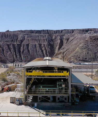
Processing structures, conveyors, and rooflines documented in detail from the air — the inspection that doesn't require a shutdown or a harness.
PLANT · FACILITY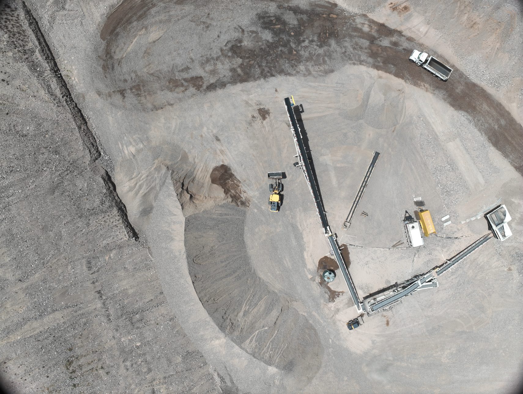
Photogrammetry-derived stockpile volumes for the aggregate and materials operations feeding Front Range construction — repeatable, defensible numbers.
VOLUMETRICS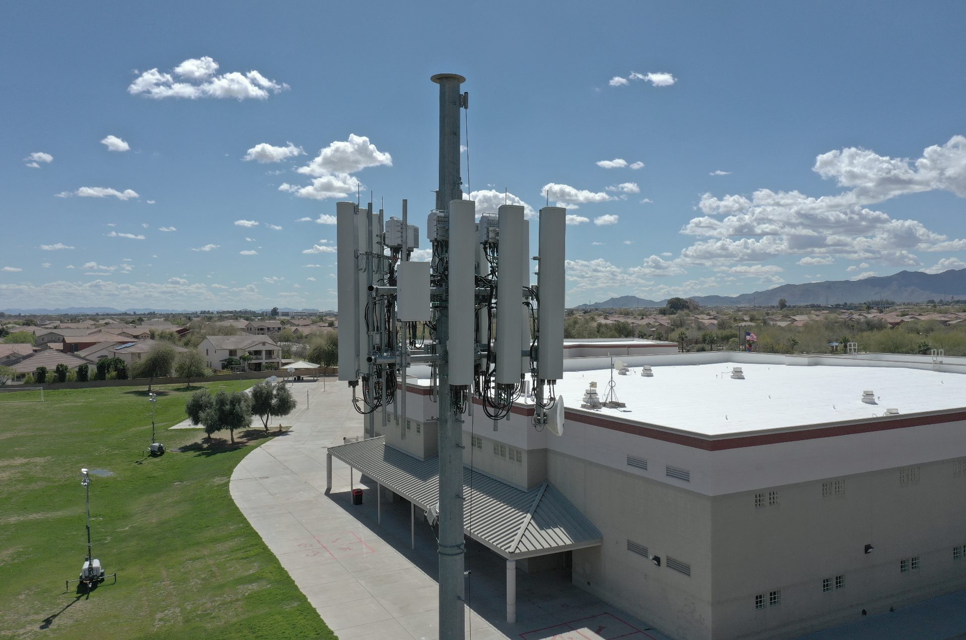
Antennas, mounts, and structures inspected without a climb crew — high-resolution detail on every face of the asset.
NO-CLIMB INSPECTIONIndustrial flights are planned around your site's safety and access requirements — orientation, escorts, exclusion zones — and flown by licensed, insured pilots with LAANC authorization where airspace requires it.
Scoped like site work, because it is site work.
Asset list, site rules, and data requirements — we plan the flight around your safety program.
Inspection, mapping, or volumetric passes — with thermal added when electrical or mechanical assets call for it.
Imagery organized by asset; volumes and orthos computed; findings flagged.
Engineering-ready outputs by shared link, in the formats your team uses.
Colorado's industrial base has specific flying demands — we plan for them.
The pits and yards feeding Denver's construction boom need monthly volumetrics and compliance documentation — repeatable flights, defensible numbers.
Well pads, gathering lines, and substations across Weld and Adams counties — documented efficiently across distributed sites.
Front Range ridgelines and rooftops carry the towers — we inspect them without climb crews.
Density altitude and afternoon winds are real constraints here — our pilots plan margins for both.
Industrial sites don't forgive amateur hour — access rules, safety plans, and data accuracy all have to hold up.
Industrial clients often bundle these — same site visit when possible.
Photogrammetry-derived volumes are typically within 1–2% of ground survey for well-flown sites — and perfectly repeatable month over month for inventory tracking.
Yes — we work to your orientation, escort, and exclusion-zone requirements, and carry $2M liability coverage with COI on request.
Yes — that's the point of the drone. Towers, plants, and electrical assets are inspected live, with thermal added where it helps.
Yes — our Colorado pilot network covers the metro and Front Range, so distributed assets get documented on one schedule.
Standard imagery plus orthos, elevation models, and volumetric reports exported for CAD/GIS workflows.
FAA Part 107 certified, $2M insured, with LAANC authorization pulled wherever airspace requires it.
Rated 5.0★ from 271 verified Google reviews across our locations.
John and team are the consummate professionals! Very reliable, quick, and high quality deliverables!
Professional, efficient, and easy to work with. The team delivered clean, high-quality aerials and communicated clearly throughout the project.
Needed work done quickly for drone photography. They responded quickly, knew exactly what was required, and explained it well — great customer service.
John was a professional and very knowledgeable. He made the process of getting drone footage seamless and did an exceptional job.
Absolutely amazing experience with Desert Drones. They did a shoot for my business and made my product really speak for itself!
John is a true professional. Every time we need drone photography or videography done, he is excited to take on the project.
Send the asset list — plants, piles, towers, pads — and we'll scope the flight and the deliverables.