
El Paso’s airspace is more complex than most drone companies are prepared to handle. El Paso International Airport (Class C airspace) combined with Fort Bliss Army Post and Biggs Army Airfield — a major U.S. military installation with active restricted airspace — creates an operational environment that demands careful pre-flight planning and FAA coordination on every job. From the UTEP campus and historic downtown to the Eastside and Upper Valley, Desert Drones serves clients across the El Paso metro, the Chihuahuan Desert region, and Southern New Mexico including Las Cruces, Sunland Park, and Santa Teresa.
Fort Bliss is one of the largest U.S. Army installations in the country. We know the restricted airspace boundaries, coordinate appropriately for projects near the base, and maintain strict compliance with military airspace requirements. We never fly in restricted areas without proper clearance.
El Paso’s cross-border economy, military presence, and its position as the largest U.S. city directly adjacent to Mexico make it a market unlike any other. We understand the local industries — manufacturing, logistics, construction, military contracting — and serve them professionally.
El Paso has historically been underserved by professional commercial drone operators. Desert Drones brings the same professionalism demanded by Phoenix and Dallas clients to the Sun City — FAA-certified pilots, $2M insurance, professional editing, and fast turnaround for real estate listings, UTEP-area commercial properties, and Chihuahuan Desert industrial projects.
We serve the entire El Paso/Las Cruces metro, including Sunland Park, NM; Anthony; Santa Teresa; Las Cruces; and the White Sands corridor. Many El Paso-based clients have projects on both sides of the state line — we serve them all.
El Paso’s economy is driven by the military (Fort Bliss is the largest employer in the region), manufacturing and logistics (particularly maquiladora supply chains and border commerce), construction, and a growing real estate market fueled by military transfers and regional population growth.
Construction in El Paso is concentrated in the Northeast side, the Westside, and the upper valley areas where new residential and commercial development is active. Real estate photography demand has grown alongside the construction cycle, with out-of-state buyers and military families often making purchase decisions based on virtual tours and aerial photography before ever visiting in person.
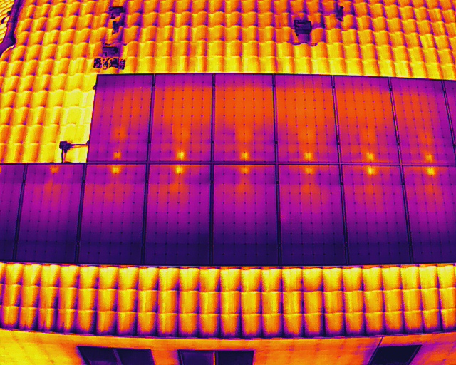
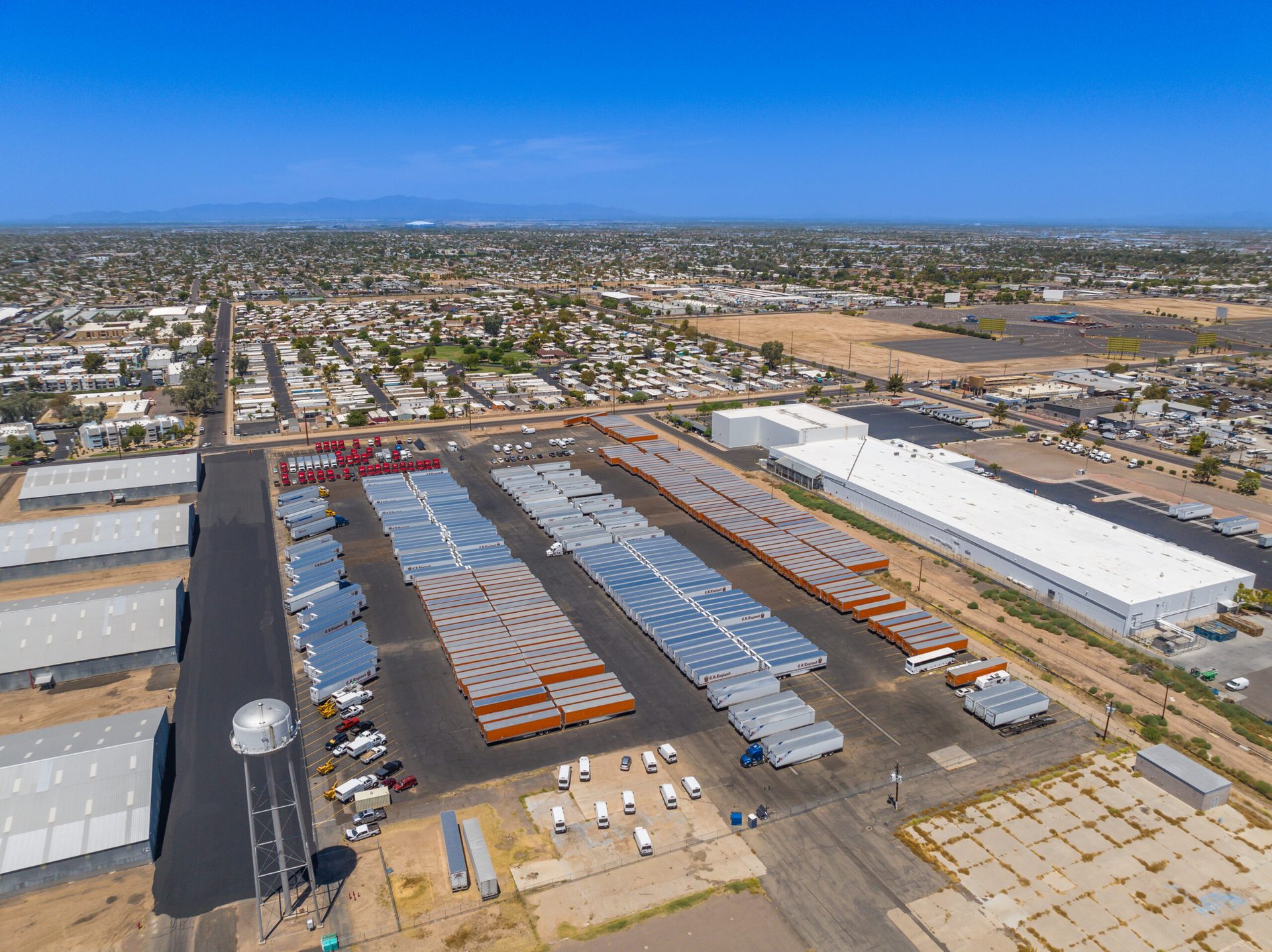
The manufacturing and logistics sector in El Paso and Santa Teresa, NM — centered around Union Pacific’s rail hub and the I-10/I-25 interchange — has aerial documentation and facility inspection needs we regularly serve. Thermal FLIR inspections for large warehouse and manufacturing facilities are particularly valuable in El Paso’s intense summer heat.
All El Paso operations include FAA Part 107 certified pilots, appropriate airspace authorizations, and $2 million in liability insurance.
El Paso’s real estate market has been driven by military transfers, retirees, and regional population growth on the Northeast side and upper valley. Construction activity is focused on residential communities, commercial retail, and logistics facilities in Santa Teresa, NM, and the West Texas corridor. We provide real estate aerial photography and construction progress documentation for builders and brokers throughout the El Paso metro.
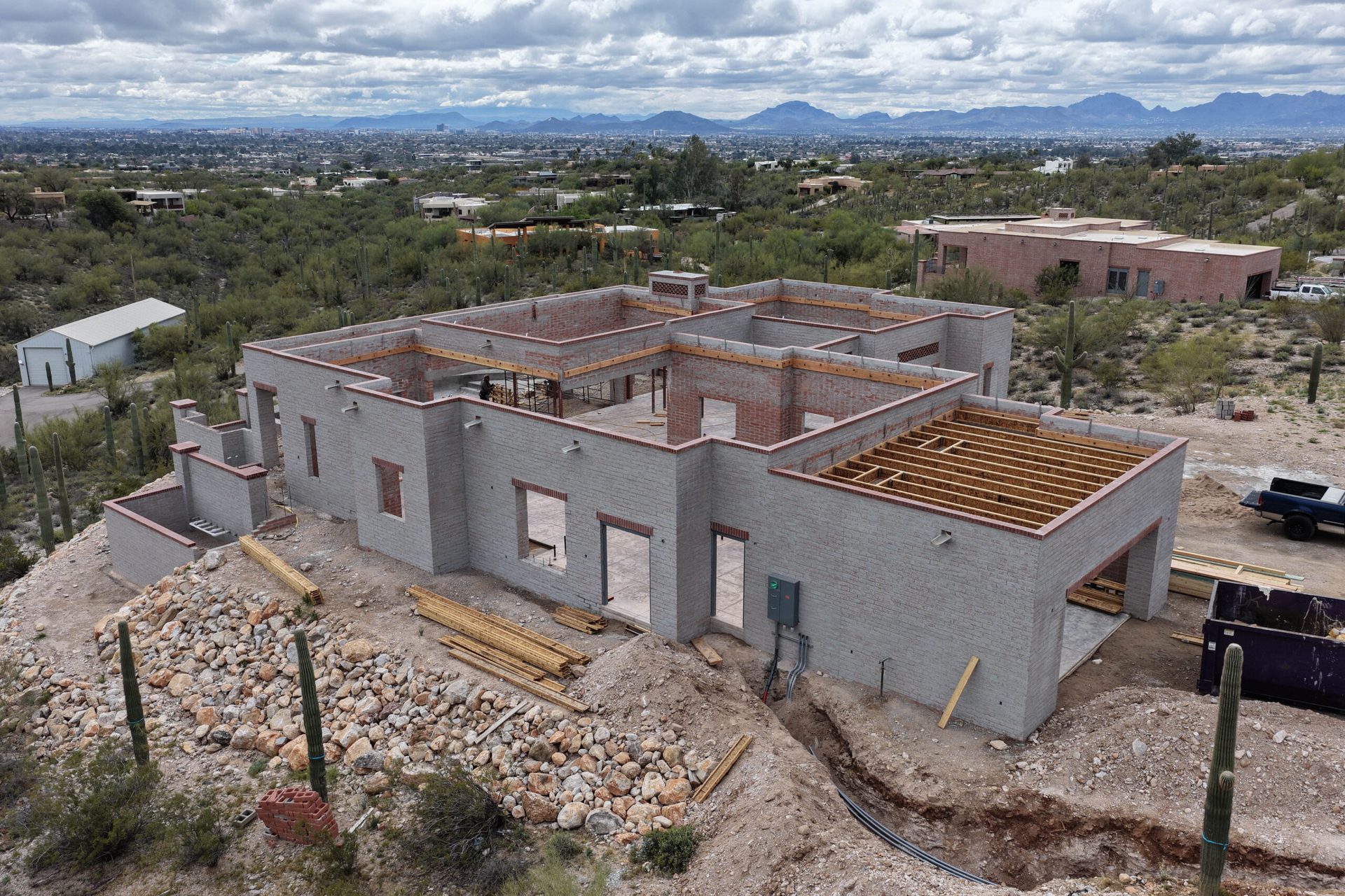
El Paso is in an active construction cycle — from new residential communities in the Northeast corridor to commercial development on the Westside and upper valley. We provide weekly or monthly progress photography for general contractors, subcontractors, and project owners. Our construction clients use aerial documentation for milestone reporting, stakeholder presentations, and insurance documentation.
Fort Bliss is the largest employer in the El Paso region, with tens of thousands of military personnel and civilian contractors. Military and government contractors have documentation, inspection, and site survey needs that require FAA-certified, insured operators. We serve government contractors and base-adjacent commercial clients with appropriate credentials and operational compliance.
El Paso and Santa Teresa are major logistics hubs — Union Pacific, BNSF, and extensive trucking infrastructure move goods across the U.S.–Mexico border. Large manufacturing and distribution facilities in this corridor have aerial documentation and inspection needs, including rooftop and facility photography, thermal FLIR surveys, and site overview documentation.
El Paso’s industrial sector includes water utilities, refineries, pipeline infrastructure, and heavy industry along the Rio Grande corridor. We perform aerial inspection photography and thermal FLIR surveys for industrial infrastructure clients throughout the El Paso–Las Cruces region.
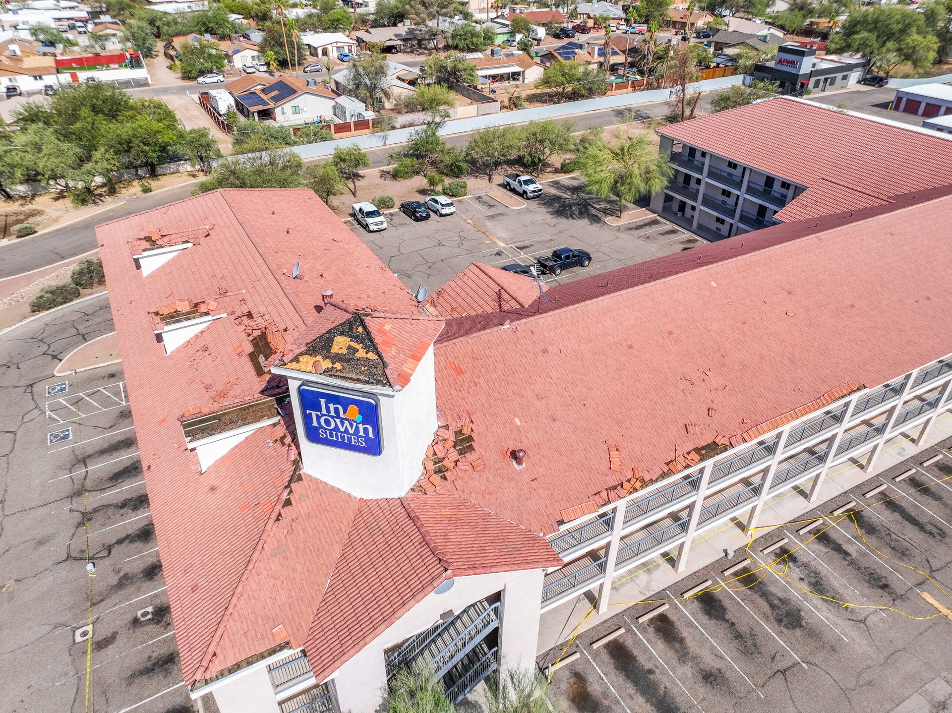
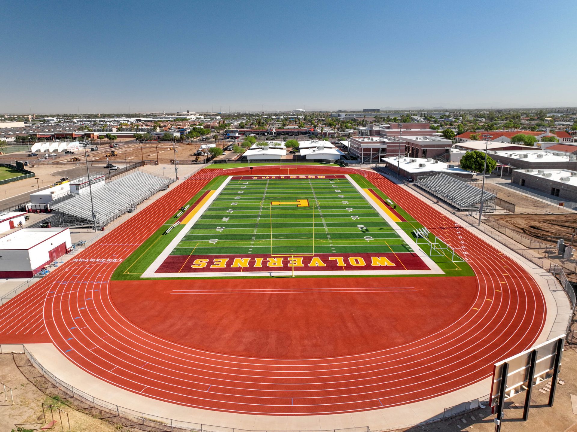
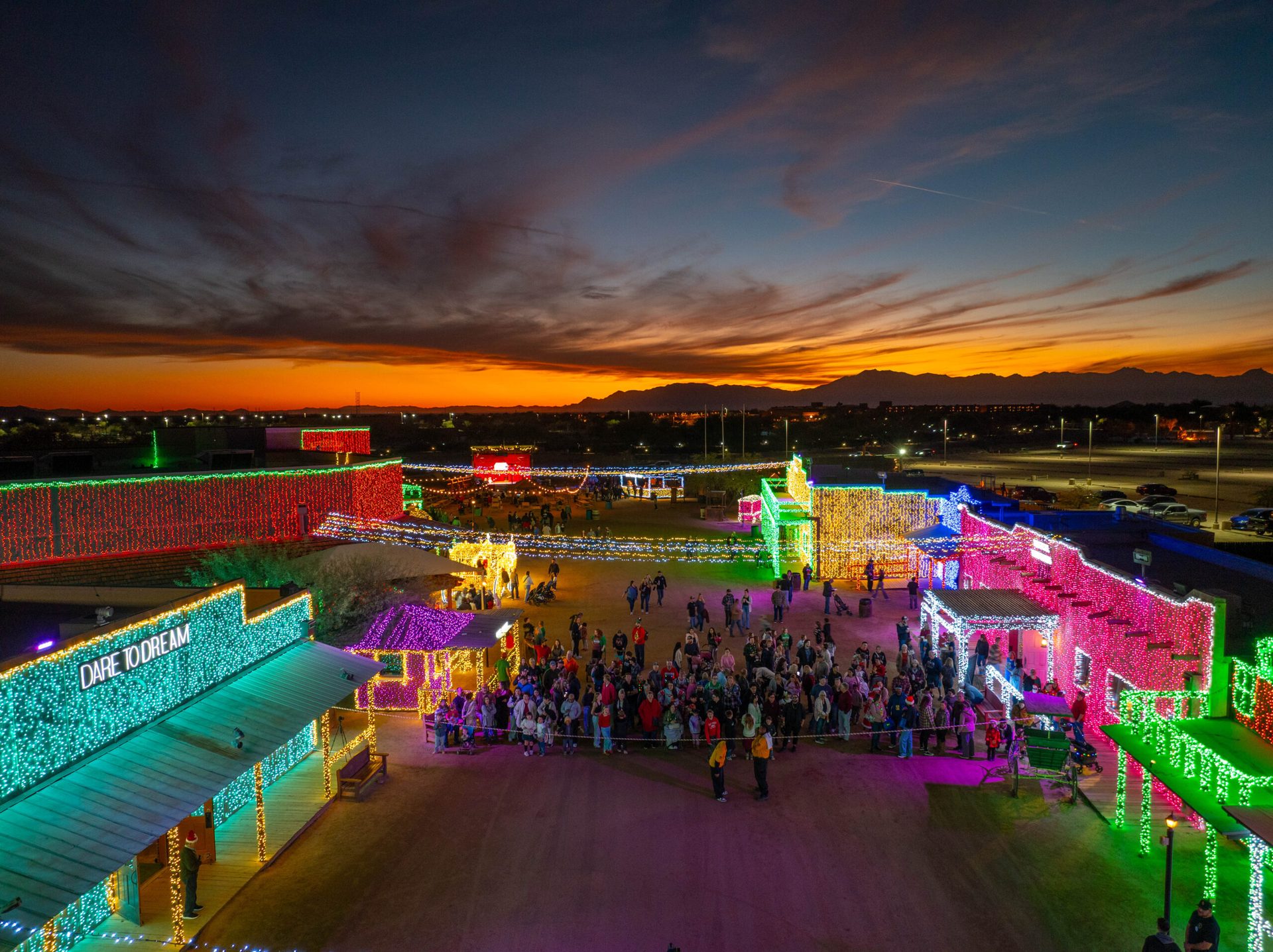
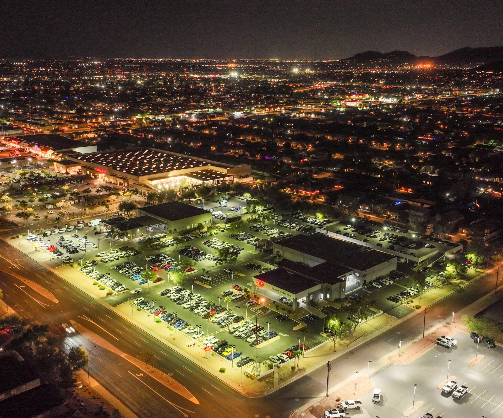
A sample of our aerial work across the El Paso metro — residential and commercial real estate, construction progress documentation, Fort Bliss area industrial projects, and border-region commercial development.


Our pricing is transparent and competitive for the El Paso market. Every quote is customized to your project’s scope, location, and deliverables — but here are our typical ranges for El Paso-area jobs.
| Service | Typical Range | What’s Included |
|---|---|---|
| Aerial Photography | $300 – $550 | 10–20 edited aerial stills, same-day delivery available |
| Real Estate Package | $200 – $450 | Aerial photos + 60–90 sec video edit |
| Construction Progress Visit | $350 – $700 | Orthomosaic map + progress photos |
| FPV Videography | $800 – $1,500 | Cinematic FPV edit, color graded |
| Full Video Production | $800 – $1,800 | Edited cinematic video with music |
| Thermal / FLIR Inspection | $450 – $1,100 | Thermal report + annotated images |
Pricing varies by project size, location, and number of deliverables. Contact us for a free custom quote — we typically respond within 2 hours during business days.
Rated 5.0★ from 271 verified Google reviews across our locations.
John and team are the consummate professionals! Very reliable, quick, and high quality deliverables!
Professional, efficient, and easy to work with. The team delivered clean, high-quality aerials and communicated clearly throughout the project.
Needed work done quickly for drone photography. They responded quickly, knew exactly what was required, and explained it well — great customer service.
John was a professional and very knowledgeable. He made the process of getting drone footage seamless and did an exceptional job.
Absolutely amazing experience with Desert Drones. They did a shoot for my business and made my product really speak for itself!
John is a true professional. Every time we need drone photography or videography done, he is excited to take on the project.
Commercial drone services in El Paso typically range from $200 to $550 for aerial photography, and $350 to $700 per visit for construction progress documentation. El Paso is a lower-cost market than Phoenix or Dallas, and our pricing reflects local market conditions. Contact us at 915.237.1040 for a free custom quote.
Fort Bliss and Biggs Army Airfield have restricted military airspace that requires strict compliance. The Fort Bliss restricted airspace (R-4405) is a no-fly zone for unauthorized commercial drone operations. Desert Drones does not fly within Fort Bliss restricted areas. For projects located near (but outside) Fort Bliss boundaries, we coordinate with FAA to confirm appropriate authorization before any flight. El Paso’s proximity to Fort Bliss means we plan every job with military airspace in mind.
El Paso’s proximity to the Mexico border (less than 10 miles from the city center) can result in Temporary Flight Restrictions (TFRs) related to border security operations. El Paso International Airport also experienced a 10-day airspace closure in February 2026 related to counter-drone operations. Desert Drones checks FAA NOTAMs and TFRs before every job to ensure we’re operating within current restrictions. We do not fly within border enforcement operations areas or during active TFRs.
Yes — Desert Drones serves the entire El Paso/Las Cruces bi-state metro including Las Cruces, Sunland Park, Anthony, Santa Teresa, Chaparral, and the White Sands corridor. Many clients have projects spanning both sides of the Texas/New Mexico state line, and we serve them all from a single point of contact.
For most El Paso aerial photography jobs, we can schedule within 3-5 business days and deliver edited photos within 24-48 hours of the flight. Construction progress visits are typically scheduled on a weekly or monthly recurring basis. Contact us at 915.237.1040 for current availability.
Commercial drone photography in Texas requires FAA Part 107 certification (all Desert Drones pilots are certified) and LAANC airspace authorization within El Paso International Airport’s Class C airspace. Texas state law generally prohibits cities from creating local drone regulations, so city permits are not required for most commercial operations on private property. Government contracts and work near Fort Bliss may have additional requirements we coordinate on a case-by-case basis.
Desert Drones operates professional-grade DJI systems including the Mavic 3 Enterprise, DJI M30T for thermal inspections, and FPV platforms for cinematic production work. All systems are maintained to manufacturer standards and are under current inspection. We carry $2 million in liability insurance on every job.
Professional drone services in the Sun City. Call or click to get your free quote today.