
A loose electrical connection, a water-logged roof after a Texas storm, a dead solar string, an overheating motor — every one of them shows up as a temperature difference before it shows up as a failure. We fly FAA-certified radiometric infrared missions across Dallas–Fort Worth that find those problems from the air, safely and fast, with the numbers to back it up.
FAA Part 107 Certified · Fully Insured · LAANC Authorized · 5.0★ from 271 Google reviews
Desert Drones is an FAA Part 107–certified drone services company providing aerial thermal (infrared) inspections across Dallas–Fort Worth — building envelope and roof-moisture scans, electrical and mechanical equipment surveys, and solar-array fault detection. We fly calibrated radiometric sensors that record a temperature for every pixel and deliver annotated infrared reports, typically within 48 hours.
A thermal camera sees the one thing a normal inspection can't: temperature. Flown from the air, it covers a whole roof, array, or facility in a single pass.
An inspection you can act on and hand to a contractor, insurer, or facilities team — not a folder of orange pictures.
Thermal is one capability with three high-value uses across Dallas–Fort Worth — each flown with a calibrated radiometric sensor, not a color-map filter.
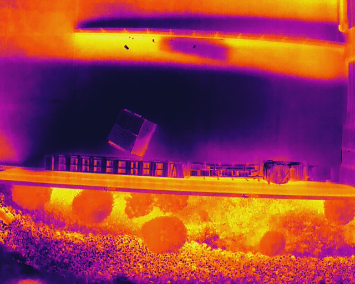
Flown after sunset, trapped moisture under a membrane glows against the cooling roof — so we map exactly where water got in after a Texas storm, before it rots the deck.
RADIOMETRIC · POST-SUNSET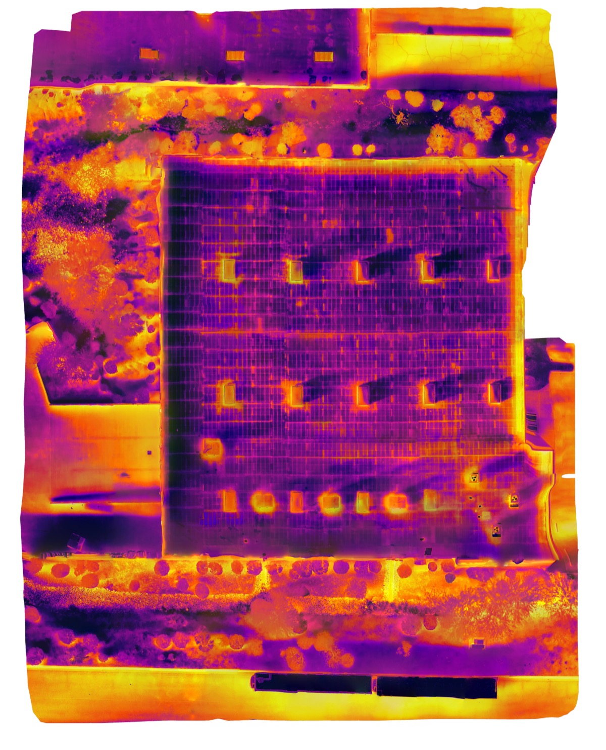
Every thermal frame stitched into one measurable orthomosaic — anomalies numbered and located, with cut-test spots flagged before any tear-off.
ORTHOMOSAIC · COMMERCIAL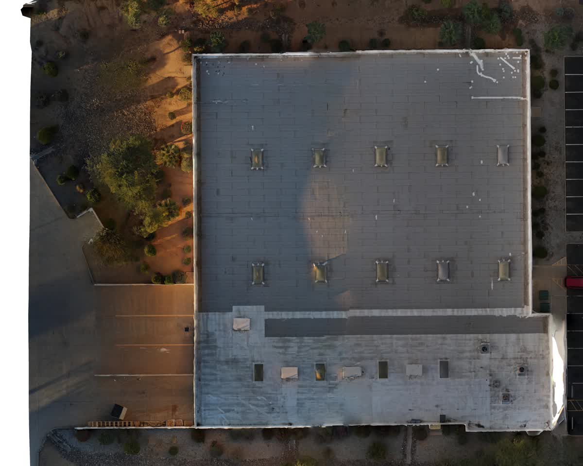
The same sensor finds overheating electrical connections and dead solar strings under load — delivered next to a matched visible-light frame so your crew goes straight to the fault.
PAIRED · ANNOTATEDRoof and envelope moisture is where a radiometric scan pays off fastest in DFW's storm climate, but the same sensor and workflow find overheating electrical gear and failing solar arrays — flown by licensed pilots on the ground in the metro.
Most thermal jobs are a single flight — here's how it goes from call to report.
Roof, solar array, electrical yard, or facility — we scope what you need imaged and the best thermal window (often just after sunset).
Calibrated infrared sensor, LAANC authorization pulled ahead, full coverage in one pass with matching visible-light frames.
We stitch thermal orthomosaics, pull temperatures, and flag anomalies the day of the flight.
You get the numbered, located, measured report within 48 hours.
DFW's storms, heat, and solar growth are exactly what a thermal drone is built to catch.
After a hail or wind event, water trapped under a membrane reads as thermal mass. We baseline before storm season and re-scan after to pinpoint where water got in.
Summer load pushes electrical and mechanical gear hard. An aerial IR pass finds the hot connection or failing motor before it takes a system down.
DFW's growing rooftop and commercial solar means array faults everywhere; an aerial scan checks a whole array for hot spots and dead strings in minutes.
Most metro sites sit under DFW International, Love Field, Addison, or Alliance airspace. We pull LAANC before every flight.
Thermal data is only useful if it's real — calibrated, radiometric, and read by a licensed pro.
Thermal clients often bundle these — same DFW pilots, same day when it makes sense.
A real calibrated radiometric sensor. Every pixel records an actual temperature, so our reports give you measured degrees and deltas — not a color effect over a normal photo.
Trapped roof moisture after storms, overheating electrical connections and equipment, and solar-array faults like dead cells, hot spots, and offline strings.
Yes — most of DFW is controlled airspace. We hold FAA Part 107 certification and pull the LAANC authorization for each flight.
No. Thermal is captured from the air while equipment runs under normal load — which is exactly when heat faults are visible.
FAA Part 107 certified and fully insured, with a certificate of insurance on request.
Most thermal inspections are delivered within 48 hours as an annotated PDF with paired infrared and visible-light imagery.
Rated 5.0★ from 271 verified Google reviews across our locations.
John and team are the consummate professionals! Very reliable, quick, and high quality deliverables!
Professional, efficient, and easy to work with. The team delivered clean, high-quality aerials and communicated clearly throughout the project.
Needed work done quickly for drone photography. They responded quickly, knew exactly what was required, and explained it well — great customer service.
John was a professional and very knowledgeable. He made the process of getting drone footage seamless and did an exceptional job.
Absolutely amazing experience with Desert Drones. They did a shoot for my business and made my product really speak for itself!
John is a true professional. Every time we need drone photography or videography done, he is excited to take on the project.
Tell us what you need scanned — a roof, an array, an electrical yard, or a whole facility — and we'll get you a quote and a flight date.