
No metro in the country gives a listing a backdrop like Denver — the Front Range behind a roofline, a greenbelt out the back gate, downtown on the horizon. A drone puts the buyer over the property and shows the setting that sells it. We fly FAA-certified real estate shoots across the Denver metro and deliver gallery-ready aerials, fast.
FAA Part 107 Certified · Fully Insured · LAANC Authorized · 5.0★ from 271 Google reviews
Desert Drones is an FAA Part 107–certified drone photography company serving real estate agents, builders, and homeowners across the Denver metro — listing hero aerials with mountain context, twilight shots, lot and acreage overviews, neighborhood and amenity framing, and cinematic property video. We fly with licensed pilots on the ground in Denver and Aurora and deliver edited, MLS-ready images, typically within 24–48 hours.
A ground photo shows a room. An aerial shows why someone should live there — the mountains, the park, the lot, and the neighborhood around it.
Edited, ready-to-post images and video — sized for the MLS and for social — not a card full of raw files.
Real shoots flown by Desert Drones — the same standards and editing every Denver listing gets.
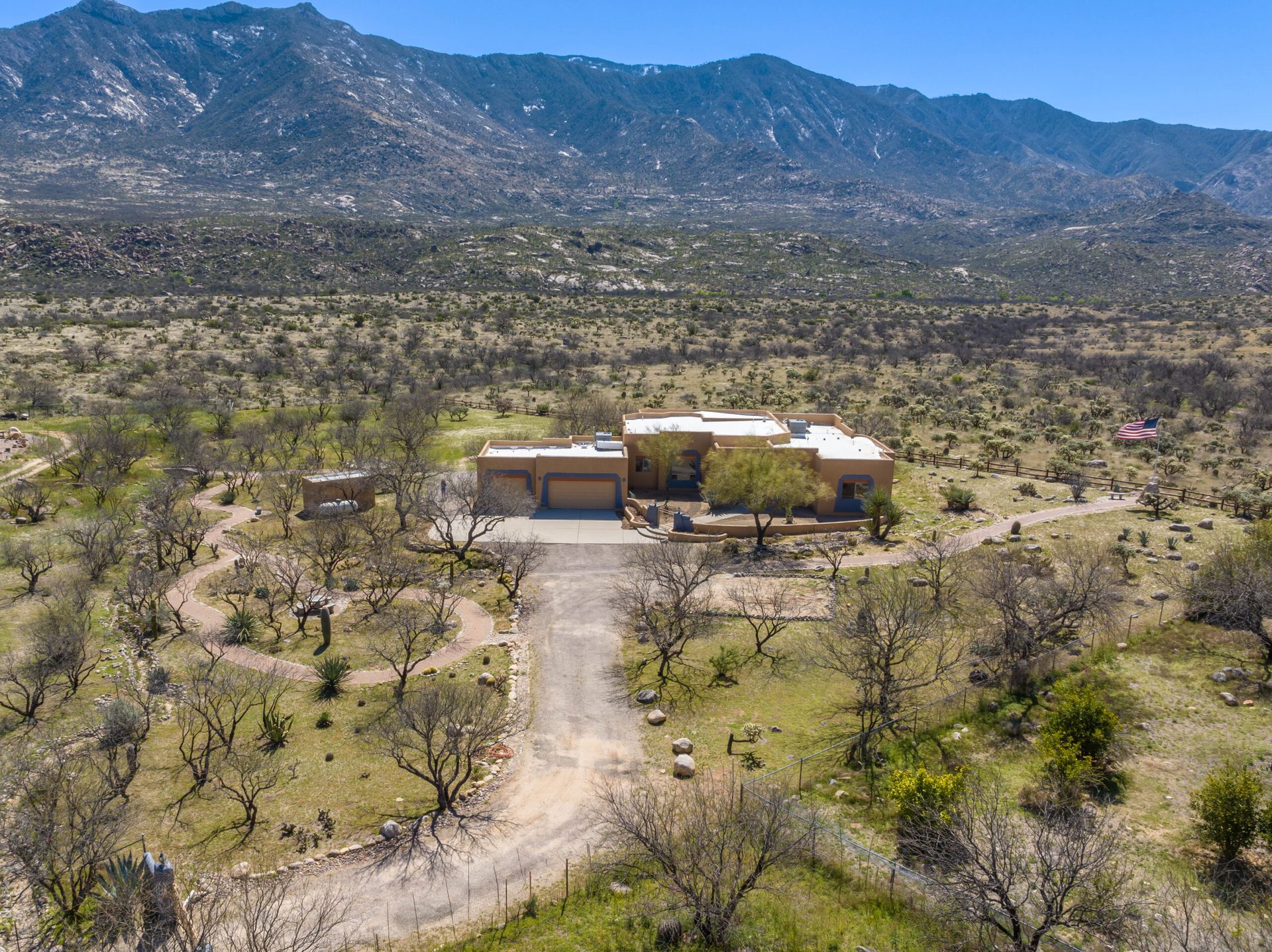
Boundary and context aerials that make a property's setting readable — the shot that sells acreage and mountain-corridor listings from Golden to Evergreen.
LAND · BOUNDARY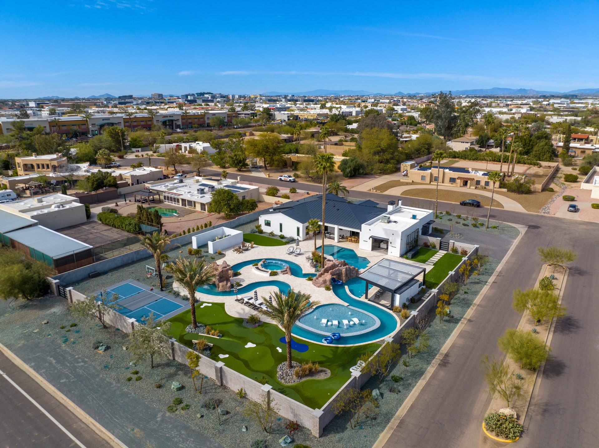
A hero aerial from a luxury estate listing — architecture, grounds, and setting in one frame. The exact treatment a Cherry Creek or Cherry Hills listing gets.
LUXURY · MLS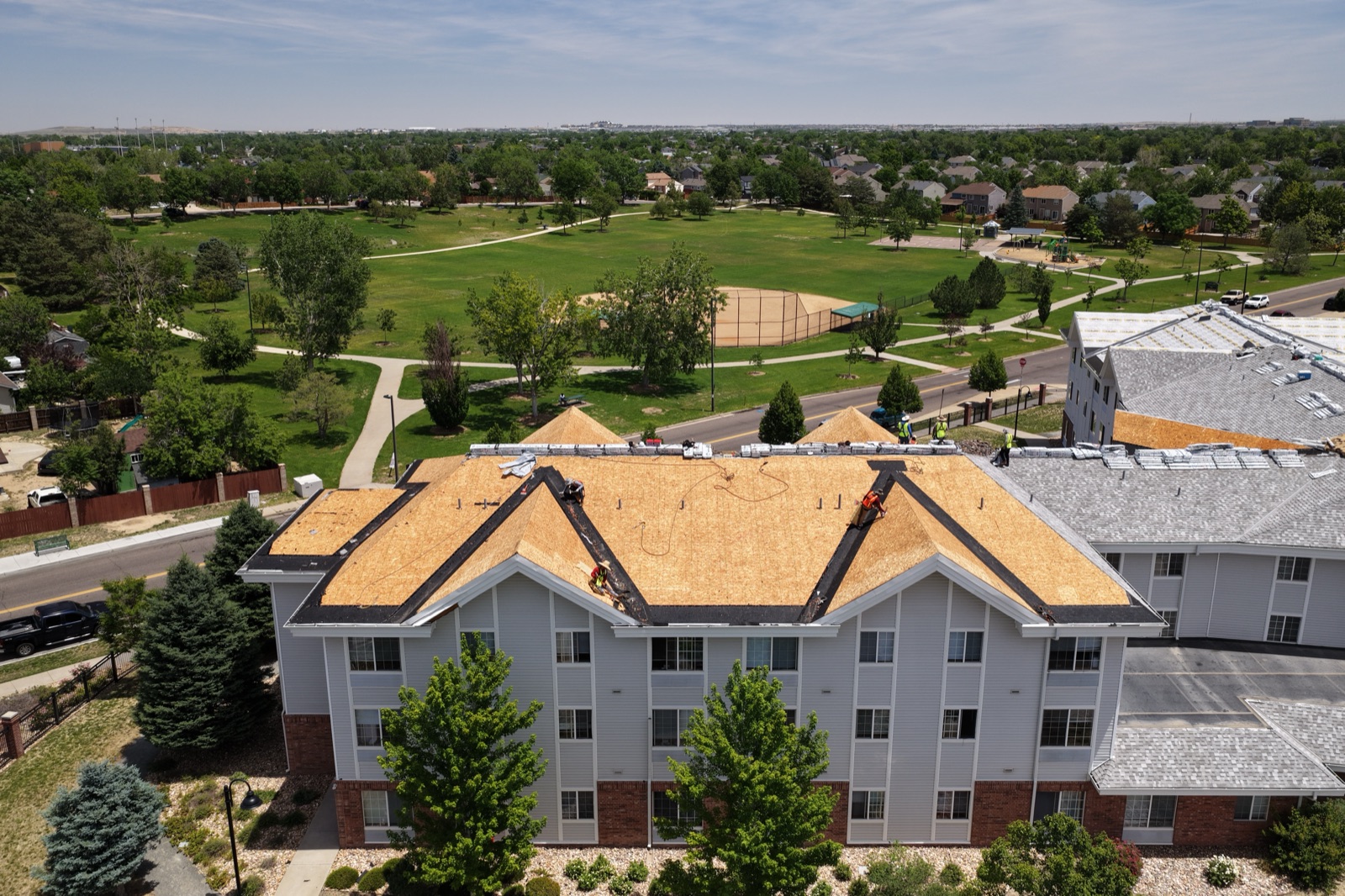
A real Denver-metro frame from our June 2026 flying — the parks, trees, and skyline context that ties a listing to its neighborhood.
DENVER · JUNE 2026These shoots were flown by Desert Drones ourselves. In Denver, we fly with FAA Part 107 pilots on the ground in the metro — Denver and Aurora — so a shoot in Highlands Ranch, Boulder, or Castle Rock gets a certified, insured pilot and the same fast turnaround.
Real property tours flown by Desert Drones — press play.
From the call to gallery-ready images in a couple of days — here's the path.
Send the address and the listing timeline. We schedule around light — golden hour and twilight for premium listings — and confirm the flight window.
A licensed Denver-metro pilot captures hero elevations, lot views, and neighborhood context — with LAANC authorization pulled for controlled airspace.
Images are color-corrected, straightened, and selected for the listing lead and gallery; video is cut to a clean property tour.
Your agent gets MLS-ready files by shared link within 24–48 hours, sized for the listing and for social.
Denver real estate isn't one market — here's what aerials do here that they don't everywhere.
The Front Range is Denver's best listing asset. We fly angles that put the mountains behind the roofline — the frame that makes a buyer stop scrolling.
West and south of the metro, lots get big and terrain gets real. Top-down and boundary aerials make foothills acreage readable to an out-of-state buyer.
RiNo, LoHi, and Wash Park listings live on location. Aerials show the park across the street and the skyline ten minutes away.
Much of the metro sits under DEN's Class B shelves, with Centennial and Rocky Mountain Metro below. We pull the LAANC authorization before every flight.
When a Colorado listing is on the line, the difference between a licensed pro and a hobbyist is legal, insurable, and visible in the photos.
Real estate clients often add these — same Denver pilots, same shoot when it makes sense.
Typically 24–48 hours after the shoot — edited and MLS-ready, so it never holds up your listing going live.
Yes. Twilight and a cinematic video tour are popular add-ons for premium and luxury Denver listings; just ask when you book.
Yes — we fly with FAA Part 107 pilots on the ground in Denver and Aurora, covering the metro from Boulder to Castle Rock and Golden to the plains.
Yes. Much of the metro sits under DEN Class B, Centennial, or Rocky Mountain Metro airspace; we pull the LAANC authorization for every flight.
Our pilots plan for both — high-altitude flight performance at 5,280 feet and Denver's afternoon wind patterns. We schedule morning windows when conditions call for it.
FAA Part 107 certified and insured with $2M liability coverage, with a certificate of insurance available on request.
You get full usage rights for marketing the listing — MLS, your site, and social.
Rated 5.0★ from 271 verified Google reviews across our locations.
John and team are the consummate professionals! Very reliable, quick, and high quality deliverables!
Professional, efficient, and easy to work with. The team delivered clean, high-quality aerials and communicated clearly throughout the project.
Needed work done quickly for drone photography. They responded quickly, knew exactly what was required, and explained it well — great customer service.
John was a professional and very knowledgeable. He made the process of getting drone footage seamless and did an exceptional job.
Absolutely amazing experience with Desert Drones. They did a shoot for my business and made my product really speak for itself!
John is a true professional. Every time we need drone photography or videography done, he is excited to take on the project.
Send the address and your timeline — we'll schedule a licensed Denver-metro pilot and get your agent gallery-ready aerials in 24–48 hours.