Denver’s Mile High elevation creates unique operational considerations for drone services — battery performance degrades at altitude, propeller efficiency changes, and the complex Denver International Airport Class B airspace covers much of the metro. Desert Drones has the operational experience, equipment configuration, and FAA Part 107 credentials to perform reliably at Denver’s elevation and within its complex airspace. We handle all LAANC coordination for Denver metro projects automatically — so your shoot is never grounded by paperwork.
At 5,280 feet MSL, drone performance is measurably different than at sea level. We account for reduced air density in our flight planning, battery management, and equipment selection — so your Denver shoot performs as professionally as any job at lower elevation.
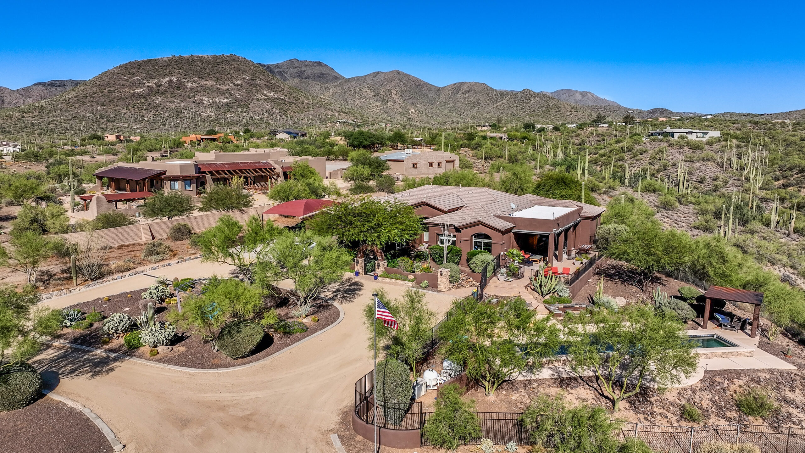
The Rocky Mountains create a visual context that no other U.S. city can match. We position shots to take full advantage of the Front Range backdrop for construction marketing, real estate listings, and commercial brand content — imagery that stops the scroll.
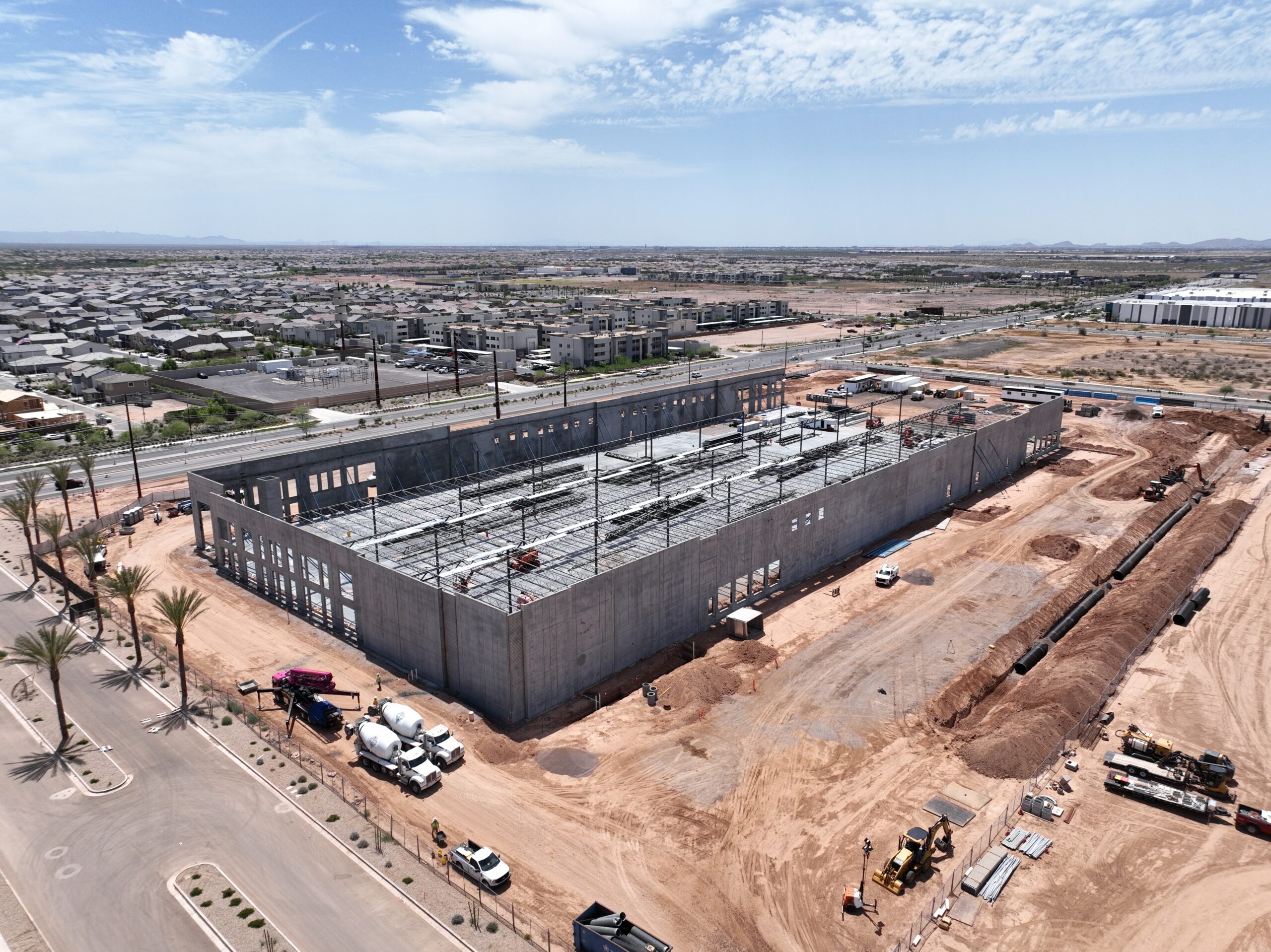
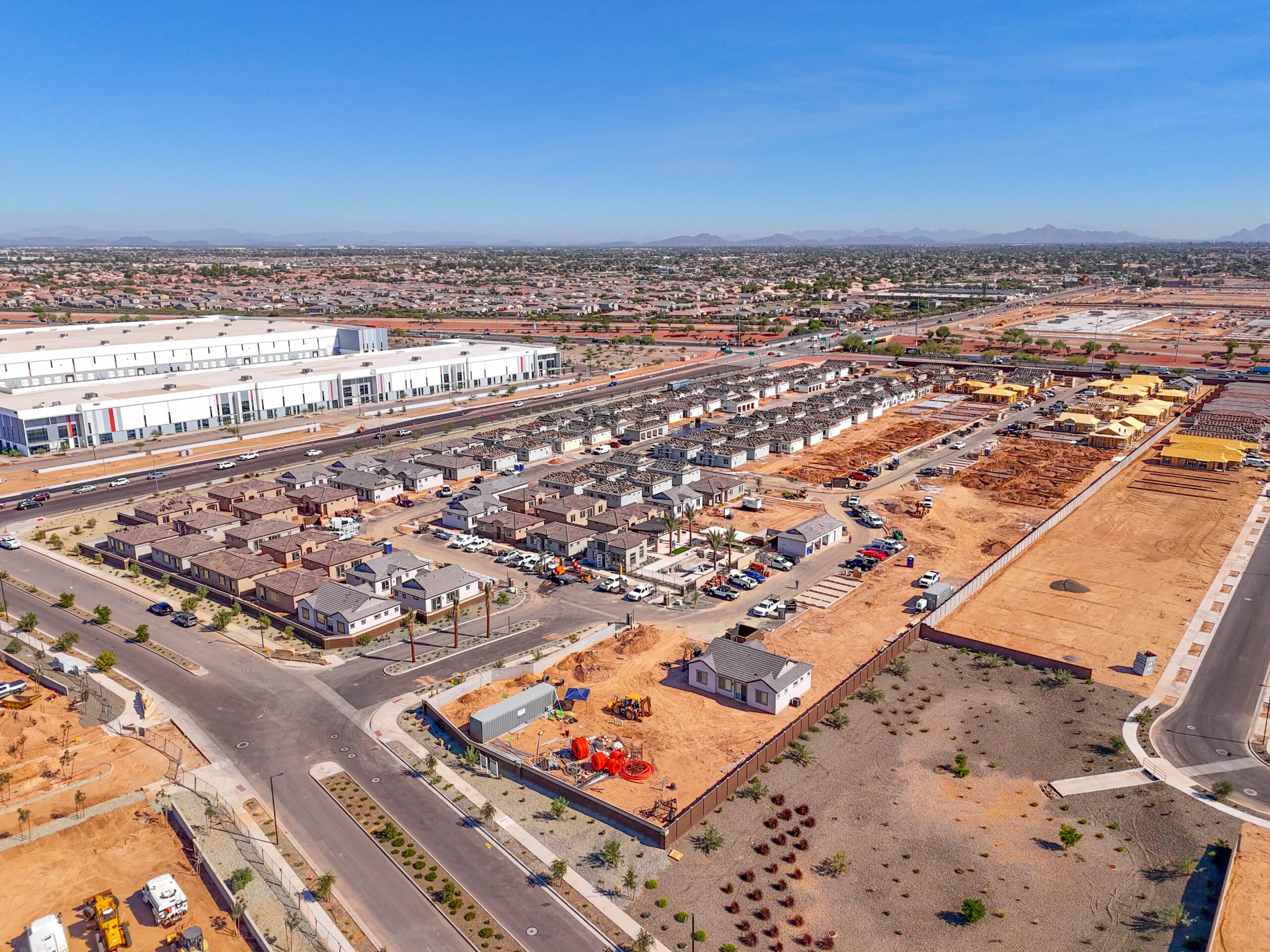
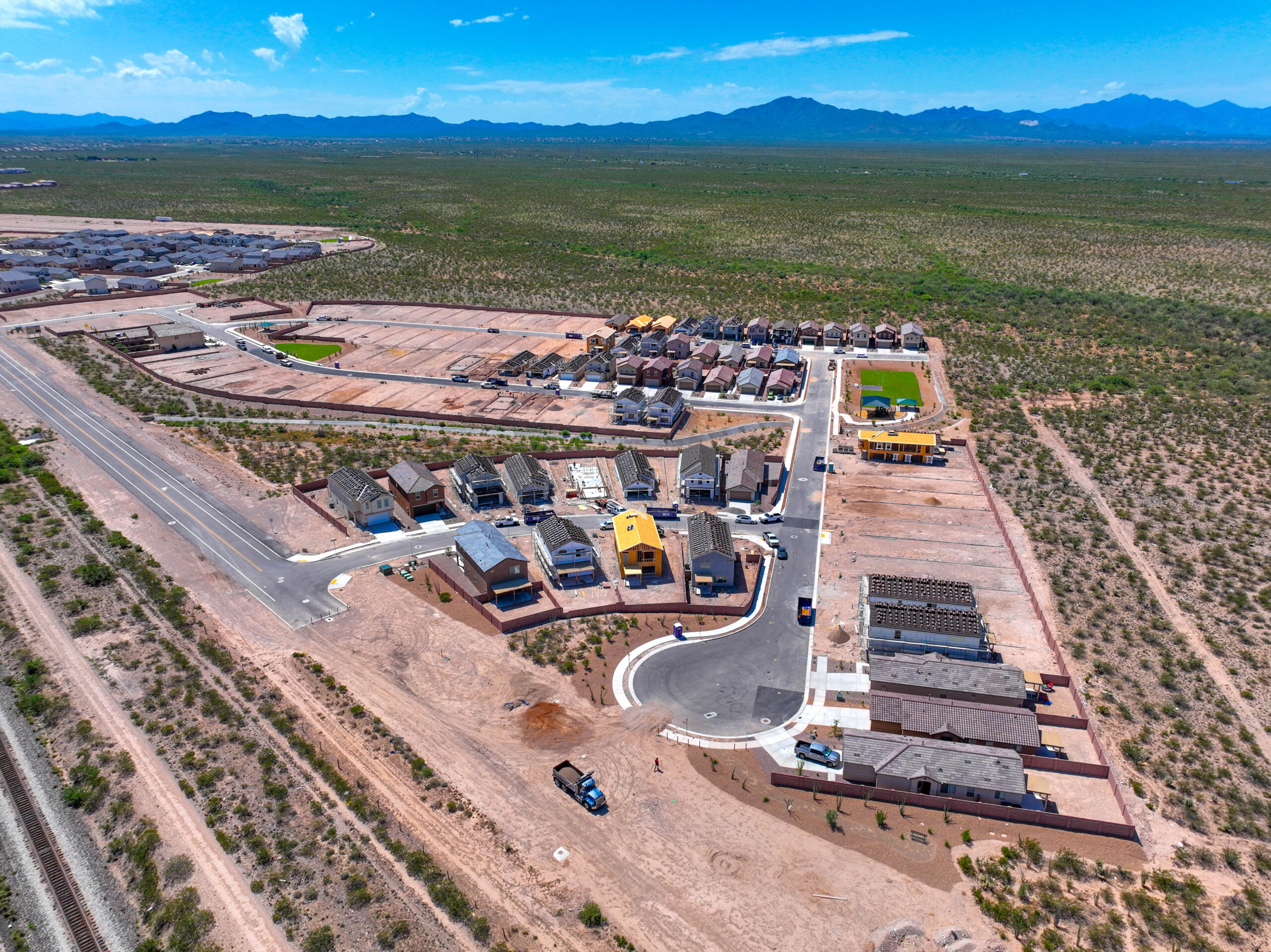
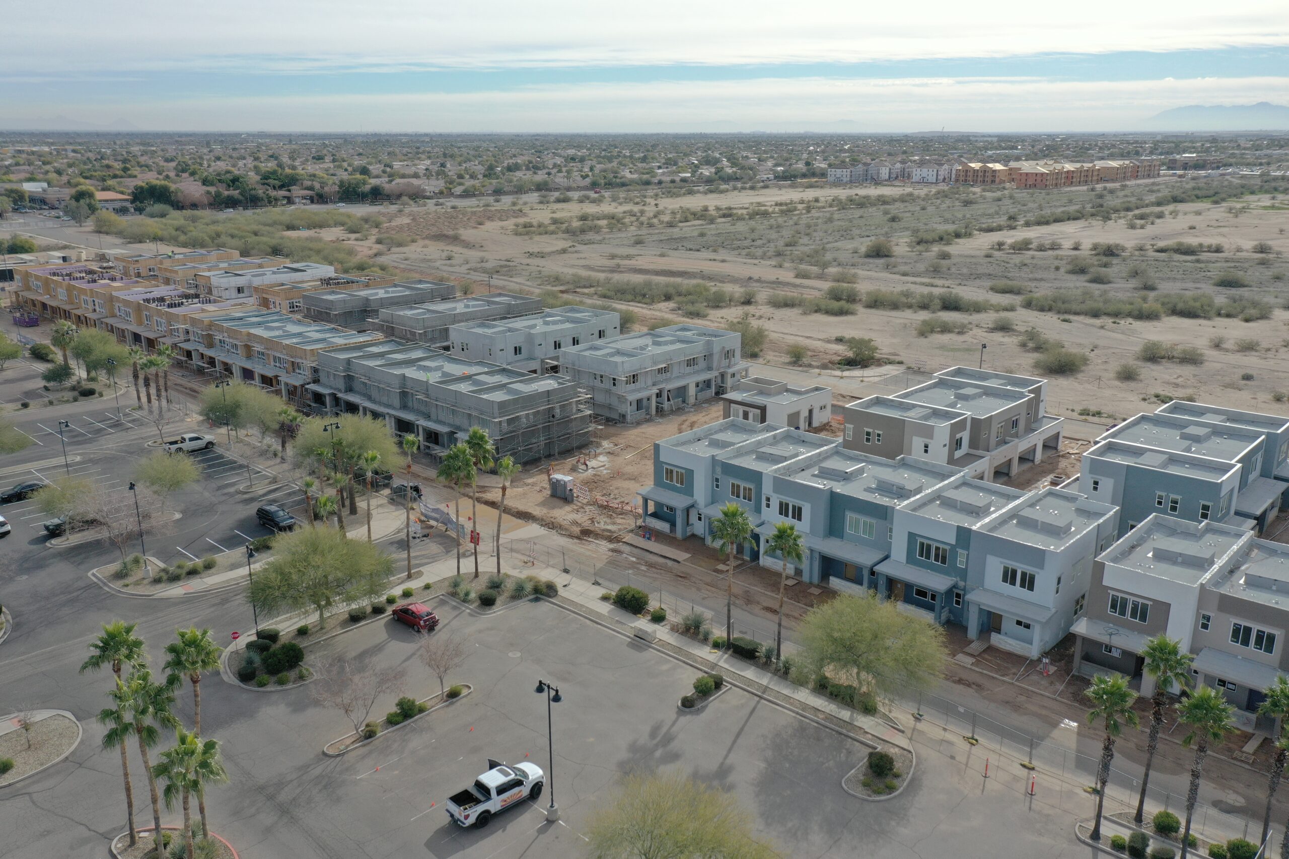
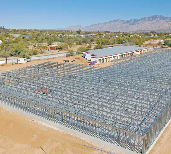
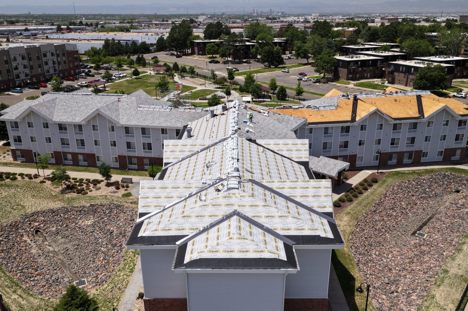
Denver has experienced significant construction growth in mixed-use, residential, and commercial categories. We serve GCs and developers with reliable progress documentation, orthomosaic mapping, and milestone photography across the Denver metro and suburban Front Range.
Colorado’s energy industry — oil and gas in Weld County, wind and solar across the Eastern Plains, and pipeline inspection corridors — has strong drone inspection and surveying needs. We serve energy sector clients with thermal FLIR, surveying, and infrastructure inspection services.
Denver and the broader Front Range corridor is one of the most economically dynamic regions in the Mountain West. Construction is booming from the Denver Tech Center to Northglenn, real estate is highly competitive in neighborhoods like Cherry Creek, LoHi, and the Highlands, and Colorado’s energy and tourism industries create unique aerial service demand that differs markedly from desert Southwest markets.
High altitude is the defining operational characteristic of Denver drone work. At 5,280 feet MSL, our standard equipment produces slightly reduced maximum altitude and shortened flight times compared to lower-elevation operations. We plan accordingly — bringing additional batteries, calculating conservative flight parameters, and scheduling around Denver’s frequently windy afternoon conditions. For projects in the higher terrain west of Denver (Evergreen, Golden, Morrison), we adjust further for elevation gain.
Denver International Airport’s Class B airspace is one of the largest in the country, with complex shelf structures that affect operations throughout the metro. We use LAANC for instant airspace authorization on the vast majority of Denver-area jobs. For projects near Colorado’s other airports — Boulder Municipal, Centennial, Front Range — we coordinate the appropriate Class D or Class E airspace authorization.
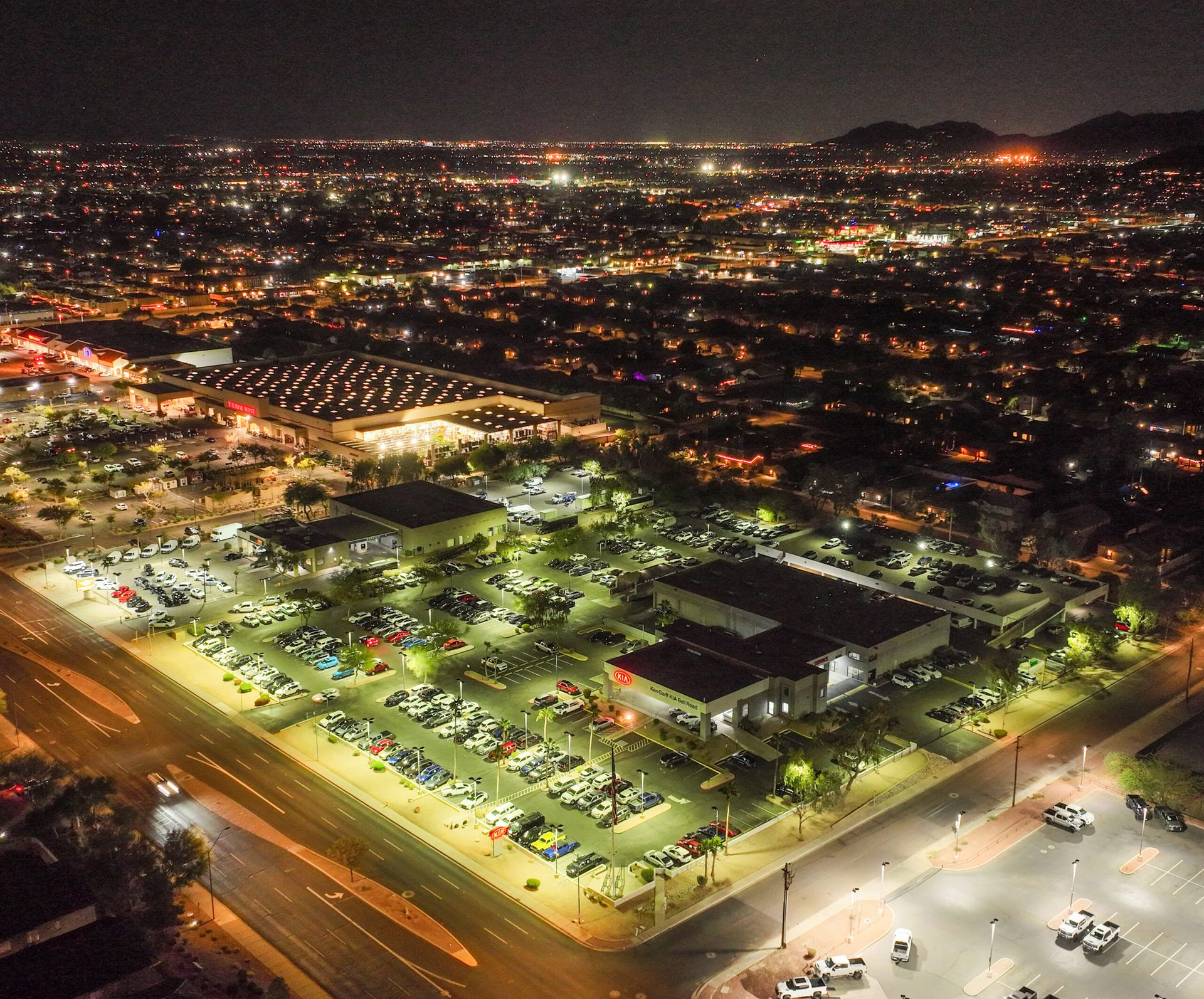
Our Denver clients span commercial real estate photography and marketing, construction progress documentation for Front Range developers, energy sector inspection and surveying, and tourism/hospitality content for Colorado mountain properties. We also serve Boulder, Colorado Springs, Fort Collins, and Castle Rock for projects within reasonable drive distance.
Denver’s real estate market is one of the most competitive in the country, with high buyer demand for Front Range properties that offer mountain views, walkability, and proximity to outdoor recreation. Aerial photography communicates neighborhood context — proximity to parks, highway access, mountain backdrops — in ways that ground-level photography cannot. We serve luxury agents in Cherry Creek and the Highlands, as well as volume builders in Aurora, Thornton, and Littleton.
Denver’s construction pipeline includes mixed-use developments in RiNo and LoHi, commercial office and industrial in the DTC and I-25 corridor, and residential master plans in suburban Front Range communities. We provide construction progress documentation, drone mapping, and milestone photography for general contractors, project owners, and development companies throughout Arapahoe, Jefferson, Adams, and Douglas counties.
Colorado is a major energy-producing state, with active oil and gas operations in Weld County’s DJ Basin, pipeline infrastructure across the Front Range, and growing renewable energy projects on the Eastern Plains. We perform aerial inspection photography for pipeline corridors, wellpad documentation, and wind/solar facility surveys.
Colorado’s outdoor recreation economy generates significant demand for aerial tourism and hospitality content — ski resort marketing, mountain town real estate, eco-lodge photography, and trail/recreation area documentation. We serve tourism marketing firms, hospitality developers, and property owners with aerial content that communicates the unique appeal of Colorado’s mountain communities.
Colorado’s aggregate mining and quarry operations have drone mapping and inspection needs similar to Arizona’s mining sector. We serve quarry operators, mining engineers, and aggregate producers with stockpile volume surveys, orthomosaic maps, and progress documentation for operations across the Front Range and Western Slope.
A sample of our aerial work across the Denver metro and Front Range — real estate, construction, energy, and more.
Denver-area pricing reflects professional-grade high-altitude operations, FAA certification, and the travel logistics of the Front Range market. Every quote is customized to your project’s scope and deliverables.
| Service | Typical Range | What’s Included |
|---|---|---|
| Aerial Photography | $350 – $650 | 10–20 edited stills, next-day delivery |
| Real Estate Package | $275 – $550 | Photos + 60–90 sec video |
| Construction Progress Visit | $400 – $850 | Ortho map + progress photos |
| FPV Videography | $950 – $1,700 | Cinematic FPV edit, color graded |
| Full Video Production | $900 – $2,000 | Edited video with music |
| Energy/Pipeline Inspection | $600 – $1,500 | Inspection photos + report |
Pricing varies by project size, location, and number of deliverables. Contact us for a free custom quote — we typically respond within 2 hours during business days.
Rated 5.0★ from 271 verified Google reviews across our locations.
John and team are the consummate professionals! Very reliable, quick, and high quality deliverables!
Professional, efficient, and easy to work with. The team delivered clean, high-quality aerials and communicated clearly throughout the project.
Needed work done quickly for drone photography. They responded quickly, knew exactly what was required, and explained it well — great customer service.
John was a professional and very knowledgeable. He made the process of getting drone footage seamless and did an exceptional job.
Absolutely amazing experience with Desert Drones. They did a shoot for my business and made my product really speak for itself!
John is a true professional. Every time we need drone photography or videography done, he is excited to take on the project.
Commercial drone photography in Denver typically ranges from $275 to $650 for aerial and real estate packages, and $400 to $850 per visit for construction progress documentation. Full video production starts at $900. Desert Drones provides free custom quotes — contact us at 303.997.3271 or submit the form below.
Yes — Denver’s elevation (5,280 feet MSL) does affect drone performance, but does not prevent commercial drone operations. At altitude, drones experience slightly reduced battery life and propeller efficiency due to thinner air. Desert Drones accounts for these factors in all Denver-area flight planning. FAA Part 107 altitude limits apply to height above ground level (AGL), not above mean sea level — so the 400-foot AGL limit still applies regardless of Denver’s elevation.
Denver International Airport (DEN) is surrounded by Class B controlled airspace that covers a large portion of the metro area. Commercial drone operations within this airspace require FAA LAANC authorization, which Desert Drones obtains automatically before every Denver job. Operations near Boulder Municipal Airport (Class D) or Centennial Airport also require airspace coordination. For most Denver commercial projects, LAANC approvals are instant and do not delay scheduling.
Yes — Desert Drones serves Denver and the broader Front Range including Boulder, Aurora, Thornton, Lakewood, Arvada, Westminster, Englewood, Centennial, Littleton, Castle Rock, and Colorado Springs. Fort Collins and Greeley are served for larger projects. The Boulder area has its own airport (Boulder Municipal, Class D) which requires airspace coordination we handle in advance.
Denver’s city parks prohibit drone operations with three exceptions: East Reservoir, Hutchinson Park, and Wright Street Park are designated drone-approved areas. For commercial drone jobs on private property, commercial construction sites, or operations outside city parks, Denver’s park ordinance does not apply. Desert Drones focuses on commercial client projects where operations are on private property or properly permitted locations.
Yes — the Front Range regularly experiences afternoon upslope winds, particularly in spring and summer. We schedule shoots for morning or early afternoon windows when wind conditions are most favorable. If conditions change on your scheduled day, we’ll notify you promptly and reschedule at no charge when weather makes safe operations impossible.
Desert Drones operates professional-grade DJI systems including the Mavic 3 Enterprise, DJI M30T for thermal inspections, and FPV platforms for cinematic production work. For high-altitude Denver operations, we configure equipment with additional battery capacity and conservative flight parameters. We carry $2 million in liability insurance on every job.
We serve Denver and the Front Range including Boulder, Aurora, Thornton, Lakewood, Arvada, Westminster, Englewood, Centennial, Littleton, Castle Rock, and Colorado Springs.