
Dallas–Fort Worth is building faster than almost any metro in the country — master-planned communities, distribution centers, and data-center campuses breaking ground across the region. We fly FAA-certified missions that turn that constant change into a record your lenders and stakeholders can read: monthly progress sets, orthomosaic site maps, and earthwork volumetrics.
FAA Part 107 Certified · Fully Insured · LAANC Authorized · 5.0★ from 271 Google reviews
Desert Drones is an FAA Part 107–certified drone services company providing construction progress documentation, orthomosaic site mapping, 3D models, and earthwork volumetrics for builders, developers, and general contractors across Dallas–Fort Worth. We fly active sites on a recurring schedule — weekly, monthly, or by milestone — with licensed pilots on the ground in the metro, and deliver measurable maps and consistent progress sets within 48 hours.
Every mission is planned around your reporting needs and delivered in formats your team and stakeholders already use.
Usable data your team, your subs, and your lenders can all work from — not a shoebox of photos.
Whether it's a master-planned community in Prosper or a distribution center off I-35, a construction drone job comes down to three deliverables.
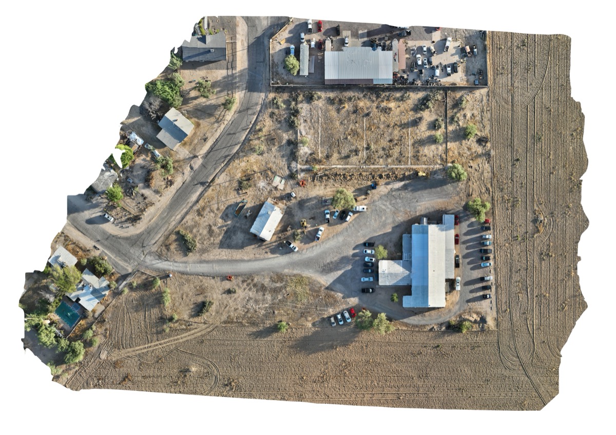
A stitched, measurable map of the entire site each visit — drop it under your civil drawings to check grading, layout, and progress against plan.
GEOTIFF · MEASURABLE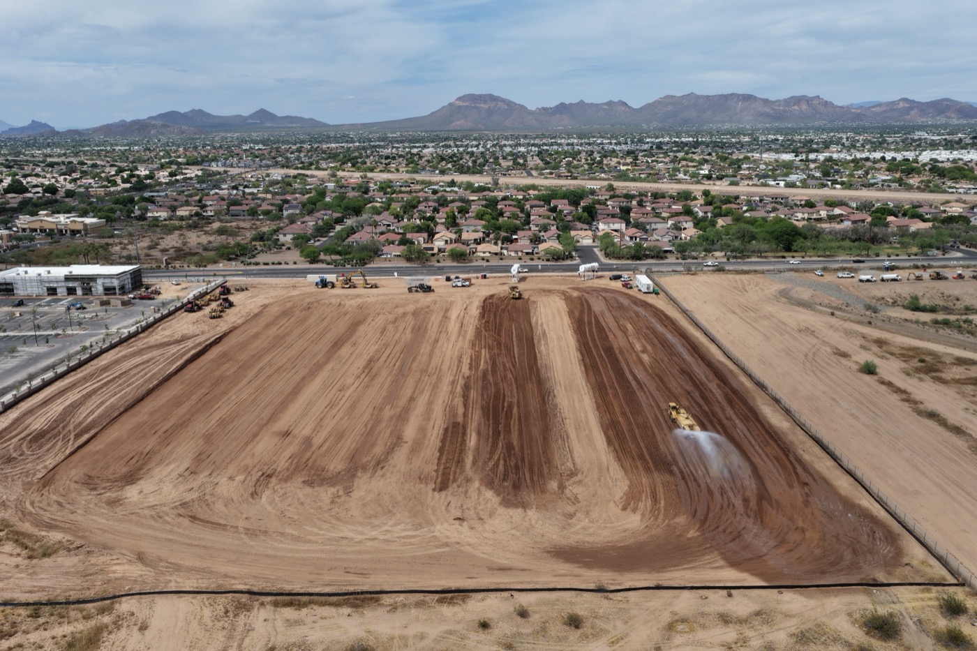
Measured cut/fill and stockpile volumes in cubic yards against a documented base plane — the numbers that support pay apps and reconcile dirt on a moving DFW site.
CUT / FILL · REPORTS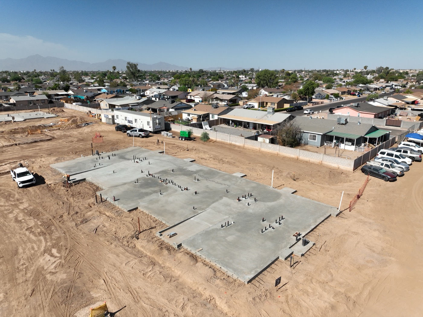
Same-angle progress imagery on a standing cadence, geo-referenced so month-over-month comparison is one-to-one — the record lenders and equity partners want.
MONTHLY · ARCHIVEDWe fly construction across Dallas–Fort Worth with FAA Part 107 pilots on the ground in the metro — and we handle the LAANC authorizations for the DFW, Love Field, and Alliance airspace most metro sites sit under.
Most builders set us up once and let it run — here's the path from first call to a standing cadence.
We confirm the site boundary, what you need documented, and a cadence — weekly, monthly, or by milestone. You get a quote and a first flight date on that call.
We fly the same repeatable pattern every visit, pull the LAANC authorization ahead of time, and coordinate around your crews.
Imagery is processed the day of the flight — maps stitched, volumes calculated, highlights flagged.
You get the full set within 48 hours by shared link, and every prior capture stays archived.
Flying construction in DFW isn't the same as anywhere else — here's how we plan around it.
We know the DFW build-out — Frisco, Prosper, Celina to the north; the I-35 and AllianceTexas logistics corridors — the access, staging, and sightlines that make a clean progress set.
Before Texas storm season we lock in a dated baseline of site conditions. If hail or a windstorm hits, you have evidence for insurance and delay claims.
DFW's data-center and distribution boom means large-footprint sites where an aerial map beats a ground walk — that's exactly the work drones do best.
Most metro sites sit under DFW International, Love Field, Addison, or Alliance airspace. We pull the LAANC authorization before every flight.
On an active DFW jobsite, the difference between a licensed pro and a hobbyist is legal, insurable, and measurable.
Construction clients often bundle these — same DFW pilots, same day when it makes sense.
Yes — most of DFW is controlled airspace near DFW International, Love Field, Addison, or Alliance. We hold FAA Part 107 certification and pull the LAANC authorization for each flight; sites needing a further authorization can take 3–4 weeks, which we handle.
Weekly, monthly, or milestone-based — whatever your reporting cadence requires. Many GC and developer sites run on a standing monthly schedule.
Yes — orthomosaic maps plus cut/fill and stockpile volumetrics with measured reports, suitable for coordination and pay-app support.
Progress documentation, orthomosaic site mapping, 2D/3D models, earthwork and stockpile volumetrics, thermal/roof QA scans, and marketing flyovers.
FAA Part 107 certified and fully insured. We provide a certificate of insurance on request and can add your entity as additional insured when a project requires it.
Most work is quoted per flight, with a lower per-visit rate on a standing schedule. Tell us the site size and cadence and we'll give you a flat number.
Rated 5.0★ from 271 verified Google reviews across our locations.
John and team are the consummate professionals! Very reliable, quick, and high quality deliverables!
Professional, efficient, and easy to work with. The team delivered clean, high-quality aerials and communicated clearly throughout the project.
Needed work done quickly for drone photography. They responded quickly, knew exactly what was required, and explained it well — great customer service.
John was a professional and very knowledgeable. He made the process of getting drone footage seamless and did an exceptional job.
Absolutely amazing experience with Desert Drones. They did a shoot for my business and made my product really speak for itself!
John is a true professional. Every time we need drone photography or videography done, he is excited to take on the project.
Tell us the location and your reporting cadence — we'll get you a quote and a first flight date.