
From warehouse shells rising in far-east El Paso to new communities climbing the Northeast, the Borderplex is building. Weekly aerial documentation keeps owners, GCs, and lenders looking at the same site truth — progress photos, orthomosaic maps, and milestone sets, delivered on schedule.
FAA Part 107 Certified · Fully Insured · LAANC Authorized · 5.0★ from 271 Google reviews
Desert Drones provides FAA Part 107–certified construction drone services in El Paso, TX — recurring progress documentation, orthomosaic site maps, milestone photography, and completion video for general contractors, developers, and owners across the Borderplex. We fly with a licensed pilot based in El Paso and deliver on a schedule your project team can plan around.
One visit, one consistent shot list — so week 30 compares cleanly to week 3.
Organized, dated, and delivered the same way every visit — built for OAC meetings and pay-app packages.
Representative captures from our pilots — the deliverables an El Paso project gets, visit after visit.
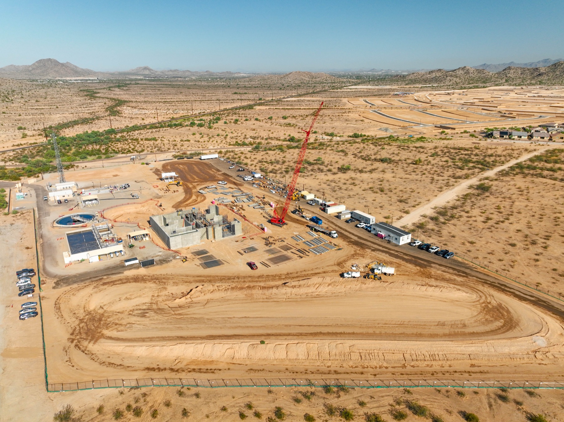
The same framing every visit turns photos into a timeline — owners see momentum, GCs get protection, lenders get proof for the draw.
PROGRESS · RECURRING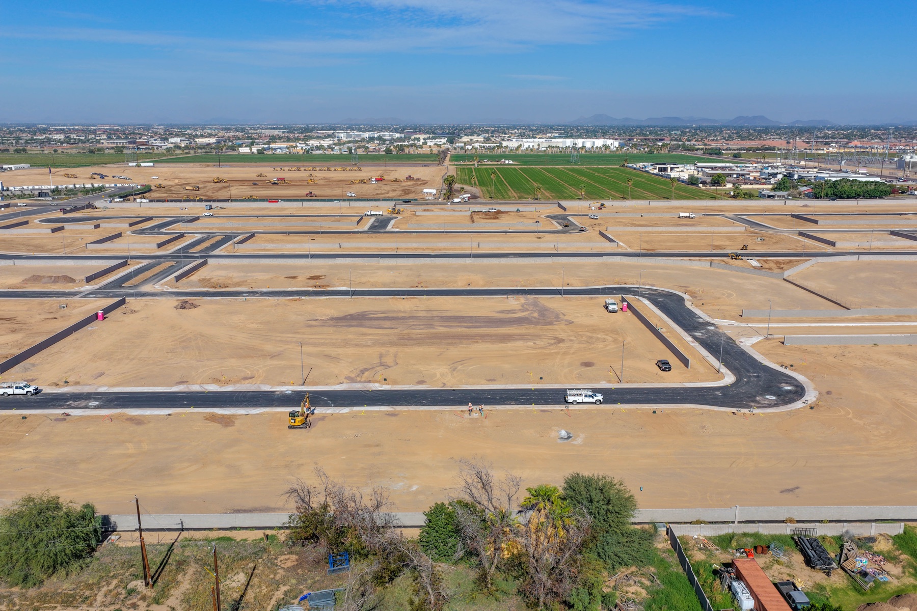
A measurable, top-down map of the entire site — overlay it on the civil drawings, measure stockpiles and laydown, and settle where-things-are questions in seconds.
ORTHO · MEASURABLE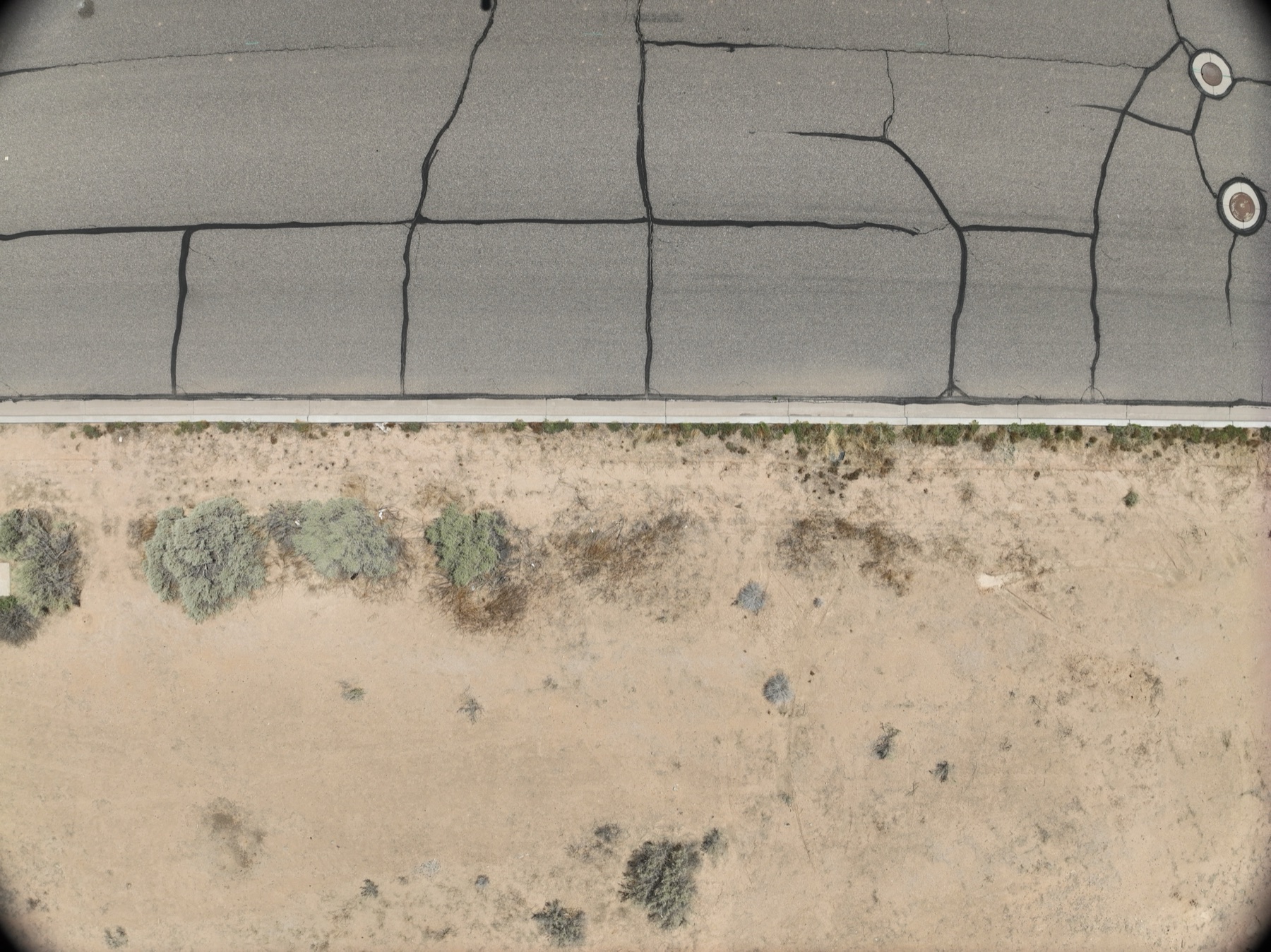
Cut, fill, pads, and drainage in one readable frame — the stage of the job where aerial documentation pays for itself fastest.
EARTHWORK · PADSWe document projects across the Borderplex with an FAA Part 107 pilot based in El Paso, coordinated by our team — same shot list, same cadence, whether the site is a far-east warehouse shell or a Northeast community.
Set the cadence once — then the documentation just shows up.
Send the site plan and what you need — weekly progress, monthly orthos, milestone sets, or all three. We build the shot list.
Our licensed El Paso pilot flies the same mission every visit, with LAANC pulled for ELP Class C airspace and military airspace at Biggs planned around.
Photos edited and organized; orthomosaics processed and checked against the previous visit.
Everything lands in your shared folder, dated and organized, before the OAC meeting.
El Paso's construction market has its own physics. Here's what we plan around.
Cross-border trade keeps far-east El Paso adding warehouse and distribution space. Big-footprint shells are exactly what orthomosaic documentation was made for.
Horizon City, the Far East, and the Northeast keep adding communities — much of it Fort Bliss–driven. Recurring aerials sell homes and document the build at once.
High sun, spring winds, and monsoon dust are real factors. We schedule flights for clean light and safe wind windows — and we've operated in desert conditions for years.
ELP's Class C covers much of the metro, with Biggs Army Airfield and Fort Bliss to the northeast. We pull LAANC and plan around military airspace on every mission.
Construction documentation has to be legal, repeatable, and accurate enough to settle disputes — that takes a licensed operation, not a hobbyist with a drone.
Construction clients often bundle these — same pilot, same visit when it makes sense.
Whatever cadence the project needs — weekly and monthly are most common. The framing stays identical visit to visit so progress is comparable.
Yes — measurable top-down maps (GeoTIFF/JPEG) you can overlay on civils, updated on your schedule.
Yes on the airport side — most ELP Class C flights are authorized through FAA LAANC. Near Biggs and Fort Bliss we plan the mission around military airspace and tell you upfront what's flyable.
Recurring site visits in El Paso typically run $400–$800 per visit depending on site size and deliverables; orthomosaic processing adds to that. We quote per site.
FAA Part 107 certified and fully insured — certificate of insurance available for your project file.
A licensed Part 107 pilot based in El Paso, flying a professional mapping-capable drone, coordinated and quality-checked by our team.
Rated 5.0★ from 271 verified Google reviews across our locations.
John and team are the consummate professionals! Very reliable, quick, and high quality deliverables!
Professional, efficient, and easy to work with. The team delivered clean, high-quality aerials and communicated clearly throughout the project.
Needed work done quickly for drone photography. They responded quickly, knew exactly what was required, and explained it well — great customer service.
John was a professional and very knowledgeable. He made the process of getting drone footage seamless and did an exceptional job.
Absolutely amazing experience with Desert Drones. They did a shoot for my business and made my product really speak for itself!
John is a true professional. Every time we need drone photography or videography done, he is excited to take on the project.
Send the site plan and your timeline — we'll scope the program and quote it.