
Desert Drones is an FAA Part 107 certified, fully insured commercial drone company. We fly for general contractors, developers, property managers, engineering firms, and marketing teams across the Southwest, and we cover the rest of the country through a vetted pilot network with one point of contact. Flat quotes, airspace handled, deliverables in 48 hours.
FAA Part 107 Certified · $1M Liability Insured · LAANC Authorized · 5.0★ from 271 Google reviews
Commercial drone services are aerial data and media captured by a licensed operator for a business purpose: construction progress documentation, orthomosaic site mapping and volumetrics, roof, solar and thermal inspections, commercial real estate marketing, industrial facility documentation, and advertising footage. Desert Drones LLC provides all of these from home markets in Phoenix, Tucson, Las Vegas, Dallas, El Paso, Denver, and Albuquerque, and nationwide through its Part 107 pilot network.
National retailers, homebuilders, general contractors, and commercial real estate firms, documented from the same aerial program.

Every engagement is scoped around what your team has to produce next: a draw request, a listing, a maintenance plan, a claim, a campaign.
One licensed, insured team for the whole list. Each service has its own page with scope, deliverables, and examples.
Anonymized where a client asked for it. Each one links to a short write-up with the airspace, deliverables, and what the client did with them.
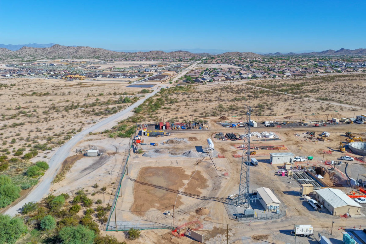
Scheduled progress documentation of a water reclamation facility expansion: repeatable flight plans, dated photo sets, and orthomosaics for the owner and the contractor. See the Goodyear project →
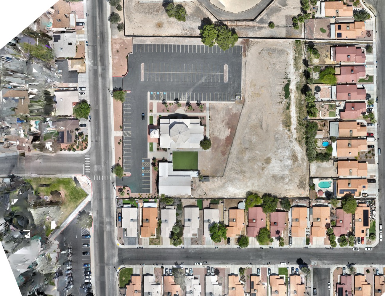
Pre-construction topographic survey and orthomosaics delivered to a civil engineering firm for site design, flown under Class B authorization. See the Las Vegas survey →
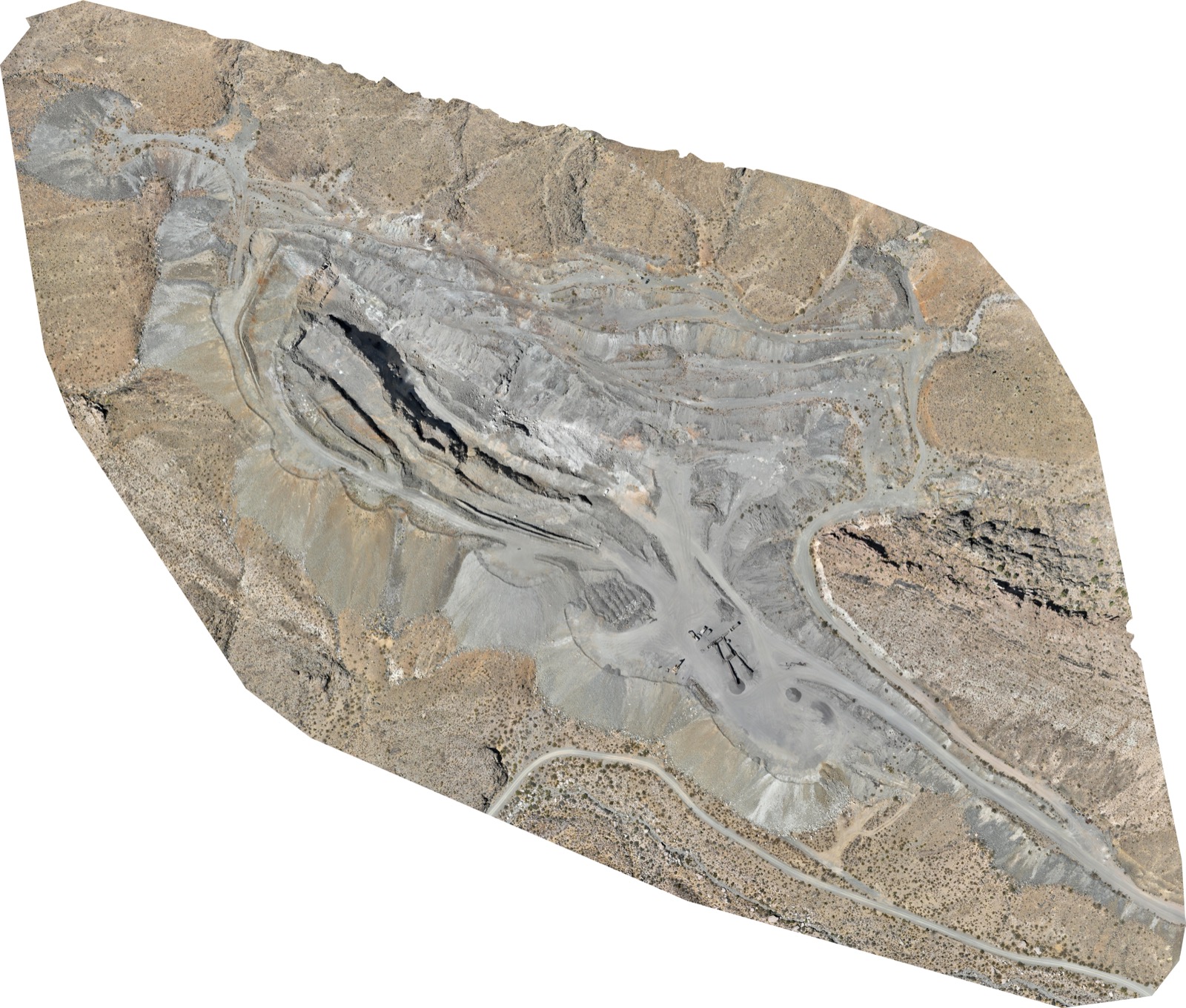
High-resolution orthomosaic of three mine areas from roughly 4,000 images, processed for a global mining company and scheduled for a repeat overflight. See the mine orthomosaic →
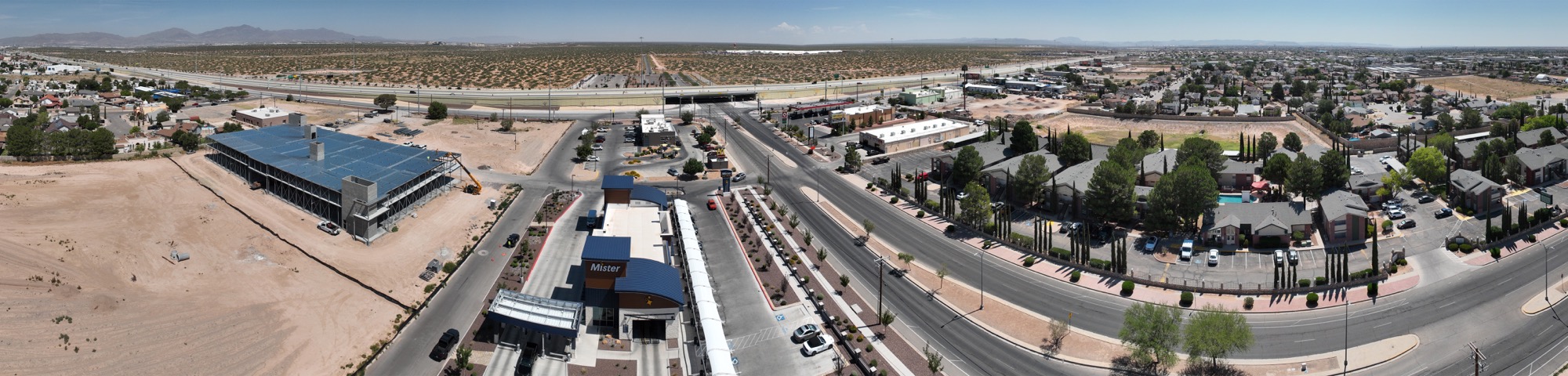
Aerial video and 360-degree stills of a commercial land parcel near the airport, produced for a national brokerage's marketing package. See the El Paso site →
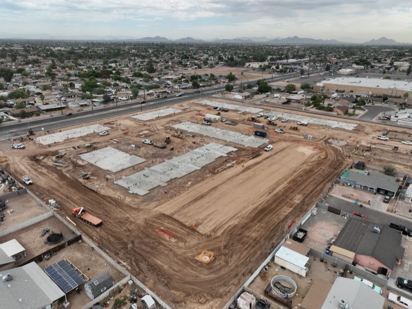
Monthly progress sets and site maps across two apartment communities for a national multifamily developer, flown on the same plan every visit for ownership and lender reporting. Construction progress services →
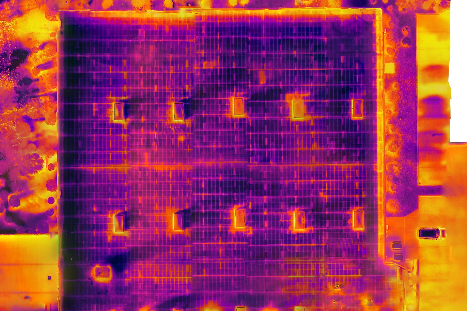
Radiometric thermal scan plus a measurable orthomosaic of a large commercial roof, delivered as an annotated report the contractor used to scope repairs and document the pre-work condition. Roof inspection services →
Three recent construction deliverables, as sent to the client.
Most clients set us up once and let it run. Here is the path from first call to a standing schedule.
Site address, what you need captured, how often, and who receives it. You get a flat quote on that call, with a lower per-visit rate on a standing schedule.
We pull LAANC authorization or file with the FAA for zero-altitude grids, and send a certificate of insurance before we mobilize. Your entity can be added as additional insured.
A Part 107 pilot flies a planned mission that is repeated on every visit. Most sites take under an hour on the ground, with crews working.
Edited stills and video, orthomosaics, volumetric reports, and 3D models within 48 hours through a shared link, DroneDeploy, or your own platform.
Everything arrives in formats that drop into your existing workflow. Raw files are available on request.
Per flight, as a flat number based on site size and deliverables. No hourly meters, no surprise processing fees. Typical ranges below; multi-site and recurring schedules are quoted lower per visit.
Our own pilots cover Arizona, Nevada, Texas, Colorado, and New Mexico from these home markets. Outside them, we deploy vetted Part 107 pilots from our network under the same capture standard, coordinated by one point of contact.
Yes. We carry $1M commercial liability coverage. A certificate of insurance is sent on request before the first flight, and your entity can be added as additional insured when a contract requires it.
Yes. Most of our commercial flights are over active sites with crews working or occupied commercial properties. We plan flight paths and timing to stay clear of personnel, equipment, and cranes, and we coordinate with your superintendent or property manager on the day.
Phoenix Sky Harbor, Las Vegas Harry Reid, Dallas Love Field, and most of our markets have controlled airspace. We pull LAANC authorization for sites under the facility map ceilings and file with the FAA for zero-altitude grids, which takes longer, so tell us early.
Standard turnaround is 48 hours from the flight. Progress photo sets are often same day. Orthomosaics, volumetrics, and 3D models depend on site size and are usually within two business days.
Per flight, as a flat number based on site size and deliverables. Recurring schedules get a lower per-visit rate because repeat sites are faster to fly and process. Mapping and volumetrics are quoted separately from photo and video.
Yes. Our own team covers Arizona, Nevada, Texas, Colorado, and New Mexico. Outside those states we deploy vetted Part 107 pilots from our network, with the same capture standard and one point of contact for the whole portfolio.
High-resolution JPEG and RAW stills, 4K video, GeoTIFF orthomosaics, DXF and LAS for engineering teams, PDF volumetric reports, and web-viewable 3D models. Files are delivered through a shared link or directly into DroneDeploy or your own platform.
Our orthomosaics and volumetric reports are produced from georeferenced flights with documented ground sample distance and, where required, RTK positioning and ground control. They are routinely used for pay-app support, dispute resolution, and insurance claim documentation.
Yes. One coordinator schedules every site, the same flight plan is repeated at each visit, and deliverables are organized by site and date so a regional manager can compare properties side by side.
A drone photographer sells images. A commercial drone services company is contracted for a business outcome: a dated progress record, a measurable site map, an inspection report, or campaign footage delivered to spec, with Part 107 licensing, insurance, and airspace authorization handled as part of the job.
5.0 stars across 271 Google reviews between our Southwest profiles.
John and team are the consummate professionals! Very reliable, quick, and high quality deliverables!
Professional, efficient, and easy to work with. The team delivered clean, high-quality aerials and communicated clearly throughout the project.
Needed work done quickly for drone photography. They responded quickly, knew exactly what was required, and explained it well. Great customer service.
John was a professional and very knowledgeable. He made the process of getting drone footage seamless and did an exceptional job.
Tell us the site, what you need back, and when. You will have a flat quote and a flight date the same day.