
A global mining company needed a current, georeferenced picture of three working areas at a gold mine in the mountains west of Las Vegas. Desert Drones flew all three in a single trip and delivered orthomosaics the client could drop straight into their own GIS.
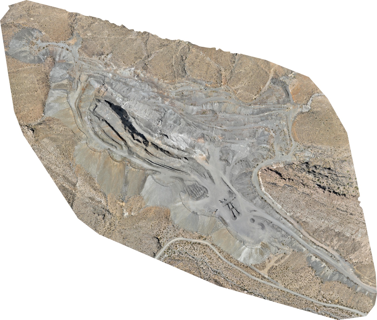
A working gold mine in steep, rocky terrain, with a deep pit, benched walls, haul roads and a processing pad at the bottom. The three areas the client wanted mapped sit at different elevations, and the largest one changes shape as mining continues. The client manages the property from overseas, so they needed imagery accurate enough to measure from, not just look at.
Each area was flown as a crossed grid, one pass east–west and one north–south, so the pit walls and benches were captured from two directions rather than only straight down. Terrain-following flight planning kept ground sampling distance consistent from the rim to the pit floor. The 87-acre area alone took 2,322 frames; the 36-acre and 6-acre areas added 1,367 and 296. All three were flown by the same FAA Part 107 certified pilot over four days.
One orthomosaic per area, georeferenced and exported with a KML overlay and world file, so the client's team could open it in their own mapping software without any conversion. The flight plans were saved so the survey can be repeated on the same lines, which is what makes change over time measurable: a second overflight is scheduled for December 2026 to compare against this baseline.
Mine sites are large, remote and expensive to walk. A drone orthomosaic gives the operator a single current image of the whole property at a resolution where individual boulders and bench edges are visible, in days rather than the weeks a ground survey of the same ground would take. For an owner working from another continent, it is the difference between managing from photographs and managing from data.
Every flight is by an FAA Part 107 certified, insured pilot. Tell us where the site is and what you need back.