
Desert Drones is an FAA Part 107 certified, fully insured drone inspection company. We inspect roofs, solar arrays, building envelopes, towers, and industrial facilities with high-resolution and radiometric thermal sensors, and deliver an annotated report within 48 hours. No lifts, no rope access, no shutdown. Home markets across Arizona, Nevada, Texas, Colorado, and New Mexico, nationwide through a vetted pilot network.
FAA Part 107 Certified · $1M Liability Insured · LAANC Authorized · 5.0★ from 271 Google reviews
Drone inspection services use a licensed remote pilot to capture high-resolution and radiometric thermal imagery of a roof, solar array, structure, or facility, then deliver an annotated report with every finding located on the asset. Desert Drones LLC provides visual, thermal, and measurement-grade drone inspections from home markets in Phoenix, Tucson, Las Vegas, Dallas, El Paso, Denver, and Albuquerque, and nationwide through its Part 107 pilot network, for property managers, roofing and solar contractors, general contractors, insurers, and plant operators. If you are searching for a drone inspection company near you in any of those markets, the pilot who flies your job is based there.
National retailers, homebuilders, general contractors, roofing and solar firms, and commercial property teams, documented from the same inspection program.

Every inspection is scoped around the decision you have to make next: a repair scope, a claim, a warranty, a maintenance budget, a purchase.
One licensed, insured team for every asset type. Each service has its own page with scope, deliverables, pricing, and examples by market.
Every finding is located on the asset and annotated in the report, with a paired visible and thermal frame where thermal was flown.
Anonymized where a client asked for it. Each one links to the service or project page with the airspace, sensors, and deliverables.
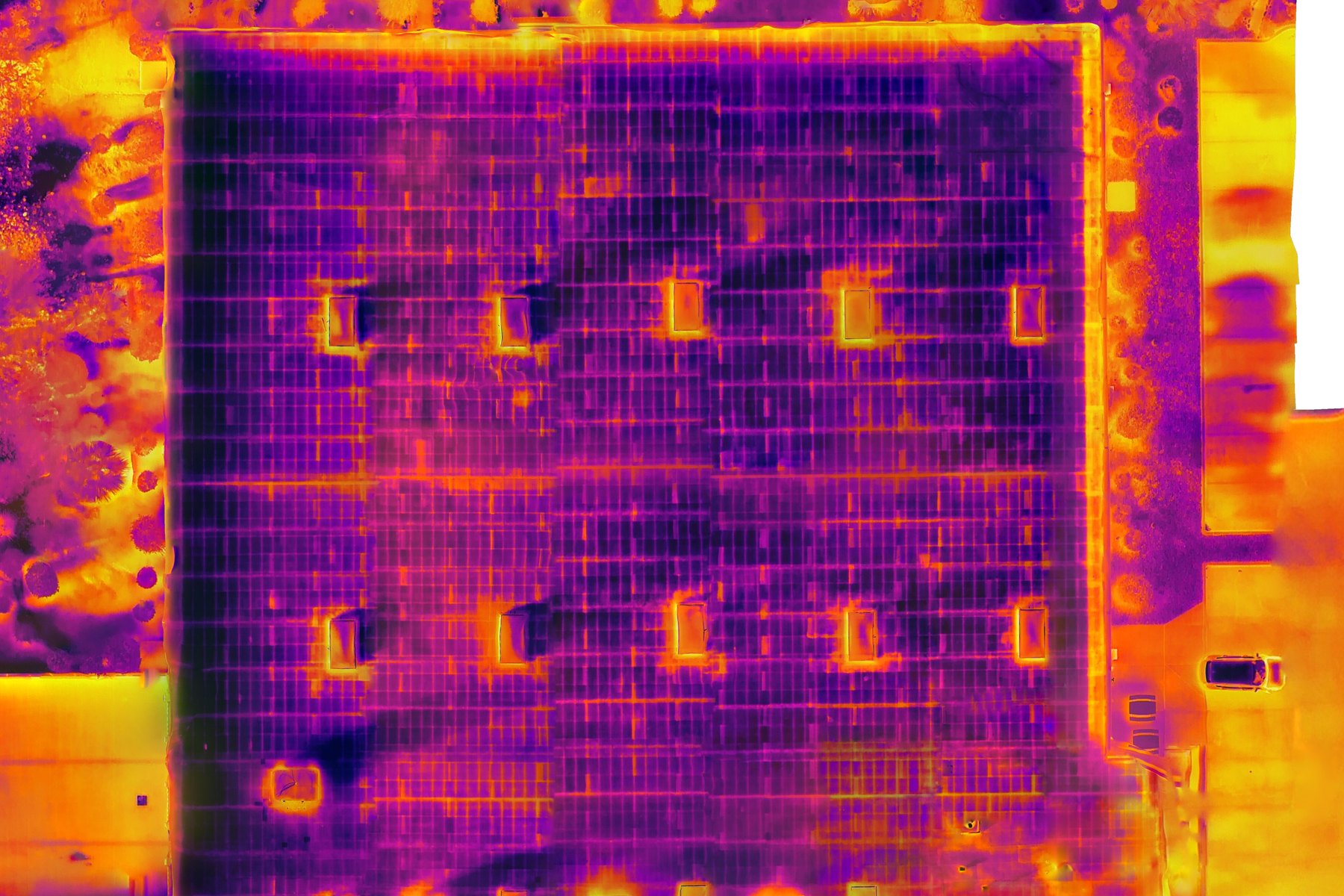
Post-sunset radiometric thermal survey plus visual orthomosaic of a four-acre flat roof, with wet-insulation areas quantified for a national roofing contractor, then re-flown before the repair. Read the Phoenix roof survey →
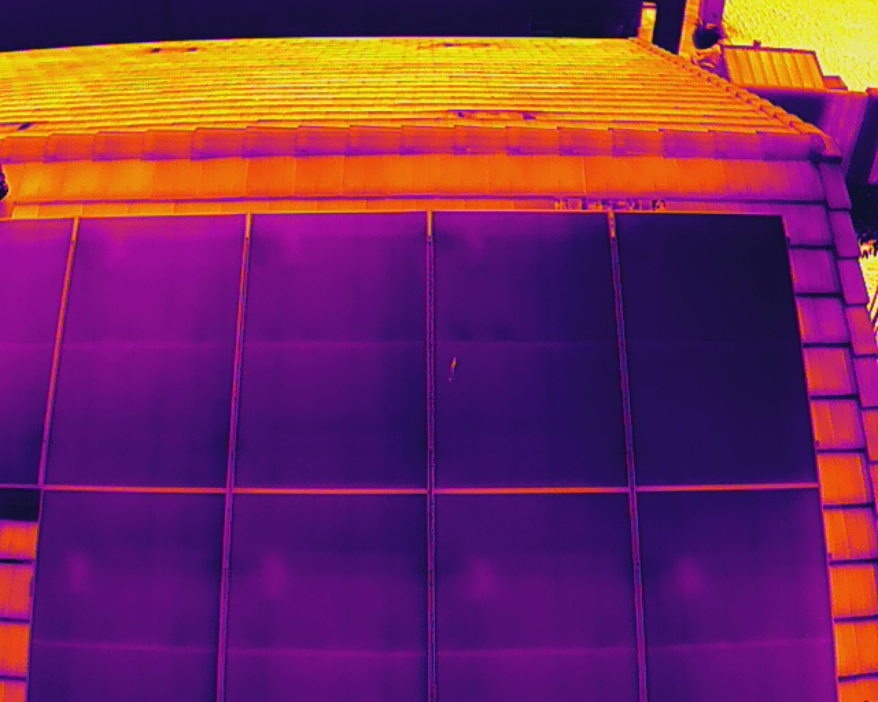
Thermal and visual scan of a rooftop array on an energized system, with underperforming modules located, classified by fault type, and reported to the owner for a warranty claim. Solar panel inspections →
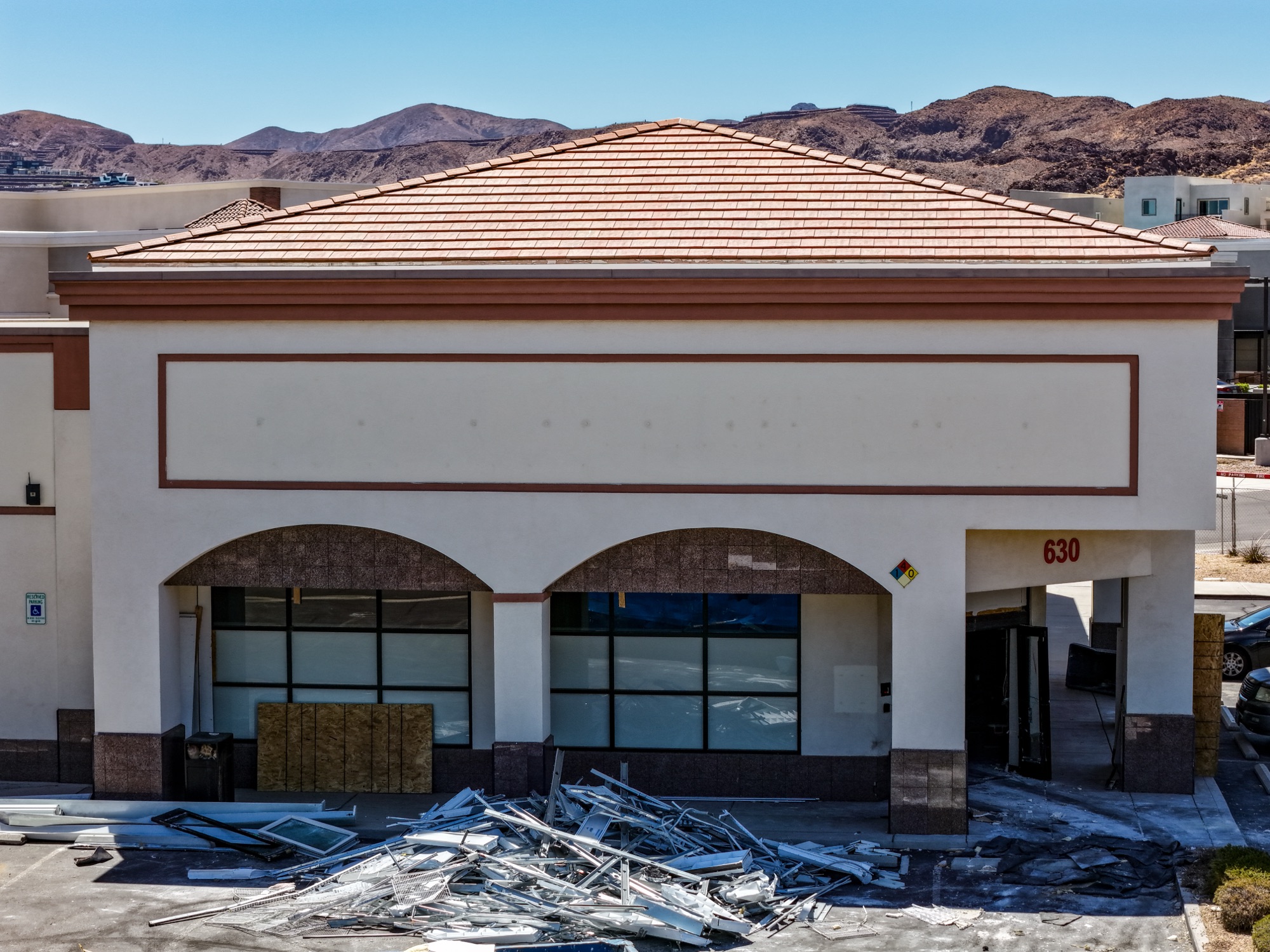
Visual roof inspection of a commercial building and its mechanical equipment, flown without a lift and delivered as dated, geotagged imagery for the property manager's asset file. Las Vegas roof inspections →
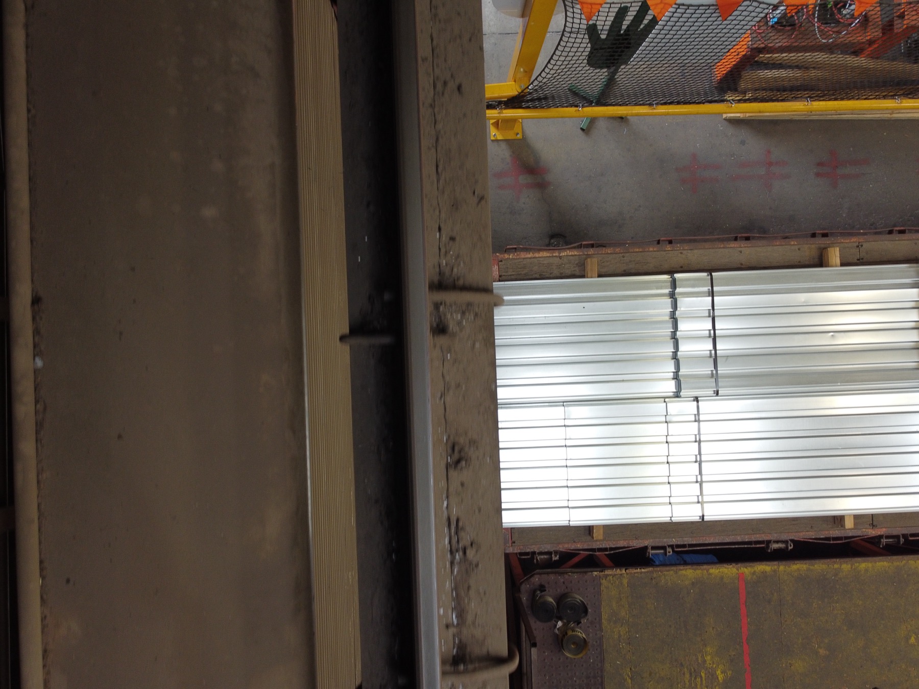
Overhead crane runway beams, columns, and rail clips inspected from the air inside a working plant: 417 photos and 4K video, no lift, no shutdown. Read the Glendale plant inspection →
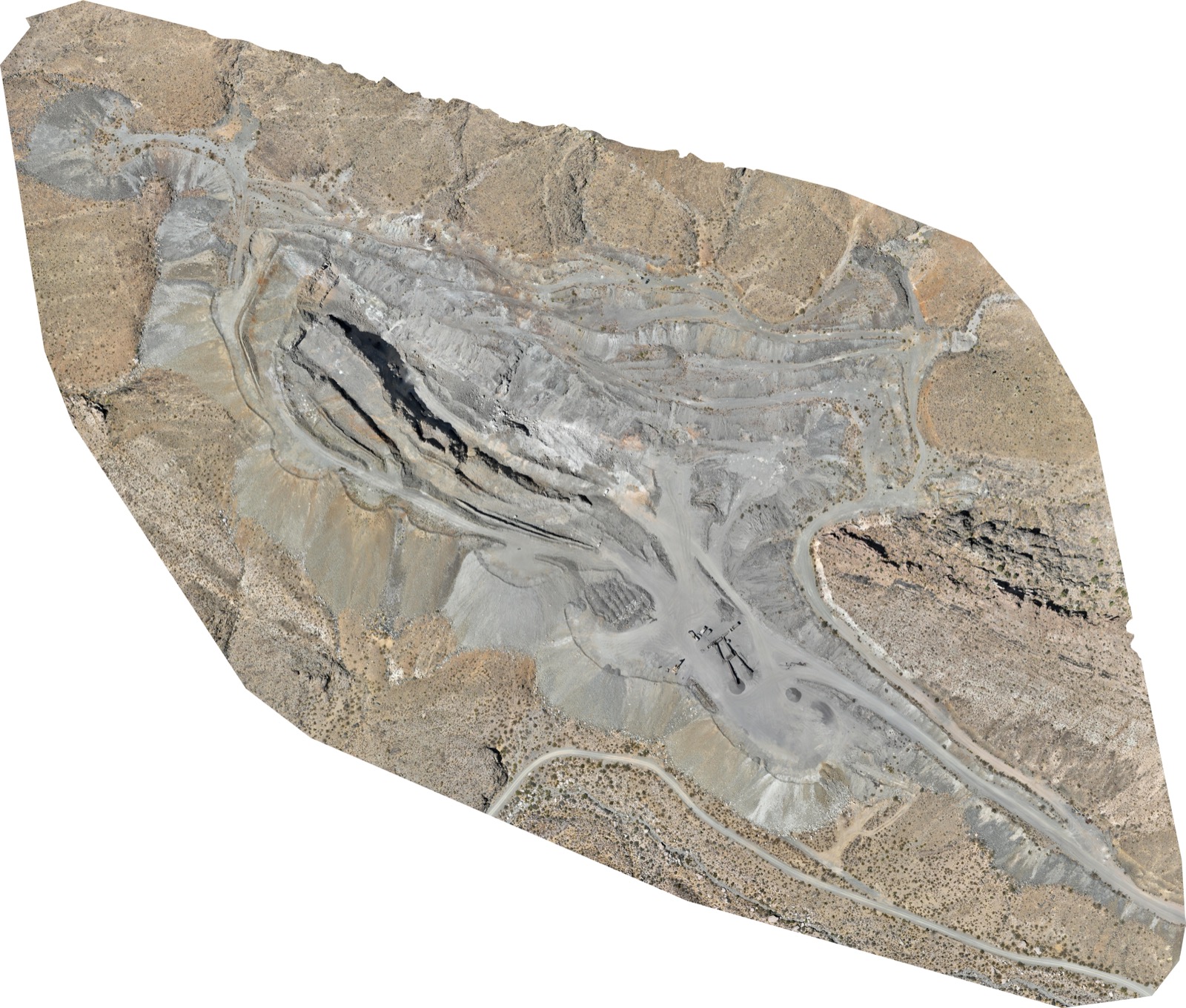
High-resolution orthomosaic of three mine areas from roughly 4,000 images, processed for a global mining company and scheduled for a repeat overflight. See the mine orthomosaic →
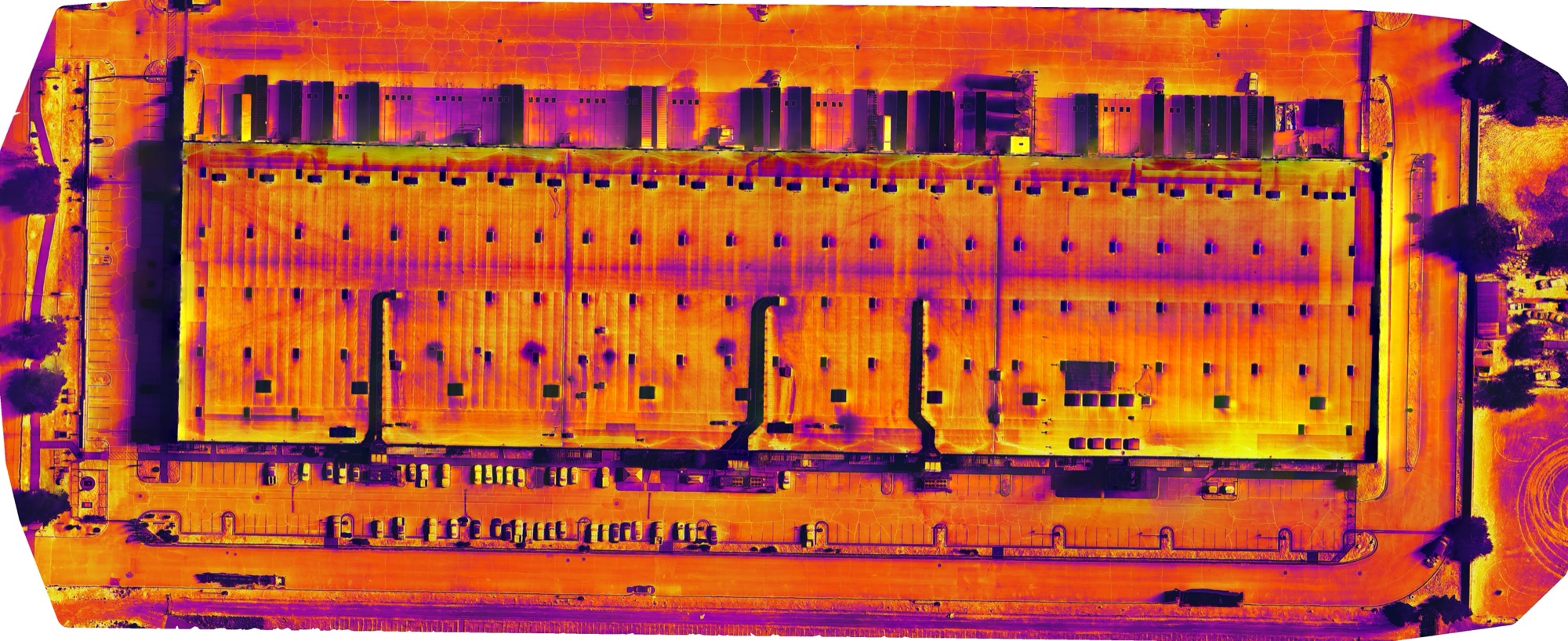
Post-sunset radiometric thermal survey stitched into a measurable thermal orthomosaic, so wet insulation could be quantified by area before the repair scope was written. Dallas thermal inspections →
A 40-second cut from real jobs: tile and flat-roof condition surveys, a post-sunset thermal moisture map, and an indoor crane-runway steel inspection, plus two site documentation deliverables.
From the first call to a report you can forward, without anyone on the roof or the structure.
Address, asset type, and what you need back: visual, thermal, measurements, or all three. You get a flat quote, and we pull LAANC or FAA authorization and send a certificate of insurance before mobilizing.
A Part 107 pilot flies a planned grid plus oblique detail passes with a high-resolution camera and, where needed, a radiometric thermal sensor at the right time of day. Most single assets take under 90 minutes on site.
Imagery is reviewed frame by frame, anomalies are located and classified, and thermal data is stitched into a measurable orthomosaic where it helps quantify the finding.
Annotated imagery, thermal findings, measurements, and a written summary within 48 hours through a shared link, DroneDeploy, or your own platform. Repeat flights use the same plan so visits are comparable.
Documentation you can act on or forward the same day. Raw files are available on request.
Flat per-asset quotes based on size and deliverables, with processing and the written report included. No hourly meters. Portfolios and recurring programs are quoted lower per site.
Our own pilots cover Arizona, Nevada, Texas, Colorado, and New Mexico from these home markets. Outside them, we deploy vetted Part 107 pilots from our network under the same capture standard, coordinated by one point of contact.
Each market has its own roof, solar, and thermal inspection page with local airspace notes, examples, and the number to call.
Most single-property drone roof inspections run $750 to $2,000 depending on roof area and whether thermal imaging is included. Rooftop and commercial solar or thermal scans start around $1,000. Single-site industrial volumetric surveys run $400 to $800. Portfolios, multi-building campuses, and recurring programs are quoted per site at a lower rate, and every quote is a flat number that includes processing and the written report.
For condition documentation they are usually better. A drone captures the entire roof or array at 1 to 3 millimeters per pixel, every photo is geotagged, and nothing is missed because a section was unsafe to walk. Radiometric thermal sensors record a temperature value for every pixel, so moisture and electrical anomalies are measured rather than guessed. What a drone does not do is physically probe a core sample or pull a panel, so for repair scoping we recommend the drone report first and a targeted hands-on visit only where it flags a problem.
On roofs: ponding, trapped moisture under the membrane, open seams and blisters, hail bruising and fractures, failed flashing and penetrations, displaced or cracked tile, clogged drains and scuppers, and parapet or coping damage. On solar: hot cells, bypass diode failures, string and combiner outages, soiling, shading, and physical damage, each mapped to the module. On facilities and structures: overheating electrical equipment, corrosion, cracked or spalled facade, antenna mount condition, stockpile volumes, and highwall or slope changes.
Yes when the alternative is a lift rental, a roofing crew on a fragile membrane, or a warranty inspection nobody can schedule. A one-hour flight documents the whole roof with dated, geotagged imagery that can be compared visit to visit, which is what property managers need for capital planning, warranty claims, and pre-purchase due diligence. Thermal surveys routinely find wet insulation that a visual walk cannot see.
No. Thermal solar inspections are flown on an energized system because the faults only show under load. Industrial and plant inspections are flown over operating sites with the pilot coordinating with your safety lead; production continues and nobody climbs a structure.
Every flight is operated by an FAA Part 107 certified remote pilot, the license the FAA requires for any commercial drone work. Desert Drones carries $1M commercial liability insurance and provides a certificate of insurance before mobilizing, with your entity added as additional insured when a contract requires it.
Yes. We hold LAANC authorizations around Sky Harbor, Tucson International, Harry Reid, Love Field, DFW, El Paso International, Denver International, and Albuquerque Sunport, and we file FAA authorizations for zero-altitude grids. Airspace is handled before the quote is confirmed, so it never delays the inspection.
A single commercial roof or rooftop array takes 30 to 90 minutes on site. Thermal roof surveys are flown after sunset or before sunrise for the best contrast, so they are scheduled as an evening or early morning visit. Annotated imagery and the written report are delivered within 48 hours through a shared link, with raw files available on request.
Yes. We fly communications towers, water tanks, stacks, conveyors, bridges, and canal and utility corridors with high-resolution zoom and thermal sensors, delivering annotated imagery and, where useful, a 3D model. Structural engineers use the imagery to decide where a hands-on inspection is needed instead of climbing everything.
Our imagery is dated and geotagged, thermal data is radiometric, and reports document the sensor, altitude, and conditions. Adjusters, roofing contractors, and property owners use them for hail and storm claims, pre-work condition records, and warranty disputes. We also fly multi-site claim canvasses for carriers after storm events.
5.0 stars across 271 Google reviews between our Southwest profiles.
John and team are the consummate professionals! Very reliable, quick, and high quality deliverables!
Professional, efficient, and easy to work with. The team delivered clean, high-quality aerials and communicated clearly throughout the project.
Needed work done quickly for drone photography. They responded quickly, knew exactly what was required, and explained it well. Great customer service.
John was a professional and very knowledgeable. He made the process of getting drone footage seamless and did an exceptional job.
Tell us the address, the asset, and what you need back. You will have a flat quote and a flight date the same day.