
A global commercial real estate firm was marketing a large undeveloped parcel in El Paso and needed buyers to understand its position: next to the airport, the interstate and the city's industrial corridor. Desert Drones delivered a full aerial package in one morning, under FAA authorization inside El Paso International's Class C airspace.
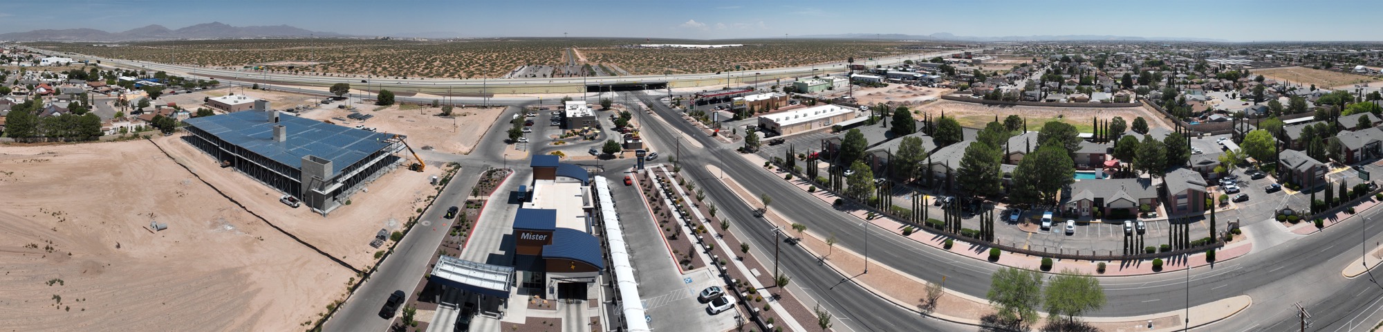
Raw land sells on context. A buyer wants to see the parcel, but they also want to see how close it sits to the runway, the highway interchange and the neighbors who might become tenants. The listing team needed video for the offering memorandum, stills for the brochure and 360° panoramas a prospect could pan around in from another city.
The parcel is in the airport's Class C airspace, so the flight was planned and authorized through FAA LAANC in advance, with the altitude ceiling the authorization allowed. We flew orbit and reveal moves for the video, a set of ultra-wide stills from the four compass points, and 360° panoramas from fixed points across the site, all in a single morning session by an FAA Part 107 certified pilot.
Seventy-six 4K video clips for the listing team's editor, nineteen ultra-wide stills, nine interactive 360° panoramas, nine stitched panoramas and five high-resolution captures, delivered the following week. Everything was shot with the mountains and the airport in frame on purpose, because that is the sales story.
El Paso's growth is on the east side, near the airport and the border crossings, and much of the land there sits in controlled airspace. Working here means handling the FAA authorization as a routine step, not a blocker. For a brokerage based elsewhere, having a local operator who can be on site within days and deliver a complete package is the difference between a listing that launches on schedule and one that waits.
Every flight is by an FAA Part 107 certified, insured pilot. Tell us where the site is and what you need back.