
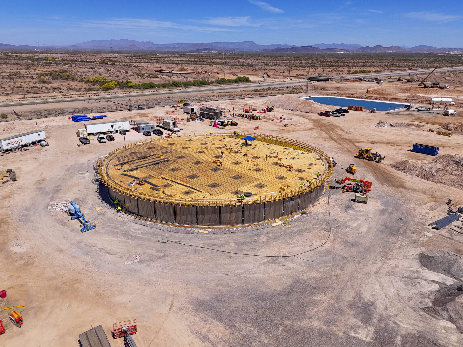
DFW Is Building — and Contractors Need Eyes in the Sky
Dallas-Fort Worth is one of the fastest-growing metro areas in the country. Drive any direction out of downtown Dallas and you’ll hit active construction — master-planned communities going up in Frisco and Celina, industrial warehouses spreading across the south side of DFW airport, mixed-use developments reshaping neighborhoods like Deep Ellum and the Design District. The crane count on the DFW skyline at any given moment tells the story: this metro doesn’t stop building.
With that kind of volume and pace comes a real documentation problem. General contractors, developers, and project investors need to track site progress across multiple phases — foundation, framing, MEP rough-in, exterior, and close-out — and getting that documentation consistently, accurately, and without disrupting the crew on the ground is harder than it sounds. That’s where construction drone services come in.
Desert Drones LLC provides FAA-certified aerial construction documentation for DFW-area projects — site monitoring, progress reports, investor updates, and as-built documentation — delivered on your schedule.
How Aerial Progress Documentation Helps on a DFW Job Site
The obvious answer is that drone footage looks great in a presentation. And it does. But the day-to-day value for DFW construction companies goes deeper than that.
Progress verification — When a general contractor has three active sites across Plano, McKinney, and Irving, they can’t physically be at every one of them every day. Weekly aerial documentation gives PMs a visual record of exactly what was completed in the past seven days without adding windshield time.
Subcontractor accountability — A dated aerial photo showing that the framing crew left the site without completing the specified work for that phase is a lot harder to argue against than a verbal disagreement. Aerial documentation creates a timestamped visual record that protects GCs and owners alike.
Investor and lender reporting — Construction lenders in Texas typically require draw inspection reports before releasing progress payments. Drone documentation that clearly shows completed work percentages gives lenders and investors an easy visual reference that speeds up the draw process.
Insurance and risk documentation — If a contractor dispute or insurance claim arises from a North Texas hailstorm hitting a partially-complete roof, having a dated aerial photo from the day before versus the day after is the difference between a clean claim and a drawn-out argument.
What Our Dallas Construction Documentation Includes
Every DFW construction documentation package from Desert Drones is built around what your project actually needs. Most construction packages include:
- Scheduled weekly or bi-weekly flights timed to align with your construction schedule and draw inspection dates
- High-resolution 4K video of the full site perimeter and interior work zones
- Geotagged still photos from consistent flight paths so progress comparisons are shot from the same angle every time
- Orthomosaic site maps for large projects — a stitched overhead image of the entire site showing exact dimensions and work locations
- Before/after comparison sets matched to your project phase milestones
- Fast turnaround — deliverables within 24 hours of each flight so your team has current material before the next stakeholder meeting
DFW Construction Industries We Serve
Residential developers and homebuilders — Master-planned communities in Celina, Prosper, Forney, and Waxahachie need phase-by-phase aerial documentation as lots move from raw land to finished homes. We can cover hundreds of lots in a single flight.
Commercial and industrial GCs — Tilt-wall warehouse and distribution center construction along I-20, I-35, and near DFW airport represents some of the largest construction volume in the metro. Aerial documentation for this category focuses on site preparation, tilt-up panel placement, and roof completion milestones.
Infrastructure and civil contractors — Road widening projects, highway interchanges, and utility infrastructure projects benefit from aerial progress documentation that gives public agency clients a clear visual record without requiring frequent site visits.
Real estate developers and mixed-use projects — Urban infill projects in Uptown, Oak Lawn, and the Bishop Arts District need aerial documentation that shows neighborhood context alongside the build — critical for marketing to pre-leasing tenants and residential buyers.
Working Around DFW Airspace
The Dallas-Fort Worth area has some of the most complex airspace in the country. DFW International Airport, Love Field, Addison Airport, and multiple private and military fields create a patchwork of controlled airspace that requires careful coordination on every flight.
All Desert Drones pilots hold FAA Part 107 Remote Pilot certification and are experienced with the LAANC system that governs commercial drone operations in controlled airspace near Dallas-area airports. We handle all airspace authorization before we ever load the drone into the truck.
Frequently Asked Questions
How often should we schedule construction drone flights in DFW?
For most active construction sites, weekly flights during framing and structure phases are ideal. Monthly flights may be sufficient during longer groundwork phases. We’ll recommend a flight cadence based on your project schedule during onboarding.
Can you work with our project management software?
We deliver files in standard formats (MP4, JPG, GeoTIFF for orthomosaics) compatible with most construction PM platforms including Procore, PlanGrid, and Buildertrend.
What happens during active construction when workers are on site?
We coordinate flight windows with your site superintendent — typically early morning before the full crew arrives, or during scheduled lunch breaks. Our flights are brief and we never interfere with active crane operations or elevated work.
Do you handle multi-site documentation contracts?
Yes. GCs and developers with multiple active DFW sites can set up a retainer arrangement that covers regular flights across all locations at a predictable monthly rate.
Can aerial documentation help with city permit inspections?
Aerial documentation doesn’t replace city inspections, but it supplements them. Progress photos that show completed rough framing, utility installations, and site grading help project managers prepare documentation packages for permit milestone inspections more efficiently.
How quickly can you mobilize after a storm or unexpected site event?
For DFW clients, we target 24-hour mobilization for post-event documentation. Active clients on retainer get priority scheduling.
Get Started with DFW Construction Drone Documentation
Whether you’re breaking ground on a 500-lot subdivision in Celina or finishing out a Class A warehouse off I-20, Desert Drones can set up a documentation program that fits your project timeline and reporting requirements.
We serve the full DFW metroplex — Dallas, Fort Worth, Frisco, McKinney, Allen, Plano, Irving, Arlington, Grand Prairie, Garland, Mesquite, Rockwall, Forney, and beyond.
Start the conversation at desertdronesllc.com. We’ll put together a documentation proposal matched to your project scope within one business day.