Trustindex verifies that the original source of the review is Google.
Desert Drones is fantastic to work with! They do an incredible job bringing our vision to life and capturing our projects in a way that truly showcases the work being done. Highly recommend their team. Thanks again, Desert Drones!
brooke ryan
Trustindex verifies that the original source of the review is Google.
Desert Drones is awesome to work with! They help bring our vision to life and showcase our work in the best way possible. Highly recommend them to anyone looking for quality drone services. Thanks, Desert Drones!
Frank Segarra
Trustindex verifies that the original source of the review is Google.
John and team are the consummate professionals! Very reliable, quick, and high quality deliverables!
Stephen Cook
Trustindex verifies that the original source of the review is Google.
Professional, efficient, and easy to work with. The team delivered clean, high-quality aerials and communicated clearly throughout the project. One of the best drone service providers we’ve worked with in the Phoenix area.
Greg DeMeritt Jr
Trustindex verifies that the original source of the review is Google.
Needed work done quickly for drone photography. They responded quickly and knew exactly what was required and explained it well. They provided great customer service and got me exactly what I needed, when I needed. Finally found my Drone guys!
Doug Fleming
Trustindex verifies that the original source of the review is Google.
John was a professional and very knowledgeable. He made the process of getting drone footage seamless and did an exceptional job. The speed of completion along with quality of his work was excellent. Highly recommend using them if...
Good JuJu Agency
Trustindex verifies that the original source of the review is Google.
John is true professional. Every time we need some drone photography or videography done John is excited to take on the project. From midnight fireworks displays to busy sections of the city with all kinds of obstacles, working with Desert Drones never fails to hit the mark.
Jesus Figueroa
Trustindex verifies that the original source of the review is Google.
Absolutely amazing experience with Desert Drones. They did a shoot for my business and I must say, they made my product really speak for itself! The aerial shots were stunning and perfectly captured every special moment. John was very professional, punctual, and easy to work with. Highly recommend them for any event coverage—you won’t be disappointed!
Eustolia Schau
Trustindex verifies that the original source of the review is Google.
Great company and amazing aerial photography!
Katie Schwertz
Trustindex verifies that the original source of the review is Google.
John took care of the interior and exterior drone footage for our manufacturing facility in Tucson. He was great to work with! Very knowledgeable, answered all our questions, and shot some great videos. He was also quick to respond to emails and calls throughout the whole process. I would definitely use Desert Drones again in the future.
Real Estate & Property Marketing Across the State
Arizona’s landscape is as varied as its industries. From the high desert of Flagstaff to the sprawling solar farms of the south and the dense real estate markets of Phoenix and Tucson, every project requires a different aerial approach. At Desert Drones, we provide aerial photography services across Arizona, adapting techniques, equipment, and strategy to the setting. Whether it’s real estate, construction, industrial work, or rural development, we deliver clear, accurate, and professional aerial imagery statewide.
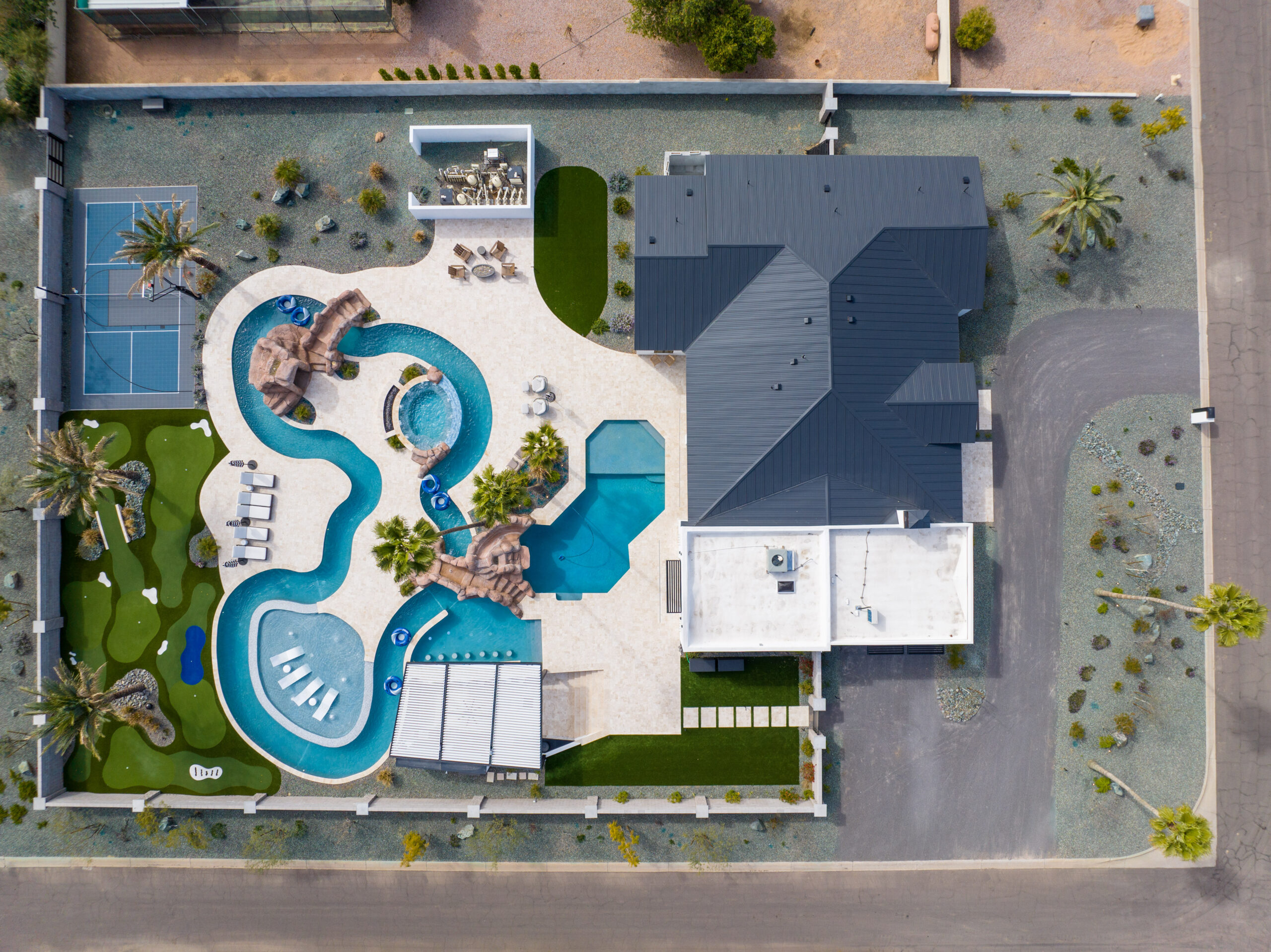
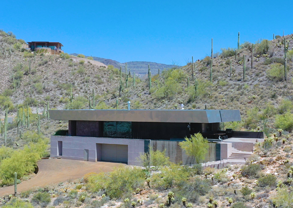
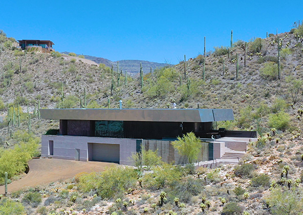
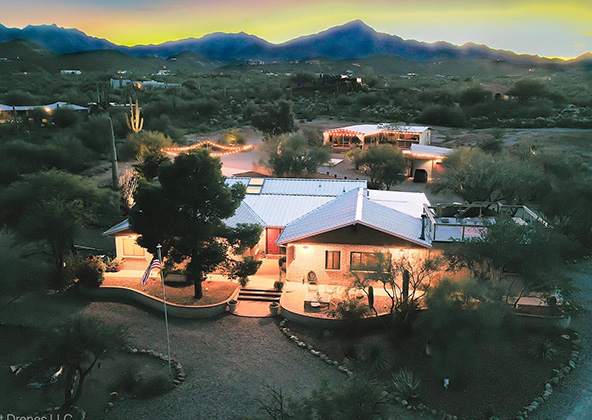
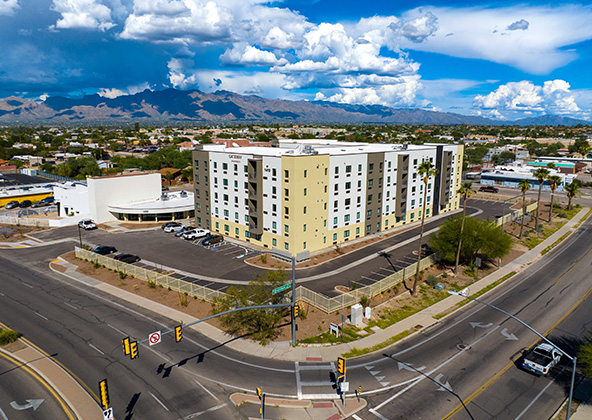
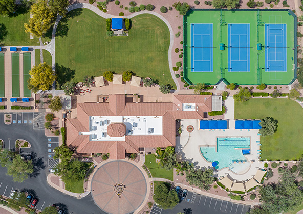
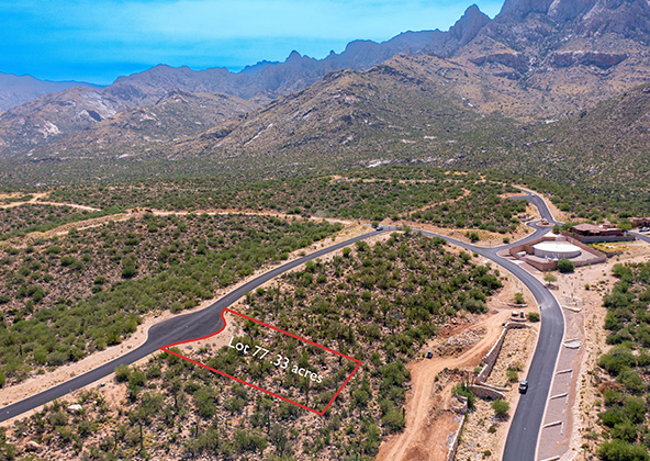
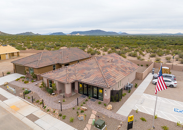
Arizona’s real estate market is one of the most competitive in the nation, ranging from luxury hillside homes in Scottsdale to master-planned communities in Mesa and Tucson. Aerial photography allows buyers to see not just the property itself but also its relationship to the surrounding neighborhood, terrain, and amenities.
We provide:
High-resolution aerial photos showing property layout, landscaping, and lot lines.
Contextual views of surroundings like mountain ranges, golf courses, or downtown skylines.
• • Cohesive packages combining drone imagery with ground photography.
Developers and agents use these visuals for MLS, brochures, and presentations, making listings stand out. In Arizona’s premium markets, aerial photos often set the difference between a quick showing and a property sitting unnoticed.
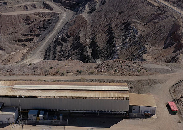
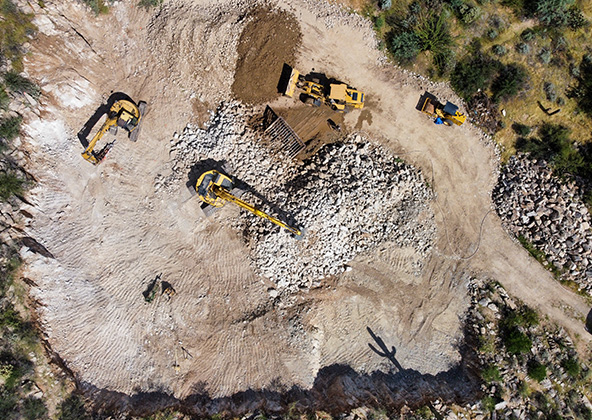
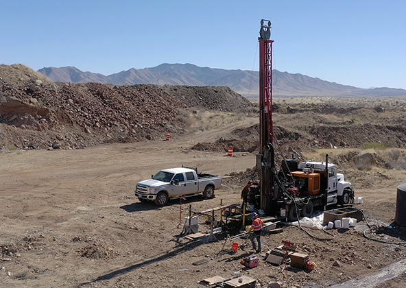
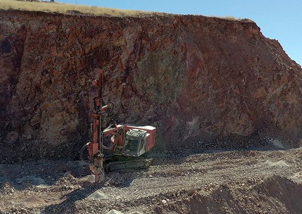
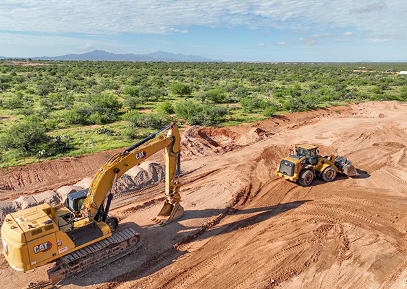
Solar, Mining & Industrial Applications
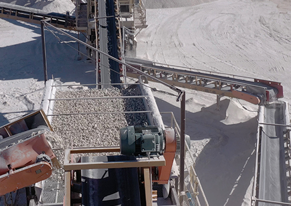
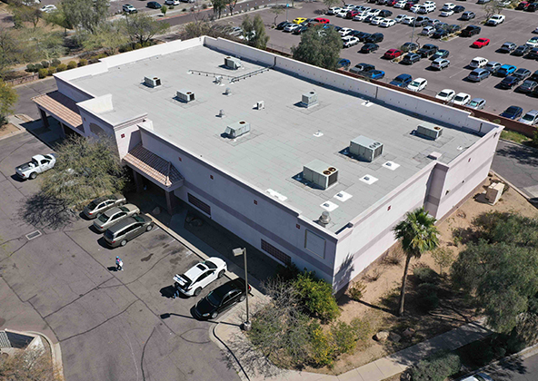
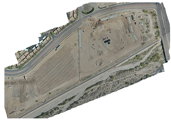
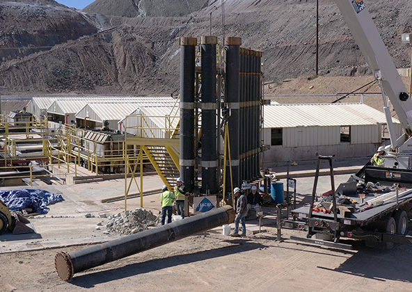
Arizona’s economy leans heavily on renewable energy and natural resources. Southern and western Arizona, in particular, are home to large solar farms, copper mines, and industrial parks that require regular aerial documentation.
Our drone photography provides:
Solar field coverage — capturing system layouts, condition monitoring, and promotional photos for energy providers.
Mining site imagery — documenting pit boundaries, haul roads, and facility changes.
Industrial facilities — visualizing access routes, logistics yards, and construction progress.
For these sectors, aerial imagery isn’t just about marketing — it’s about creating an accurate record. Many Arizona clients use our imagery to satisfy investor reporting, environmental compliance, and stakeholder communication.
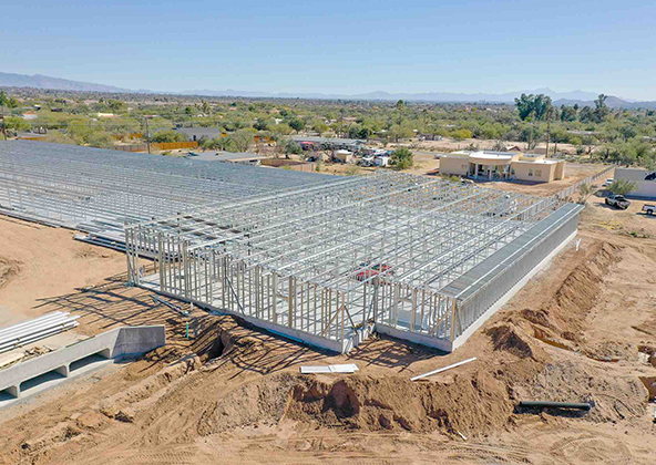
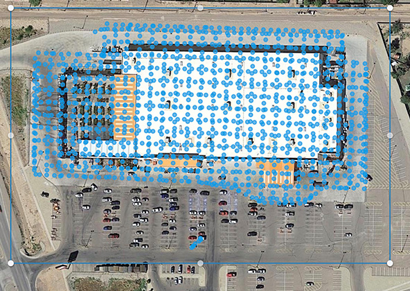
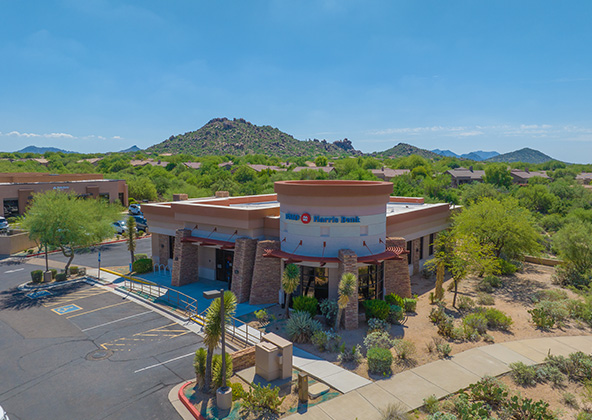
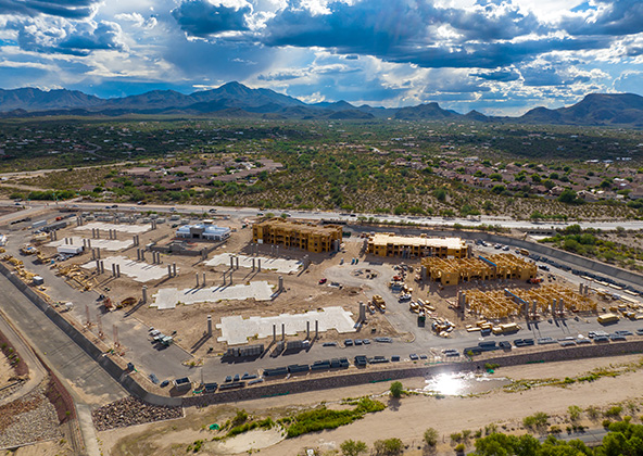
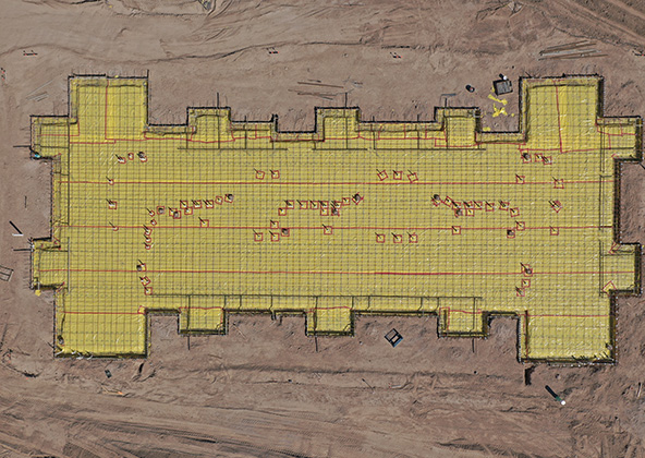
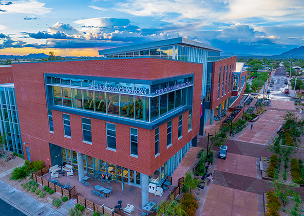
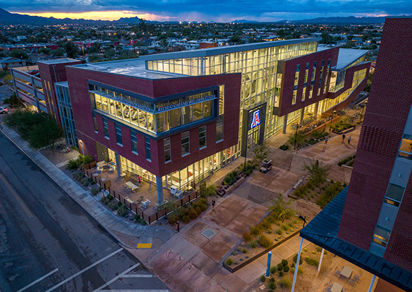
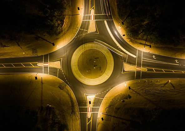
Public Projects, Campuses & Infrastructure
Cities, counties, and universities across Arizona are investing heavily in new facilities and infrastructure. Our aerial photography helps document these projects with clarity and precision.
Examples include:
Road expansions and highway upgrades in Tucson and Phoenix.
University campus expansions in Flagstaff and Tempe.
Municipal facilities and public parks in Prescott, Chandler, and beyond.
These images support public communication, internal planning, and contractor documentation. Aerial photography offers a perspective that ensures stakeholders understand scope and progress at a glance.
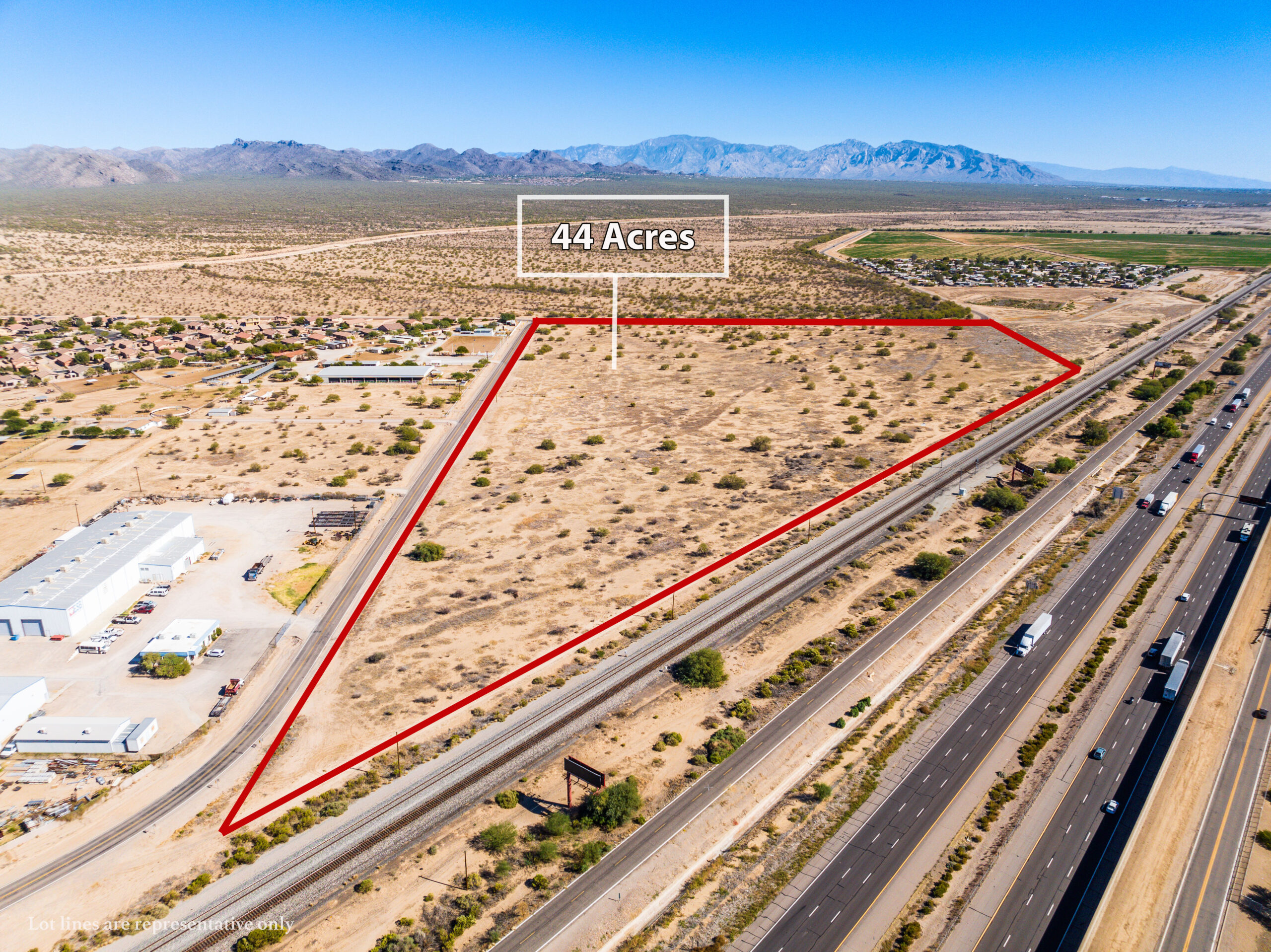
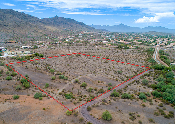
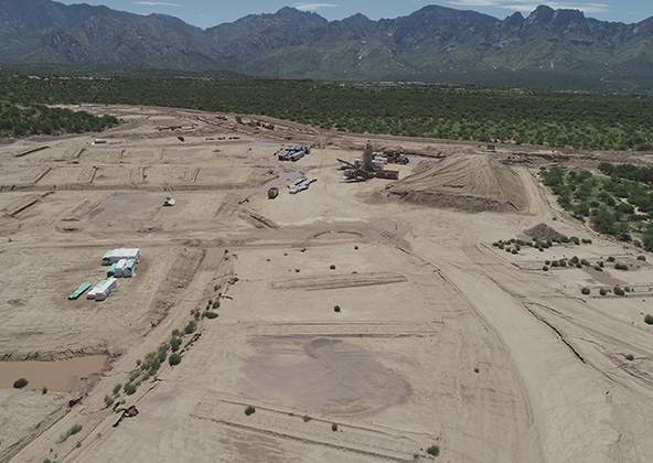
Rural & Remote Aerial Operations
Much of Arizona lies outside the metro cores, and projects in agriculture, ranching, and utilities require drone services that can scale into rural zones. Desert Drones is equipped for remote aerial photography — we bring the right drones, backup equipment, and logistics planning to cover projects where access is limited.
We commonly support:
Land parcel photography for developers and brokers.
Agricultural monitoring, including irrigation layouts and field conditions.
Utility and pipeline documentation for power and water companies.
Operating statewide means accounting for long distances, desert heat, and limited infrastructure — factors we plan for in every rural mission.
Why Desert Drones Is Arizona’s Choice for Aerial Photography
Clients across Arizona choose us because we combine technology, compliance, and proven industry knowledge. With FAA Part 107 certification, $2M insurance coverage, and years of experience in Arizona’s varied conditions, we deliver images that are both safe to capture and ready to use.
Key advantages include:
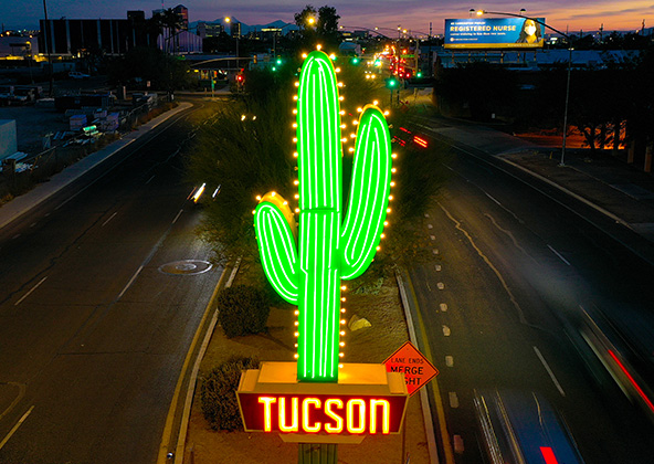
Broad experience across Phoenix, Tucson, Flagstaff, Sedona, Prescott, Yuma, and rural counties.
Industry-specific deliverables for real estate, solar, industrial, and public projects.
Fast, reliable turnaround so clients can act on visuals quickly.
Consistent quality statewide, regardless of project size or location.
Aerial photography provides a unique perspective. Real estate listings, events, construction progress photos and site surveillance are just a few examples of where you need drones to do the job right.
Mining
Aerial photography and videography provide fast and cost effective mapping, documentation, elevation and stockpile calculations to streamline your mining operations.
Industrial
Drones are uniquely qualified to capture aerial data for inspections of cellular, electrical, mining, solar and other industrial sites. Providing higher quality data at a lower risk rate than traditional inspections, makes drone services a must on your project.
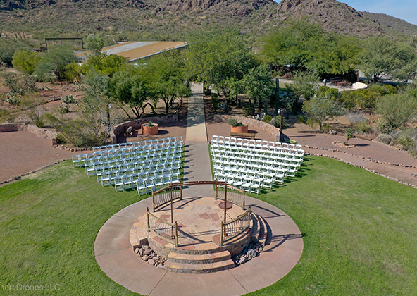
Events
No matter what kind of event you are having, aerial photography and videography make your audience feel like they are there. Make your advertising, marketing campaign and website stand out with dramatic pictures and videos that only drones can capture.
Licensed & Insured
Desert Drones, LLC is operated by a FAA (Federal Aviation Administration) licensed pilots, Desert Drones, LLC is licensed & insured up to $2M.
Aerial photography and videography provide fast and cost effective mapping, documentation, elevation and stockpile calculations to streamline your mining operations.
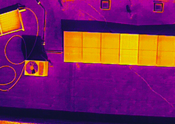
Southwest Arizona is a great place for solar. In phoenix and tucson we get over 300 days of sun every year. Let us give you valuable information while your system is still under warranty. Make sure you are getting what you paid for in you PV system.
Gallery
MLS aerial drone photos for commercial and residential real estate
drone services for real estate
Aerial Drone Photography for Marketing and Advertising