
Trustindex verifies that the original source of the review is Google. Desert Drones is fantastic to work with! They do an incredible job bringing our vision to life and capturing our projects in a way that truly showcases the work being done. Highly recommend their team. Thanks again, Desert Drones!Trustindex verifies that the original source of the review is Google. Desert Drones is awesome to work with! They help bring our vision to life and showcase our work in the best way possible. Highly recommend them to anyone looking for quality drone services. Thanks, Desert Drones!Trustindex verifies that the original source of the review is Google. John and team are the consummate professionals! Very reliable, quick, and high quality deliverables!Trustindex verifies that the original source of the review is Google. Professional, efficient, and easy to work with. The team delivered clean, high-quality aerials and communicated clearly throughout the project. One of the best drone service providers we’ve worked with in the Phoenix area.Trustindex verifies that the original source of the review is Google. Needed work done quickly for drone photography. They responded quickly and knew exactly what was required and explained it well. They provided great customer service and got me exactly what I needed, when I needed. Finally found my Drone guys!Trustindex verifies that the original source of the review is Google. John was a professional and very knowledgeable. He made the process of getting drone footage seamless and did an exceptional job. The speed of completion along with quality of his work was excellent. Highly recommend using them if...Trustindex verifies that the original source of the review is Google. John is true professional. Every time we need some drone photography or videography done John is excited to take on the project. From midnight fireworks displays to busy sections of the city with all kinds of obstacles, working with Desert Drones never fails to hit the mark.Trustindex verifies that the original source of the review is Google. Absolutely amazing experience with Desert Drones. They did a shoot for my business and I must say, they made my product really speak for itself! The aerial shots were stunning and perfectly captured every special moment. John was very professional, punctual, and easy to work with. Highly recommend them for any event coverage—you won’t be disappointed!Trustindex verifies that the original source of the review is Google. Great company and amazing aerial photography!Trustindex verifies that the original source of the review is Google. John took care of the interior and exterior drone footage for our manufacturing facility in Tucson. He was great to work with! Very knowledgeable, answered all our questions, and shot some great videos. He was also quick to respond to emails and calls throughout the whole process. I would definitely use Desert Drones again in the future.
In a city like Phoenix, visuals tell powerful stories — of real estate, construction, marketing, and more. At Desert Drones, we offer drone photography services in Phoenix, AZ that combine technical precision with creative vision. From sweeping images of neighborhoods to detailed shots of structures, our drone photography elevates projects and brand campaigns in ways that standard ground photos simply can’t match.
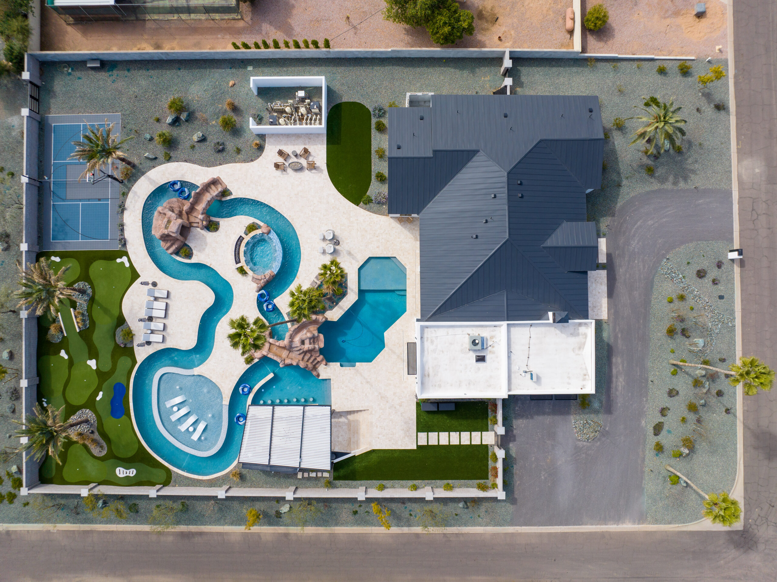
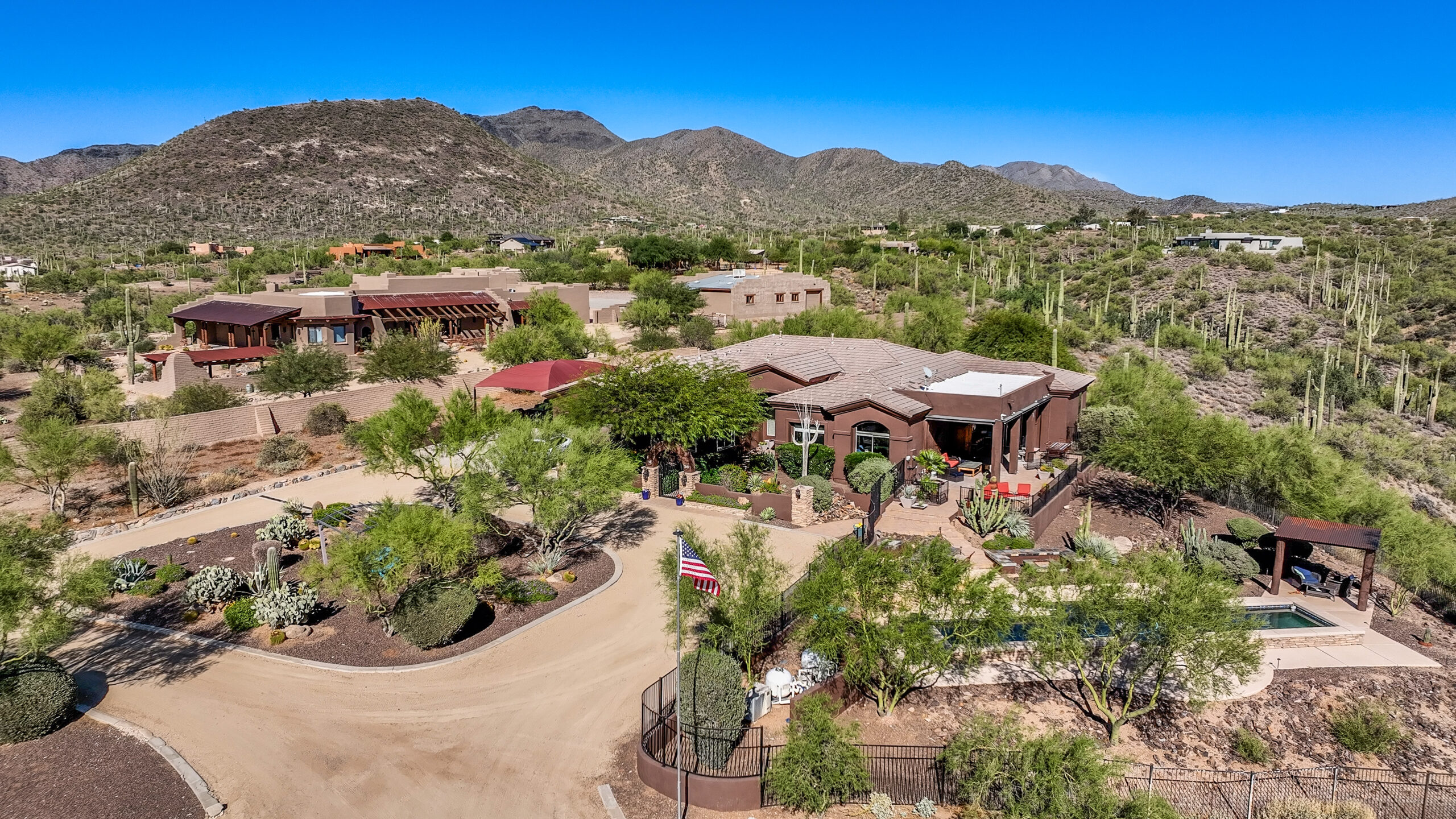
Listings live or die by first impressions. Our drone photographers deliver high-resolution aerial images that showcase more than just a property’s footprint — we capture lot boundaries, landscaping, terrain, and surroundings. In Phoenix areas like Scottsdale, Tempe, Gilbert, and Chandler, these visuals help homes stand out in a crowded market.
We pair our aerial shots with ground-level imagery and twilight photography to create cohesive visual stories. Realtors use our photography for MLS, virtual tours, brochures, and web galleries to engage potential buyers longer and generate more leads.
Projects require oversight. Desert Drones provides regular site flights delivering photographic progress updates that document each phase: excavation, foundation, framing, roofing, and finishes. With consistent imagery, contractors, developers, and stakeholders can compare phases side by side, detect issues early, and keep communication transparent.
From custom homes in north Phoenix to large-scale developments across Maricopa County, our aerial documentation supports better project management, fewer disputes, and stronger accountability.
Your brand deserves visuals that elevate it. We work with marketing teams, agencies, and businesses to produce aerial images ideal for web banners, social media, billboards, and advertising campaigns. Whether it’s a commercial development, retail complex, resort, or event venue, drone photography helps tell your story from an elevated perspective.
We also deliver branded overlays and annotated compositions to guide viewers’ attention — showing pathways, entry points, and features in ways that drive engagement.
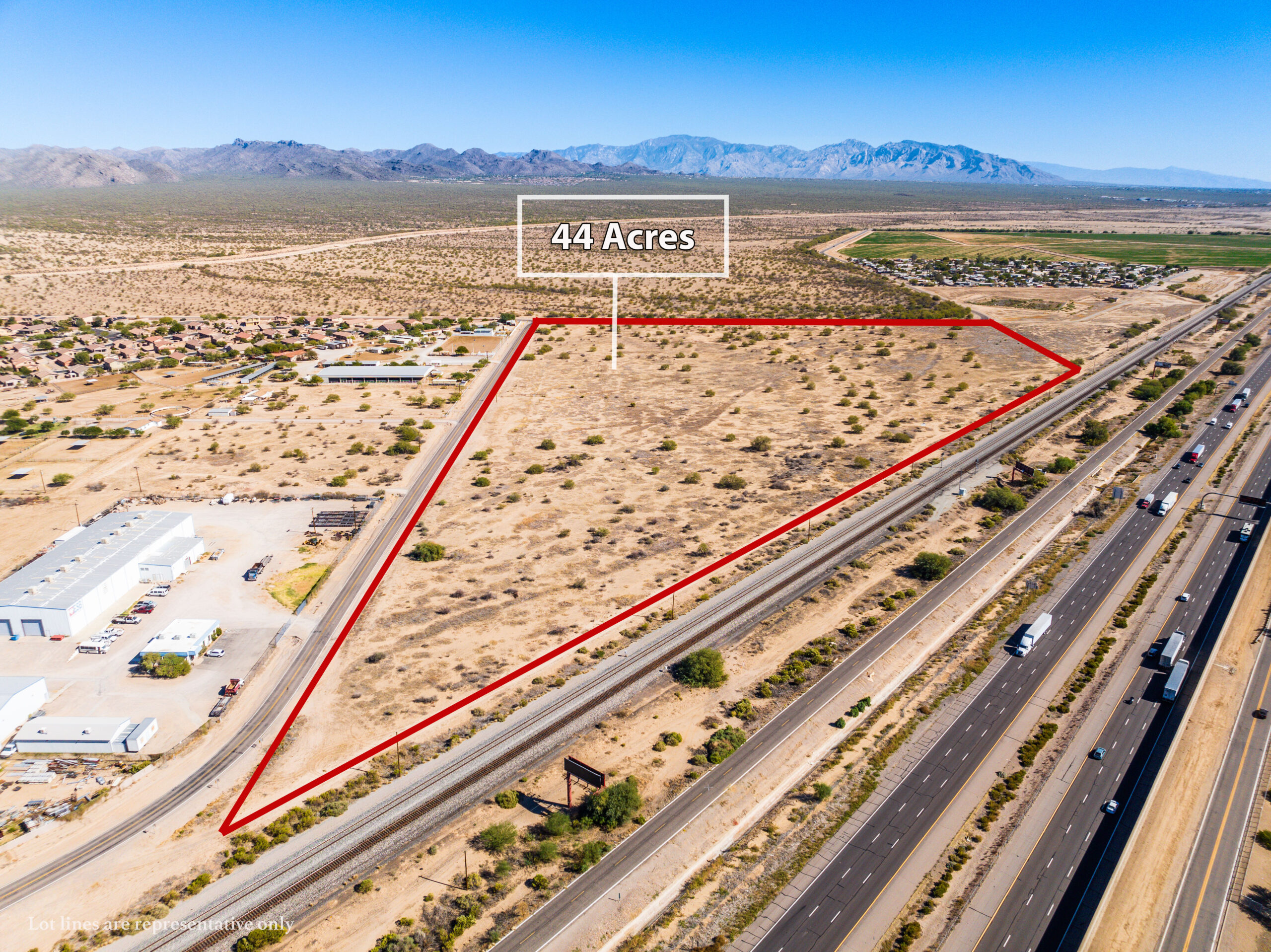
Beyond marketing, drone photography is essential for industrial, solar, and infrastructure projects. We capture detailed images of solar arrays, factories, pipelines, and utility installations to document condition, layout, and context.
These photos complement mapping, inspections, and thermal drone work — providing clients a full visual package. For solar developers in Phoenix or industrial sites near the urban fringe, these images help stakeholders assess site features, accessibility, and expansion options.
Phoenix hosts diverse events, landmarks, and public spaces. From rooftops and stadiums to parks and cityscapes, our drone photographers capture iconic overhead shots that elevate your event or property.
Whether for marketing future events, showcasing urban development, or documenting public works, aerial imagery helps you show scale, surroundings, and context. Landmarks like Camelback Mountain, Papago Park, or the Phoenix Convention Center gain new dimension through aerial perspectives.
Choosing a drone photographer is about more than a one-off shoot — it’s about reliability, vision, and technical excellence. At Desert Drones:
When you hire us, you get more than a camera in the sky — you get a creative partner invested in telling your visual story. Reach out today to schedule your Phoenix drone photography session.
Yes. We coordinate required authorizations and waivers to legally fly near airports or restricted zones, ensuring every mission is compliant.
We produce 20–48 MP stills and retouched images optimized for print and digital use.
Yes, when logistics and lighting permit. We coordinate ground and aerial teams so your visual package is cohesive.
Standard delivery is 24–48 hours after flight. Rush delivery options are available for urgent projects.
Absolutely. We optimize scheduling for best light (golden hour, morning/late afternoon) and avoid unwanted shadows or glare.


If you searched specifically for drone photography Phoenix services, you are in the right place â Desert Drones pilots deliver the same high-quality aerial imagery under both names.