
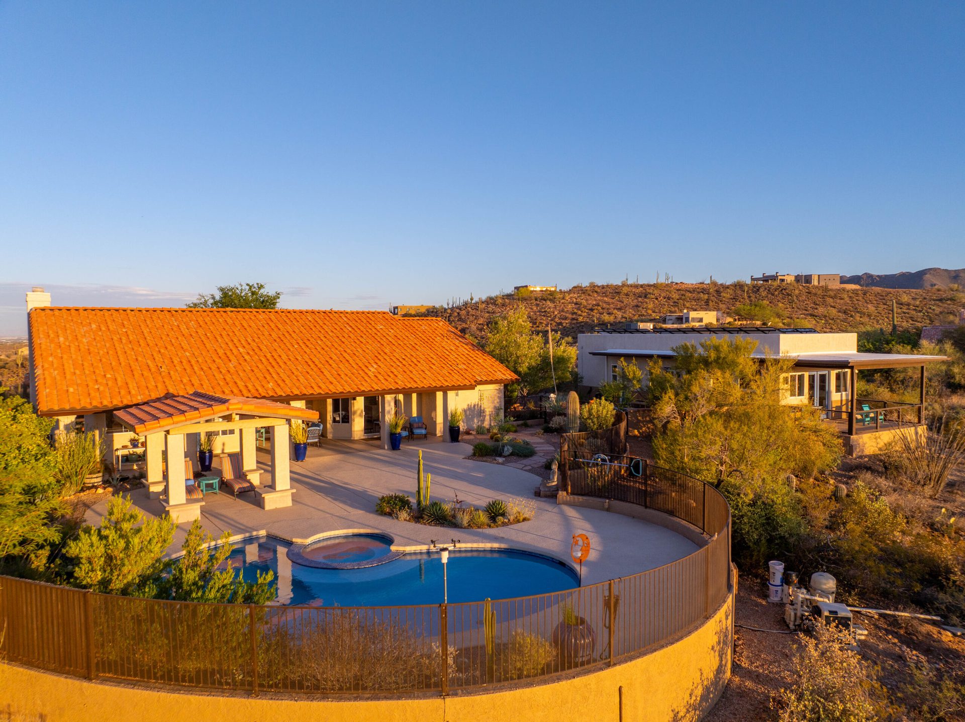
Albuquerque Drone Photography in Monsoon Season — High-Altitude Aerial Coverage
Albuquerque sits at 5,300 feet above sea level. That altitude is significant. It means the air is thinner, which can make heat feel less oppressive, but it also means something else: altitude provides naturally clear air and exceptional visibility. Add monsoon season to that equation, and you get something special. In July, when storm systems roll up from Mexico and the Gulf of California, they bring moisture but also create dramatic atmospheric conditions. The Sandia Mountains turn pink in sunset light — that famous “Sandia crest” phenomenon — and the entire High Desert landscape photographs in sharp, vivid detail. For anyone working in construction documentation, real estate aerial photography, or solar installations, Albuquerque’s elevation and monsoon conditions create some of the best aerial photography windows in the entire Southwest.
Desert Drones LLC offers aerial drone services across Albuquerque and all of New Mexico — real estate, construction, roof inspection, thermal solar, and commercial video throughout the metro and beyond.
Albuquerque is New Mexico’s largest city, sprawling across multiple neighborhoods and districts. To the east, the Sandia Mountains form a dramatic escarpment. To the west, the Rio Grande flows north-south, defining a natural boundary. The city encompasses everything from historic downtown and Old Town to modern subdivisions and commercial corridors. Development extends north toward Bernalillo and Kirtland Air Force Base, south toward Belen, and west across the mesa. Rio Rancho, just across the river, is experiencing rapid growth. For contractors, developers, and real estate professionals, the challenge is often getting quality aerial coverage that captures Albuquerque’s unique geography and rapid development.
Desert Drones LLC serves Albuquerque and the greater Rio Grande Valley. We understand the altitude advantage, the monsoon patterns specific to northern New Mexico, and exactly how to capture the Sandias, the Rio Grande corridor, and Albuquerque’s unique landscape at its absolute best. Whether you need aerial drone photography, thermal inspections, or marketing videography, we’re ready to deliver professional results that showcase your projects and properties in the best possible light.
Why Albuquerque in July Is Unique for Aerial Photography
High Altitude, Clear Air, and Monsoon Light
At 5,300 feet, Albuquerque’s elevation creates naturally clear air. There’s less atmospheric haze than at sea level or in lower desert valleys. Add monsoon season to that, and you get exceptional conditions. In July, when moisture surges northward and thunderstorms build, the air becomes even more dramatically clean. Post-storm, the visibility is remarkable. The Sandia Mountains, which on a hazy May afternoon might be obscured or indistinct, become crisp and detailed. Individual ridges, peaks, and geological formations become visible. Colors intensify. The entire landscape photographs with a clarity and richness that’s simply unavailable on the typical clear June morning.
This is precisely why experienced aerial photographers schedule shoots during monsoon season in Albuquerque. Early morning before storms build, or 24–48 hours after a system passes, the air is exceptionally clear. Equipment operates reliably. Temperatures are manageable. And the images come out with a sharpness and color saturation that justifies the scheduling complexity. For construction professionals and real estate agents who understand this timing advantage, it’s the difference between adequate documentation and truly compelling imagery.
- High altitude (5,300 ft) provides naturally clear air and reduced atmospheric haze
- Post-monsoon visibility increases dramatically — mountains photograph with sharp detail
- Early morning temperatures are cool and equipment-friendly
- Monsoon moisture brings vibrant greens to vegetation and the bosque
- Sandia Mountains photograph with pink, purple, and deep blue hues depending on light angle
The Sandia Mountains and Rio Grande Corridor Geography
Albuquerque’s defining geographic features are iconic. The Sandia Mountains rise dramatically to the east — a 10,000-foot escarpment that appears in countless photos and defines the city’s eastern boundary. The Rio Grande flows north-south through the center of the city, creating a natural geographic division. The bosque — the riparian forest along the Rio Grande — is a distinctive visual feature that looks dramatically different from altitude. The Jemez Mountains are visible to the north. The landscape transitions from urban density near downtown and the University of New Mexico to suburban sprawl as you move outward, then to open mesa and ranch land beyond the city edges.
Aerial photography captures all of this geography in a single shot or sequence. A property photographed from altitude shows its relationship to the Sandias, the Rio Grande, surrounding neighborhoods, and major landmarks. Developers can show how a project fits into Albuquerque’s urban form. Real estate agents can showcase neighborhood character. The entire city’s geography becomes part of the property story.
Neighborhoods, Corridors, and Development Zones
Albuquerque encompasses multiple distinct neighborhoods and development areas. Historic Old Town, with its Spanish colonial architecture and plaza layout, photographs with character and authenticity from altitude. Downtown is experiencing revitalization. The University of New Mexico campus and surrounding neighborhoods define central Albuquerque. The Northeast Heights, with its newer subdivisions and commercial corridors, slopes toward the Sandias. The Westside sprawls across the mesa west of the Rio Grande. Rio Rancho, just across the river, is experiencing explosive growth. North Valley subdivisions extend toward Bernalillo and Kirtland Air Force Base. The South Valley extends toward Belen. For contractors and developers, this geographic diversity means constantly changing project types and locations.
We work throughout Albuquerque and the Rio Grande Valley, scheduling construction documentation, real estate aerial coverage, and inspections for clients in every neighborhood and corridor. In July, with monsoon forecasts and altitude advantage, we can maintain consistent, professional schedules.
What We Cover in Albuquerque
Construction Progress Documentation: From residential subdivisions in Rio Rancho to commercial projects in downtown Albuquerque to mixed-use development throughout the city, construction documentation via drone shows every phase. We schedule regular flights — weekly or monthly — that create comprehensive visual timelines. Stakeholders, investors, and inspectors see real progress in professional imagery captured during optimal monsoon-season windows.
Real Estate Aerial Photography: Whether it’s a property with Sandia Mountain views, a Rio Rancho residential community, or a commercial property in Old Town, real estate aerial photography showcases properties in their geographic and neighborhood context. We capture lot boundaries, views to landmarks, neighborhood character, and overall appeal. Early morning monsoon-season shoots deliver stunning imagery with crisp detail and vibrant color.
Solar Installation and Array Documentation: Solar installations are common throughout Albuquerque and Rio Rancho — residential rooftop systems, commercial installations, and large arrays are widespread. Solar documentation serves warranty, insurance, and performance-tracking purposes. We’ve documented solar throughout Albuquerque, Rio Rancho, and the broader Rio Grande Valley.
Thermal Imaging and Building Inspections: Thermal imaging reveals heat loss, electrical hotspots, and potential moisture issues in commercial and industrial properties. Paired with roof inspections, thermal data helps facility owners and property managers understand true property condition. We fly thermal throughout Albuquerque on commercial, mixed-use, and institutional properties.
Orthomosaic Mapping and Surveys: Large properties, development sites, or industrial areas benefit from precise orthomosaic mapping. We provide high-resolution, georeferenced top-down imagery suitable for planning, engineering, and regulatory purposes.
FPV Videography and Marketing Content: For real estate marketing, construction narrative videos, or promotional campaigns, FPV and aerial videography creates dynamic, engaging content. Flying through a new community, gliding across the Rio Grande corridor, or showcasing Albuquerque’s geography — this content tells stories that static photography cannot.
How the Process Works
Before the Shoot
- Project Consultation: We discuss your objectives, location, and specific imagery needs. Are you documenting construction, marketing real estate, or conducting inspections? We align our approach with your goals and timelines.
- Monsoon Timing and Weather Planning: In July, we monitor monsoon forecasts closely. We identify optimal shooting windows — typically early morning or 24–48 hours after monsoon systems pass. We communicate timing to you and adjust schedules as conditions evolve.
- Airspace Review: We confirm your location for any airspace considerations and verify FAA Part 107 compliance. Albuquerque airspace includes proximity to Kirtland Air Force Base, so we verify authorization for your specific location.
- Equipment Preparation: All aircraft, sensors, batteries, and backup systems are inspected and ready. High altitude requires specific protocols, so we ensure all equipment is optimized for Albuquerque’s elevation and conditions.
- Shot List and Logistics: We develop a preliminary shot list covering angles, altitudes, coverage areas, and estimated flight time. For construction or real estate, this becomes our operational blueprint.
On the Day of the Shoot
- Early Arrival and Setup: We arrive 30–45 minutes before the scheduled shoot window. For early morning shoots (which we recommend in July), this typically means arrival by 6:00–6:30 AM to be ready for launch by 6:30–7:00 AM.
- Flight Operations: Once conditions are optimal, we launch and begin capturing imagery according to the shot list. We fly at multiple altitudes and angles, capturing wide context shots and detailed close-ups. For construction or real estate, this means comprehensive coverage.
- Real-Time Communication: You or your site representative can observe and provide feedback. We adjust coverage, angles, or focus areas to ensure we’re capturing your specific priorities.
- Data Verification: All footage is recorded on redundant storage. We verify file integrity on-site and confirm successful capture before concluding operations.
- High-Altitude Protocols: At 5,300+ feet, we monitor equipment performance and follow specific high-altitude operational protocols to ensure safe, reliable results.
After the Shoot
- Post-Processing: Raw imagery is imported into professional editing software. We apply color correction, stabilization, and enhancement. The high altitude provides naturally sharp captures, so post-processing focuses on optimization.
- Image Selection and Curation: We review all captures and select the strongest imagery. For real estate, we deliver 15–30 premium images. For construction, it’s a comprehensive time-stamped series.
- Deliverable Preparation: Images are organized, named descriptively, and provided in formats suited to your use — high-res for print, web-optimized for real estate portals, GIS-compatible for technical projects.
- Delivery and Support: We typically deliver within 3–5 business days. We answer questions, make revisions, and ensure you’re completely satisfied.
Who Benefits from Aerial Drone Work in Albuquerque?
Contractors and Developers
Albuquerque’s construction industry is robust and diverse. Residential subdivisions, commercial mixed-use projects, and industrial development occur throughout the city. Construction progress documentation via drone provides regular visual updates that keep stakeholders, investors, and inspectors informed. We’ve worked with general contractors, developers, and project managers throughout Albuquerque, providing monthly or weekly documentation that covers every phase.
Real Estate Agents and Brokers
Albuquerque’s real estate market includes everything from historic properties to new developments to land parcels. Real estate aerial photography showcases properties in their geographic and neighborhood context. Early morning monsoon-season shoots deliver stunning imagery with Sandia backdrops and crisp detail.
Solar and Commercial Clients
Solar installations are widespread throughout Albuquerque and Rio Rancho. Solar documentation serves warranty, insurance, and performance purposes. Property managers and facility owners rely on comprehensive aerial inspections for condition assessment. We’ve documented solar and commercial properties throughout the Rio Grande Valley.
Why Choose Desert Drones LLC?
FAA Part 107 Certified
We hold current FAA Part 107 Remote Pilot certification, fully authorizing commercial drone operations throughout Albuquerque airspace. We maintain comprehensive commercial liability insurance and understand Albuquerque’s airspace environment, including proximity to Kirtland Air Force Base. Safety and regulatory compliance are non-negotiable.
Local Albuquerque Knowledge and Altitude Expertise
We’re based in and deeply familiar with Albuquerque and the Rio Grande Valley. We understand the neighborhoods, the development corridors, the Sandia Mountains geography, and the monsoon patterns specific to northern New Mexico. We know how altitude affects operations and imagery quality. When you hire Desert Drones LLC, you’re working with professionals invested in your success and familiar with Albuquerque’s unique market.
Frequently Asked Questions
Q: Does high altitude really make a difference for drone photography?
A: Yes. Albuquerque’s 5,300-foot elevation means naturally clear air and reduced atmospheric haze. Combined with monsoon season’s cleansing effect, you get exceptional visibility and image quality. The Sandias photograph with sharp detail, and colors are more vivid than in lower-elevation areas.
Q: How does the monsoon affect scheduling?
A: Monsoon brings both opportunities and challenges. Afternoon convection can create unpredictable weather, so we schedule shoots early morning or based on post-storm forecasts. The air quality after a monsoon system passes is dramatically superior — that’s when we get our best results.
Q: What time of day do you typically shoot in July?
A: We typically schedule for 6:30–8:00 AM, capturing early morning light and cooler temperatures. By 9:00 AM it’s often 85°F+ and the light becomes harsh. Early morning also avoids afternoon convection.
Q: Can you fly near Kirtland Air Force Base?
A: Kirtland’s restricted airspace surrounds the base, but most of Albuquerque is outside that restricted zone. We verify airspace status for your specific location and handle all necessary coordination as part of our FAA Part 107 operations.
Q: Can I use the images for commercial purposes?
A: Absolutely. All imagery is provided under commercial license for your use in real estate marketing, construction documentation, promotional campaigns, and any commercial purpose. We retain gallery rights for portfolio use only.
Ready to Book Your Albuquerque Drone Shoot?
Monsoon season is here, and Albuquerque’s high-altitude advantage combined with monsoon-cleared air makes July the perfect time for aerial work. The Sandias are dramatic, the light is crisp, and visibility is exceptional. Whether you’re managing construction, marketing real estate, documenting solar installations, or creating promotional content, now is the time to schedule your aerial shoot.
We’re ready to book your session. Contact us to discuss your project, confirm timing around monsoon forecasts, and get scheduled. We’ll guide you through the process, answer questions, and deliver professional imagery that exceeds your expectations.
We cover the full range of commercial and industrial drone work in New Mexico — see our complete guide to drone services in Albuquerque and our ABQ real estate drone photography page.
Desert Drones LLC — Serving Albuquerque and the Rio Grande Valley
Email: info@desertdronesllc.com
Website: Get a Quote or Book Now
Service Area: Albuquerque, Rio Rancho, Bernalillo, and throughout northern New Mexico