
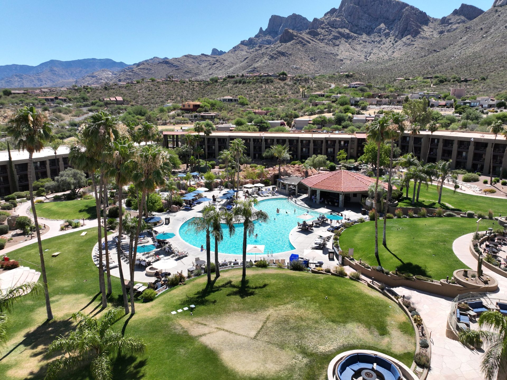
Phoenix Aerial Drone Photography — Shooting the Valley of the Sun in July
Phoenix in July is intense. Temperatures routinely exceed 112°F. The asphalt shimmers. The air radiates heat. For most people, it’s a time to stay indoors or head north to cooler mountains. But for aerial photographers and construction professionals who understand the Valley’s rhythm, July is actually prime season. Here’s why: the monsoon patterns that sweep in from the Gulf of California create dramatic afternoon skies, and — more importantly — there’s a narrow golden window in the early morning when the air is stillest, the light is coolest, and the entire Phoenix metro appears in stunning clarity.
Desert Drones LLC offers aerial drone services across Phoenix and the Valley of the Sun — real estate, construction documentation, roof inspection, solar, and commercial video for the entire metro.
From the Camelback Mountain peaks catching sunrise light to the sprawling subdivisions of Peoria and the commercial corridors around I-10, Phoenix is one of the largest metro areas in the Southwest. Construction never stops here. Real estate moves fast. Solar installations are going up constantly. And when you need construction documentation, real estate aerial coverage, or solar documentation, timing is everything.
Desert Drones LLC serves the greater Phoenix area, and we’ve learned exactly how to capture the Valley at its best — which means early mornings, precise scheduling around monsoon forecasts, and equipment that can handle the extreme heat. Whether you’re based in central Phoenix, North Scottsdale, the Westside, or the East Valley, we’ve got you covered.
Why Phoenix in July Is Unique for Aerial Photography
Heat, Monsoon Drama, and Post-Storm Light Windows
July in Phoenix is a study in extremes. Daytime temperatures hit 110–115°F regularly. But the monsoon — that surge of moisture from the south — creates dramatic weather patterns. Towering thunderheads build in late afternoon. Lightning pierces the sky. Dust storms (haboobs) roar across the desert. And then, just as suddenly, the system clears. For about 45 minutes after these storms pass, the air is dramatically clearer, the humidity drops temporarily, and the light takes on a quality that’s simply not available on the typical clear May morning.
This is why we schedule aerial shoots based on monsoon forecasts, not just on project deadlines. A construction site photographed at 6:30 AM the day after a monsoon system passes looks dramatically better than the same site photographed in mid-May. The detail is sharper. The shadows are defined. The colors of roofing materials, concrete, and landscaping all appear more vivid. For real estate agents, this means better property photos. For contractors, it means documentation that looks professional and detailed.
- Post-monsoon air clarity increases visibility 30–40%
- Early morning temperatures (75–85°F) keep equipment operating at peak performance
- Dramatic monsoon clouds create visual interest for marketing and promotional content
- Shadow definition at low sun angles reveals architectural detail and site topology
- The entire Valley photographs with crisp focus and vibrant color
The Phoenix Skyline and Mountain Backdrop
Phoenix is surrounded by distinctive geography. Camelback Mountain — that iconic twin-peaked formation — rises dramatically north of central Phoenix. South Mountain sits to the south. The White Tanks are to the northwest. These mountains provide visual anchoring and create stunning backdrops for aerial photography. When you’re documenting property or construction in Phoenix, these mountains are part of the story. In post-monsoon light, they photograph with sharp detail and rich color.
The city itself sprawls across the Valley floor in a seemingly endless grid of subdivisions, shopping centers, office parks, and industrial corridors. From altitude, Phoenix reveals its scale and complexity. The Salt River winds through central Phoenix. Camelback Road and Papago Parkway create distinctive visual lines. The downtown skyline rises in the center. For real estate marketing and promotional content, this geography is powerful. You can show a property’s location relative to the mountains, the downtown core, and major corridors all in a single aerial shot.
- Camelback Mountain: iconic peak north of Phoenix, visible from almost anywhere in the metro
- South Mountain Park and Preserve: vast desert landscape forming the southern boundary
- White Tanks Regional Park: northwest mountain range visible from West Valley shoots
- Salt River: linear feature running through central Phoenix, defining geography
- Downtown Phoenix: rising skyline providing urban contrast against desert backdrop
Subdivisions, Corridors, and Development Zones
The Phoenix metro area is vast — over 200 square miles of continuous urban sprawl. Construction and development happen across dozens of neighborhoods and corridors simultaneously. The Northwest Valley (Peoria, Glendale, Surprise) is experiencing explosive growth. The Northeast (Scottsdale, Paradise Valley, North Phoenix) continues to develop. Tempe and the East Valley are major commercial hubs. The Westside has industrial and solar development spreading rapidly. For contractors and developers, the challenge is often getting quality aerial documentation that shows progress across multiple sites.
We work throughout the Phoenix metro, scheduling regular shoots for developers who need monthly or weekly construction progress documentation. In July, with the monsoon providing both scheduling opportunities (post-storm clarity) and challenges (unpredictable afternoon weather), we’re experienced at finding the optimal windows and delivering consistent, professional results.
- Peoria and Northwest Valley: rapid residential and mixed-use development
- North Scottsdale and Paradise Valley: luxury residential with large-lot properties
- Central Phoenix: urban infill, downtown mixed-use, historic neighborhoods
- Tempe and East Valley: commercial corridors, retail, office, logistics hubs
- Phoenix Westside: industrial parks, warehouse development, large-scale solar installations
What We Cover in Phoenix
Construction Progress Documentation: From residential subdivisions to commercial mixed-use projects to industrial complexes, construction documentation via aerial drone is the standard in Phoenix. We provide regular imagery showing every phase — site prep, foundation, framing, roofing, and final details. Early morning shoots (6:30–8:00 AM) avoid the intense midday heat and capture the best light. Monthly or weekly documentation creates a visual timeline that contractors, project managers, and stakeholders can follow.
Real Estate Aerial Photography: Whether it’s a luxury home in Paradise Valley, a large-lot property in the Northwest Valley, or a development site in Tempe, real estate aerial photography shows properties in their geographic context. We work with agents, brokerages, and developers throughout Phoenix to deliver images that market properties effectively and attract serious buyers.
Solar Installation and Array Documentation: The Phoenix area is a major hub for solar installation and commercial development. Residential rooftop systems, commercial installations, and utility-scale solar farms are proliferating across the Valley. Solar documentation serves warranty, insurance, and performance-tracking purposes. We’ve documented solar across central Phoenix, the West Valley, and throughout the broader metro area.
Thermal Imaging and Building Inspections: Thermal imaging reveals heat loss, electrical hotspots, and potential moisture issues in commercial and industrial properties. Paired with standard roof inspections, thermal data gives facility owners and property managers comprehensive condition assessments. We fly thermal on shopping centers, office buildings, warehouses, and manufacturing facilities throughout the Phoenix metro.
Commercial Property Inspections: Office parks, retail centers, industrial warehouses, and mixed-use developments benefit from comprehensive aerial inspections. We document roof condition, HVAC systems, parking lot layout, and overall site integrity. For insurance claims, maintenance decisions, and property assessments, this documentation is invaluable.
Orthomosaic Mapping and Surveys: Need precise, high-resolution orthomosaic imagery of a development site or a large property? We provide top-down georeferenced mosaics suitable for planning, engineering, and regulatory purposes.
FPV Videography and Marketing Content: For promotional campaigns, property marketing, or construction narrative videos, FPV and aerial videography creates dynamic, engaging content. Flying through a new subdivision, gliding along a commercial corridor, or capturing a property’s relationship to surrounding landmarks — this content tells stories that static photos can’t.
How the Process Works
Before the Shoot
- Project Consultation: We discuss your objectives, location, and specific imagery needs. Are you documenting construction, marketing real estate, or conducting an inspection? We align our approach with your goals.
- Monsoon and Weather Planning: In July, we monitor weather forecasts closely. We identify optimal shooting windows — typically 24–48 hours after monsoon systems pass, or early mornings before afternoon convection builds. We communicate timing to you and adjust schedules as conditions evolve.
- Airspace and Regulatory Review: Phoenix airspace includes Class B controlled airspace around Sky Harbor International Airport. We confirm all airspace authorizations and ensure full FAA Part 107 compliance for your location.
- Equipment Preparation: All aircraft, sensors, batteries, and backup systems are checked and ready. July heat is intense — we have redundant power systems, backup aircraft, and thermal management protocols in place.
- Shot List and Logistics: We provide you with a preliminary shot list covering angles, altitudes, coverage areas, and estimated flight time.
On the Day of the Shoot
- Early Arrival and Setup: We arrive 30–45 minutes early to set up, conduct final equipment checks, and coordinate with your site. For early morning shoots in July, this might mean arrival by 6:00 AM.
- Flight Operations: Once conditions are green, we launch and begin capturing imagery at multiple altitudes and angles according to your shot list.
- Real-Time Feedback: You or your site representative can observe and provide feedback. We adjust coverage, angles, or focus areas as needed.
- Data Verification: All footage is recorded on redundant storage. We verify file integrity on-site before leaving.
- Safety and Heat Management: We manage equipment temperature, monitor battery performance, and follow professional protocols to ensure quality results in extreme heat.
After the Shoot
- Post-Processing: Raw imagery is imported into professional editing software. We apply color correction, stabilization, and quality enhancement.
- Image Selection: We curate the strongest imagery — 15–30 premium images for real estate, a comprehensive time-stamped series for construction. Every image headed to our gallery is fully polished.
- Deliverables Preparation: Images are organized and provided in formats suitable for your purpose — high-res for print, optimized for web and real estate portals, GIS-compatible for technical projects.
- Delivery and Support: Final images typically delivered within 3–5 business days. We answer questions, make revisions, and ensure complete satisfaction.
Who Benefits from Aerial Drone Work in Phoenix?
Contractors and Developers
Phoenix’s construction industry is booming. Residential subdivisions, commercial mixed-use projects, and industrial developments are underway across the Valley. Construction progress documentation via drone is now standard practice. Stakeholders, investors, and city planners expect regular aerial updates. We’ve worked with general contractors, project managers, and developers throughout Phoenix, providing consistent documentation that keeps everyone informed and projects on track.
- Monthly progress documentation for investor and stakeholder reporting
- Site layout showing relationship to surrounding properties and infrastructure
- Safety documentation and regulatory compliance records
- Time-lapse sequences showing project evolution from groundbreaking to completion
- Precise measurements via orthomosaic imagery
Real Estate Agents and Brokers
Phoenix’s real estate market is competitive and fast-moving. Real estate aerial photography has become essential for premium listings and large properties. Aerial shots show lot size, property boundaries, relationship to mountains and the downtown skyline, and neighborhood character. We work with individual agents and brokerages throughout Phoenix to deliver images that help listings stand out and close faster.
- Luxury property marketing in Paradise Valley and North Scottsdale
- Large-lot and development site documentation
- Neighborhood context and landmark visibility
- Virtual tours and 360-degree property presentations
- Marketing content for real estate portals and promotional campaigns
Solar and Commercial Clients
The Phoenix area is a major hub for solar installation. Property managers, facility owners, and solar companies rely on solar documentation and aerial inspections for warranty, insurance, and operational purposes. We’ve documented solar arrays across the Phoenix metro — from residential rooftops to large commercial systems. Paired with thermal imaging, we provide comprehensive performance and diagnostic data.
- Residential and commercial rooftop solar documentation
- Ground-mount and utility-scale solar array surveys
- Thermal imaging for system performance and hotspot detection
- Commercial property condition assessments
- Warranty and insurance documentation
Marketing and Advertising Teams
Whether promoting a new subdivision, a retail corridor, a hospitality venue, or a corporate campus, aerial videography and FPV content creates compelling marketing material. Dynamic aerial footage engages viewers and tells stories that static photography cannot.
- Promotional and brand videos featuring developments or properties
- Dynamic FPV flyovers for real estate and marketing campaigns
- Social media content and short-form promotional videos
- Event coverage and aerial storytelling
- Tourism and destination marketing content
Why Choose Desert Drones LLC?
FAA Part 107 Certified
We hold current FAA Part 107 Remote Pilot certification, authorizing us to conduct commercial drone operations throughout U.S. airspace. We maintain comprehensive commercial liability insurance and understand Phoenix’s specific airspace considerations, including Class B controlled airspace near Sky Harbor International Airport. Safety and regulatory compliance are non-negotiable.
- Current FAA Part 107 Remote Pilot License
- Comprehensive commercial liability insurance
- Phoenix airspace expertise and Sky Harbor coordination experience
- Professional-grade equipment maintained to manufacturer specifications
- Ongoing training and regulatory compliance maintenance
Local Phoenix Knowledge
We understand Phoenix — the neighborhoods, the development zones, the monsoon patterns, and the optimal shooting windows. We have relationships with contractors, real estate professionals, and commercial clients throughout the Valley. When you hire Desert Drones LLC, you’re hiring professionals deeply familiar with the Phoenix market and invested in delivering results that exceed your expectations.
- Deep knowledge of Phoenix neighborhoods, subdivisions, and commercial areas
- Understanding of monsoon patterns and July heat management
- Established relationships with local contractors, brokers, and business owners
- Fast turnaround and accessible local team members
- Familiarity with Phoenix airspace and regulatory environment
Professional Deliverables
Every project gets the same professional treatment. High-resolution imagery, expert post-processing, and clear communication are standard. We stand behind every deliverable and make sure you’re completely satisfied.
- High-resolution imagery suitable for print and web
- Professional color correction and post-processing
- Organized file delivery with descriptive naming
- Multiple formats for flexibility (RAW, JPG, PNG, video codecs)
- Equipment redundancy and heat management protocols for July shoots
Frequently Asked Questions
Q: Is it really safe to fly drones in Phoenix’s heat?
A: Yes, with proper planning. We manage battery performance, monitor equipment temperature, and schedule shoots early morning (6:30–8:00 AM) when temperatures are manageable. By 9:00 AM in July it’s often 100°F+, so we schedule accordingly.
Q: Can you fly near Sky Harbor Airport?
A: Sky Harbor is surrounded by Class B airspace, which requires coordination. Most residential and commercial areas throughout Phoenix can be serviced with proper authorization — we handle all airspace coordination as part of our FAA Part 107 operations.
Q: How does monsoon weather affect scheduling?
A: Monsoon brings both challenges and opportunities. Afternoon convection can be unpredictable, so we schedule shoots early morning or based on post-storm windows. Air quality 24–48 hours after a monsoon system passes is dramatically better than typical May or June days — timing around these patterns actively improves your imagery.
Q: What’s the best time of day to shoot in July?
A: Early morning — 6:30 to 8:00 AM. Cooler equipment, softer light, clearest air. By 9:00 AM the heat and light become challenging for both equipment and image quality.
Q: Can I use aerial images for commercial marketing?
A: Yes. All imagery is delivered under commercial license for use in real estate marketing, construction documentation, promotional campaigns, and any other commercial purpose. We retain gallery rights for portfolio use only.
Ready to Book Your Phoenix Drone Shoot?
July is prime season for aerial work in Phoenix. Monsoon patterns are creating optimal windows, and early morning light captures the Valley at its best. Whether you’re managing construction across multiple sites, marketing real estate, documenting solar installations, or creating promotional content, now is the time to get in the air.
We’re ready to book your shoot. Contact us to discuss your project, confirm timing around monsoon forecasts, and schedule your session. Professional imagery. Local expertise. Results that deliver.
Explore more about what we do in the Valley: our Phoenix real estate drone photography page and Phoenix drone roof inspections cover both services in detail.
Desert Drones LLC — Serving the Greater Phoenix Area
Website: Get a Quote or Book Now
Service Area: Phoenix, Scottsdale, Tempe, Mesa, Glendale, Peoria, Paradise Valley, Chandler, Gilbert, and throughout the greater Phoenix metro area