
The Superstition Mountains form this dramatic wall to the east of Mesa. From the ground, they’re a beautiful backdrop. From 400 feet up in a drone, they’re a reference point that makes every aerial composition stronger. And right now, in mid-July during monsoon season in the East Valley, that backdrop matters even more because the light changes by the hour.
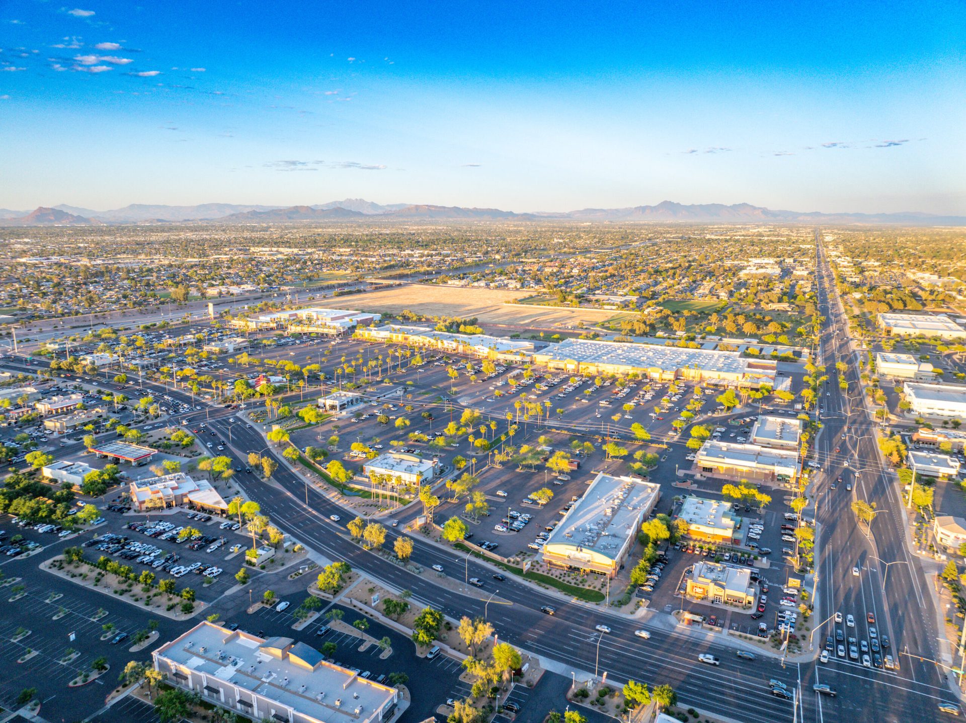
Mesa is part of the Phoenix metro area, but the East Valley has its own rhythm. It’s growing differently than Scottsdale or the west side. The construction here is constant—residential developments, commercial projects, subdivision expansions—and contractors understand something that’s becoming standard in project management: drone documentation matters.
Here at Desert Drones LLC, we’ve been flying Mesa and East Valley construction sites consistently. Not just for the pretty pictures, though those matter for marketing. For actual project tracking.
Why Contractors Choose Aerial Photography for Progress Documentation
When you’re managing a construction project, you need to document scope, track progress, and create a record that satisfies lenders, insurance companies, and ownership. A photo from a ladder or a smartphone doesn’t do that job. You need context. You need to see the entire site at once. You need to show how grading relates to adjacent properties, how foundation work is progressing, how utilities are being laid out.
A drone gives you that perspective. It shows the site in total. It lets contractors create documentation that’s precise, detailed, and actually useful for project management. In Mesa, we’re documenting foundation work, grading progress, phase development in residential communities, and structural work in commercial projects.
Monsoon season in Mesa actually creates scheduling advantages. Storms pause outdoor work, which is exactly when contractors want recent documentation. They can show owners and lenders where work stands, then resume operations after conditions clear. We can turn around quick shoots within the storm windows, which means contractors aren’t losing momentum.
Real Estate Aerial for East Valley Subdivisions: Showcasing the Location
Mesa subdivisions have changed. These aren’t the one-size-fits-all master-planned communities of the 1990s. Modern developments in Mesa, Gilbert, and Chandler are varied. Different home styles, lot sizes that range significantly, and strategic use of the natural landscape. When a real estate agent is selling a home in one of these communities, they need to show what makes that property and location special.
Aerial photography does that. It shows the neighborhood layout. It frames homes against the Superstitions. It demonstrates lot size and relationship to parks, trails, or water features. In a competitive real estate market like the Phoenix metro area, an agent with aerial imagery has an immediate advantage.
We work with agents across the East Valley. Homes in Mesa proper, Ahwatukee, the northern Mesa neighborhoods that border Tempe, developments in Gilbert and Chandler—all benefit from aerial perspective. The Superstition Mountains provide that natural backdrop that makes compositions stronger and properties more memorable.
The Advantage of Local Knowledge: Flying the East Valley Consistently
Here’s something that matters more than people sometimes realize: we know this area. We’re based in the Phoenix metro area. We understand East Valley geography, growth patterns, and seasonal changes. We know where the water features are, where the best vantage points sit, and how monsoon season affects scheduling and light quality.
When contractors in Mesa book us for documentation, they’re not dealing with a service that flies in occasionally. They’re working with pilots who understand the market, who know the local development patterns, and who can schedule around monsoon weather with predictability. That makes the relationship more efficient and the results more reliable.
What Monsoon Season Means for Mesa Aerial Photography
July and August in Mesa, like the rest of Phoenix metro, is monsoon season. Afternoon storms roll in, wind picks up, and the air quality changes. But that weather pattern also creates advantages for aerial work. Once a storm passes, the air clears. Humidity drops. Light quality improves dramatically. Construction sites photograph sharply. Subdivisions photograph crisply.
If you’re a contractor managing a Mesa-area project, this is actually ideal timing for comprehensive documentation. If you’re a real estate agent with listings, post-storm conditions create the best light. If you’re tracking any kind of construction or development progress, monsoon season gives you sharp, detailed imagery.
We can schedule around weather windows. We understand the local patterns. We can deliver quick turnarounds when conditions are right. Whether you need real estate aerial, construction documentation, or site photography for a Mesa-area property, we’re ready to fly.
The Superstitions are in the frame. The light is changing. Let’s get your East Valley project captured from above.
Book your Mesa aerial photography at https://desertdronesllc.com/
Looking for a drone crew in Mesa? See our full Mesa drone services page for services, pricing, reviews, and a free East Valley quote.