
July in Las Vegas is brutally hot—we’re talking 115 degrees by noon, dry enough that your lips crack if you forget sunscreen, and the kind of heat that makes the asphalt shimmer. But for aerial photography? That Mojave heat actually gives you something unexpected. Clear skies. Intense color contrast. The landscape shows everything.
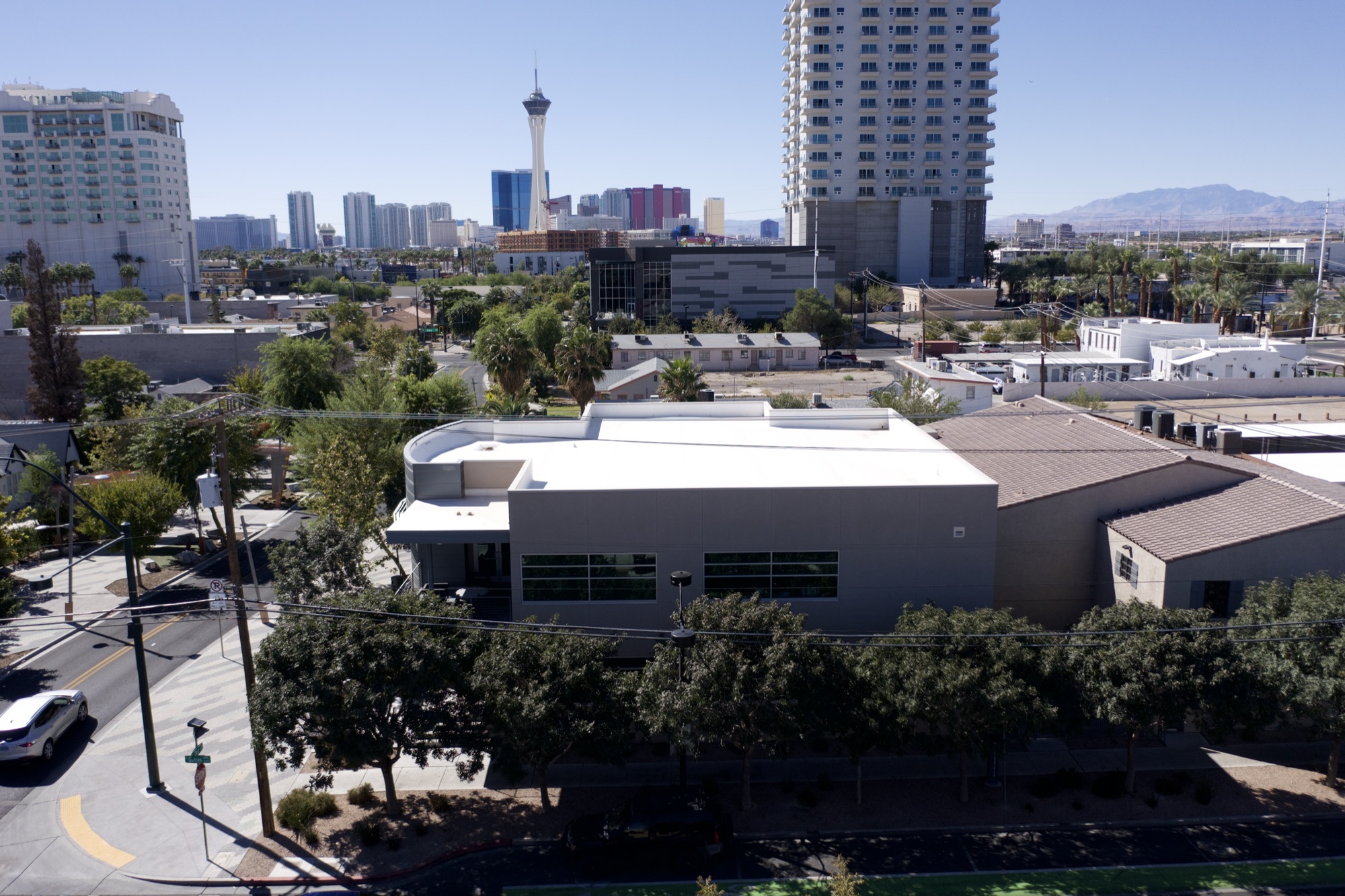
Las Vegas aerial photography isn’t just about the Strip, though people always think that first. It’s about what’s happening in Henderson, what’s going on in Summerlin, how the subdivisions expand outward in perfect grids, and how the natural landscape—Red Rock Canyon, Spring Mountains, Lake Mead—provides this dramatic boundary between city and nothing.
We’ve been flying a lot in the Las Vegas area, and the work we’re doing is different from what we’d shoot in Phoenix or Albuquerque. This is a market that’s growing different.
The Vegas Real Estate Boom From Above: Luxury Homes and Master-Planned Communities
Henderson and Summerlin are not small anymore. These are massive, carefully planned developments—the kind of neighborhoods where every street name references something Spanish, every HOA has three levels, and the average home sits on a quarter-acre or more. From the ground, they look like any other suburban community. From 400 feet up in a drone, you see the pattern. You see the infrastructure. You see exactly where the newest phases are expanding and how the developments relate to the natural landscape beyond.
Real estate agents across the Las Vegas metro understand this now. Luxury homes in Summerlin, high-end properties in Seven Hills, estates anywhere in Henderson—they all need aerial photography. The homes are built for outdoor living. Pools, courtyards, desert landscaping that looks incredible from above. An aerial shot shows the property, the lot size, the relationship to neighboring homes, and the view corridor toward Red Rock or the mountains. That’s information a ground-level photo just can’t convey.
Solar and Commercial Infrastructure: What Only Aerial Photos Reveal
Here’s something that doesn’t always make it into the conversation about Las Vegas aerial photography: solar. Commercial solar, rooftop solar on large buildings, solar carports in parking lots across the valley—this is infrastructure that’s completely invisible unless you’re looking from above. We’ve been contracted to document solar installations, track project progress, and photograph completed systems for contractors and facility managers across the Las Vegas area.
The dry, clear conditions in July mean that detailed photography is possible. You’re not fighting humidity. You’re not dealing with dust storms the way you would in Arizona monsoon season. The light is intense, but that intensity actually helps with clarity. Commercial properties—office parks in and around the business corridor, retail developments, industrial facilities—photograph sharply when conditions are right.
Construction Progress: Tracking the Growth From the Air
The Las Vegas construction market is active. Residential developments in North Las Vegas, commercial projects along the I-15 corridor, mixed-use developments in Downtown Vegas—there’s constant activity. Contractors need documentation. Progress photos from a drone aren’t just nice to have. They’re part of project management. They show lenders, insurance companies, and ownership exactly where work stands at any point in time.
July conditions in Vegas mean the drone is going to get sharp, detailed imagery. High altitude work is possible because the air is stable. Multi-site documentation is efficient because the sky is clear and predictable. We can fly multiple properties in a day, which makes scheduling easier for contractors juggling several projects at once.
The Natural Backdrop: Red Rock, Spring Mountains, Lake Mead
One thing that makes Las Vegas aerial photography distinctive is the landscape. Red Rock Canyon rises up less than 30 minutes west of the Strip. The Spring Mountains provide natural relief and visual drama. Lake Mead to the northeast is blue against the desert. When you’re composing aerial shots—whether for real estate, construction documentation, or just because someone wants to see their property in context—these natural features become part of the story.
A drone video can frame a property or development against Red Rock. A time-lapse of a construction site can show the progression of work with the mountains in the background. Even commercial properties gain presence when they’re positioned against the natural landscape.
What to Expect When You Book Las Vegas Aerial Photography in Summer
July and August in Las Vegas are actually ideal for aerial work if you’re comfortable with logistics. Heat doesn’t matter to the drone. Clear skies are guaranteed most days. You’re not waiting for weather windows like you would in monsoon states. Scheduling is straightforward.
If you’re a real estate agent with a luxury listing in Summerlin or Henderson, an aerial shoot in July gets done quickly and looks sharp. If you’re a contractor with multiple sites and need progress documentation, summer light and clear skies mean efficient work. If you’re managing a commercial property and need to document infrastructure or track improvement projects, Las Vegas aerial photography in summer delivers results.
We’re based here and we know the market. We know the neighborhoods, the developments, the geography. We can shoot your property, your project, or your site with the specificity and local knowledge that generic drone services can’t offer.
Whether you’re selling a home, tracking construction progress, or documenting commercial infrastructure, Las Vegas aerial photography is our specialty. The light is here. The air is clear. Let’s get your project captured from above.
Book your Las Vegas drone shoot at https://desertdronesllc.com/