
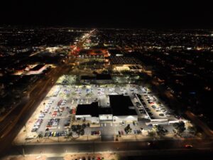
Why Denver Real Estate Needs Aerial Photography More Than Most Markets
Denver’s real estate market moves fast. Buyers in the metro — from Capitol Hill to Cherry Creek, from the Highlands to Stapleton — expect to do serious research online before they ever set foot in a home. That means your listing photos aren’t just marketing.
They’re the first showing. And in a competitive market where dozens of homes hit Zillow every week, the listings with aerial photography get significantly more attention than the ones without it.
Desert Drones provides FAA-certified aerial real estate photography throughout the Denver metro. We work with agents, developers, and property owners to create drone photography and video that shows homes the way buyers actually want to see them — from above, in context, with the mountains in the background and the neighborhood laid out in a way that no ground-level shot can match.
Whether you’re selling a bungalow in the Highlands or a luxury home in the foothills, we make your listing stand out.
The Mountain View Premium in Denver Real Estate
Denver has a geographic advantage that most cities don’t: the Front Range. The Rocky Mountains as a backdrop make aerial photography uniquely powerful here. A ground-level photo of a home in Evergreen or a property in Lakewood shows a house.
An aerial photo of the same home shows that house with a panoramic view of the mountains behind it — an entirely different story that buyers respond to emotionally.
Even inside the city, Denver’s varied neighborhoods have stories that aerial photography tells better than ground-level shots. The tree-lined streets of Washington Park look entirely different from 150 feet than they do from the sidewalk. The walkable energy of LoHi, with its mix of restored Victorian homes and modern construction, shows up beautifully in aerial video.
The spaciousness of a Stapleton home with access to Central Park makes more sense when buyers can see it from the air.
Properties with outdoor features — decks, patios, gardens, hot tubs — also benefit enormously from aerial photography in Denver’s outdoor-lifestyle market. Buyers here are looking for space to enjoy the Colorado lifestyle. Showing them a backyard from ground level means showing them a fence and some grass.
Showing them that same backyard from above means showing them how it connects to the neighborhood, the views available from the deck, and the overall property in its full context.
What Professional Drone Real Estate Photography Includes
When we photograph a Denver property, we start by planning what makes this specific home look best from the air. Every property has unique selling points that aerial perspective can highlight. We identify those before the shoot and build our flight plan around them.
On shoot day, we arrive with our drone and camera equipment and conduct pre-flight safety checks. We coordinate with whoever is on-site and brief them on what we’re doing and how long we’ll be flying.
We then execute a systematic series of aerial photos from multiple altitudes and angles — wide establishing shots that show the home in its neighborhood, mid-distance shots that emphasize the property’s features, and specific detail shots of outdoor areas, views, and any unique characteristics.
We also shoot aerial video — slow, cinematic passes around the property that give buyers a dynamic sense of scale and setting that still photos can’t convey.
In post-production, we edit all imagery to professional standards. Photos are color-corrected and optimized for web and print. Videos are edited into polished reels with smooth transitions. Everything is delivered in formats compatible with MLS systems, agent websites, and social media platforms. Most agents receive final deliverables within three to five business days.
Aerial Photography for Every Price Point in the Denver Market
You don’t have to be selling a million-dollar property to benefit from drone photography. We work across all price segments of the Denver market. An entry-level home in Aurora or Englewood photographed with aerial imagery shows buyers more about the neighborhood, lot size, and location than any ground-level set of photos. That additional context converts casual browsers into serious inquiries.
At the luxury end, aerial photography is simply expected. Buyers researching high-end properties in Cherry Hills Village, Greenwood Village, or the Bonnie Brae neighborhood expect to see comprehensive aerial coverage. A luxury listing without drone photography is immediately at a disadvantage versus comparable properties that include it.
For new construction, aerial photography is a particularly powerful tool. Builders showing model homes or spec homes benefit from images that capture the entire development, show how the homes relate to community amenities, and document the neighborhood-in-progress in ways that help buyers visualize the finished community. We work with Denver-area builders on everything from single spec homes to multi-phase community marketing packages.
Aerial Video: Showing Denver Properties in Motion
Still photos are essential, but aerial video adds a dimension that photography can’t replicate. Buyers who watch a well-produced drone video of a property understand the layout, the flow, and the scale in a fundamentally different way than buyers who scroll through photos.
For properties where those factors matter — large lots, complex layouts, homes with multiple distinct outdoor spaces, properties where the approach and setting are part of the appeal — video is often what converts an online view into a showing appointment.
We produce short social media clips — typically 15–30 seconds — optimized for Instagram Reels, Facebook posts, and TikTok. These are designed to capture attention fast and drive traffic to the full listing. Longer property tour videos — typically 60–120 seconds — are suitable for YouTube, embedding on listing pages, and emailing to prospective buyers.
We can deliver one or both formats depending on your marketing strategy.
Our aerial video includes smooth, cinematic movements — slow approaches down the driveway, sweeping reveal shots that show the home against its mountain backdrop, and deliberate orbits that give buyers a complete 360-degree sense of the property. We add background music and can incorporate title cards or other text overlays when appropriate. The result is content that feels professional and makes a genuine impression.
Denver’s Airspace Challenges and How We Navigate Them
Denver’s proximity to DIA, Centennial Airport, and several other general aviation facilities in the metro means airspace management is a real consideration for drone photography. Hobby drone operators often don’t realize how much restricted airspace exists around the Denver metro. Flying without proper authorizations near airports is illegal and creates genuine safety risks.
As FAA Part 107 certified operators, we handle airspace authorization through LAANC (Low Altitude Authorization and Notification Capability) for every flight in controlled airspace. We know which areas around the Denver metro require authorization, what altitudes are permitted, and how to operate safely and legally.
You don’t need to think about any of this — we handle it completely as part of every project. Your listing gets professional aerial photography without any airspace compliance concerns.
Showcasing Denver’s Diverse Neighborhoods From the Air
Every Denver neighborhood has its own character, and drone photography helps communicate that character to buyers. A Wash Park home photographed from above shows the mature tree canopy, the proximity to the park itself, and the neighborhood density that makes it one of the most sought-after zip codes in the city.
A LoHi property shows the urban energy and rooftop views. A home in Green Valley Ranch or Stapleton shows the planned community design and access to open space in a way no ground-level shot communicates effectively.
Foothills properties — Evergreen, Morrison, Golden, Conifer, Bailey — have their own aerial photography needs. These homes often have dramatic terrain, mountain views, and acreage that absolutely must be shown from above to make sense to buyers. We photograph foothills properties with specific attention to the relationship between home and landscape, capturing the mountain setting that makes these properties so compelling.
Ready to Show Your Denver Listings From the Air
Whether you’re an agent looking to differentiate your listings, a builder wanting to showcase new homes, or a homeowner preparing to sell, professional aerial photography is one of the highest-ROI marketing investments you can make in the Denver market. Properties look better, generate more interest, and sell faster when buyers can see them from the air.
Ready to add drone photography to your Denver listings? Visit our Real Estate Photography Services page to see our portfolio and request a quote, or contact Desert Drones directly to discuss your property and timeline. We’re FAA-certified, experienced with Denver’s unique geography and market, and committed to delivering photography that sells homes. Let’s show your property from a perspective your competitors aren’t using yet.