
The Rocky Mountains show up in almost every view from Denver. That’s what makes aerial photography in Colorado different from desert markets. You’re not shooting against flat horizons or distant ridges. You’re working with mountains that dominate the composition, that provide scale, that make every shot more dramatic just by virtue of being there.
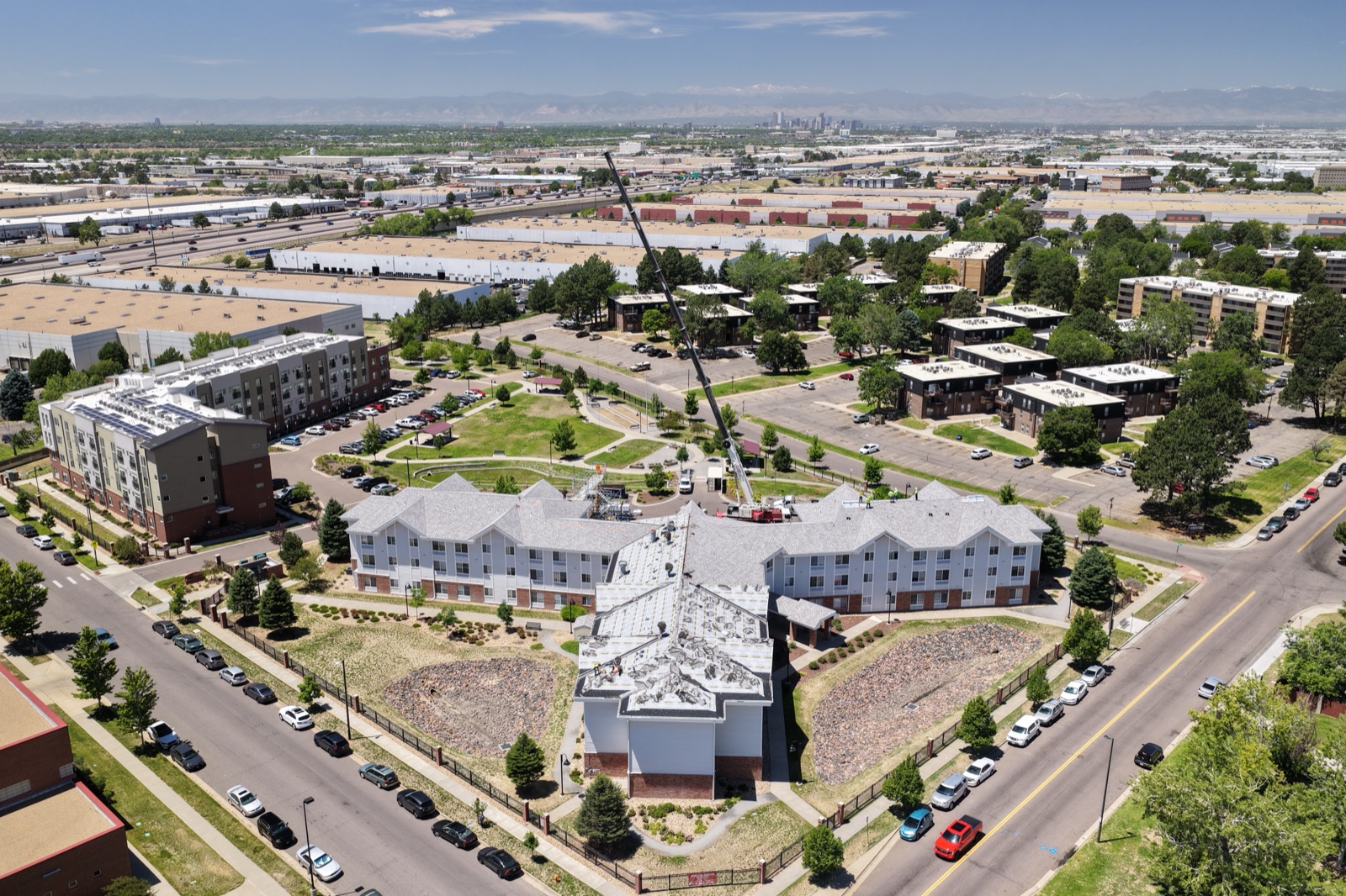
July in Denver is summer—warm days, cool nights, and that specific quality of Colorado light that makes everything look more vivid than it probably should. Afternoon thunderstorms roll over the peaks. Green is everywhere because this is the Front Range, not the desert. If you’re booking drone photography in Denver right now, you’re booking in a season when the landscape is at its most dynamic.
The metro area stretches from Boulder down through Aurora, from the mountains to the plains. Growth is constant. Construction is everywhere. Real estate is competitive. Aerial photography has become essential for agents who want to sell homes effectively. We’ve been flying across the Denver area, and the work is different here than what we do in the Southwest markets. Different landscape. Different season. Different challenge. Exactly what makes it compelling.
Rocky Mountain Backdrops: The Geography That Makes Every Composition Stronger
Most cities struggle to find landscape features that make aerial compositions interesting. Denver doesn’t have that problem. The Rockies are there. Red Rocks Amphitheatre rises up west of the city. The Front Range creates a natural boundary between urban development and wilderness. Mountains frame every view.
Real estate agents across the Denver metro understand this. Properties with mountain views are premium products. Homes in Boulder, properties in Westminster and Broomfield that look back toward the peaks, listings in Aurora that face west toward the mountains—they all benefit from aerial perspective that shows the view context. A drone shot demonstrates the actual mountain vista from the property. It shows lot size and neighborhood in relation to the landscape. That’s information that matters to buyers.
We’re working with real estate professionals across Denver and the Front Range. The Park Hill neighborhood, properties in Cherry Creek, listings in south Denver, newer developments in Aurora and Thornton—they all photograph better when you can frame them against the mountains. The landscape context makes the location memorable.
Front Range Growth: Construction From Golden Peaks to the Plains
The I-25 corridor is busy. Development pushes north from Denver toward Fort Collins, west toward the mountains, south toward Castle Rock, and east toward the plains. Aurora, Thornton, Westminster, Broomfield—these suburbs are growing. New residential developments, commercial projects, mixed-use properties—the construction is constant.
Contractors across the Front Range need progress documentation. They need to show lenders, insurance companies, and ownership where projects stand. A drone provides that perspective. It shows site scope, tracks grading progress, documents foundation and framing work, and creates a record that’s actually useful for project management.
We’re documenting construction progress across the Denver metro. The light in summer Colorado is particularly good for detail work. Shadows show dimension. Colors are vivid. The mountains in the background can be framed as reference points that show project location.
The Unique Quality of Colorado Summer Light
July light in Colorado hits different. It’s not the flat heat of the desert or the humid glare of Texas. The altitude affects the light quality. The mountains create complex light patterns. Afternoon storms and clearing skies create dramatic conditions. For photographers and anyone who cares about how images look, Colorado summer is genuinely special.
This light quality matters for real estate photography. It matters for construction documentation. It matters for any kind of commercial photography. Properties photograph better in Colorado light. The sharpness and the color saturation are just different.
If you’re booking aerial photography in Denver, you’re booking in a location where the visual conditions are inherently more dramatic than most places. The mountains help. The light helps. The landscape helps.
Commercial Real Estate and Rooftop Documentation
Denver’s commercial real estate market is active. Downtown Denver keeps evolving. Office developments, retail centers, mixed-use projects—they’re constantly changing. Commercial brokers, facility managers, and developers use aerial photography to show properties, track changes, and document conditions.
We’re doing commercial work across Denver. Office parks in the I-25 corridor, retail developments in surrounding areas, industrial properties, mixed-use complexes—we have experience with the range and scale of commercial real estate documentation. Aerial perspective shows property context and surrounding development in ways that ground photos can’t convey.
High Altitude and Technical Considerations
Denver sits at 5,280 feet elevation. The air is thinner. That affects drone operations, battery performance, and flight dynamics compared to sea-level markets. We understand these considerations. We’re experienced flying at elevation. We know how to work with the conditions and deliver quality results that don’t make excuses for the geography.
It’s one of the reasons local expertise matters. Flying Denver isn’t the same as flying Phoenix or Dallas. The conditions are different. The regulations are different. The landscape is different. We have that experience, and it shows in our results.
What to Expect When You Book Denver Aerial Photography
July in Denver means scheduling around afternoon storms, but those storms are often brief and the subsequent clearing creates dramatic light. We can work with your schedule. We can coordinate around weather windows. We can deliver quality results even in summer conditions.
Real estate agents, contractors, commercial property professionals—they all understand that aerial photography is essential in a competitive market. We deliver results with the specificity and local knowledge that matters.
Whether you’re selling a home with mountain views, tracking construction progress on the Front Range, or documenting commercial properties, Denver aerial photography is our specialty. The mountains are in frame. The light is particular to this place. The growth is real. Let’s get your Denver-area project captured from above.
Book your Denver aerial photography at https://desertdronesllc.com/