
Albuquerque Real Estate Drone Photography for NM Realtors
Albuquerque’s landscape is genuinely one of a kind. The Sandia Mountains rise nearly 10,000 feet to the east, their crest catching first light at dawn. The Rio Grande cuts a ribbon of green through the city, separating the developed West Side from the sprawling Northeast Heights and Four Hills neighborhoods. Adobe homes and territorial architecture blend seamlessly into high desert terrain dotted with juniper and piñon. For buyers shopping for Albuquerque properties—whether they’re drawn to the mountain views, acreage in Corrales, or a renovated home in Nob Hill—the right angle makes all the difference. Desert Drones delivers professional aerial imagery that captures the true character of New Mexico real estate.
Why Albuquerque Real Estate Listings Benefit from Drone Photography
Aerial perspective reveals what ground-level photos simply cannot. In Northeast Heights and Four Hills, properties are prized for their Sandia Mountain views. Drone photography captures the dramatic backdrop and the lot’s relationship to that iconic ridge. Buyers want proof that the view is real and unobstructed—a single overhead shot provides exactly that.
Rio Grande valley land parcels tell a different story. Sellers and agents need to communicate acreage, accessibility, and proximity to water that makes New Mexico property valuable. Aerial imagery shows the true footprint of a parcel, its boundaries relative to surrounding properties, and any water rights advantages. This is especially important for North Valley ranches and horse properties, where buyers evaluate entire operational layouts—pasture placement, barn access, driveway infrastructure—before scheduling a showing.
Corrales acreage and rural properties benefit enormously from drone photography. Buyers can immediately understand the property’s isolation or proximity to Albuquerque, the surrounding topography, and how much land they’re actually acquiring. A 5-acre parcel looks very different from the air than it does from a single driveway shot.
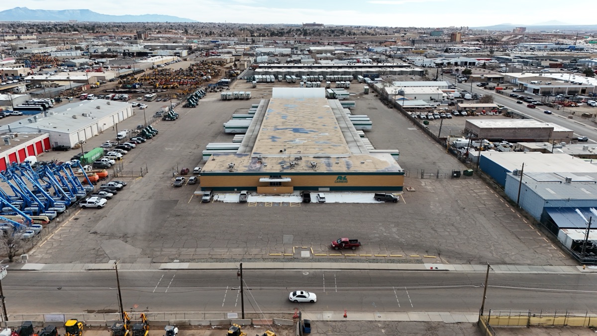
Commercial properties in Nob Hill and UNM-area listings benefit from showing traffic flow, neighboring businesses, and visibility from major roads. For realtors representing these properties, real estate drone albuquerque nm services become a competitive necessity.
What Our ABQ Drone Photography Service Includes
Our drone photography service in Albuquerque starts with a consultation. We discuss your property, the specific angles and features you want to highlight, and what your target buyer needs to see. We review proximity to Albuquerque International Sunport or Kirtland Air Force Base airspace, neighborhood sensitivities, and weather windows.
Before we fly, we perform a thorough FAA airspace check. Albuquerque sits in a complex airspace environment due to the Sunport and military operations at Kirtland AFB. We ensure full compliance and coordinate as needed.
The shoot captures high-resolution aerial stills and aerial video from multiple angles and elevations. Photos are color-corrected and delivered in high resolution for print and digital use. Video is edited with smooth transitions, ready for social media or website embedding. Most Albuquerque real estate drone photography sessions are delivered within 2–3 business days.
Who This Service Is For in Albuquerque
Residential Realtors: If you represent homes in Northeast Heights, Paradise Hills, Four Hills, or anywhere in the Albuquerque area, drone photography sets your listings apart. Buyers expect quality aerial imagery, and it builds confidence before a showing.
Ranch and Land Brokers: North Valley ranches, Corrales acreage, and Rio Grande valley land require aerial context to show value. For land brokers selling in New Mexico, this is essential—there’s no other way to communicate acreage and layout effectively.
Luxury Home Sellers: High-end properties in Albuquerque often feature mountain views, architectural details, and sophisticated landscaping. Aerial imagery captures the overall elegance and setting that justifies the price.
Commercial Property Owners: Office parks, retail properties, and mixed-use developments benefit from showing traffic patterns, visibility, and relationship to major roads.
Developers: Large-parcel projects and subdivision developments across New Mexico need clear, professional aerial documentation showing scale, progress, and planning.
Why Albuquerque Realtors Choose Desert Drones
We hold FAA Part 107 certification and understand Albuquerque’s unique airspace. We’re familiar with the procedures around Sunport and Kirtland AFB, the constraints and windows for flying, and how to coordinate with local authorities. This expertise means fewer delays and more reliable service.
We know New Mexico terrain and the Albuquerque real estate market. We understand which angles matter for mountain-view properties, how to frame Rio Grande valley land, and what buyers actually want to see. We’re responsive—questions and revisions get answered quickly. Learn more at our real estate drone services page.
The Greater Albuquerque Association of REALTORS serves one of New Mexico’s most active property markets. Drone photography Albuquerque agents book through Desert Drones helps showcase mountain views, lot size, and surrounding landscape in ways ground photography simply can’t replicate.
Frequently Asked Questions
Can you fly near Albuquerque International Sunport and Kirtland AFB? Yes. We hold FAA Part 107 certification and understand the airspace restrictions. We perform airspace checks on every job and coordinate with authorities as required.
What’s the best approach for ranch and horse property photography? Multiple altitudes and angles. We fly at varying heights to show both the overall property footprint and detailed features like barn placement, pasture layout, or water features—giving buyers the complete picture.
How does aerial photography help showcase adobe and Southwestern architecture? Aerial shots reveal the architectural footprint, roofline detail, and how the home sits on the land. Combined with the Sandia Mountains backdrop, drone photography captures the authentic character that buyers seek in Albuquerque real estate.
How fast can you turn around drone photography for an Albuquerque listing? Most jobs deliver within 2–3 business days. If you need faster service on a time-sensitive listing, contact us to discuss options.
Ready to Book Your Albuquerque Drone Photography Session?
The Sandia Mountains and Rio Grande valley make Albuquerque one of the most distinctive real estate markets in the Southwest. Your property deserves photography that captures that distinction. Contact Desert Drones to schedule your Albuquerque real estate drone photography session and see how aerial imagery positions your listing for success.