
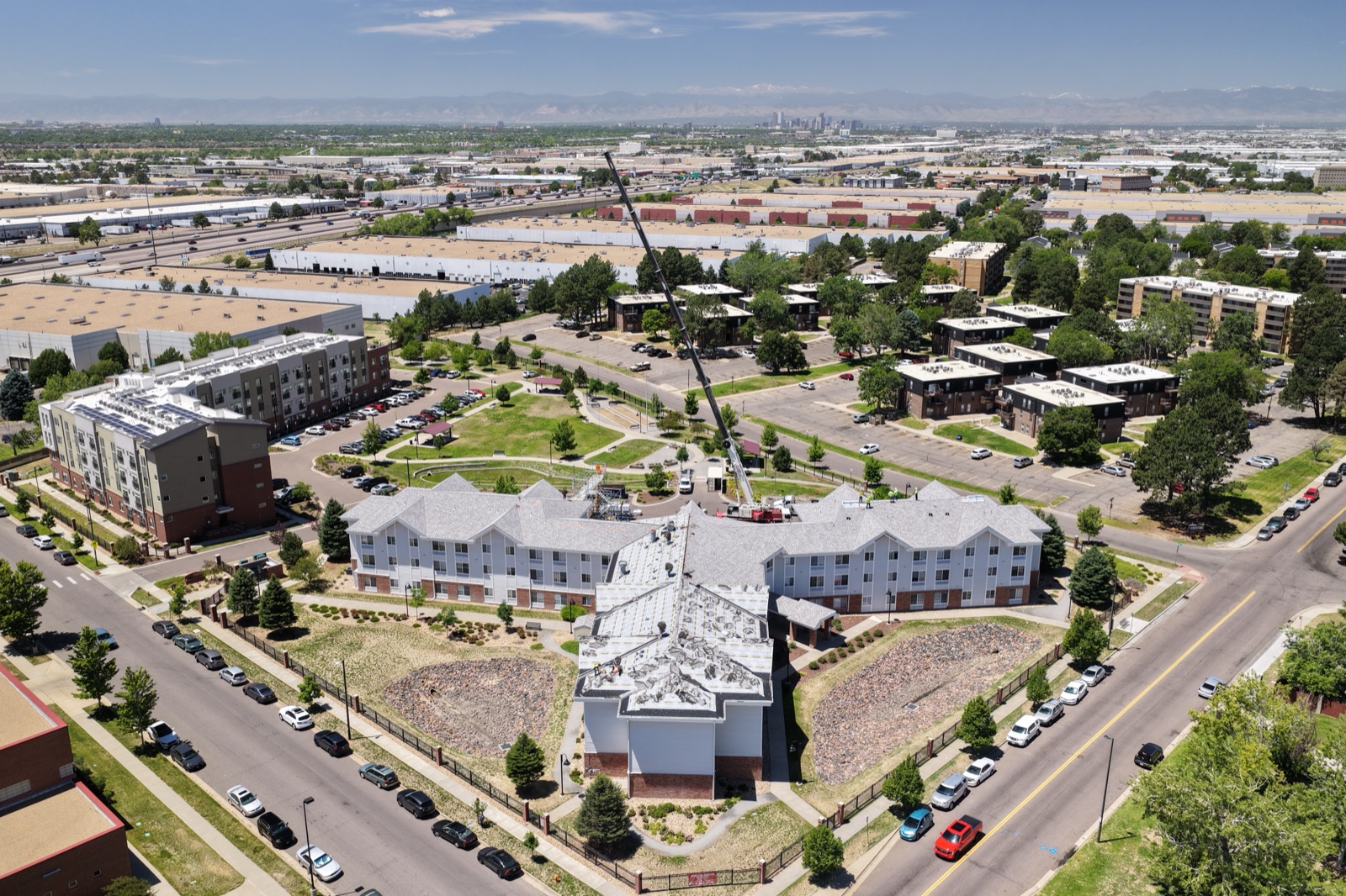
Aerial Photography in Denver, CO | Rocky Mountain Drone Services
Nowhere in the continental US does aerial photography look quite like it does in Denver. The Front Range rises dramatically to the west, turning ordinary property shots into something genuinely spectacular. Realtors listing homes in Cherry Creek or Washington Park want buyers to see that mountain backdrop. Brands shooting outdoor content want the Rockies in frame. Developers and construction teams need site documentation with mountain context. Desert Drones LLC is FAA Part 107 certified and experienced with Denver’s unique airspace and altitude challenges. We deliver professional aerial photography that captures the dramatic beauty surrounding your project, property, or brand.
Why Aerial Photography in Denver Looks Different
The Denver metro sits at 5,280 feet elevation with the Rocky Mountain Front Range rising another 8,000+ feet to the west. This geography creates lighting and composition opportunities you simply won’t find in flat regions. Golden hour light hits mountain peaks at angles that frame properties, developments, and landscapes in ways that feel almost cinematic.
Cherry Creek and Washington Park luxury real estate thrives on mountain views. A penthouse or mansion listing gains serious visual impact when drone footage shows those peaks behind the property. Buyers see the location value differently from the air—the proximity to outdoor recreation, the neighborhood positioning relative to downtown and the mountains, the full sense of place.
LoDo and RiNo commercial development, along with newer neighborhoods like Stapleton and Central Park, all benefit from aerial context. Outdoor and active lifestyle brands know this too. Ski resorts, outdoor retailers, and adventure tourism companies use drone photography denver co to emphasize Colorado’s mountain access. Red Rocks Amphitheatre vicinity shoots carry the drama of that landscape.
Aerial photography in Denver isn’t just about getting a higher vantage point—it’s about the view itself. The mountains make every shot stronger.
What Our Denver Aerial Photography Service Includes
We start with a consultation to understand your project, goals, and timeline. We discuss exact locations, shot lists, and deliverables you need.
Next comes our FAA airspace check. Denver’s airspace is complex. You’re within the Class B airspace around Denver International Airport (DEN) and also near Buckley Space Force Base. We coordinate airspace clearances, verify Part 107 flight restrictions, and confirm we can legally operate at your location.
For the actual shoot, we deliver high-resolution aerial stills for print, web, and real estate listings, plus aerial video and cinematic fly-throughs that tell a visual story. Our equipment handles Denver’s high altitude and mountain wind conditions. We color-grade and edit deliverables to match your brand or the property’s best features. Most clients receive edited finals within 5–7 business days; rush turnaround is available.
Who Uses Aerial Photography in Denver
Luxury Real Estate Agents and Realtors — Homes in Cherry Creek, Washington Park, Highlands, and other premium neighborhoods need visual differentiation. Aerial photography showcases mountain views, lot size, and neighborhood character.
Commercial Brands and Outdoor Companies — Outdoor retailers, adventure tourism, craft breweries, and lifestyle brands all shoot content with Colorado’s mountain backdrop as their visual storytelling.
Developers and General Contractors — Progress documentation, site context, and marketing materials all benefit from drone perspective. A new residential or commercial development is easier to visualize and market when you show its location, scale, and surroundings from above.
Event Organizers — Festivals, corporate events, and outdoor gatherings use aerial photography denver for marketing, sponsorship decks, and post-event coverage.
Why Denver Brands and Realtors Choose Desert Drones
We hold an FAA Part 107 license—certification that requires extensive training in regulations, airspace, safety, and equipment. We’re not hobbyists; we’re professionals accountable to federal standards.
We understand Denver’s airspace specifically. We know which locations require coordination, which airspace is restricted, and how to navigate the complex Class B restrictions. At 5,280 feet baseline elevation, drone motors work harder and battery performance changes. We account for this in flight planning and equipment selection. Learn more at our aerial photography service hub. Contact Desert Drones today to discuss your Denver aerial photography needs.
The Denver Metro Association of REALTORS reports that listings with professional aerial media consistently outperform those without. Aerial photography Denver real estate agents use through Desert Drones captures the mountain backdrops and urban character that define the region’s most desirable neighborhoods.
Frequently Asked Questions
How does Denver’s high altitude affect drone performance? Denver’s 5,280-foot elevation affects motor efficiency and battery life. We plan flights conservatively and monitor battery levels carefully. Our experience with high-altitude operations ensures reliable results.
Do you need special permission to fly near Denver International Airport or Buckley Space Force Base? Yes. We check NOTAM airspace restrictions and coordinate with these facilities when required. We determine exact legal flying parameters for your location before scheduling.
What’s the best time of day to shoot aerial photography in Denver? Golden hour (sunrise and early evening) is ideal—the sun angle lights the mountain peaks beautifully and creates dramatic shadows. The best time ultimately depends on your project’s needs.
How fast can you turn around aerial photography? Standard turnaround is 5–7 business days for edited final deliverables. Rush delivery (2–3 days) is available for realtors with urgent listings or brands with tight deadlines.
What if weather or wind prevents flying on my scheduled date? We reschedule at no charge. Mountain weather and wind can be unpredictable, and we won’t compromise safety or image quality by flying in marginal conditions.
Ready to Book Your Denver Aerial Photography Session?
Whether you’re a realtor showcasing mountain views, a brand capturing the Rocky Mountain backdrop, or a developer documenting site progress, Desert Drones delivers professional aerial photography that brings Denver’s dramatic landscapes to life. Contact Desert Drones today to discuss your project.