
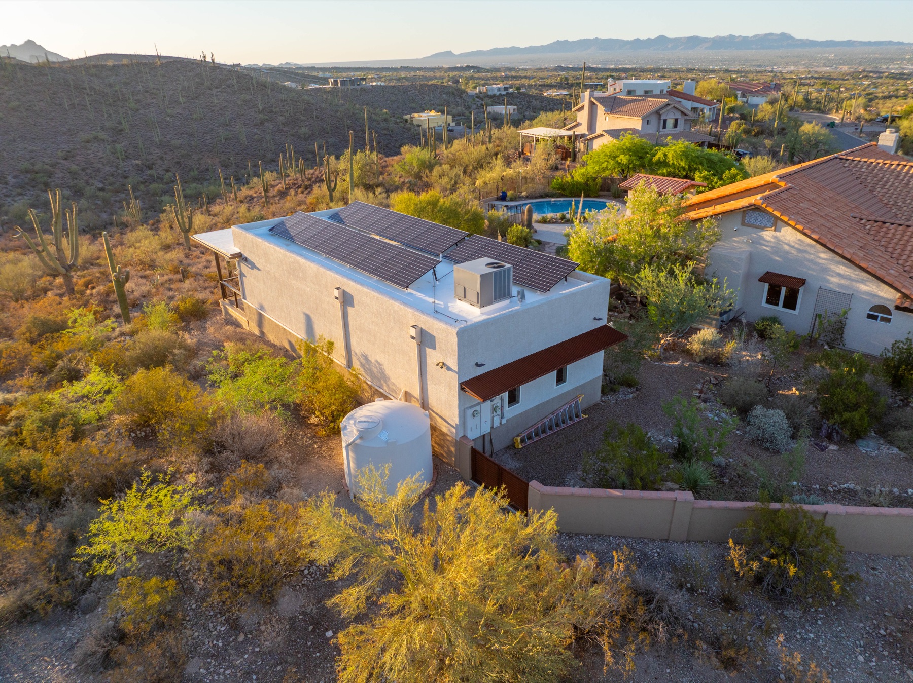
El Paso Real Estate Drone Photography for Realtors
El Paso’s real estate market is unlike anywhere else in Texas. With the Franklin Mountains as a dramatic backdrop, luxury neighborhoods spread across elevated terrain, and properties ranging from West Texas estates to cross-border investment homes, listings face a unique challenge: standing out in a market where geography matters as much as square footage. A property in Kern Place looks entirely different from one in Upper Valley, and buyers need to see those distinctions. That’s where professional drone photography comes in. Desert Drones LLC brings FAA Part 107 certification and local expertise to El Paso real estate, giving your listings the aerial perspective they deserve.
Why El Paso Listings Need Aerial Photography
The El Paso real estate market spans dramatically different terrain, and that’s your selling advantage—if buyers can actually see it. Neighborhoods like Cielo Vista showcase elevated views of the city and mountains. Upper Valley properties sit on expansive lots with vistas that traditional ground-level photography simply cannot capture. West El Paso’s newer developments benefit from context shots showing proximity to shopping, schools, and the Franklin Mountains. Commercial properties near the airport or along major corridors need aerial shots to convey their visibility and access.
The Hueco Mountains and Franklin Mountains create a natural frame for luxury listings that deserves to be showcased. Buyers flying in from other states or investors evaluating West Texas commercial property want to understand the landscape before they visit. Aerial photography answers that question in seconds.
Additionally, drone photography builds trust. When a seller invests in professional aerial footage, it signals that the property is being marketed seriously. Realtors who offer drone photography as a listing standard often see faster sales and higher engagement. In a competitive market, drone photography el paso properties simply get more qualified inquiries because buyers are drawn to the visual story the property tells from above.
What Our El Paso Drone Photography Service Includes
When you book drone photography el paso with Desert Drones, we start with a pre-shoot consultation to understand your property’s best angles, any airspace restrictions, and your timeline. We handle all FAA airspace checks and safety considerations—you don’t have to think about it.
On shoot day, our FAA Part 107 certified pilots arrive with professional equipment and capture high-resolution aerial still photographs from multiple angles and heights. We also shoot smooth aerial video, including cinematic flyovers and property walkthroughs for virtual tours or social media. All footage is color-corrected and professionally edited.
Deliverables include a set of high-res still images ready for MLS listings, edited 4K video ready to embed or share, and a shorter social-media-optimized version. Most projects turn around in 3–5 business days. If conditions aren’t right on shoot day, we reschedule at no extra charge.
Who This Service Is For
Residential Realtors: Agents selling homes across El Paso benefit from drone photography to differentiate their listings. If you’re handling properties in high-end neighborhoods or rural acreage, drone photography becomes a competitive necessity.
Commercial Brokers and Developers: Office parks, retail centers, industrial properties, and vacant land all benefit from aerial context. Developers planning new construction can show potential tenants or buyers the surrounding landscape and visibility from the street.
Luxury Home Sellers: Luxury buyers expect premium presentation. Professional drone photography justifies the investment and reaches out-of-state buyers before they travel to El Paso.
Property Management Companies: Managers overseeing portfolios can use aerial photography for inspections, marketing, and documentation across their El Paso properties.
Why Choose Desert Drones
Desert Drones LLC is FAA Part 107 certified—meaning our pilots have passed federal exams and carry proper insurance. We don’t cut corners on safety or legality. That matters because your MLS listing, your marketing materials, and your reputation are on the line.
We’re based in Tucson and know the El Paso region well. We understand the airspace rules around Fort Bliss, we know how weather patterns affect shoot windows, and we’re familiar with the neighborhoods and terrain that make El Paso properties unique. We deliver professional files—edited, color-graded, and formatted for immediate use on your MLS, website, or social channels. Learn more at our real estate drone services page.
The El Paso Association of Realtors consistently shows that listings with professional drone photography El Paso properties receive more views and sell faster than those with ground-level photography alone. Our FAA-certified pilots bring that advantage to every shoot.
Frequently Asked Questions
How much does drone photography el paso cost? Pricing depends on property size, complexity, and deliverables. Contact us for a custom quote.
Is drone photography legal in El Paso? Yes, when done by FAA Part 107 certified pilots following all regulations. We handle all airspace checks and fly within federal guidelines.
How long does the aerial shoot take? Most residential properties take 30–60 minutes to shoot. Delivery of edited files follows in 3–5 business days.
Can you fly near Fort Bliss or restricted airspace? We check airspace before every shoot. Some areas near military installations have restrictions, but most El Paso properties can be flown safely. We’ll let you know during the consultation.
Ready to Book Your El Paso Drone Photography Session?
Professional drone photography transforms how El Paso properties are marketed. Whether you’re a realtor listing luxury homes, a commercial broker showcasing industrial property, or a developer marketing new construction, we’re ready to capture your property from above. Contact Desert Drones LLC today to get started.