Construction Drone Services in Dallas, TX | DFW Metroplex
TLW Construction Inc
Trustindex verifies that the original source of the review is Google.
Desert Drones is fantastic to work with! They do an incredible job bringing our vision to life and capturing our projects in a way that truly showcases the work being done. Highly recommend their team. Thanks again, Desert Drones!
brooke ryan
Trustindex verifies that the original source of the review is Google.
Desert Drones is awesome to work with! They help bring our vision to life and showcase our work in the best way possible. Highly recommend them to anyone looking for quality drone services. Thanks, Desert Drones!
Frank Segarra
Trustindex verifies that the original source of the review is Google.
John and team are the consummate professionals! Very reliable, quick, and high quality deliverables!
Stephen Cook
Trustindex verifies that the original source of the review is Google.
Professional, efficient, and easy to work with. The team delivered clean, high-quality aerials and communicated clearly throughout the project. One of the best drone service providers we’ve worked with in the Phoenix area.
Greg DeMeritt Jr
Trustindex verifies that the original source of the review is Google.
Needed work done quickly for drone photography. They responded quickly and knew exactly what was required and explained it well. They provided great customer service and got me exactly what I needed, when I needed. Finally found my Drone guys!
Doug Fleming
Trustindex verifies that the original source of the review is Google.
John was a professional and very knowledgeable. He made the process of getting drone footage seamless and did an exceptional job. The speed of completion along with quality of his work was excellent. Highly recommend using them if...
Good JuJu Agency
Trustindex verifies that the original source of the review is Google.
John is true professional. Every time we need some drone photography or videography done John is excited to take on the project. From midnight fireworks displays to busy sections of the city with all kinds of obstacles, working with Desert Drones never fails to hit the mark.
Jesus Figueroa
Trustindex verifies that the original source of the review is Google.
Absolutely amazing experience with Desert Drones. They did a shoot for my business and I must say, they made my product really speak for itself! The aerial shots were stunning and perfectly captured every special moment. John was very professional, punctual, and easy to work with. Highly recommend them for any event coverage—you won’t be disappointed!
Eustolia Schau
Trustindex verifies that the original source of the review is Google.
Great company and amazing aerial photography!
Katie Schwertz
Trustindex verifies that the original source of the review is Google.
John took care of the interior and exterior drone footage for our manufacturing facility in Tucson. He was great to work with! Very knowledgeable, answered all our questions, and shot some great videos. He was also quick to respond to emails and calls throughout the whole process. I would definitely use Desert Drones again in the future.
Dallas–Fort Worth is the fastest-growing construction market in the United States — with Uptown and Midtown high-rise towers rising at record pace, Legacy West and Frisco master-planned developments pushing north, and the Alliance/Inland Port logistics corridor anchoring one of the largest industrial real estate markets in the country. At Desert Drones, we provide construction drone services throughout the DFW Metroplex, delivering the aerial data that Dallas-area contractors, developers, and project managers need to build smarter.
Our FAA-certified pilots capture high-resolution aerial photos, 4K video, and precision mapping that improve communication, reduce risk, and keep every phase of your Dallas project on schedule — from pre-groundbreaking to final inspection.
Smarter Construction Oversight Across DFW
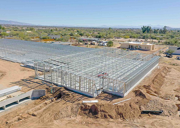
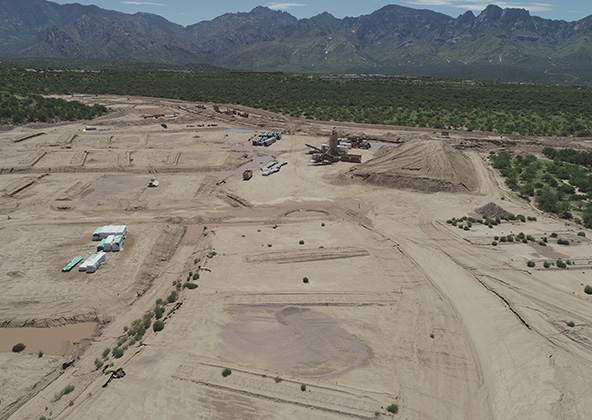
Dallas construction projects are large, fast-moving, and high-stakes. Our drone program gives DFW contractors and developers the consistent aerial perspective needed to manage multi-phase projects across a sprawling metroplex:
Weekly or biweekly aerial site photography for every project phase
4K progress video for investor decks and lender draw documentation
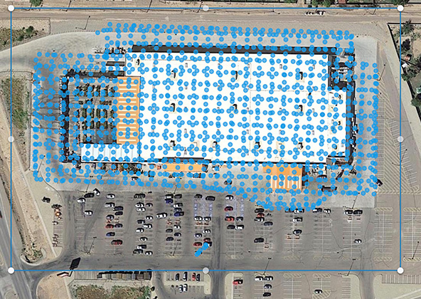
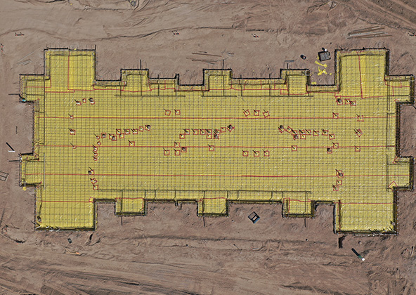
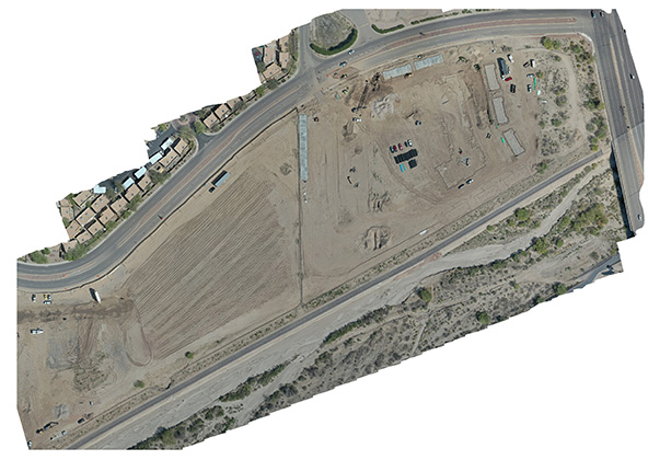
Orthomosaic maps and topographic surveys for grading verification
Volumetric earthwork and stockpile analysis for large pad sites
Whether you’re managing a Uptown Dallas residential tower, a Legacy West corporate campus, or a 1-million-square-foot Alliance Industrial Park warehouse, Desert Drones delivers the visuals your team needs to stay aligned.
Aerial Documentation That Keeps Texas Projects Moving
DFW construction sites change rapidly — especially during North Texas tornado and hail season (March–June) when post-storm documentation becomes critical for insurance claims and schedule recovery. Our drone program gives you consistent, repeatable visual records so nothing gets missed:
GPS-locked flight routes for identical framing visit after visit
Post-storm aerial documentation for insurance and subcontractor accountability after hail events
Integration with Procore, Autodesk Build, and construction management platforms
Same-day turnaround options during critical North Texas weather recovery windows
Why Dallas Builders Work with Desert Drones
Dallas contractors and developers choose Desert Drones because we understand the scale and pace of DFW construction — fast timelines, large site footprints, complex airspace near DFW International and Love Field, and the accountability demands of REIT and institutional developers. What sets us apart:
FAA Part 107 certified and LAANC authorized near DFW International and Dallas Love Field
North Texas construction sites face real safety risks — tornado season (March–June), severe hail events, and extreme summer heat all create hazardous conditions that drones can help manage. Our construction drone services in Dallas improve safety by:
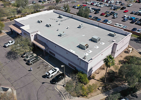
Enabling remote inspection of rooftops, scaffolding, and high structures — no workers at height required
Providing post-storm aerial documentation for insurance claims and subcontractor disputes
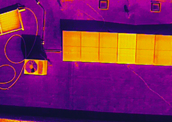
Thermal imaging to detect moisture infiltration, electrical hazards, and insulation failures
OSHA compliance documentation for multi-story Uptown and Midtown highrise projects
On fast-track DFW projects, having systematic aerial documentation before and after weather events protects your schedule, your budget, and your relationships.
Better Communication for Owners, Lenders & Project Teams
Clear visuals prevent costly misunderstandings on complex DFW construction programs. Our aerial reporting makes it easy to keep REIT investors, private equity sponsors, lenders, and city planning departments aligned — even across a sprawling 20-county metroplex:
Executive-ready progress decks for Uptown, Midtown, Deep Ellum, and Oak Lawn high-rise developments
Lender draw documentation with timestamped aerial photos and 4K video
City of Dallas and Tarrant County planning presentation materials
Pre-leasing footage for Alliance, Inland Port, and Mesquite industrial park warehouses
Built for Dallas Urban, Suburban & Industrial Job Sites
DFW construction happens across an extraordinary range of environments — dense urban cores, sprawling suburban master communities, and some of the largest industrial sites in the country. Our Dallas-area drone teams serve them all:
Urban highrises — Uptown, Midtown, Downtown Dallas, Deep Ellum mixed-use
Yes — we are FAA LAANC authorized for controlled airspace operations near DFW International and Dallas Love Field, with full coordination with air traffic authorities before every flight.
Absolutely. We offer pre- and post-storm aerial documentation specifically for North Texas hail and tornado events — providing the site condition records your insurance team, lender, and subcontractors need for claims and schedule recovery.
Yes. We deliver 3D surface models and cut-and-fill volumetric analysis accurate to a few centimeters — compatible with Civil 3D, Revit, and GIS platforms used by DFW’s engineering firms. Ideal for large industrial and residential pad development sites.
Yes — we regularly manage multi-site drone programs for developers, GCs, and REITs with multiple active projects across the DFW Metroplex. We coordinate scheduling, deliverables, and reporting across all sites through a single point of contact.
Most projects are delivered within 24–48 hours of the flight — photos, 4K video, and map exports. Same-day options are available for critical post-storm documentation windows.
Yes. Desert Drones carries $2 million in liability insurance and adheres to FAA Part 107 and OSHA safety standards — meeting requirements for institutional investors, REITs, and general contractors across the DFW market.
Licensed & Insured
Desert Drones, LLC is operated by a licensed pilot by the FAA (Federal Aviation Administration), Desert Drones, LLC is licensed & insured up to $2M.
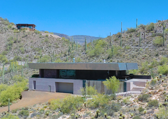
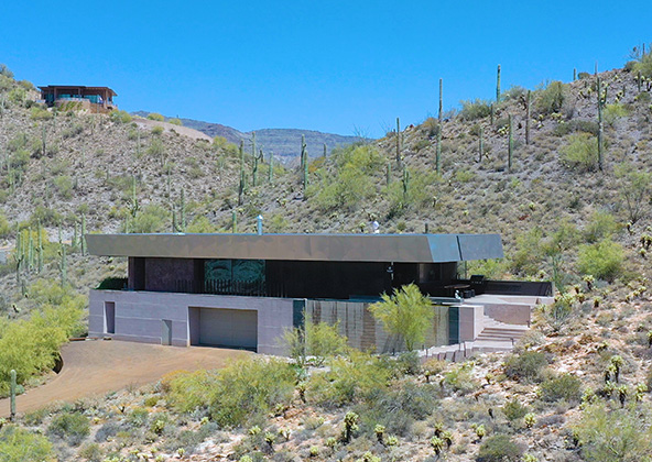
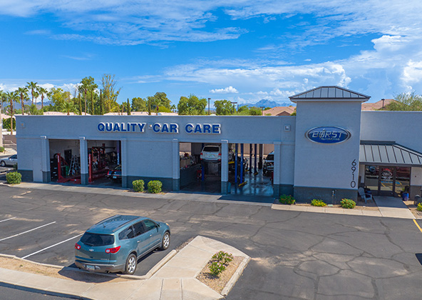
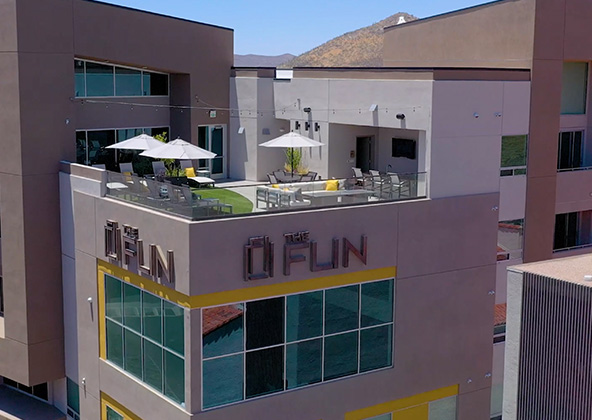
Aerial photography provides a unique perspective. Real estate listings, events, construction progress photos and site surveillance are just a few examples of where you need drones to do the job right.
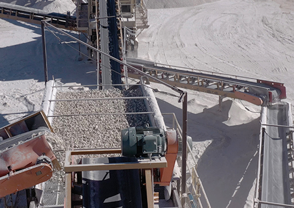
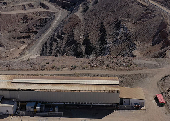
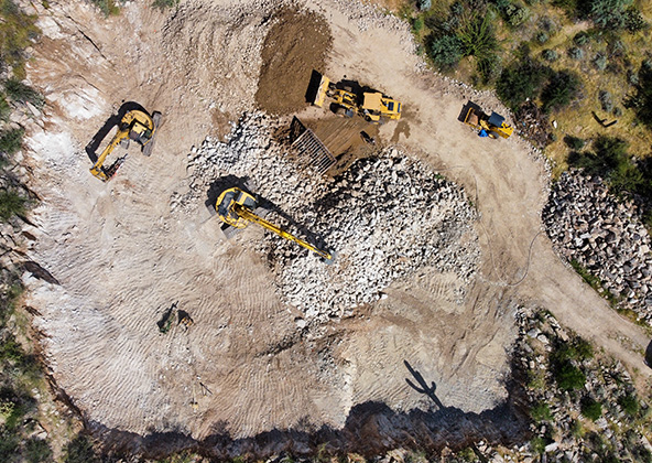
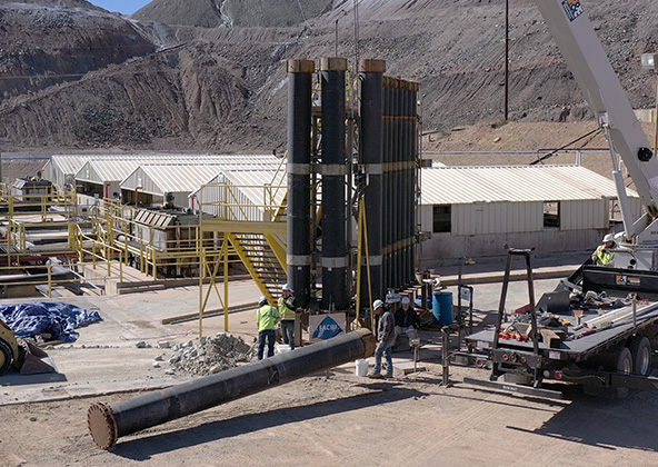
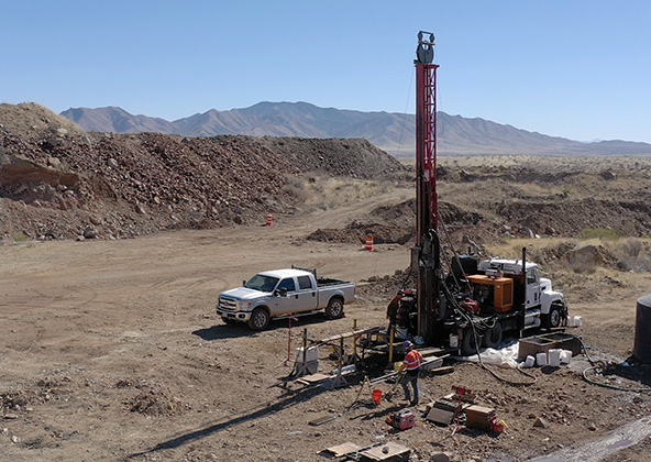
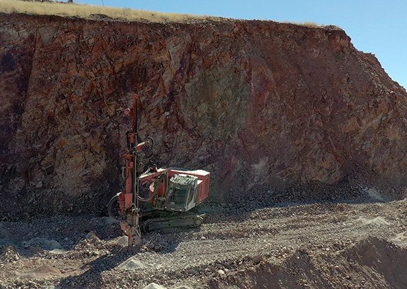
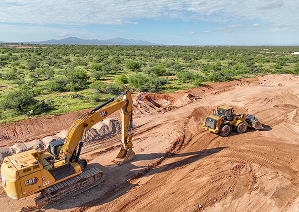
Mining
Aerial photography and videography provide fast and cost effective mapping, documentation, elevation and stockpile calculations to streamline your mining operations.
Industrial
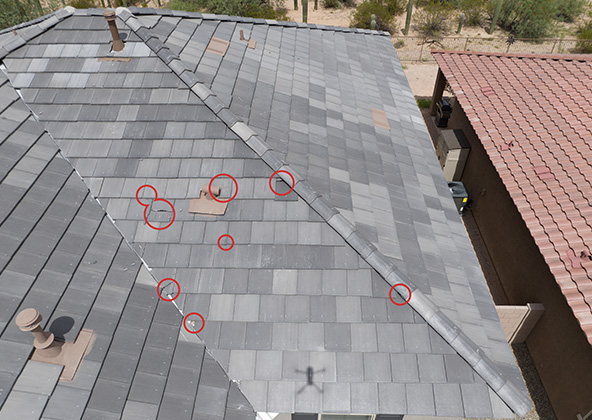
Drones are uniquely qualified to capture aerial data for inspections of cellular, electrical, mining, solar and other industrial sites. Providing higher quality data at a lower risk rate than traditional inspections, makes drone services a must on your project.
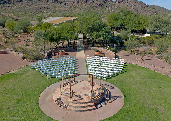
Events
No matter what kind of event you are having, aerial photography and videography make your audience feel like they are there. Make your advertising, marketing campaign and website stand out with dramatic pictures and videos that only drones can capture.
Licensed & Insured
Desert Drones, LLC is operated by a FAA (Federal Aviation Administration) licensed pilots, Desert Drones, LLC is licensed & insured up to $2M.
Aerial photography and videography provide fast and cost effective mapping, documentation, elevation and stockpile calculations to streamline your mining operations.
Southwest Arizona is a great place for solar. In phoenix and tucson we get over 300 days of sun every year. Let us give you valuable information while your system is still under warranty. Make sure you are getting what you paid for in you PV system.
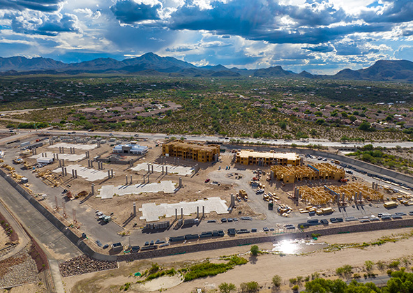
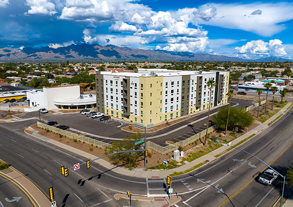
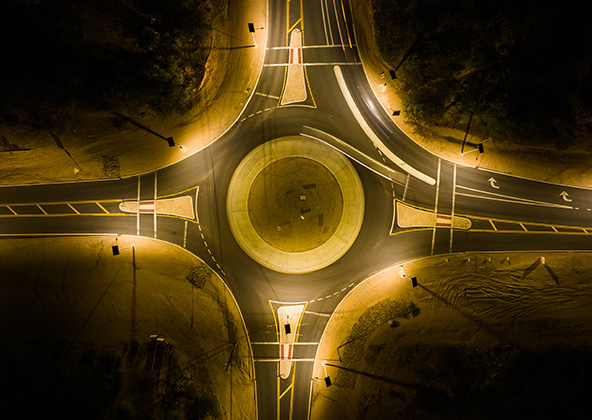
Gallery
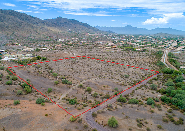
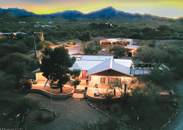
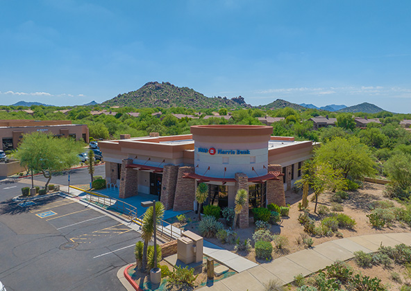
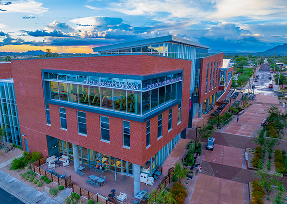
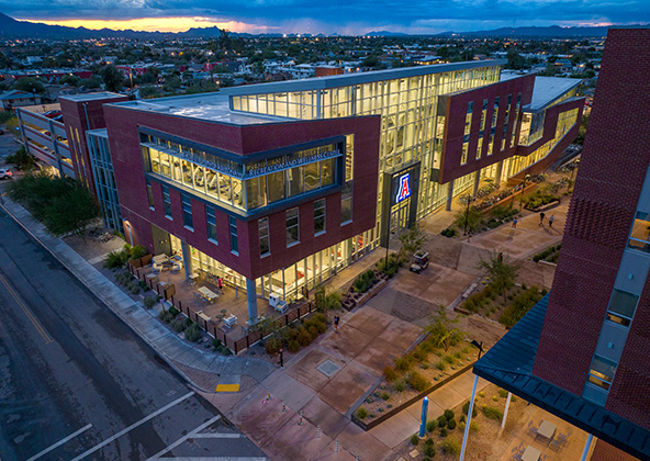
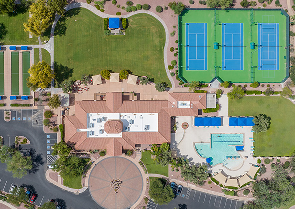
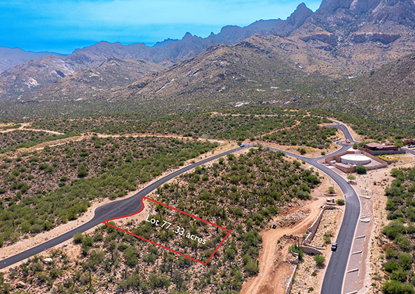
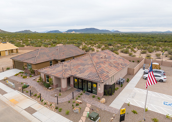
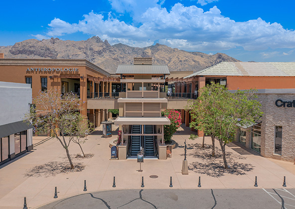
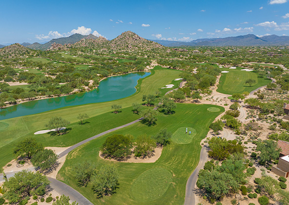
MLS aerial drone photos for commercial and residential real estate
drone services for real estate
Aerial Drone Photography for Marketing and Advertising