Construction Drone Services in Denver & Across Colorado
TLW Construction Inc
Trustindex verifies that the original source of the review is Google.
Desert Drones is fantastic to work with! They do an incredible job bringing our vision to life and capturing our projects in a way that truly showcases the work being done. Highly recommend their team. Thanks again, Desert Drones!
brooke ryan
Trustindex verifies that the original source of the review is Google.
Desert Drones is awesome to work with! They help bring our vision to life and showcase our work in the best way possible. Highly recommend them to anyone looking for quality drone services. Thanks, Desert Drones!
Frank Segarra
Trustindex verifies that the original source of the review is Google.
John and team are the consummate professionals! Very reliable, quick, and high quality deliverables!
Stephen Cook
Trustindex verifies that the original source of the review is Google.
Professional, efficient, and easy to work with. The team delivered clean, high-quality aerials and communicated clearly throughout the project. One of the best drone service providers we’ve worked with in the Phoenix area.
Greg DeMeritt Jr
Trustindex verifies that the original source of the review is Google.
Needed work done quickly for drone photography. They responded quickly and knew exactly what was required and explained it well. They provided great customer service and got me exactly what I needed, when I needed. Finally found my Drone guys!
Doug Fleming
Trustindex verifies that the original source of the review is Google.
John was a professional and very knowledgeable. He made the process of getting drone footage seamless and did an exceptional job. The speed of completion along with quality of his work was excellent. Highly recommend using them if...
Good JuJu Agency
Trustindex verifies that the original source of the review is Google.
John is true professional. Every time we need some drone photography or videography done John is excited to take on the project. From midnight fireworks displays to busy sections of the city with all kinds of obstacles, working with Desert Drones never fails to hit the mark.
Jesus Figueroa
Trustindex verifies that the original source of the review is Google.
Absolutely amazing experience with Desert Drones. They did a shoot for my business and I must say, they made my product really speak for itself! The aerial shots were stunning and perfectly captured every special moment. John was very professional, punctual, and easy to work with. Highly recommend them for any event coverage—you won’t be disappointed!
Eustolia Schau
Trustindex verifies that the original source of the review is Google.
Great company and amazing aerial photography!
Katie Schwertz
Trustindex verifies that the original source of the review is Google.
John took care of the interior and exterior drone footage for our manufacturing facility in Tucson. He was great to work with! Very knowledgeable, answered all our questions, and shot some great videos. He was also quick to respond to emails and calls throughout the whole process. I would definitely use Desert Drones again in the future.
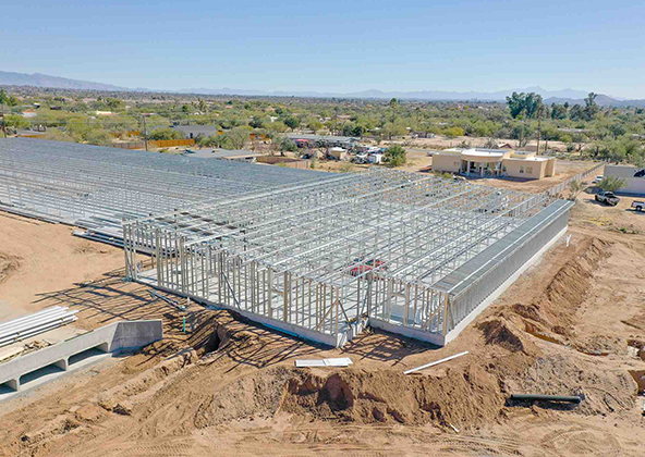
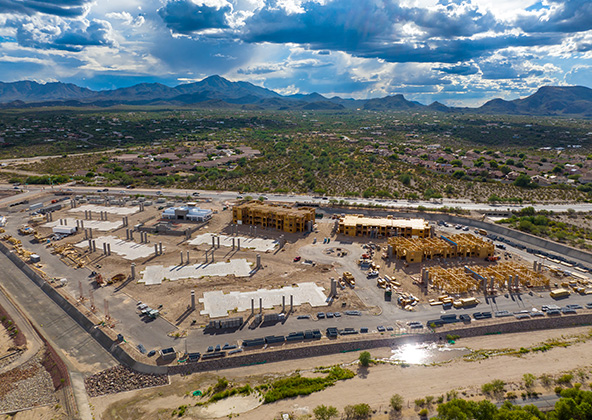
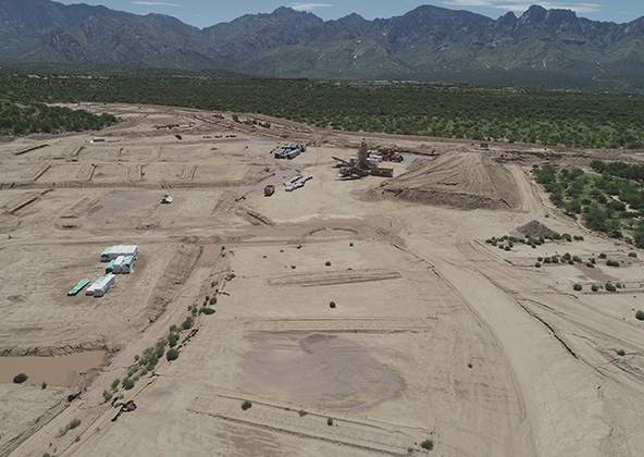
Denver is in the middle of a Front Range construction boom — with luxury apartment towers rising in RiNo and LoHi, sprawling master-planned communities in Stapleton, Highlands Ranch, and Castle Rock, and a massive logistics and industrial park buildout along the I-70 and E-470 corridors. At Desert Drones, we provide construction drone services throughout the Denver metro and Front Range, delivering the aerial intelligence contractors, developers, and project managers need to build efficiently at altitude.
Our FAA-certified pilots are experienced with Denver’s high-altitude flight conditions, extreme hail seasons, and complex controlled airspace near DEN International Airport — ensuring you get accurate, consistent data when you need it most.
Smarter Construction Oversight in the Denver Metro
Denver’s construction market moves fast — apartment towers, logistics parks, and Westside residential phases often run simultaneously. Our drone services give you the real-time aerial perspective needed to keep complex Denver-area projects on schedule and budget:
Consistent progress photography for weekly or biweekly stakeholder reporting
4K aerial video for investor decks and lender draw documentation
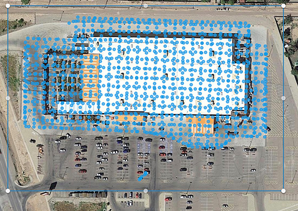
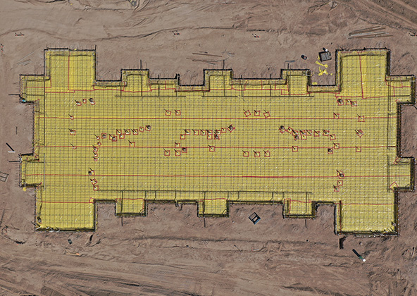
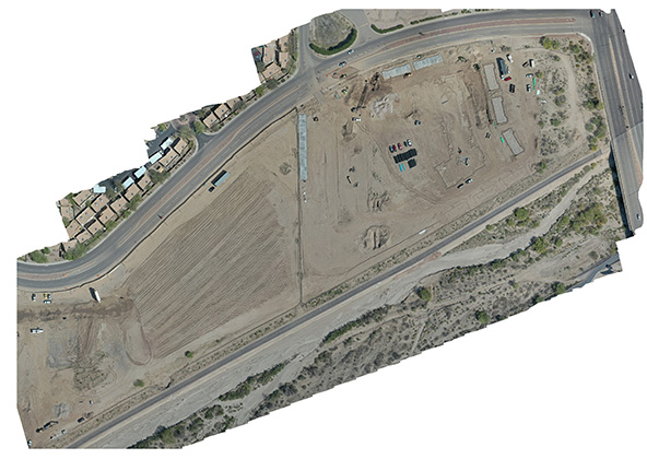
Orthomosaic mapping and topographic surveys for grading verification
Volumetric earthwork and stockpile analysis
From a Cherry Creek mixed-use tower to a 300-acre Highlands Ranch subdivision, Desert Drones gives your team a consistent visual record of every project phase.
Aerial Documentation That Keeps Projects On Track
Denver’s Front Range weather patterns, including severe hail seasons and rapidly changing mountain conditions, make comprehensive aerial documentation essential — not optional. Our drones give you real-time, repeatable visual intelligence so nothing gets missed and every stakeholder stays informed:
GPS-locked flight routes for identical framing visit after visit
Same-day turnaround options for fast-moving phases like framing and foundation
Integration with Procore, Autodesk Build, and construction management platforms
When a hail event or spring storm disrupts your schedule, our aerial documentation provides the pre- and post-event site condition records your insurance team and lender need.
Why Colorado Builders Trust Desert Drones
Colorado builders choose Desert Drones because we understand Denver’s unique construction demands — high altitude, front-range weather patterns, DIA-area airspace constraints, and a fast-moving metro market. What sets us apart:
FAA Part 107 certified and LAANC authorized near Denver International Airport
$2M liability insurance — meets lender and GC requirements
Experienced with altitude-adjusted flight planning above 5,280 feet
Deliverables within 24–48 hours — photos, 4K video, mapping datasets
Integrations with Civil 3D, Revit, Procore, and ArcGIS
Construction Drone Services We Provide in Colorado
Our services are tailored to the needs of Colorado construction teams:
Aerial Construction Site Photography & Video — for progress tracking, presentations, and stakeholder updates
Weekly/Monthly Progress Mapping — orthomosaics and visual logs that show changes over time
3D Modeling & Topographic Mapping — digital models for Earthwork tracking and planning
Pre-Pour, Pre-Roof, & Site Condition Reports — before/after imagery that supports scheduling and QA/QC
All deliverables are delivered in easy-to-use formats that fit into daily reporting and project controls.
How Our Colorado Construction Drone Workflow Works
We begin with a short project kickoff to understand your goals, access constraints, deliverable needs, and safety protocols. Then we manage flight planning, airspace checks, capture, processing, and delivery anywhere in Colorado.
You get:
Fully FAA-compliant operations
Minimal disruption to site operations
Fast scheduling and turnaround
Deliverables optimized for your construction platform
To schedule construction drone services in Denver or anywhere in Colorado, contact Desert Drones and put aerial data to work on your next build.
Improve Safety, Documentation & Risk Management
Denver construction sites face specific safety challenges — unpredictable Front Range weather, high-altitude equipment performance variance, and extreme hail events that can damage materials and halt schedules. Our drones enhance safety and risk management by:
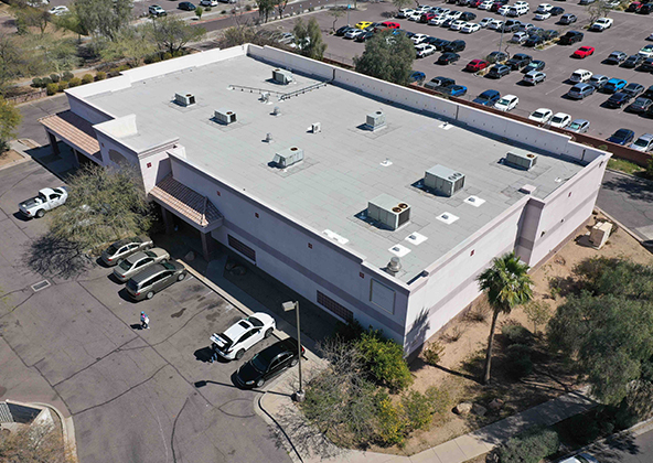
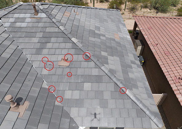
Enabling remote inspection of roofs, scaffolding, and elevated structures without putting workers at height
Providing pre- and post-hailstorm aerial documentation for insurance claims and subcontractor accountability
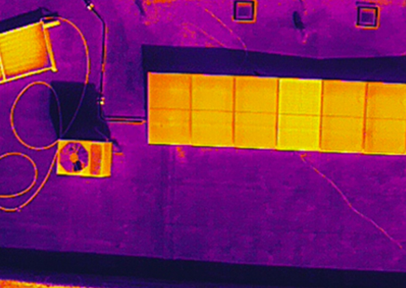
Thermal imaging for moisture infiltration and electrical hazard identification
OSHA compliance documentation for multi-story urban infill projects
Denver’s late spring and summer hail season (peak May–September) makes systematic aerial documentation a cost-saving necessity for any project with exposed roofing, framing, or cladding.
Keep Owners, Investors & Teams Aligned
Clear, consistent visuals keep Denver’s complex construction projects moving. Our aerial documentation makes it easy for owners, lenders, and investors to stay aligned — even when managing multiple Front Range projects simultaneously:
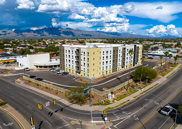
Executive-ready progress decks for RiNo, LoHi, Uptown, and Cherry Creek high-rise and mixed-use projects
Lender draw documentation packages with timestamped aerial photos and video
HOA and city council presentation materials for Stapleton, Highlands Ranch, and Castle Rock master communities
Whether you’re presenting to a REIT, a Colorado development authority, or a private equity sponsor, our aerial deliverables tell your project’s story with precision and professionalism.
Ideal for Urban, Mountain & Remote Colorado Job Sites
Denver construction happens across an extraordinary range of environments — dense urban neighborhoods, I-25 corridor transit-oriented developments, Westside industrial parks, mountain foothills communities, and remote rural infrastructure. Our Denver-area drone teams are equipped and experienced for all of it:
Urban infill — RiNo, LoHi, Five Points, Sloan’s Lake mixed-use
Suburban master communities — Highlands Ranch, Castle Rock, Aurora, Westminster
Industrial and logistics — I-70 and E-470 corridor warehouse parks
Mountain and foothills projects — Jefferson County, Evergreen, Conifer
For mountain site projects above 6,000 feet, we apply altitude-adjusted flight planning to ensure consistent data quality and safe operations in thinner air.
Frequently Asked Questions — Construction Drones in Denver, CO
Yes — our pilots are experienced with altitude-adjusted flight planning for Denver and Front Range job sites. We account for reduced air density effects on drone performance to ensure consistent, safe data collection above 5,280 feet.
Absolutely. We offer pre- and post-storm aerial documentation specifically designed to support insurance claims and subcontractor accountability after hail events — one of the most valuable drone applications in Colorado’s construction market.
Yes — we are FAA LAANC authorized to operate in controlled airspace around Denver International Airport and Centennial Airport, with full coordination with air traffic authorities before every flight.
Yes. We deliver 3D surface models and cut-and-fill volumetric analysis accurate to a few centimeters, compatible with Civil 3D, Revit, and GIS platforms used by Denver’s engineering firms.
Most projects are delivered within 24–48 hours of the flight — photos, 4K video, annotated maps. Same-day options are available for fast-moving phases.
Yes. Desert Drones carries $2 million in liability insurance and adheres to FAA Part 107 and OSHA safety standards on all Denver-area and Colorado construction sites.
Licensed & Insured
Desert Drones, LLC is operated by a licensed pilot by the FAA (Federal Aviation Administration), Desert Drones, LLC is licensed & insured up to $2M.
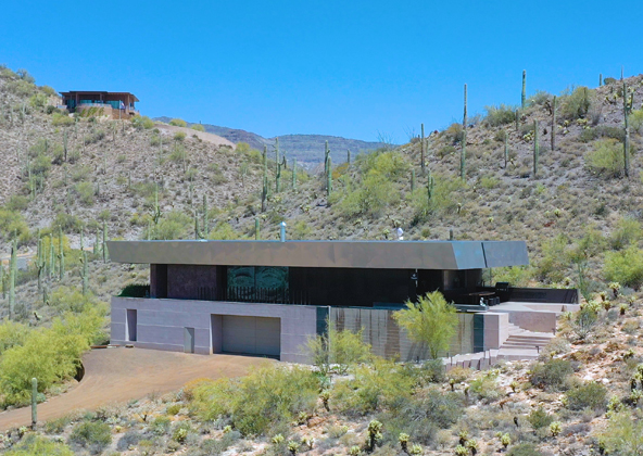
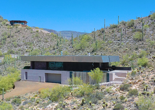
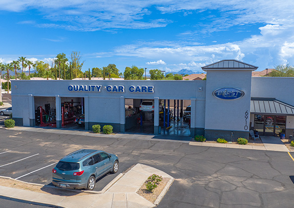
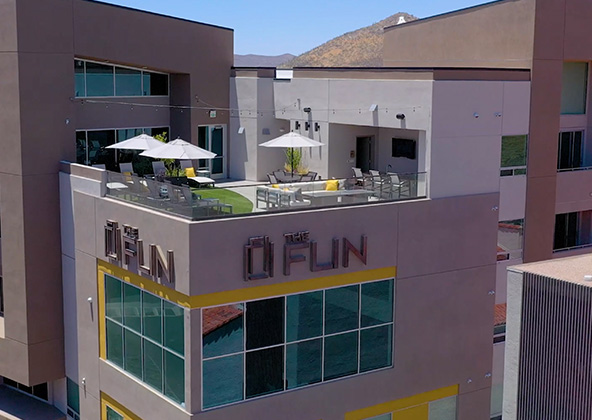
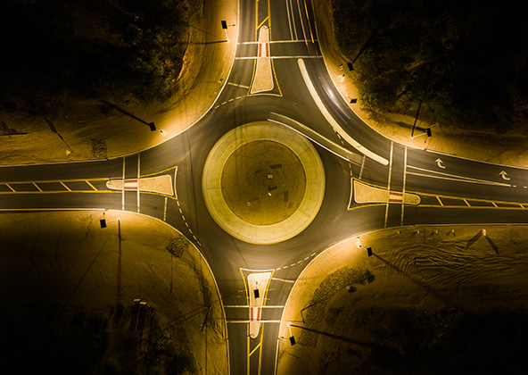
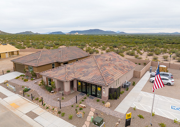
Aerial photography provides a unique perspective. Real estate listings, events, construction progress photos and site surveillance are just a few examples of where you need drones to do the job right.
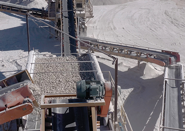
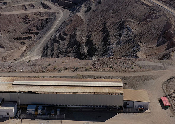
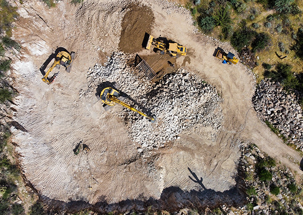
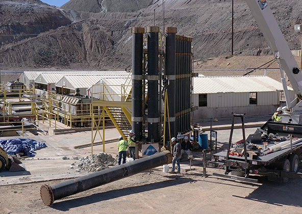
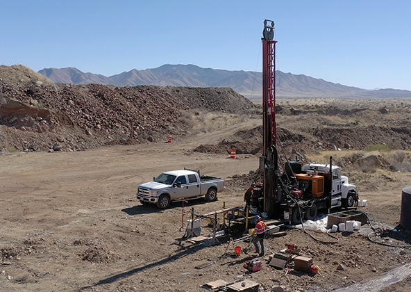
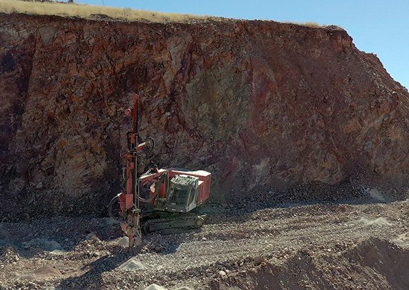
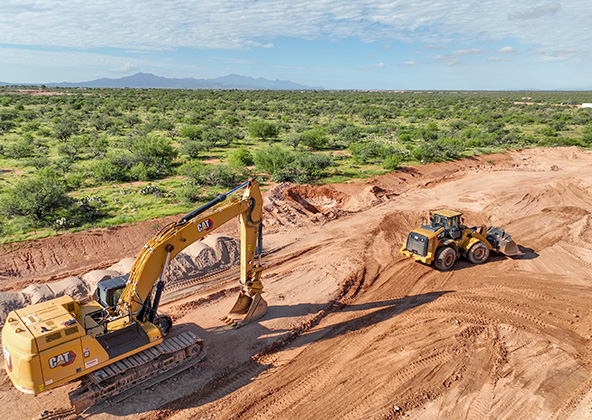
Mining
Aerial photography and videography provide fast and cost effective mapping, documentation, elevation and stockpile calculations to streamline your mining operations.
Industrial
Drones are uniquely qualified to capture aerial data for inspections of cellular, electrical, mining, solar and other industrial sites. Providing higher quality data at a lower risk rate than traditional inspections, makes drone services a must on your project.
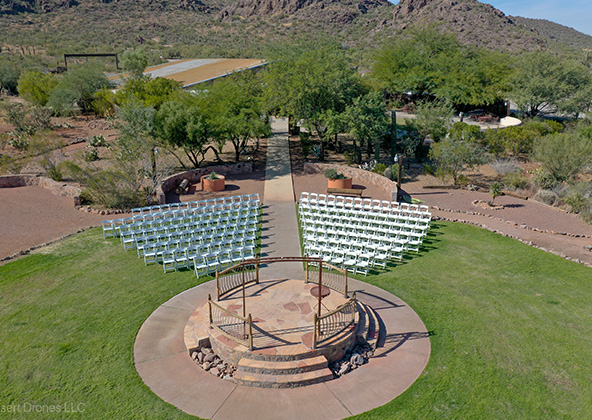
Events
No matter what kind of event you are having, aerial photography and videography make your audience feel like they are there. Make your advertising, marketing campaign and website stand out with dramatic pictures and videos that only drones can capture.
Licensed & Insured
Desert Drones, LLC is operated by a FAA (Federal Aviation Administration) licensed pilots, Desert Drones, LLC is licensed & insured up to $2M.
Aerial photography and videography provide fast and cost effective mapping, documentation, elevation and stockpile calculations to streamline your mining operations.
Southwest Arizona is a great place for solar. In phoenix and tucson we get over 300 days of sun every year. Let us give you valuable information while your system is still under warranty. Make sure you are getting what you paid for in you PV system.
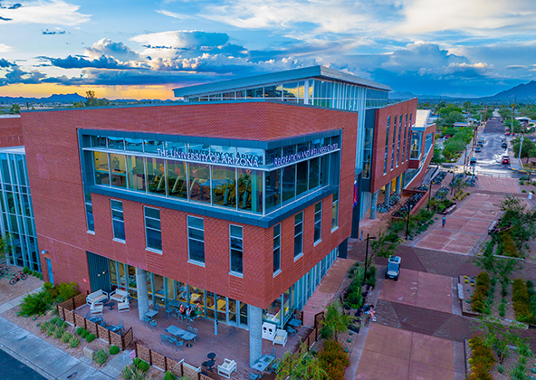
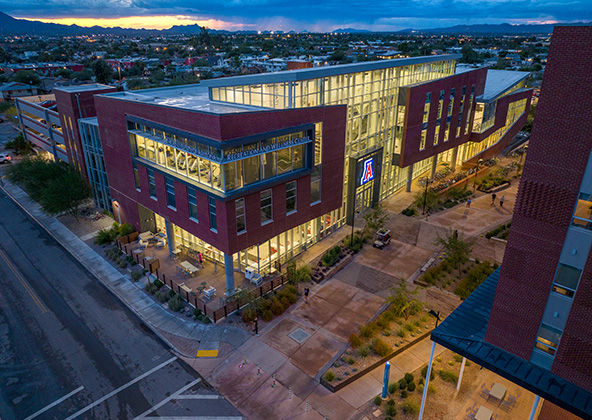
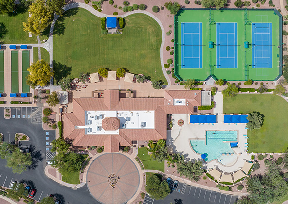
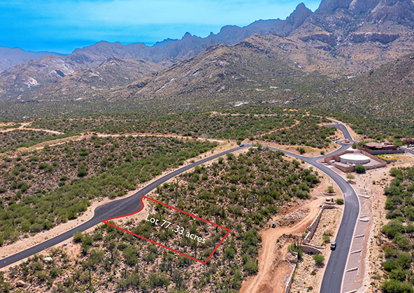
Gallery
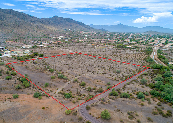
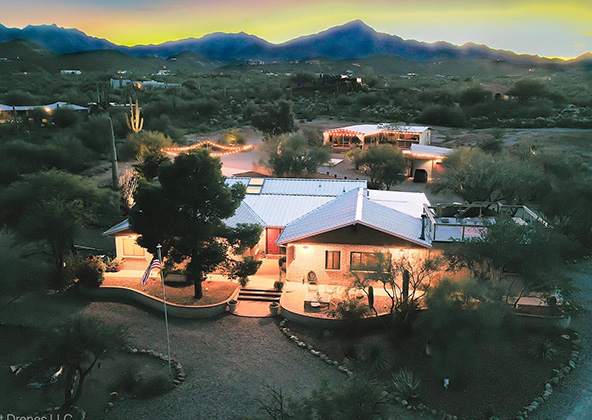
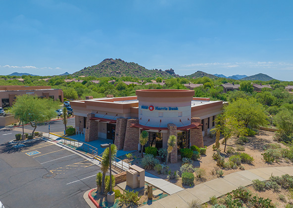
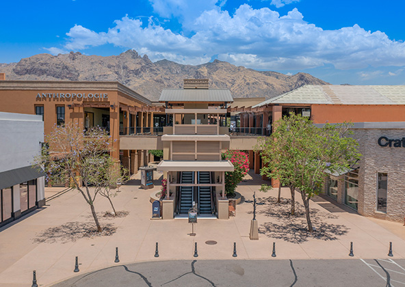
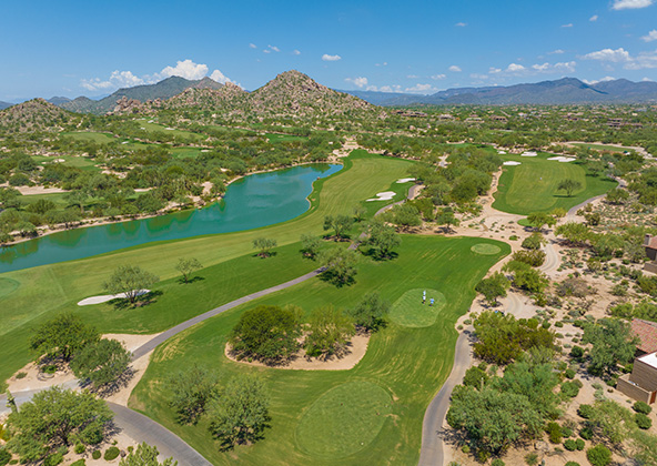
MLS aerial drone photos for commercial and residential real estate
drone services for real estate
Aerial Drone Photography for Marketing and Advertising