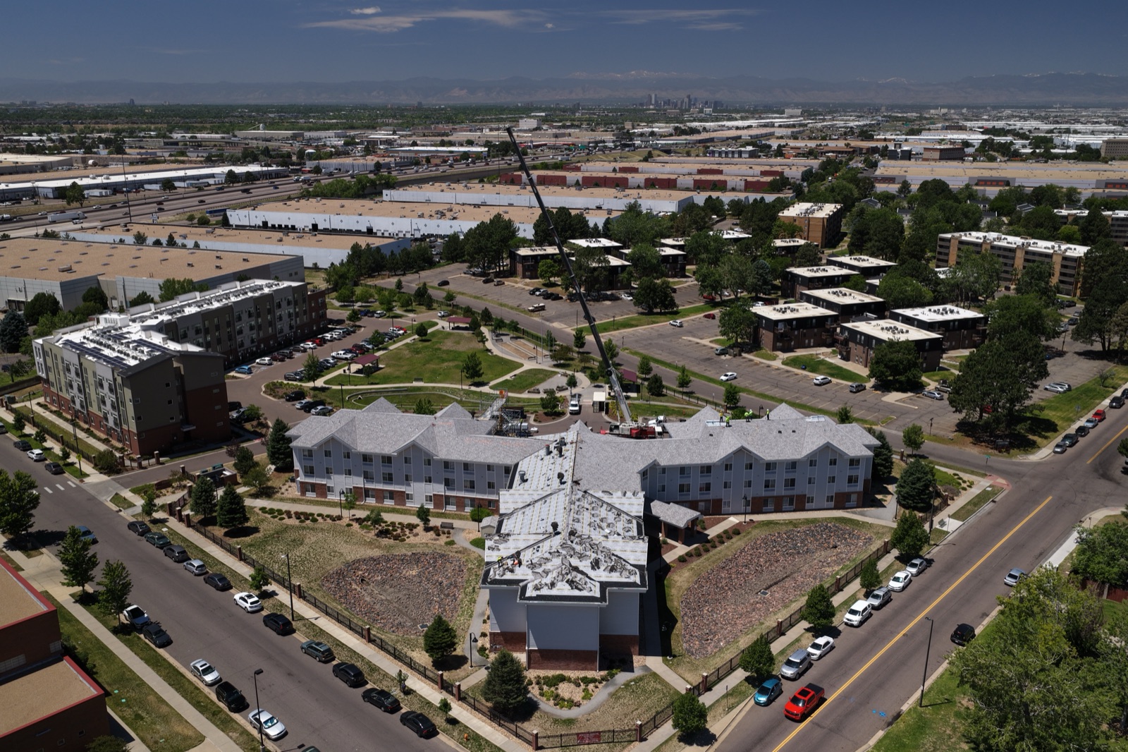
Denver sits at the edge of something special. The Rocky Mountain foothills roll up just west of the city, the downtown skyline catches light differently depending on the season and time of day, and neighborhoods like RiNo and LoDo offer that perfect mix of industrial character and modern development. If you’re a real estate agent, brand marketer, event planner, or commercial developer in the Denver metro, you already know it—the views here are genuinely compelling. The problem? A standard camera on the ground can’t do justice to what makes Denver visually interesting. That’s where professional aerial photography comes in. At Desert Drones LLC, we specialize in aerial photography Denver clients trust, and we’ve spent years capturing Colorado’s Front Range from the air—so we know exactly how to frame your project, property, or event to show it at its absolute best.
Why Denver Needs Professional Aerial Photography
Denver is different from a lot of markets. You’ve got mountains visible from downtown. Urban density mixes with wide-open spaces here too. You’ve got neighborhoods built into hillsides with views most cities would kill for. But here’s the thing: those views don’t automatically show up in photos. They have to be framed correctly. A drone at the right altitude and angle can capture the relationship between your property and the landscape around it—the elevation, the proximity to the Front Range, the way your development sits in the larger context of the city. That’s impossible from ground level.
For realtors especially, this matters a lot. A luxury home in the Highlands with mountain views is a selling point. But the buyer needs to see those views clearly. Standard photography from the master bedroom window or the deck just doesn’t convey it the way an aerial shot does. Same goes for commercial properties. A retail or office development in RiNo or downtown Denver looks completely different from 150 feet up. You can see the parking layout, the surrounding walkability, the street presence—all the things that matter to a commercial tenant or buyer.
What Makes Denver’s Landscape Unique for Drone Photography
The Rocky Mountains aren’t just scenery in Denver—they’re part of your location’s identity. Every property, every project, every event up here exists in relationship to that mountain backdrop. From the air, you can see the foothills transition into the urban core. You can see how the light moves across the Front Range throughout the day. You can capture the scale of developments in a way that makes sense to viewers.
Denver’s mix of old and new creates visual interest too. The LoDo district has that historic brick warehouse feel combined with new mixed-use development. RiNo is all about street art and industrial reimagining. The newer parts of town have modern architecture with clean lines. And then you’ve got the natural terrain—the South Platte River, open space parks, the way neighborhoods climb the foothills. Professional aerial photography lets you tell the story of your specific property or brand by showing all of these elements in relationship to each other.
Professional Drone Photography Versus DIY or Standard Methods
Let’s be honest—a lot of people have drone access now. But access to a drone doesn’t equal professional results. Here’s what separates the work we do at Desert Drones LLC from DIY footage or standard photography:
First, there’s licensing and safety. We’re FAA-certified, which means we’ve passed the Part 107 exam, we carry proper insurance, and we know exactly which areas we can and can’t fly in. Denver has airspace restrictions near the airport and other sensitive areas. Someone flying a consumer drone without certification might not even realize they’re breaking regulations. Our certification isn’t just about following rules—it’s about doing the work safely and legally so clients don’t have liability issues.
Second, there’s equipment. We use professional-grade drones and cameras, not consumer models. The difference in image quality, color accuracy, and stabilization is substantial. Professional footage holds up under scrutiny, prints well, and looks good across different platforms—website, print brochures, social media, whatever you need.
Third, there’s experience and vision. We know the light patterns in Denver. We know how to fly to get the shot that matters for your specific project. Are you selling a house with an amazing mountain view? We know the angle and time of day that makes that view sing. Is it a commercial project? We fly to emphasize scale, context, and positioning. Are you documenting an event? We capture both the event itself and the venue’s broader context. That comes from having flown hundreds of shoots across Colorado and the Southwest.
Aerial Photography Denver: The Range of Services We Offer
Aerial photography isn’t one-size-fits-all. We tailor our approach based on what you’re trying to accomplish.
For real estate, we shoot properties to highlight landscape features, views, lot size, and position within the neighborhood. A residential listing with a mountain view or a hillside position needs to show that context. A commercial property needs to demonstrate its visibility, access, and surrounding commercial environment. We shoot both stills and video, and we edit to match your broker’s existing photos in tone and color.
For brand and commercial clients, aerial photography works as part of a broader visual strategy. Maybe you’re a developer documenting a project from multiple phases. Perhaps you’re a hotel or resort showcasing your setting. Maybe you’re a retail brand or restaurant opening a new location and want to show the surroundings and street presence. We create imagery that fits your brand and marketing goals.
For events—weddings, corporate retreats, festivals, community gatherings—aerial photography adds a new dimension. You get the wide shot of the venue and setting, the view of how many people attended, the sense of place. People love having that perspective, especially for events in Denver where the setting is often part of the appeal.
For real estate development and construction documentation, we do time-lapse and progress photography. Watching a project rise over months or years creates great content for investors, stakeholders, and marketing materials.
What Clients See: Real-World Results Across Different Industries
Let’s talk about how this actually works out in practice.
A real estate agent in the Highlands had a beautiful home listed at a premium price. The mountain view was spectacular from the master suite, but standard photography from the deck and windows didn’t convey it clearly—other homes looked similar in photos. We shot the property from multiple angles and altitudes, with one signature shot framing the home’s position in the foothills with the Continental Divide clearly visible. The agent used that shot as their lead photo, and it positioned the property differently in the market. They closed faster and closer to asking than comparable homes that didn’t have aerial context. That’s the kind of difference aerial photography Denver sellers are starting to expect.
Another example: a commercial real estate development company was marketing office space in RiNo. Their building was in a location with excellent walkability and street presence, but ground-level photos made it look like any building on any street. We shot aerials showing the building’s relationship to nearby restaurants, retail, galleries, and the overall development momentum in the neighborhood. The imagery helped tenants visualize the environment they’d actually be working in, and it became a centerpiece of their leasing materials.
We also work with brands opening new locations. A restaurant group opening their first Denver location wanted to showcase the outdoor space and the surrounding neighborhood vibe. Aerial photography showed the street-level activity, the nearby parks, the overall feel of the area—exactly what a potential customer or investor would want to understand about the location.
Quality, Safety, and Professionalism
When we show up to shoot for you, here’s what you get: a licensed, insured professional who knows Colorado’s airspace, weather patterns, and landscape. We’re familiar with Denver’s neighborhoods, we understand how light hits at different times of year, and we know how to deliver images that actually work for your goals.
We also handle all the legal and logistical details. If you need special permits or approvals to fly in a specific area, we manage that. If weather delays a shoot, we’re flexible and professional about rescheduling. Your images are edited and delivered in formats that work for your needs—web, print, social, whatever you’re using them for.
Safety is non-negotiable. We follow FAA regulations, we fly responsibly, and we’re insured in case anything goes wrong. More importantly, that means you don’t have to worry about liability. We handle it.
How to Get Started
If you’re in Denver or anywhere across the Southwest—we’ve got teams in Tucson, Denver, and other markets—and you need aerial photography Denver can count on, the next step is simple. Reach out and tell us what you’re working with. Whether it’s a single property, a commercial project, an event, or ongoing documentation, we’ll talk through what you need, what we can deliver, and what it costs.
You can browse our portfolio, get a sense of our style, and book a shoot directly on our website. We also offer consultations if you’re not sure exactly what you need—we’ll help you figure out the right approach to get the images that actually matter for your business or project.
Denver’s landscape is genuinely compelling. The Front Range, the urban skyline, the mix of elevation and architecture—it all deserves to be documented by someone who knows how to fly here and how to frame the story. That’s what we do. Let’s create something great for your project.