
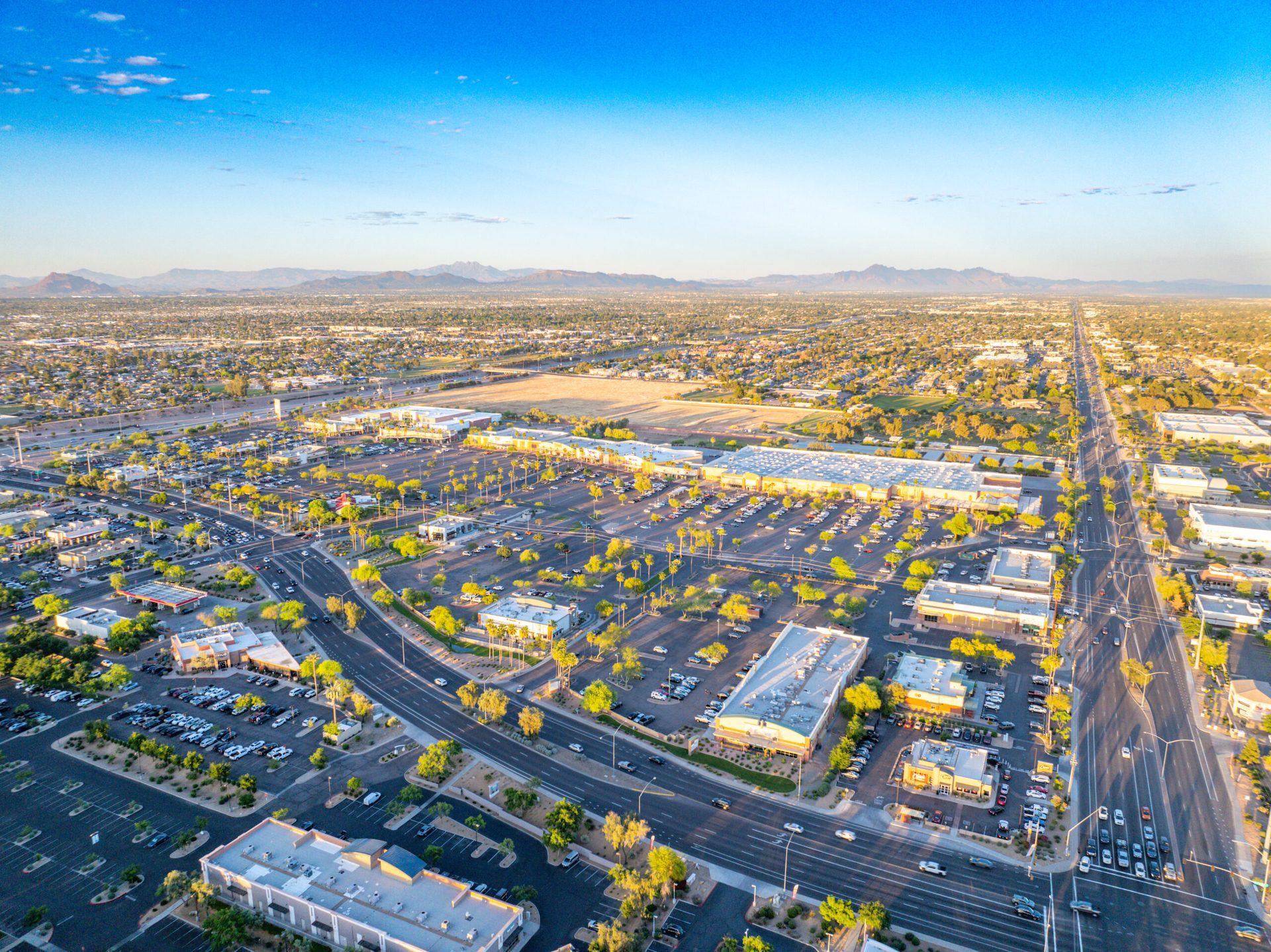
If you’re managing a construction project in Mesa or anywhere across the East Valley, you know how fast things change on job sites. One week the foundation is being poured, the next the structural steel is going up, and suddenly you’re looking at roof installation. Keeping track of progress, documenting work for investors and lenders, and maintaining safety records becomes a challenge when you’re juggling schedules, crews, and inspections. That’s where construction drone services Mesa AZ builders rely on come in—and it’s become almost essential for serious builders in this region.
The East Valley has exploded with construction activity over the past few years. From massive logistics distribution centers near Phoenix-Mesa Gateway Airport to new industrial manufacturing facilities in the Elliot Road Technology Corridor, to residential subdivisions spreading toward the Superstition Mountains, there’s constant building happening. All that growth means general contractors, developers, and property owners need reliable, professional ways to track progress, prove work completion, and communicate with stakeholders who aren’t on site every day. Drone photography and videography provide exactly that—a clear, documented aerial view of your project’s evolution from groundbreaking to completion.
1. Why Mesa Contractors Need Drone Site Monitoring
Large construction sites are complex. You’ve got multiple crews working in different areas, equipment moving around, safety concerns, and decisions that need to be made quickly. A project manager walking the site each day sees details, but they miss the big picture. They can’t easily show an investor what the site layout looks like, how much earthwork has been moved, or how the building’s footprint aligns with surrounding structures and roads.
Drone monitoring solves this. With regular aerial flights, you capture consistent, timestamped documentation of exactly where your project stands. This matters for multiple reasons. First, investors and lenders want proof of progress. When you can show them clear aerial footage from Week 1, Week 4, and Week 8, there’s no question about what’s been completed. Second, general contractors use drone imagery for internal project management—comparing planned progress to actual progress, spotting schedule delays early, and coordinating multi-phase work. Third, permitting agencies and inspectors increasingly appreciate having comprehensive aerial documentation on file. It demonstrates professionalism and helps resolve questions if they ever come up.
For projects near the Phoenix-Mesa Gateway Airport area or in zones with air traffic, working with FAA-certified drone operators matters too. There are specific regulations about where you can fly, altitude restrictions, and notification requirements. When you hire a certified operator like Desert Drones, you get a team that knows those rules inside and out and operates safely within all applicable restrictions.
2. The Business Case: What Aerial Documentation Really Delivers
It’s tempting to think of drone photography as a nice-to-have—a cool way to capture images for a project portfolio. In reality, it’s operational. Here’s what professional aerial site monitoring delivers:
Aerial progress tracking gives you a documented record over time. Instead of relying on memory or handwritten notes about where things stood three weeks ago, you have actual video and still photography. This matters when disputes arise about schedule adherence, when you need to brief new team members, or when change orders require documentation of what was actually done.
Site mapping and spatial documentation are harder to achieve from ground level. From 100-200 feet up, a drone captures the entire layout of a site—showing how buildings relate to property lines, access roads, utility corridors, and adjacent facilities. For large projects, this kind of mapping can help you optimize logistics, plan material staging areas, and coordinate crane operations.
Volumetric measurements and earthwork documentation save time and reduce disputes. When you’re moving thousands of cubic yards of earth, calculating cut-and-fill becomes important for budgeting and progress claims. Drone imagery, combined with proper software, allows you to measure exactly how much material has been moved, helping you verify contractor invoices and track costs.
Safety and compliance documentation is another big one. Construction sites can be hazardous. Having aerial footage showing site conditions, traffic control, equipment placement, and hazard management provides a safety record. If an incident occurs, you have clear documentation. Plus, safety-conscious clients appreciate operators who take aerial compliance seriously.
3. Construction Drone Services Mesa AZ: What We Offer
Not all drone work is the same. Depending on your project’s stage and needs, you might use different services.
Regular progress-report flights are the bread and butter for most construction clients. Monthly, biweekly, or even weekly flights capture how the site evolves. This is perfect for fast-moving projects where you need to document work constantly and keep stakeholders informed.
3D site mapping and modeling go deeper. Using specialized software, drone imagery can be processed into detailed 3D models of the site. This lets you see topography, building placement, and spatial relationships in three dimensions. Some clients use these models for stakeholder presentations or to compare design intent against actual construction progress.
Volumetric measurements focus on earthwork. You need to know how many cubic yards of fill you’ve added or removed? Drone data combined with topographic analysis gives you precise measurements. This is especially useful for road projects, grading work, and sites where earth movement is a major part of the scope.
Safety and compliance documentation involves capturing specific site conditions—equipment staging, personnel safety gear, traffic control setup, and hazard conditions. This creates a comprehensive visual record for your insurance carriers, your client, and regulatory agencies if needed.
4. How Often Should You Schedule Drone Flights?
There’s no one-size-fits-all answer when it comes to construction drone services Mesa AZ scheduling, but here’s how most projects approach it:
Fast-moving projects—think major grading work, foundation installation, or structural framing—benefit from weekly flights. At that pace, you capture every major change in site condition. It’s ideal if you’re managing investor communications or if the project is on a tight schedule where you need to catch delays immediately.
Medium-paced projects—standard commercial or residential builds where multiple phases are happening simultaneously—often do well with monthly flights. This captures significant progress without excessive documentation or cost.
Long-duration projects might do quarterly flights or tie them to major milestone dates. You’re less interested in every single change and more focused on documenting key completion points.
The right frequency depends on your project budget, the need for detailed documentation, and your stakeholders’ expectations. A good practice is to align drone documentation with your project schedule reviews or investor reporting cycles. That way, you’re gathering the documentation you need exactly when you need it.
5. FAA Certification and Why It Matters Near Phoenix-Mesa Gateway Airport
Here’s something a lot of folks in Mesa don’t think about until they try to hire a drone operator: the airspace rules change depending on where your project is located. Phoenix-Mesa Gateway Airport serves commercial and cargo flights. If your construction site is anywhere in the vicinity of that airport corridor, or in other controlled airspace around the East Valley, you need an operator who understands those restrictions.
FAA Part 107 certification means a pilot has passed the exam, understands airspace classifications, knows altitude restrictions, and can file proper notifications. They carry liability insurance. They follow regulations about where they can fly and operate within safety margins. For your project, that means no surprises, no fines, and confidence that your aerial documentation was captured legally and safely.
Desert Drones maintains full FAA certification across all our Southwest locations, including our Mesa office at 3707 E Southern Ave. We’re familiar with East Valley airspace, we file any required notifications before flights, and we work within all restrictions. This isn’t just a box we check—it’s how we protect your project and demonstrate professionalism to clients, lenders, and agencies.
6. A Real Example: Tracking Multi-Phase Development
Let’s walk through a realistic scenario. Imagine you’re managing a mixed-use development on the east side of Mesa—some industrial space, some retail, parking, and landscaping. The project spans eight months and has multiple phases—exactly the kind of job where construction drone services Mesa AZ teams add the most value.
Month 1-2: Site prep and grading. You schedule biweekly drone flights to document topography changes, stockpile locations, and the progression of site work. The aerial views clearly show the scale of earthwork and help your team coordinate equipment and material deliveries.
Month 3-4: Foundation and structural work. You move to weekly flights because this phase happens fast. Each flight shows the building footprint taking shape, structural elements going up. Your investor gets weekly video updates that show real, tangible progress. Your general contractor uses the imagery internally to compare planned versus actual progress and adjust crew deployment.
Month 5-6: Building systems and finishes. You drop to monthly flights—the work is still visible but changes are less dramatic week-to-week. However, having monthly aerial context still helps document that work is moving forward.
Month 7-8: Site finishes and landscaping. Again, monthly documentation captures the final push and the completed project. You now have a complete visual record from bare ground to finished facility.
Throughout the project, you’ve had clear, professional aerial documentation. This has helped you manage the schedule, keep stakeholders informed, resolve any disputes about progress, and created a visual marketing asset you can use afterward. It’s not just documentation—it’s a business tool.
7. Cost and ROI: What to Expect
Investing in construction drone services Mesa AZ contractors trust pays for itself quickly through fewer disputes, faster approvals, and better documentation.
Drone services for construction aren’t free, but they’re a modest line item compared to the overall project cost. A typical progress-report flight—one scheduled aerial shoot with processed imagery delivered within 24-48 hours—runs in the $300-600 range depending on site complexity and the depth of processing you want.
For a development project with monthly flights over six months, you’re looking at $2,000-3,500 invested in aerial documentation. For a multi-million-dollar project, that’s a rounding error. The ROI comes from preventing disputes, avoiding missed schedule items, demonstrating professionalism to stakeholders, and having clear records if questions ever arise.
If you need 3D modeling or volumetric measurement processing on top of the basic flight, expect additional costs—but again, if you’re tracking earthwork worth thousands of cubic yards, knowing your actual quantities has obvious financial value.
8. Safety and Professional Standards in Construction Airspace
Construction sites are busy places. You’ve got equipment moving, personnel on the ground, and narrow spaces. That’s why flying drones safely on a construction site isn’t just about following FAA rules—it’s about respecting the site’s operational needs.
A professional operator coordinates with your site supervisor. We confirm the best flight times, make sure the crew knows we’re flying overhead, and avoid disrupting ongoing work. Our pilots fly at safe altitudes, maintain visual line of sight, and operate with redundant safety measures. We avoid flying over personnel when possible and always prioritize ground safety.
This professional approach is why many general contractors require that any drone operator they hire maintain certification and insurance. It demonstrates that we take the job seriously and understand the working environment.
Construction Drone Services Mesa AZ: Ready to Document Your Project From the Air?
If you’re managing a construction project in Mesa, the East Valley, or anywhere across Arizona, professional drone documentation can improve your project management, keep stakeholders informed, and create a comprehensive record of your work. Whether you need weekly progress flights, 3D site mapping, volumetric measurements, or safety documentation, Desert Drones has the expertise and FAA certification to deliver.
We’re based right here in the East Valley with offices in Tucson and Mesa. Our team understands the projects happening in your region—from the manufacturing facilities near Phoenix-Mesa Gateway Airport to the residential builds in the Elliot Road corridor to everything beyond. We know the airspace, we know the builders, and we know what professional aerial documentation looks like.
Ready to get started? Contact us to discuss your project needs, schedule a consultation, or book your first flight. Visit our portfolio to see our work, check out our gallery, and get in touch. We’re ready to help you see your project from a whole new angle.