Las Vegas is booming. Between the resort corridor renovations, new residential developments spreading across Summerlin and Henderson, and infrastructure projects around the Allegiant Stadium area, there’s no shortage of active construction sites around the valley. If you’re managing a project in Las Vegas, you already know how critical it is to keep stakeholders informed, document progress for lenders and investors, and maintain clear records for permitting and compliance. That’s where construction drone services come in—and doing it right means working with a team that understands both the technology and the specific demands of Las Vegas projects.
1. Why Construction Progress Monitoring Matters in Las Vegas
Las Vegas isn’t a one-project town. When you’re juggling multiple sites—whether it’s a phased residential community stretching across the Summerlin master plan or a casino renovation on the Strip—keeping everyone on the same page gets complicated fast. Owners want weekly updates. Lenders need proof that construction is moving on schedule. General contractors have to document site conditions for insurance and compliance. Inspectors require clear records for permitting milestones. It’s a lot to track, and the stakes are high. Every delay costs money. Miscommunication between parties creates friction. And every gap in documentation becomes a potential liability.
Manual site visits and still photos don’t cut it anymore. They’re time-consuming, they miss details, and they create gaps in your documentation. A ground-level photo shows you one angle. An aerial view shows you the whole picture. Drone footage fills those gaps consistently and professionally. You get timestamped visual records of every phase of your project. From foundation work through framing and all the way to final details, you have a complete aerial perspective of progress. It’s not just nice to have—it’s becoming standard practice for professional project management in markets like Las Vegas where the pace is fast and the expectations are high.
2. Construction Site Documentation: Building Your Project Record
One of the biggest reasons Las Vegas contractors bring in drone services is straightforward: documentation. Construction sites change daily. Weather shifts. Material deliveries arrive. Equipment moves. Workers install new systems. Safety conditions evolve. If you’re relying on photos taken from ground level or memory, you’re missing the complete picture. And when something goes wrong—a delay, a safety incident, a question about who approved what—you’re left explaining instead of showing.
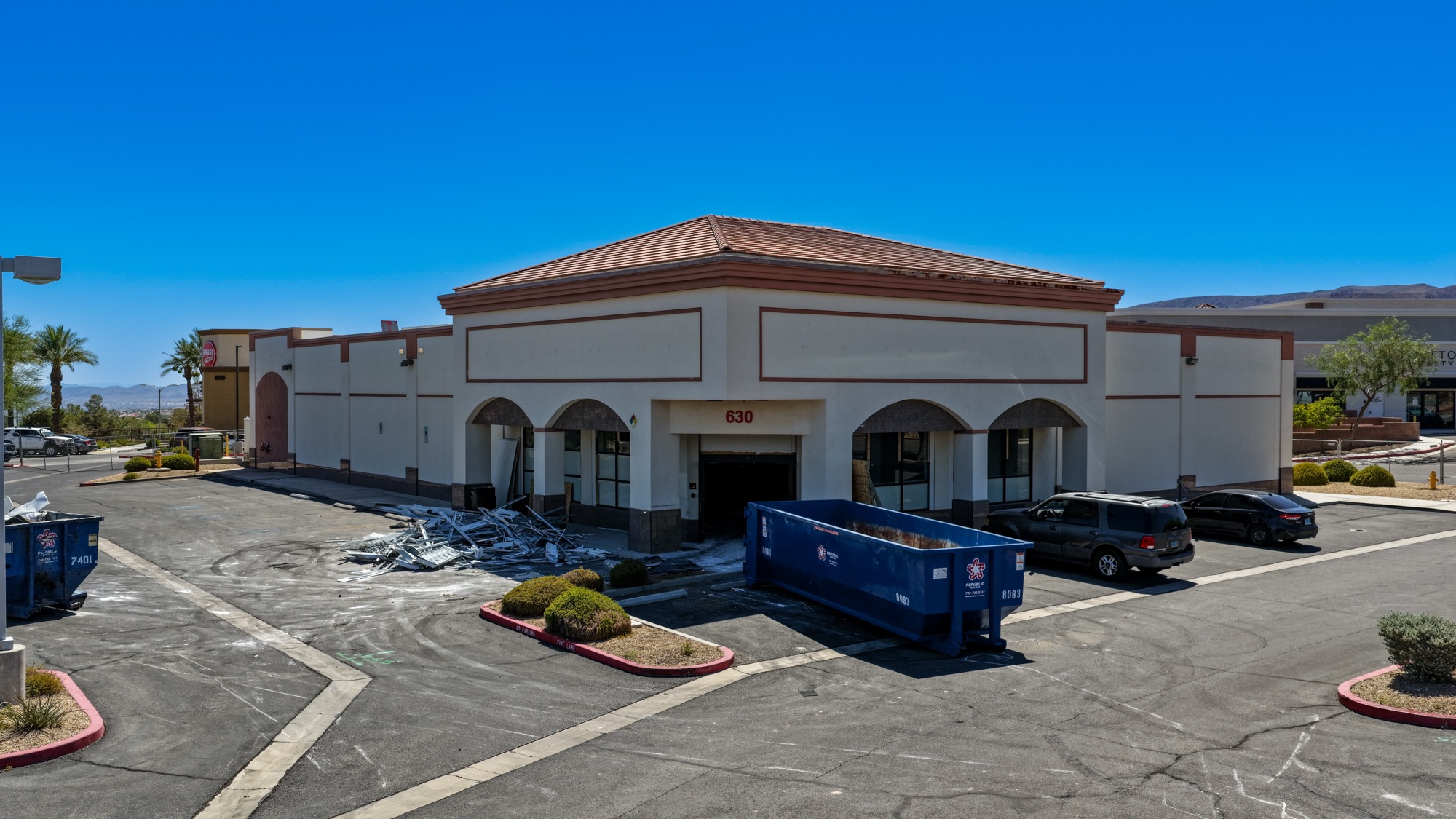
Aerial documentation gives you context that ground photos simply can’t provide. When you’re looking at a residential development site in Henderson, a drone shows you the actual footprint of completed foundations, the staging areas for materials, the flow of work across multiple phases, and how adjacent sites are progressing. That’s all visible in a single flight. You can see which subcontractor is where, how materials are being stored, whether equipment is positioned efficiently, and what’s been completed versus what’s still pending. When you need to show a lender that work is on schedule, or when you have a dispute about site conditions, or when an inspector questions whether something was done correctly, that aerial record is invaluable.
We schedule regular flights—weekly, biweekly, or monthly depending on your project pace—and create consistent documentation that survives a change in project managers, a dispute with a subcontractor, or a question from an inspector. The footage becomes your institutional memory. When a team member asks “what was the site condition before we started phase two?”, you have the answer. [INSERT PHOTO: Aerial view of a large residential construction site in Henderson with foundation work and material staging visible]
3. Investor and Lender Reporting: Keeping Capital Partners Informed
When you’ve got investors or lenders funding your Las Vegas project, they want proof. Not a verbal update. Not a guess. Definitely not a “trust me, it’s on track” phone call. Proof that their money is being deployed correctly and their project is progressing on schedule. They’re writing big checks. They want to see what they’re paying for.
Most construction loans are tied to milestones—completion of site prep, foundation, framing, roofing, and so on. You hit a milestone, you trigger a draw. Miss it, and you’re scrambling to explain the delay, and the lender or investor is questioning your execution. Drone footage is your evidence. It clearly shows what’s been completed, what’s in progress, and what’s next. It’s objective. It’s timestamped. And it tells the story of your project without spin or interpretation. A lender reviewing monthly drone footage can see exactly where the project stands without visiting the site or questioning your report.
Many of our Las Vegas clients—developers building in Summerlin, contractors managing mixed-use projects near the resort corridor, general contractors handling projects across the valley—send investors and lenders monthly drone reports. It reduces friction, accelerates draw approval, and keeps the project’s financial relationship healthy and transparent. If you’re managing equity partners or dealing with complex construction financing, this is your documentation platform. It’s professional, it’s verifiable, and it works.
4. Safety Documentation and Compliance Support
Construction safety isn’t negotiable, and documentation of safety compliance has become increasingly important for Las Vegas project managers. Insurance carriers want it. OSHA expects it. Your own liability exposure demands it. Drone flights provide aerial oversight without putting anyone at risk. You can assess site conditions, verify that safety protocols are in place, and create a visual record of how the site is being maintained—all from the air. There’s no need to send someone climbing into risky spots to take photos when a drone can capture the same information safely.
This is especially valuable on large sites where different subcontractors are working in different zones simultaneously. You can see if equipment staging is organized, if material storage is secure, if access routes are clear, if pedestrian pathways are protected, and if barriers and signage are properly positioned. For a complex project on the outskirts of Summerlin or a phased development in Henderson, that overhead view reveals safety issues that ground-level walks might miss. A drone can document site conditions in minutes and generate a timestamped record that proves you’re maintaining a safe environment.
Additionally, when OSHA or other regulatory bodies request documentation following an incident or a routine inspection, having a visual record of your site’s day-to-day condition is powerful evidence that you take safety seriously. It also serves your insurance carrier and protects you in the event of a claim or dispute about site conditions.
5. Permitting and Regulatory Approval: Showing Code Compliance
Las Vegas building departments and permitting agencies move fast when everything is clear. They move slowly when they’re uncertain or when they have to play inspector detective. Drone documentation helps you prove compliance with site plan conditions, setback requirements, buffer zones, and project staging agreements. If your permit specifies how temporary roads, storage areas, dust control measures, or equipment should be arranged, aerial photos are the clearest way to demonstrate compliance without argument.
We’ve worked with GCs managing projects across Las Vegas metro where permitting required verification of specific site conditions. Dust control implementation on a desert development in the outer reaches of Henderson? Drone footage proves it. Temporary traffic management near the Allegiant Stadium area during an active development phase? The drone shows it clearly. Material storage boundaries on an urban infill project downtown? Documented from above. Drone flights create that proof instantly, and they’re often accepted by inspectors without question because they’re impartial, timestamped documentation that’s hard to dispute.
It also reduces the back-and-forth. Instead of an inspector scheduling a site visit to confirm something you’re describing over the phone, they can review the drone documentation and move forward. For a project operating on a tight schedule, that efficiency matters. It’s the difference between a quick approval and a delay that costs thousands in holding costs and resource allocation.
6. Master-Planned Community Development: Tracking Multi-Phase Projects
Las Vegas is home to major master-planned communities, and they’re engines of economic activity and population growth. Whether it’s a sprawling residential development in Summerlin with hundreds of homes across multiple phases, a mixed-use project in Henderson with retail and residential components rolling out over years, or infrastructure work spreading across phases, master-planned developments are inherently complex. Multiple builders. Multiple phases. Overlapping timelines. Coordination challenges. Regulatory oversight. Sales and marketing timelines that need to align with construction. It’s a logistical puzzle.
Drone services are ideal for tracking these complex developments. Each month, you fly the entire community and document what’s happened since the last flight. You track which phases are under active construction, which are selling out, which are coming next. Site access patterns, material flow, equipment staging, and overall project momentum all become visible across the entire development. You document the shift from one phase to the next, the completion of infrastructure that supports multiple builders, the evolution of the community. That footage becomes your communication tool for city officials reviewing compliance, your marketing team planning release schedules, your sales office selling future phases based on documented progress, and your investor group tracking return on investment. Everyone sees the same thing—the real state of the project, not an interpretation or a report filtered through different perspectives.
7. Infrastructure and Large-Scale Project Monitoring
Beyond residential and resort projects, Las Vegas is seeing significant infrastructure development that’s transforming how the valley operates. Utilities, roads, drainage systems, utility corridors, and transportation networks are constantly evolving to support population growth. Projects around the airport, near the Allegiant Stadium, connecting Summerlin to downtown, and throughout the expanding metro area involve complex coordination, multiple contractors, and tight schedules. These aren’t simple projects—they’re critical pieces of the region’s backbone.
For these projects, drone monitoring provides the kind of scale and context that’s impossible to achieve any other way. You can’t walk the full scope of a major roadwork project in an afternoon. You can’t see how multiple simultaneous infrastructure efforts are coordinating without aerial perspective. A drone captures it all. You can see the full scope of roadwork, track utility installation progress, verify material staging for a large infrastructure project, document site access and traffic patterns, and create records useful for both day-to-day management and regulatory oversight. Infrastructure projects often span years and multiple phases, with seasonal shutdowns, weather delays, and shifting priorities—having a continuous visual timeline of that progress is invaluable for stakeholder communication and project accountability.
8. Ready to Monitor Your Las Vegas Construction Project from Above? Contact Desert Drones LLC Today
Construction in Las Vegas moves fast, and staying ahead means staying informed. Whether you’re managing a small commercial project in the valley, overseeing a phased residential community in Summerlin or Henderson, or coordinating a complex infrastructure effort, drone monitoring gives you the clarity and documentation you need to keep projects on track and stakeholders confident.
At Desert Drones LLC, we’re FAA-certified aerial professionals based right here in the Southwest. We understand Las Vegas construction—the pace, the scale, the regulatory environment, and the stakeholder communication challenges that come with it. We create consistent, professional documentation that serves your project’s needs, from daily site oversight to investor reporting to permitting support.
If you’re ready to get a clearer view of your Las Vegas construction project, let’s talk. Reach out to Desert Drones LLC today at https://desertdronesllc.com/ and let’s discuss how construction drone monitoring can keep your project moving forward.