
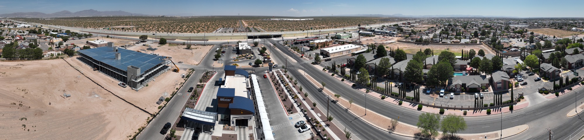
When you’re managing land development, agricultural operations, or civil engineering projects around El Paso, you need accurate data you can rely on. Traditional surveying methods take time, cost money, and can miss details that matter. That’s where drone mapping comes in. It’s not flashy marketing language—it’s a practical shift in how professionals get the information they need to make better decisions.
At Desert Drones LLC, we’ve been mapping El Paso’s landscape from the air for years. Our FAA-certified pilots and modern drone technology deliver orthomosaic maps, 3D terrain models, and precise topographic data that help landowners, developers, engineers, and municipalities understand their property at a level traditional methods simply can’t match.
1. What is Drone Mapping and How Does It Work?
Drone mapping is the process of collecting aerial imagery and data from unmanned aircraft, then stitching it together into accurate, usable maps and 3D models. Here’s what happens behind the scenes:
Our drone flies a programmed flight path over your property, capturing overlapping photographs from a consistent altitude. Specialized photogrammetry software analyzes thousands of images, identifying matching points between photos and building a precise spatial model. The result is an orthomosaic—basically a corrected, map-like image that shows your land as if you were looking straight down at it from above. We also extract elevation data to create topographic maps and three-dimensional models of the terrain.
It sounds technical, but the practical benefit is simple: you get highly accurate maps in days instead of weeks, at a fraction of the cost of hiring ground crews. For a parcel near the Franklin Mountains or rural land stretching across the Chihuahuan Desert landscape south of El Paso, this efficiency makes a real difference. The data we collect is precise enough for engineering designs, land surveys, and professional-grade planning documents.
The flight itself is controlled with precision. We program waypoints, set the camera angle, and ensure sufficient image overlap so the software can stitch everything together seamlessly. Weather conditions matter—we avoid high winds and work with clear skies to ensure image quality. For El Paso’s generally sunny climate, scheduling is usually straightforward.
2. Why El Paso Properties Benefit from Aerial Surveying
El Paso’s terrain is remarkably diverse. You’ve got the Franklin Mountains rising in the northeast, the Hueco Mountains further out, broad valley land along the Rio Grande, and everything in between. This terrain variation makes traditional surveying labor-intensive and expensive. Drones handle this variability with ease.
Agricultural operations in the Rio Grande valley benefit tremendously from aerial mapping. You can measure field dimensions precisely, identify drainage patterns, detect irrigation issues, and assess soil conditions from the imagery we capture. Land parcels being developed near the UTEP area or on the city’s growing Westside can be mapped and analyzed before a single shovel touches the ground. Developers get a complete picture of the site before committing to expensive ground surveys.
Civil engineering projects, county planning departments, and municipalities also rely on drone data for corridor studies, watershed analysis, and infrastructure planning. The terrain around El Paso’s Scenic Drive and the county areas beyond makes drone surveying especially practical. Engineers can study slope stability, assess drainage flow, and identify potential issues from the air.
Development on El Paso’s outskirts often involves complex terrain. Drone mapping helps contractors understand what they’re working with—whether it’s rocky soil, wash areas, or elevation changes that will affect construction costs. This upfront intelligence prevents expensive surprises down the line.
3. Orthomosaic Maps: Seeing Your Property With Clarity
An orthomosaic map is one of the most immediately useful deliverables we produce. Think of it as a high-resolution aerial photograph that’s been corrected for camera angle and terrain elevation, so every measurement is accurate. Unlike regular aerial photos that can distort measurements based on viewing angle, orthomosaics are geometrically corrected.
For land developers, an orthomosaic is invaluable for site planning. You can measure distances with accuracy, identify existing structures, see vegetation patterns, and check sight lines before you invest in ground-level surveys. It becomes your baseline document—the reference everything else builds from. You can overlay it with zoning maps, utilities, and other data layers.
For agricultural landowners, it shows field boundaries, irrigation lines, and terrain challenges with precision that helps with planning and resource management. You can count trees in an orchard, measure row spacing, and identify areas where water isn’t reaching correctly.
We deliver orthomosaics in formats your engineers and planners can actually work with—GIS-compatible, georeferenced to real-world coordinates, and ready for overlay with other data sets. If you’re working with consultants or city planners, they’ll have exactly what they need. The files are compatible with AutoCAD, ArcGIS, and other professional tools.
4. 3D Terrain Modeling and Topographic Data
Beyond flat maps, we create 3D models of your property. This is where drone surveying really shines for complex terrain. The software generates a point cloud—millions of individual elevation points that precisely describe the shape of the land at high resolution.
From that point cloud, we create topographic maps showing contour lines and elevation data. For engineers designing drainage systems, planning cut-and-fill operations, or assessing slope stability, this information is essential. You can see exactly where water will flow, where erosion is likely, and where you’ll need reinforcement.
Contractors can see exactly how much material needs to move, which saves money and reduces surprises. A grading project might cost thousands more or less depending on accurate volume calculations. With 3D terrain data, you eliminate guesswork.
For municipalities planning development corridors or flood management studies, 3D terrain data is foundational. The Rio Grande valley near El Paso has specific drainage concerns and flood risk areas that require careful analysis. Accurate topographic data helps engineers design solutions that actually work.
The point cloud data itself is also valuable. You can export it and work with it in various engineering software packages. Some clients use it for slope analysis, sight line studies, or environmental impact assessments. The resolution is high enough that you can identify individual trees, buildings, and terrain features.
5. Volumetric Measurements for Cut and Fill Operations
One of the most practical applications of drone surveying is calculating volumetric measurements. If you’re planning excavation, building a berm, managing material stockpiles, or grading a site, knowing exactly how much material to move prevents costly waste.
Our 3D models let us calculate volume with accuracy that saves money on every project. Instead of eyeballing it or running multiple ground surveys, we give you precise figures. Contractors can bid accurately based on real data. Projects stay on budget, and there’s less rework and waste.
Here’s an example: you’re developing property on El Paso’s outskirts and need to move 50,000 cubic yards of material for grading. That’s either a $75,000 or $125,000 contract depending on accuracy. Get the measurement wrong, and someone loses money. Get it right with drone data, and everyone wins.
For mining operations, aggregate extraction, or landfill management, volumetric calculations are routine and critical. We’ve worked with operations across the Southwest that rely on regular drone surveys to track how much material they’ve removed or added.
This is especially valuable for larger development sites on El Paso’s expanding edges, where terrain changes significantly and mistakes get expensive fast.
6. Parcel Surveys and Boundary Mapping
Property boundaries matter. Whether you’re buying land, selling it, or managing adjacent properties, you need to know exactly where your lines are. Drone surveying, combined with ground control points, gives you precise boundary mapping.
We can overlay existing parcel data from county records, identify encroachments, and create detailed maps showing your exact property lines. The aerial imagery makes boundary mistakes obvious—if there’s a fence in the wrong place or a neighbor’s building encroaching on your property, the map shows it clearly.
For real estate transactions, development planning, or dispute resolution, this documentation is solid and professionally defensible. The orthomosaic combined with property records creates a clear record of conditions at the time of the survey.
The method works whether you’re dealing with a small residential lot in Downtown El Paso, a commercial parcel near Union Plaza, or hundreds of acres in the county. We’ve surveyed everything from quarter-acre parcels to multi-thousand-acre ranches.
Ground control points—small markers placed on the property and surveyed with GPS—ensure that our aerial data ties to real-world coordinates. This is especially important for boundary work where legal accuracy matters.
7. Agricultural and Rural Land Assessment
El Paso’s agricultural area stretches along the Rio Grande valley, and farming operations need different information than urban developers. We create maps that show field boundaries, irrigation infrastructure, vegetation health patterns, and terrain challenges.
Farmers and ranch managers use this data to plan irrigation improvements, identify drainage issues, and manage land more efficiently. The imagery can reveal areas where crops aren’t thriving, which might indicate water, soil, or drainage problems. You can then send teams to investigate specific areas rather than blind guessing across hundreds of acres.
Over time, comparing maps from different seasons shows you trends in soil condition, vegetation health, and water distribution. A series of maps from spring through fall tells a story about how your irrigation system is actually working.
For rural land valuations and agricultural planning, this level of detail gives you a competitive advantage. You’re making decisions based on data, not assumptions. Lenders and appraisers also increasingly expect this level of documentation for larger agricultural properties.
Specialty crops—orchards, vineyards, or other high-value operations—benefit especially from detailed aerial surveys. You can track individual tree health, measure canopy coverage, and plan pruning and replacement programs based on actual data.
8. Ready to Map Your El Paso Property? Contact Desert Drones LLC Today
Whether you’re a land developer planning your next project, a surveyor needing precise aerial data, an agricultural operation managing Rio Grande valley land, or a municipality planning infrastructure, drone mapping delivers the accuracy and efficiency you need.
Desert Drones LLC brings FAA certification, years of experience flying El Paso’s terrain, and the technical expertise to deliver maps and models that matter. We work with architects, engineers, planners, and property owners across the Southwest, and we know El Paso’s landscape inside and out. We understand the challenges specific to this region—the terrain, the climate, the regulatory environment, and the needs of different client types.
Get in touch with us today to discuss your project and learn how drone mapping can save you time and money. Visit https://desertdronesllc.com/ to request a quote or call to talk through your needs. Let’s map your El Paso property with precision.