
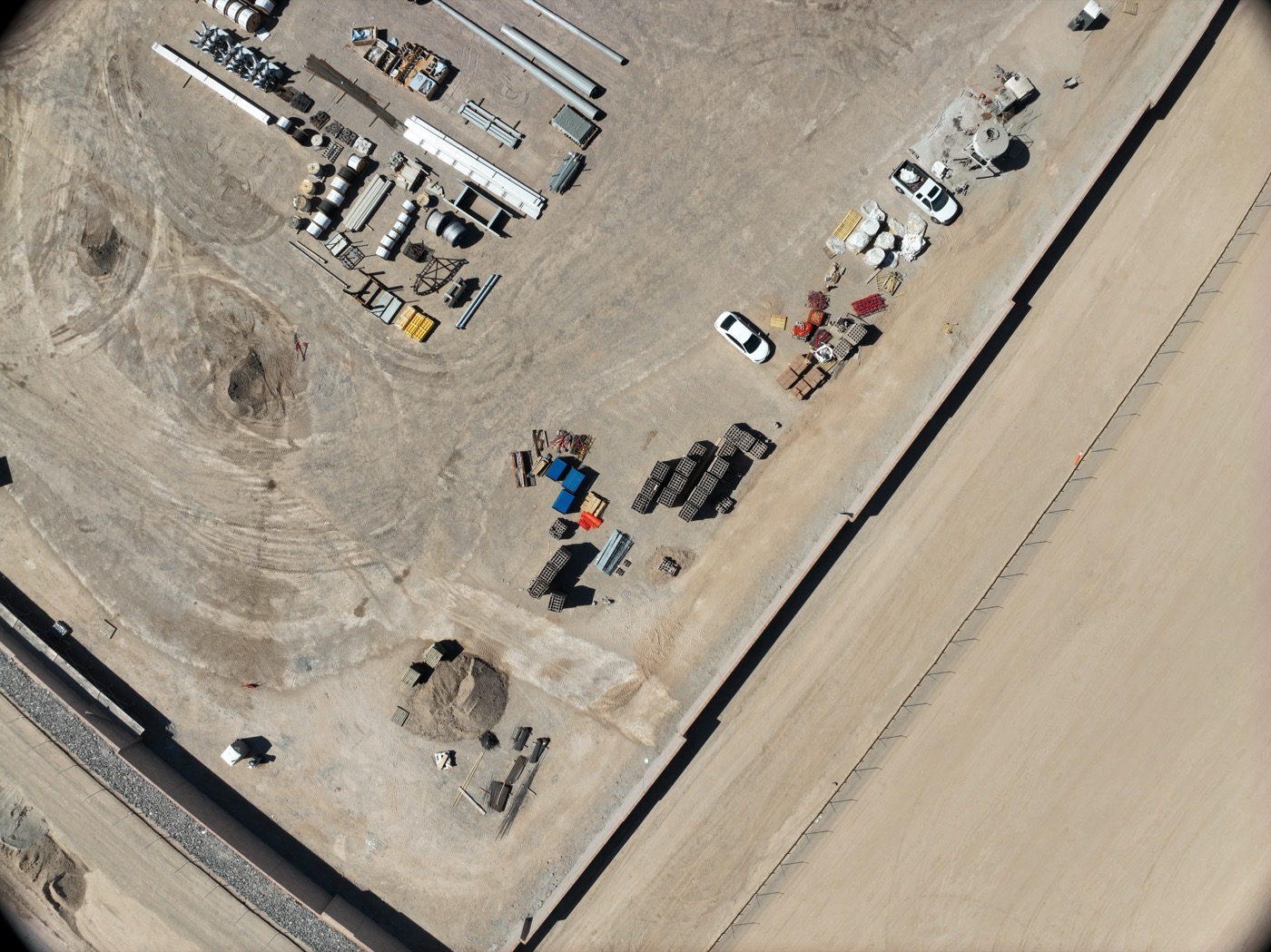
If you’re a land developer, civil engineer, or surveyor working across the Dallas-Fort Worth metro area, you already know something important. Accurate aerial data is critical. Maybe you’re mapping a future subdivision north of Frisco. Maybe you’re running a topographic survey on a 50-acre parcel in Las Colinas. Or maybe you’re analyzing drainage patterns across Trinity River floodplain properties. Either way, drone mapping has fundamentally changed how professionals approach land assessment. At Desert Drones LLC, we provide FAA-certified drone surveying and mapping services. We build them specifically for DFW’s complex real estate development, infrastructure, and planning needs.
1. Why Drone Mapping Beats Traditional Surveying Methods
Traditional ground surveying still has its place, but it’s slow and labor-intensive. On sprawling properties or challenging terrain, it can even be unsafe to complete. A team of surveyors with transit levels and measuring tapes might spend weeks on a large property. They’re constantly repositioning equipment and cross-checking measurements. By contrast, drone mapping delivers high-resolution aerial data in a fraction of the time. Our drones capture thousands of individual images across your property. We then process those images into orthomosaic maps. These are perfectly aligned, georeferenced overhead views that show accurate distances, angles, and spatial relationships.
For large parcels in fast-growing DFW subdivisions, drone surveys eliminate the need to walk every boundary and stake every elevation change. As a result, you get complete coverage in hours, not days. Plus, the data stays consistent and repeatable, and we archive it for future reference. For example, say you’re managing a 200-acre master-planned community or evaluating multiple development sites across the metroplex. That efficiency translates directly into lower survey costs and faster project approval timelines. In fact, we can capture a property that would traditionally take two weeks of ground surveying in a single afternoon flight. Ultimately, the payoff is substantial when you’re working with tight development timelines and budget constraints.
2. Orthomosaic Maps: The Foundation of Modern Land Planning
An orthomosaic map is what you get when we stitch drone imagery together. We correct it for terrain distortion and georeference it to real-world coordinates. Think of it as a perfectly accurate aerial photograph of your property with survey-grade precision. Unlike a standard aerial photo or satellite image, we process an orthomosaic to remove the perspective distortion. That distortion occurs when you photograph the ground from an angle. We align every pixel to actual latitude and longitude coordinates, so distances and angles come out measurement-accurate.
In the Dallas-Fort Worth region, we’ve used orthomosaic mapping for everything from parcel boundary documentation to pre-development site analysis. For example, developers can overlay zoning maps, utility easements, and proposed infrastructure on these orthomosaics. Meanwhile, land surveyors use them to identify existing structures, tree lines, utility poles, and drainage patterns. Municipalities planning road improvements or flood mitigation projects also rely on orthomosaics to understand current conditions across entire corridors. Similarly, engineers designing stormwater systems reference orthomosaics to see where existing utilities already run and what structures might complicate installation.
The resolution is remarkable—our drone flights capture detail down to a few inches per pixel. As a result, that level of clarity reveals subtle topographic features, encroachments, and site conditions. Documenting these manually would take weeks. For instance, you can see fence lines, vegetation patterns, gravel piles, equipment parking areas, and minor structures. Many of these might not appear on older survey records. For boundary verification and site reconnaissance, that level of detail is invaluable.
3. Topographic Data & 3D Terrain Modeling
Understanding the terrain shape of your property is foundational to any development or engineering project. Topographic surveys show elevation changes, slope angles, and watershed patterns—the actual 3D shape of the land. Drone surveys create point clouds: millions of precise 3D coordinates representing the actual surface of the ground. We capture these from hundreds of overlapping aerial images, which we then process through photogrammetry software.
For DFW projects, this matters enormously. The region’s variable terrain ranges from the rolling hills around Frisco and Plano to the flatter areas near Fort Worth. That means drainage, grading, and foundation planning all require accurate elevation data. In fact, a property that looks relatively flat at street level might have subtle but significant slopes. You only see them once you’re looking at it from above and analyzing the precise elevation at dozens of points. Our drones capture enough detail to generate digital elevation models, or DEMs. Civil engineers and architects use these for stormwater design, cut-and-fill calculations, and infrastructure planning. These models show exactly where water naturally wants to flow and where low spots will collect runoff. They also show where earthwork modifications are needed.
We’ve supported projects across the metroplex. These include subdivisions planning stormwater ponds and retention areas, highway departments evaluating drainage improvements on existing corridors, and land managers assessing erosion risks on properties bordering the Trinity River. For example, one recent project involved a 150-acre parcel north of Plano. The property owner needed to understand how stormwater would behave after development. The topographic data we provided showed three natural drainage pathways and helped engineers design the detention pond system accordingly. The 3D terrain models we produce are compatible with CAD and GIS software. Your engineering team can integrate them directly into design workflows.
4. Cut & Fill Volume Calculations with Precision
One of the most practical applications of drone surveying is calculating earthwork volumes. Before major site preparation, developers need to know: How much soil needs to come out of the high points? Where can that soil go (fill) to create ponds, berm up low areas, or prepare building pads? These questions directly impact project budgets. After all, earthwork can be one of the largest line items in site development. Moving just a few thousand extra cubic yards of fill can add thousands, or tens of thousands, of dollars to the project cost.
Traditional volume surveys required ground crews to take hundreds of measurements and manually interpolate the data. By comparison, drone-based surveys do this automatically and more accurately. We capture the baseline terrain, and then—after grading—we capture it again. The difference shows exactly how many cubic yards of material moved. The precision is typically within a few percent of actual volumes, which is more than sufficient for design and budgeting purposes. In addition, some contractors use sequential drone surveys during construction to monitor real-time progress against the grading plan.
DFW’s development corridor is booming, especially in rapidly expanding areas like the northern suburbs stretching toward McKinney and Frisco. In these areas, accurate cut-and-fill data helps developers budget earthwork costs precisely and helps contractors plan equipment deployment efficiently. What’s more, it creates a documented record for project audits and quality assurance. Disputes sometimes arise about how much work crews completed, or whether the site was graded according to specifications. When they do, the drone survey records provide clear evidence.
5. Site Feasibility Studies for Subdivisions & Master-Planned Communities
DFW’s sprawl northward into areas like Frisco, McKinney, and beyond means constant evaluation of raw land for future residential or mixed-use development. Before a land company commits millions to acquisition and infrastructure, they need to assess feasibility: Is the terrain too steep for the planned density? Are there drainage constraints? Where are natural features that might be preserved or worked into the design? Are there existing utilities or structures that complicate the development plan?
Drone mapping delivers that assessment quickly and affordably. Our surveys provide the baseline data that planners use to determine road layouts, lot configurations, utility corridors, and open space. We’ve supported feasibility studies for projects ranging from small infill subdivisions in established neighborhoods to large master-planned communities spanning hundreds of acres. For instance, one recent project involved a 280-acre property near Las Colinas where the developer was considering several different density scenarios. The orthomosaic maps and topographic data helped them identify the areas with acceptable slopes for building and the natural drainage patterns that would require pond locations. The data also highlighted the tree-lined corridors worth preserving as greenspace. In the end, the aerial perspective shows constraints and opportunities that ground-level surveys might miss entirely.
6. Parcel Boundary Documentation & Property Verification
Property lines matter. A lot. Especially when you’re dealing with multiple parcels, complex easements, or boundary disputes. Drone surveys aren’t a replacement for certified boundary surveys—those still require ground measurements and professional surveyor certification. But orthomosaic maps provide powerful supporting documentation that accelerates the survey process and helps resolve ambiguities.
We’ve worked with surveyors across DFW to create orthomosaic basemaps. These show existing structures, fences, vegetation, and utility infrastructure in relation to recorded parcel boundaries. Sometimes there’s a question about encroachment, or about where a property actually sits on the ground. In those cases, these high-resolution aerial images often provide the clarity needed to resolve disputes or support surveyor findings. For example, in one case, a property owner disputed a boundary line that someone had marked on paper decades ago. When we provided the orthomosaic, it clearly showed that an existing fence sat several feet off the recorded line. That simple visual evidence resolved the issue quickly.
For developers assembling multiple contiguous parcels for a larger project, orthomosaics show the physical reality of what’s on the ground. That makes it easier to identify missing pieces, easements, or boundary issues before purchase. Walking every line with a surveyor is expensive and time-consuming. Instead, you can review the orthomosaic from your office and identify potential issues up front.
7. Municipal & Infrastructure Planning Applications
DFW municipalities and regional planning bodies have adopted drone mapping for a range of planning and maintenance applications. We’ve provided orthomosaic maps and elevation data for:
- Stormwater and drainage studies: Understanding how water flows across large areas, identifying low points where ponds or retention structures should go, and planning improvements to aging drainage infrastructure. When cities are managing growth and annexing new areas, they need to understand the natural drainage patterns before infrastructure gets built.
- Flood mitigation projects: Agencies planning Trinity River corridor improvements, or addressing localized flooding issues in specific neighborhoods, use drone-generated elevation data. They rely on it to model water flow and design solutions. In turn, the level of topographic detail from drone surveys helps engineers position levees, detention areas, and channel improvements more precisely.
- Utility corridor planning: Electric, gas, water, and telecommunications companies use drone mapping to document existing infrastructure and plan expansions or upgrades. A new water main running across a large property needs to navigate around existing utilities. The aerial view shows where those utilities already run.
- Right-of-way assessments: For road improvements or new corridors, orthomosaics show current conditions, existing structures, and constraints that engineers need to account for. When cities are evaluating potential new roads or widening existing ones, drone surveys provide the needed baseline data. That data supports environmental assessment and community impact analysis.
We georeference the data we capture and make it compatible with GIS systems that municipalities and engineering firms already use. That means it integrates seamlessly into existing workflows. As a result, your planning department can load the orthomosaic and elevation data directly into their mapping systems. It sits alongside zoning, utilities, and other reference layers.
8. Ready to Map Your DFW Property? Contact Desert Drones LLC Today
Accurate aerial mapping and surveying data doesn’t have to be complicated or expensive. Maybe you’re a developer evaluating a new site, a surveyor supporting a boundary study, a civil engineer planning infrastructure, or a municipality managing regional planning. Whatever your role, drone surveys deliver the baseline data you need—faster and more affordably than traditional methods.
Desert Drones LLC is FAA-certified and has extensive experience with mapping and surveying projects across the Dallas-Fort Worth metroplex. In short, we understand DFW’s terrain, development patterns, and regulatory environment. We’re ready to support your next project with professional-grade aerial data, orthomosaic maps, topographic surveys, and 3D terrain models.
Ready to see what accurate drone mapping can do for your project? Get in touch with Desert Drones LLC today. Let’s talk about your surveying and mapping needs, and we’ll show you how aerial data can accelerate your timeline and improve your decision-making.