
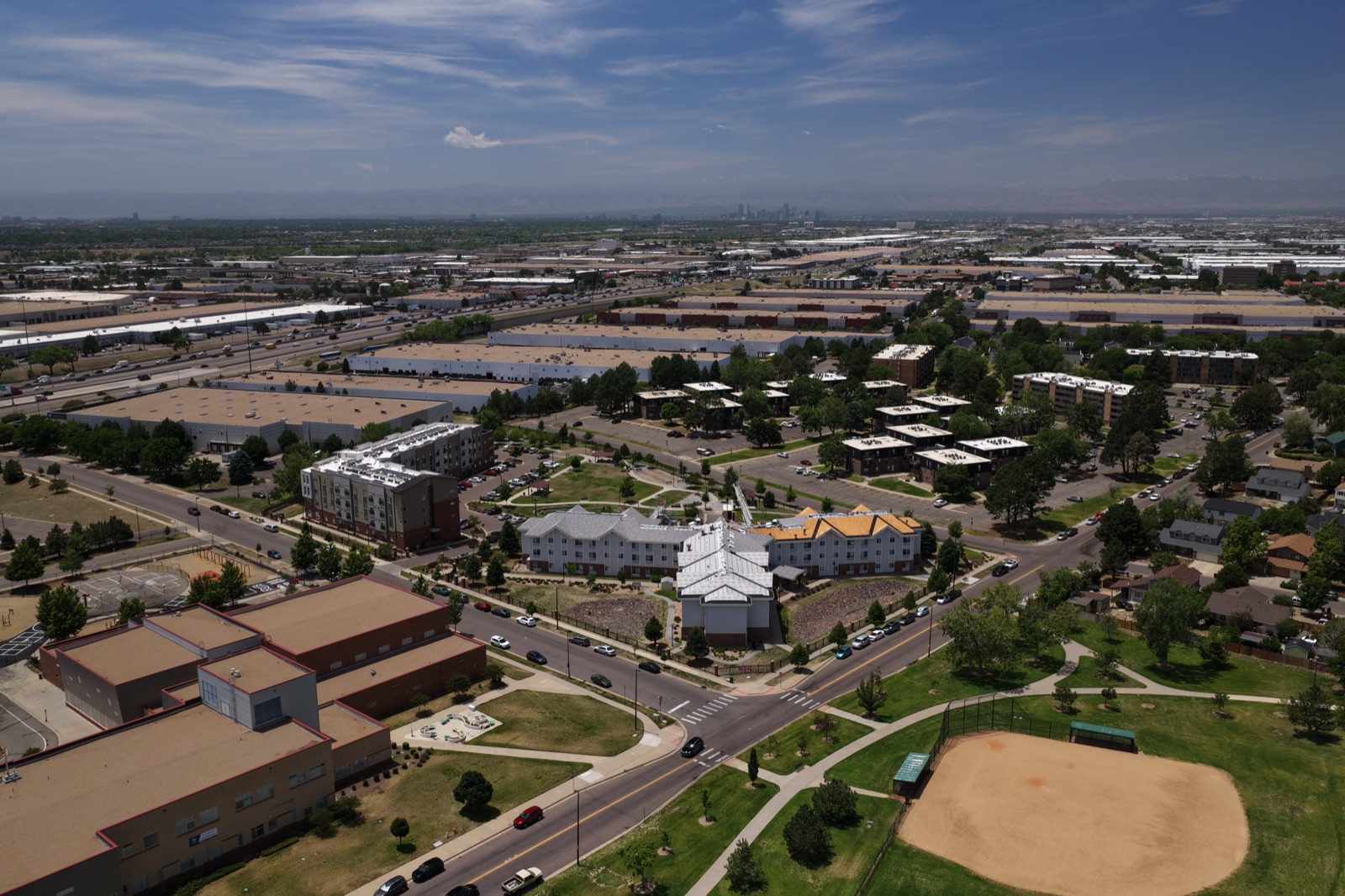
Building in Denver means working on a tight timeline with weather that doesn’t always cooperate. A sunny February morning can turn into a snow day by afternoon, and a summer pour can get pushed by a thunderstorm rolling off the foothills. Through all of it, owners, lenders, and investors still want to know one thing: how far along is the project?
Construction drone monitoring in Denver gives everyone the same answer, backed by clear images. Regular flights over the site capture progress from above, creating a visual record that shows what got done, when, and how the site is changing over time. It’s faster than walking the whole job, and it’s a lot easier to share.
Desert Drones LLC provides FAA Part 107 certified construction drone monitoring for Denver general contractors, developers, and owners, with scheduled progress flights and organized deliverables your whole team can use.
Why Denver Projects Need Aerial Progress Tracking
Denver has been building steadily for years. Infill projects keep rising around Union Station and LoDo, River North continues to fill in with apartments and creative office space, and neighborhoods like Central Park, on the old Stapleton airport site, are still adding homes and retail. Out along the I-25 and I-70 corridors, warehouses, schools, and mixed-use projects keep breaking ground.
Tight sites and big ones
Urban infill sites downtown and in RiNo are often squeezed between existing buildings, alleys, and busy streets. Getting a full view of the work from the ground is nearly impossible. A drone can capture the whole footprint, the crane, staging, and the surrounding blocks in one frame.
On the other end, suburban and industrial sites can cover dozens of acres. Walking those every week takes hours, and photos from the ground don’t show how earthwork, utilities, and foundations fit together. An overhead view does.
Front Range weather changes the schedule
Denver’s weather is famous for swinging fast. Chinook winds can gust down off the mountains, spring snowstorms can drop heavy wet snow overnight, and summer afternoons often bring lightning. When a project falls behind because of weather, aerial photos taken before and after a storm make it easy to show owners and lenders exactly what happened.
Cold also affects drone flights. Batteries lose capacity in freezing temperatures, and winter days are short. We plan winter flights for the warmest part of the day, keep batteries warm, and build in extra margin so the schedule stays on track through the season.
Short winter days also mean less usable light. Late fall and winter flights are often scheduled for late morning through early afternoon, when the sun is high enough to light the site evenly without long shadows hiding the work.
Airspace around the metro
Denver International Airport sits well out to the northeast, but other airports like Centennial and Rocky Mountain Metropolitan have controlled airspace closer to many job sites. We check every location and handle FAA authorization when it’s needed, so recurring flights don’t get held up.
How Construction Drone Monitoring in Denver Works
The value of progress monitoring comes from consistency. Here’s how we set it up so every flight lines up with the last one.
1. Kickoff and site plan
We start by meeting with your project team to understand the scope, schedule, and who will use the images. We review the site plan, mark launch points, and note hazards like cranes, power lines, and active work zones. We also confirm your site safety rules and any sign-in requirements.
2. Setting the flight schedule
Most projects do well with weekly, biweekly, or monthly flights, often timed to line up with owner meetings or draw requests. We can also add flights around key milestones, like topping out, roof dry-in, or final site work.
3. Repeatable flights
Each visit follows the same plan: the same angles, heights, and positions as the last time. That consistency is what makes side-by-side comparisons useful. We capture still photos from fixed points, overhead images of the full site, and short video clips when they’re helpful.
4. Organized delivery
After each flight, we deliver edited images labeled by date and view, so anyone on the team can find what they need. Over time, those images build into a complete visual history of the project from groundbreaking to grand opening.
Coordinating with your crew
We check in with the superintendent before every flight and keep the drone clear of crane operations and workers. If a crane is swinging or a critical pick is underway, we wait. Fitting into your site’s rhythm is part of doing this job well.
What regular aerial images help you catch
When you look at the same view every couple of weeks, small changes stand out. Staging that keeps creeping into the fire lane, stockpiles that aren’t moving, or a section of the site that hasn’t changed since the last flight all show up quickly. That gives project managers a chance to address problems before they turn into delays.
Aerial images also help with coordination between trades. An overhead view of the site makes it easier to plan laydown areas, crane positions, and delivery routes, especially on tight downtown lots where every square foot is spoken for.
And when questions come up months later about what was installed and when, a dated aerial record is far more convincing than memory. Owners and contractors both benefit from having that history in one place.
What the deliverables look like
Most clients receive a set of fixed-angle photos from each flight, a full overhead view of the site, and optional video clips. We can also put together side-by-side comparison images or a time-lapse style sequence that shows the project growing from flight to flight. Files are shared through a simple online folder so your whole team has access.
Who Uses Drone Progress Monitoring in Denver
Progress images serve several different people on the same project.
General contractors. GCs use aerial photos in weekly reports and owner meetings, and to document conditions in case questions come up later about schedule or scope.
Developers and owners. Owners who can’t visit the site often get a clear, current view of the work without driving across town or flying in from another city.
Lenders and investors. Aerial images give lenders a quick visual check on progress before releasing funds, and they keep investors confident in the project.
Architects and engineers. Design teams use overhead views to check layout, track site work, and spot potential issues early.
Marketing and leasing teams. Progress footage builds anticipation for apartments, office space, and retail before the doors open, and it makes for strong social media content.
Property managers and facility teams. Once the building is finished, the full aerial record gives the people who run it a useful reference for where utilities, drainage, and site features were installed.
Why Denver Builders Choose Desert Drones
Every pilot on our team is FAA Part 107 certified. We’re licensed for commercial work, we follow job site safety rules, and we handle airspace authorizations so your flights happen when they’re supposed to.
We know how to fly in Front Range conditions, from cold mornings to gusty afternoons, and we plan around them instead of losing days. That local experience keeps your progress record complete through every season.
We also understand that progress photos are only useful if they arrive quickly. Fast turnaround means your images are ready for the next owner meeting, not the one after. And the deliverables are professional and organized, ready to drop into reports and presentations. Learn more on our construction drone services page.
Denver Construction Drone FAQ
How often should we schedule progress flights?
It depends on the pace of the project and who’s using the images. Many teams start with biweekly or monthly flights and add extra visits around big milestones. We can adjust the schedule as the project moves through different phases.
Can you fly in the winter?
Yes, as long as conditions are safe. We avoid flying in heavy snow, icing conditions, or high winds, and we plan winter flights for the warmest part of the day. If weather cancels a flight, we reschedule as soon as conditions allow.
Will the drone interfere with work on site?
No. We coordinate with your superintendent, stay clear of crane operations and workers, and keep flights short. Most crews barely notice we’re there.
Can we use the images for marketing too?
Absolutely. Progress images and video work well for leasing campaigns, social media, and investor updates. We can capture extra marketing angles during scheduled flights if you let us know ahead of time.
Can you monitor several of our sites around the metro?
Yes. Many builders have projects spread across Denver, Aurora, Lakewood, and the suburbs. We can set up a combined schedule that covers each site on a regular rotation and keeps the deliverables organized by project.
Start Construction Drone Monitoring in Denver
Ready to give your team a clear, consistent view of every phase of your project? Contact Desert Drones LLC today for a free quote on construction drone monitoring. We serve Denver and the surrounding Front Range with FAA-certified pilots who know the local weather, terrain, and airspace, and we’ll build a flight schedule that fits your job.
Call Desert Drones in Denver: (303) 997-3271