Trustindex verifies that the original source of the review is Google.
Desert Drones is fantastic to work with! They do an incredible job bringing our vision to life and capturing our projects in a way that truly showcases the work being done. Highly recommend their team. Thanks again, Desert Drones!
brooke ryan
Trustindex verifies that the original source of the review is Google.
Desert Drones is awesome to work with! They help bring our vision to life and showcase our work in the best way possible. Highly recommend them to anyone looking for quality drone services. Thanks, Desert Drones!
Frank Segarra
Trustindex verifies that the original source of the review is Google.
John and team are the consummate professionals! Very reliable, quick, and high quality deliverables!
Stephen Cook
Trustindex verifies that the original source of the review is Google.
Professional, efficient, and easy to work with. The team delivered clean, high-quality aerials and communicated clearly throughout the project. One of the best drone service providers we’ve worked with in the Phoenix area.
Greg DeMeritt Jr
Trustindex verifies that the original source of the review is Google.
Needed work done quickly for drone photography. They responded quickly and knew exactly what was required and explained it well. They provided great customer service and got me exactly what I needed, when I needed. Finally found my Drone guys!
Doug Fleming
Trustindex verifies that the original source of the review is Google.
John was a professional and very knowledgeable. He made the process of getting drone footage seamless and did an exceptional job. The speed of completion along with quality of his work was excellent. Highly recommend using them if...
Good JuJu Agency
Trustindex verifies that the original source of the review is Google.
John is true professional. Every time we need some drone photography or videography done John is excited to take on the project. From midnight fireworks displays to busy sections of the city with all kinds of obstacles, working with Desert Drones never fails to hit the mark.
Jesus Figueroa
Trustindex verifies that the original source of the review is Google.
Absolutely amazing experience with Desert Drones. They did a shoot for my business and I must say, they made my product really speak for itself! The aerial shots were stunning and perfectly captured every special moment. John was very professional, punctual, and easy to work with. Highly recommend them for any event coverage—you won’t be disappointed!
Eustolia Schau
Trustindex verifies that the original source of the review is Google.
Great company and amazing aerial photography!
Katie Schwertz
Trustindex verifies that the original source of the review is Google.
John took care of the interior and exterior drone footage for our manufacturing facility in Tucson. He was great to work with! Very knowledgeable, answered all our questions, and shot some great videos. He was also quick to respond to emails and calls throughout the whole process. I would definitely use Desert Drones again in the future.
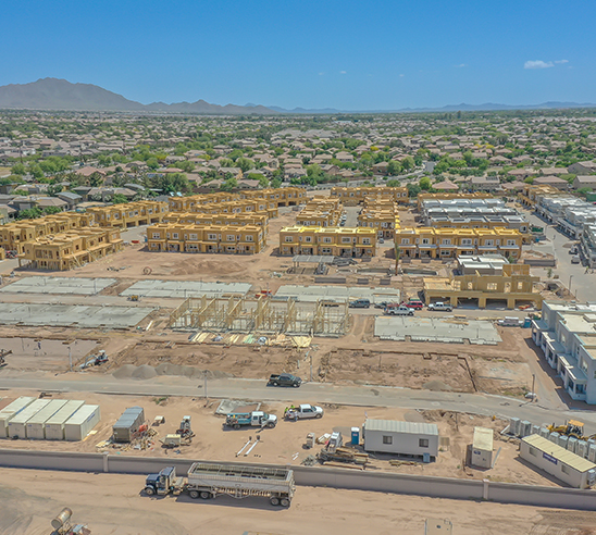
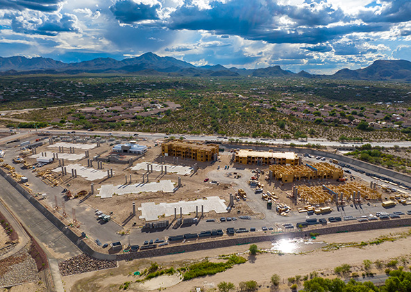
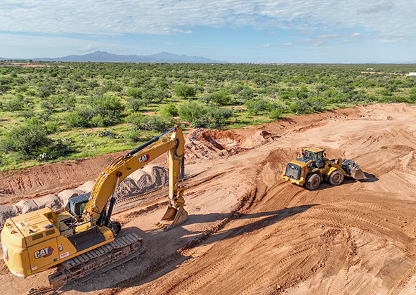
The Phoenix construction industry is experiencing unprecedented growth, with new developments rising across downtown, Scottsdale, Mesa, Chandler, Buckeye and Tempe. Managing these projects requires more than traditional methods — it requires accurate data, consistent communication, and modern technology. At Desert Drones, we provide construction drone services in Phoenix, AZ that give builders, developers, and project managers a clear aerial perspective of their sites. Our services improve efficiency, reduce risk, and keep your project moving forward on time and on budget.
Track Construction Progress with Aerial Photography & Video
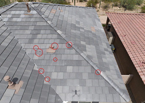
Progress tracking is one of the most valuable applications of drones in construction. Our FAA-certified pilots capture high-resolution aerial photos and 4K video that provide a reliable visual record of your site at every stage. These deliverables are ideal for executive reports, subcontractor coordination, and compliance documentation. For example, a recent commercial build in North Phoenix used our weekly flights to identify framing delays early, saving weeks of scheduling issues. Whether you’re managing a downtown tower or a residential development in Glendale, our drones provide the clarity you need to keep all stakeholders informed and accountable.
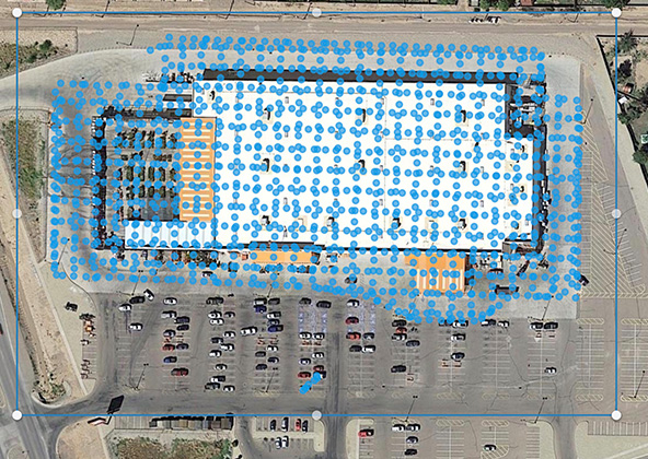
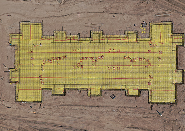
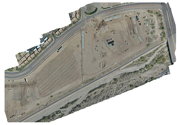
Drone Mapping, 3D Models & Topographic Surveys
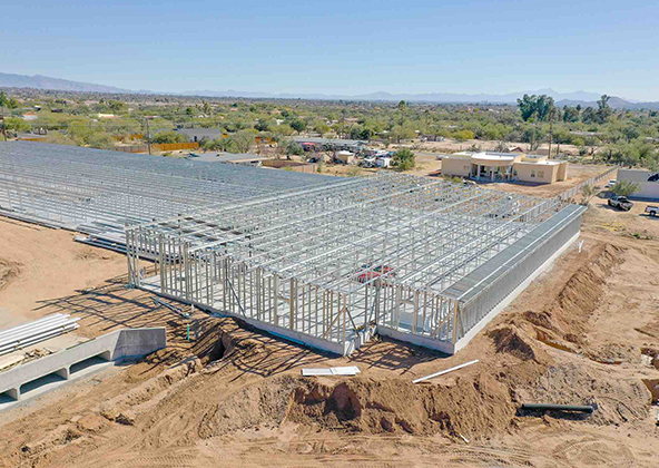
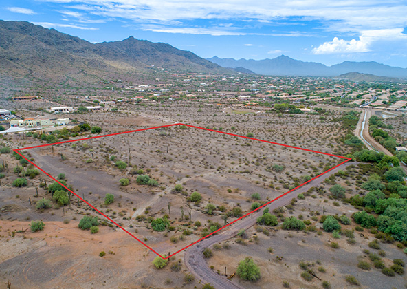
Accurate mapping is critical in Phoenix, where desert terrain and rapid expansion demand precision. Desert Drones specializes in creating orthomosaic maps, 3D surface models, and topographic surveys that integrate seamlessly into design and engineering workflows. Our data is accurate within a few centimeters and is fully compatible with platforms like Civil 3D, Revit, and GIS. For large-scale projects in Chandler and Mesa, this precision ensures earthworks are executed according to plan, avoiding costly rework. By providing fast, affordable mapping, we help construction managers reduce survey turnaround times from weeks to just days.
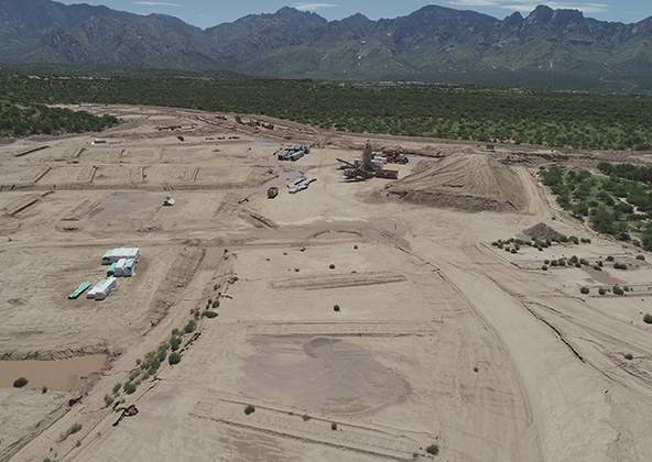
Volumetrics & Earthwork Calculations
Managing earthwork and material stockpiles is one of the most cost-intensive parts of any construction project. Our drone flights deliver precise cut-and-fill calculations and volumetric analysis, ensuring you know exactly how much soil has been moved, where it has gone, and whether it matches contracted specifications. One Phoenix client used our volumetric reports to verify subcontractor work on a 15-acre industrial site, uncovering a discrepancy that saved the developer thousands of dollars. For builders across Tempe, Scottsdale, and Maricopa County, volumetric drone data is a game-changer for accountability and budget control.
Enhancing Safety on Phoenix Construction Sites
Safety is a top priority on any job site, and in Phoenix’s extreme heat, reducing risk is even more important. Our drones allow construction teams to inspect hazardous areas remotely, eliminating the need for dangerous climbs or extended exposure to desert temperatures. This helps reduce OSHA-reportable incidents and keeps your workforce on the ground where they’re safest. For a recent residential development in South Scottsdale, our drone inspections revealed structural concerns that would have been risky to spot manually, allowing the builder to resolve issues without exposing workers to harm.
Time-Lapse Flights & Stakeholder Reporting
Construction projects often span months or years, and keeping stakeholders engaged requires consistent updates. Desert Drones provides scheduled drone flights to capture time-lapse videos and long-term aerial progress documentation. These deliverables are perfect for investor meetings, planning commissions, and marketing campaigns. For example, a multi-family development in Mesa used our time-lapse reporting to impress lenders and secure financing for future phases. Whether you’re reporting to city officials or building your company’s portfolio, time-lapse visuals demonstrate professionalism and reliability that words alone can’t convey.
FAA Compliance & Reliable Operations
Flying drones in Phoenix requires expertise in navigating FAA regulations and controlled airspace. Desert Drones operates under FAA Part 107 certification and carries full liability insurance, giving you peace of mind on every project. We are experienced in coordinating flights near Phoenix Sky Harbor International Airport and other Class D airspaces in the Valley, ensuring your project never experiences delays due to compliance issues. Our team manages all authorizations and pre-flight safety protocols so you can focus on building, not worrying about airspace restrictions.
Why Choose Desert Drones for Phoenix Construction Projects?
Desert Drones has been voted Arizona’s Best Aerial Photographer and is trusted by contractors and developers throughout the Phoenix metro. We combine advanced drone technology, FAA-certified pilots, and years of industry experience to deliver results that go beyond photography. From detailed site maps to stakeholder-ready progress videos, our services are designed for the unique challenges of construction in Phoenix. With clients across Scottsdale, Mesa, Chandler, Glendale, and Tempe, we’ve built a reputation as the most reliable aerial partner in Arizona. Contact us today to schedule your Phoenix construction site
Frequently Asked Questions About Phoenix Construction Drones
Yes. Desert Drones operates under FAA Part 107 and complies with all local and federal regulations. We also handle airspace authorizations near Sky Harbor and other controlled zones to ensure full compliance.
Our mapping and photogrammetry deliver 1–3 cm accuracy when combined with ground control points. This precision is more than sufficient for grading, volumetrics, and progress verification on Phoenix projects.
Weekly flights are standard for most projects, but fast-moving phases such as excavation or framing may require 2–3 flights per week. We customize schedules based on your project’s needs.
Yes. Our drones are designed for demanding conditions, and our pilots adapt flight schedules around weather. We typically fly early mornings in summer to reduce heat impact and avoid monsoon storms for safety.
We work with general contractors, developers, real estate investors, and city planners. Our Phoenix clients include residential builders, commercial developers, and industrial project managers who need reliable aerial data.
Licensed & Insured
Desert Drones, LLC is operated by a licensed pilot by the FAA (Federal Aviation Administration), Desert Drones, LLC is licensed & insured up to $2M.
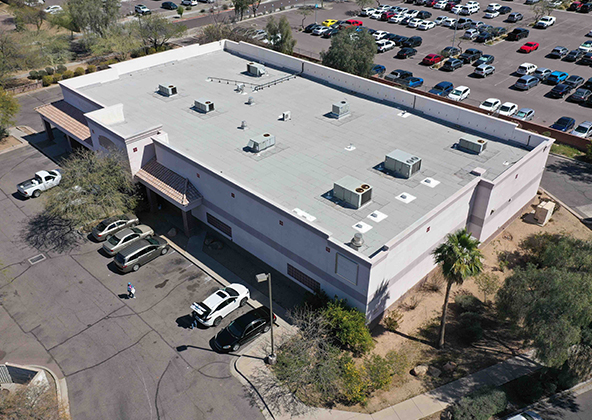
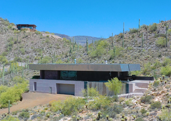
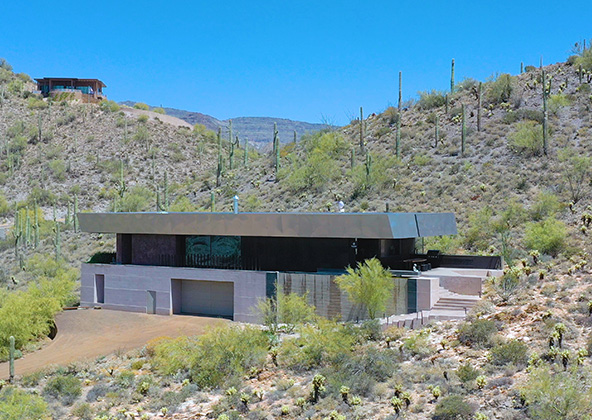
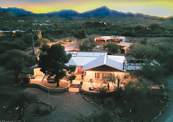
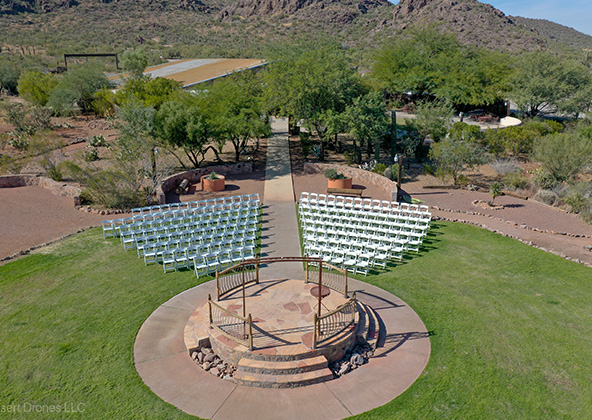
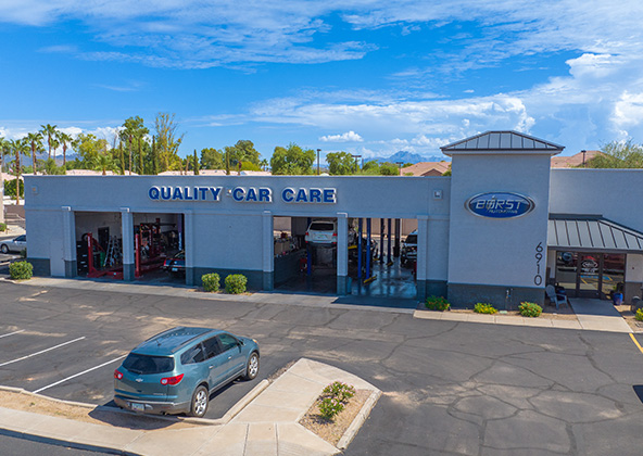
Aerial photography provides a unique perspective. Real estate listings, events, construction progress photos and site surveillance are just a few examples of where you need drones to do the job right.
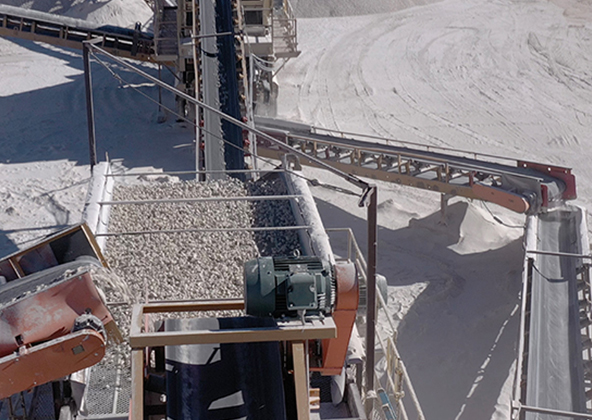
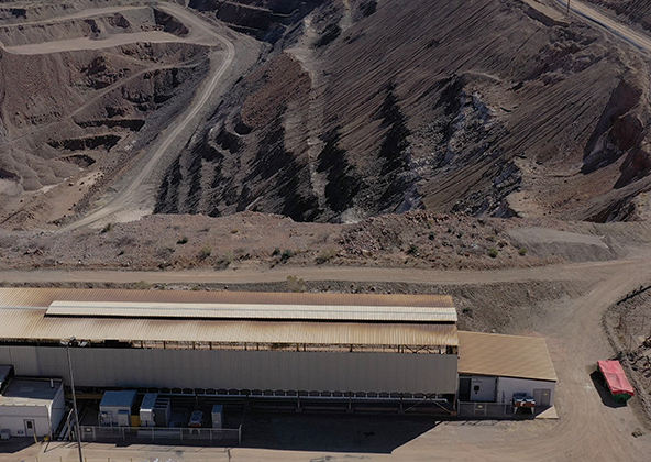
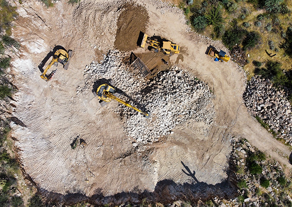
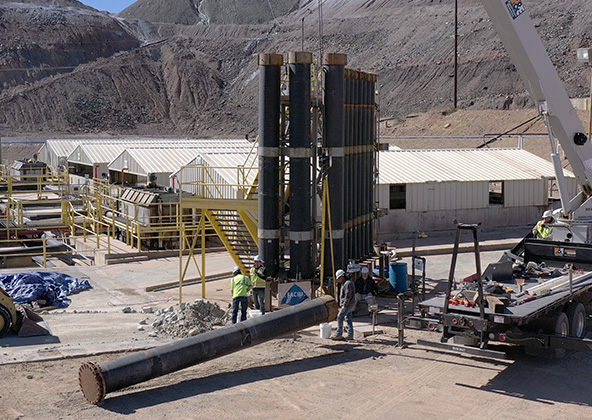
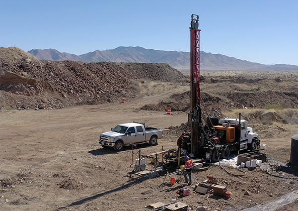
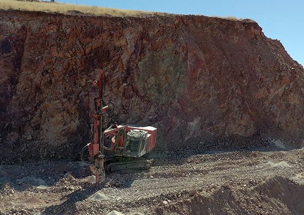
Mining
Aerial photography and videography provide fast and cost effective mapping, documentation, elevation and stockpile calculations to streamline your mining operations.
Industrial
Drones are uniquely qualified to capture aerial data for inspections of cellular, electrical, mining, solar and other industrial sites. Providing higher quality data at a lower risk rate than traditional inspections, makes drone services a must on your project.
Events
No matter what kind of event you are having, aerial photography and videography make your audience feel like they are there. Make your advertising, marketing campaign and website stand out with dramatic pictures and videos that only drones can capture.
Licensed & Insured
Desert Drones, LLC is operated by a FAA (Federal Aviation Administration) licensed pilots, Desert Drones, LLC is licensed & insured up to $2M.
Aerial photography and videography provide fast and cost effective mapping, documentation, elevation and stockpile calculations to streamline your mining operations.
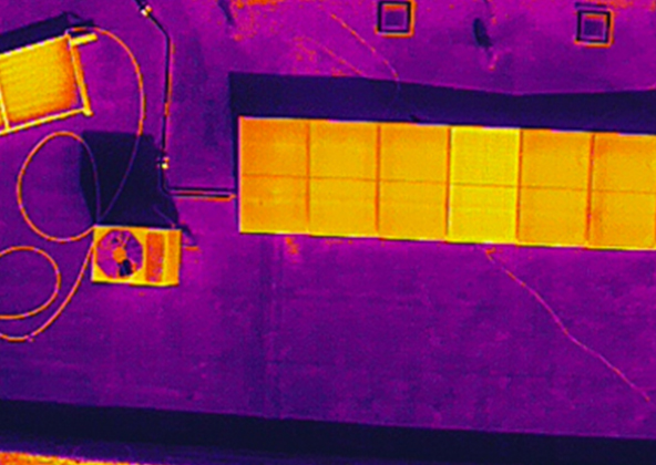
Southwest Arizona is a great place for solar. In phoenix and tucson we get over 300 days of sun every year. Let us give you valuable information while your system is still under warranty. Make sure you are getting what you paid for in you PV system.
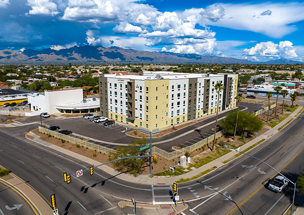
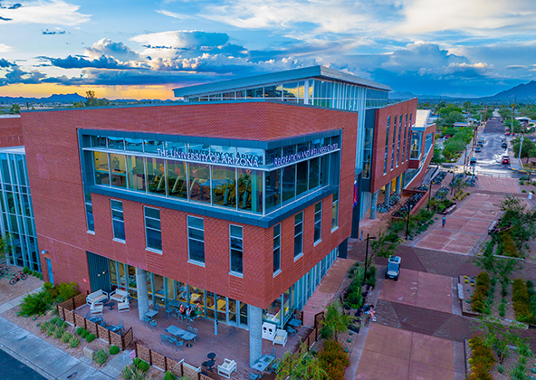
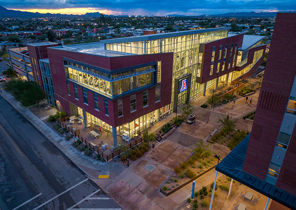
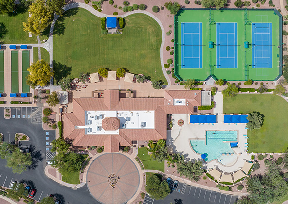
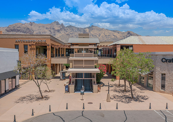
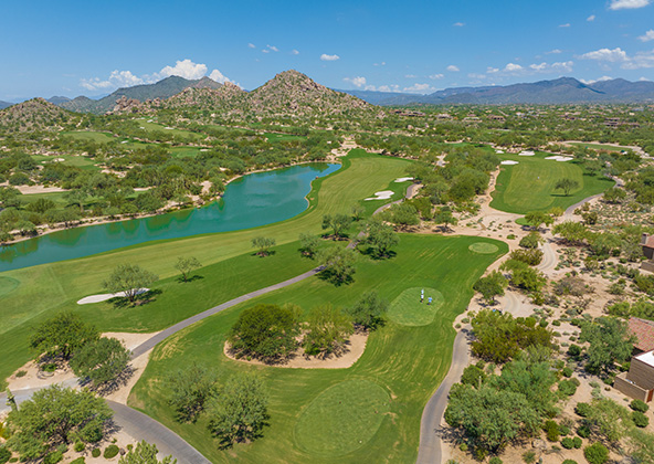
Gallery
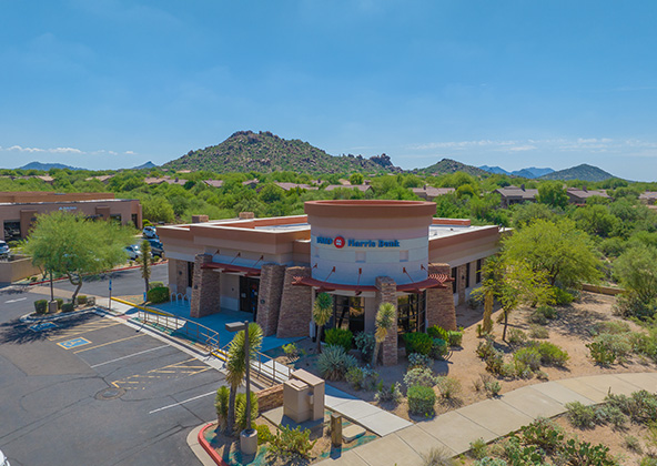
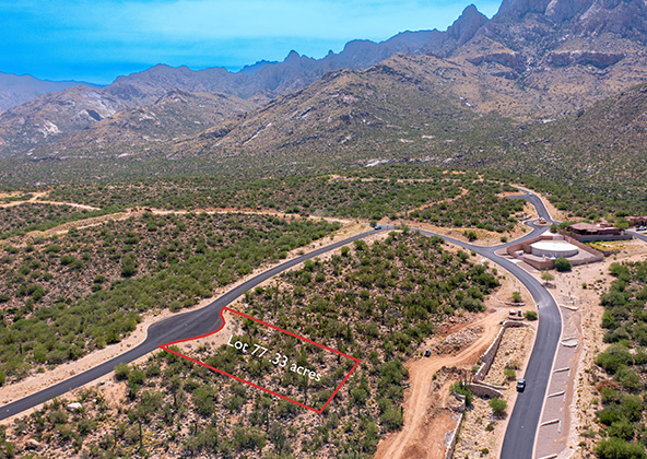
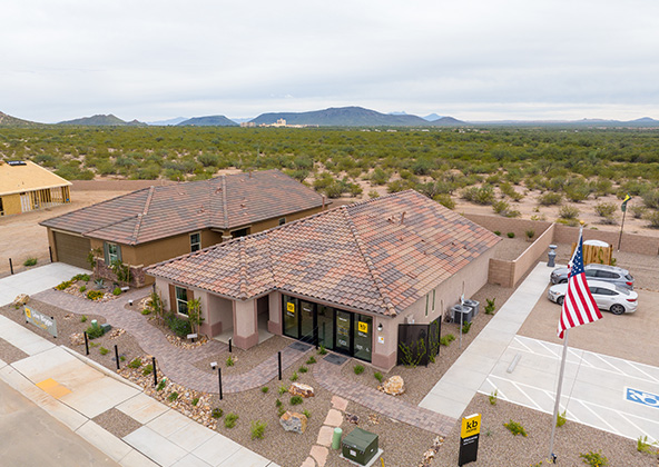
MLS aerial drone photos for commercial and residential real estate
drone services for real estate
Aerial Drone Photography for Marketing and Advertising