
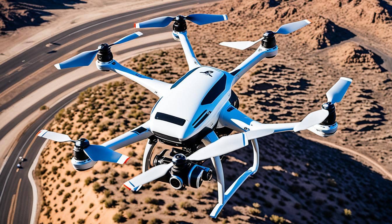
Welcome to Desert Drones LLC, your go-to for top-notch Phoenix drone services. Our skilled pilots and certified operators provide various aerial solutions. This includes stunning photography and videography, precise mapping, and detailed inspections.
Being in the Southwest, we use the newest drone tech. This helps us serve our clients all over the U.S. With safety, innovation, and your satisfaction in mind, we are your reliable choice for all aerial needs. Check out our full list of services. Let us take your projects to the next level.
Key Takeaways
- Desert Drones is a leading provider of professional Phoenix drone services.
- Our team offers a wide range of aerial solutions including photography, videography, mapping, and inspections.
- We leverage the latest drone technology to deliver unparalleled results for clients across the United States.
- Our focus is on safety, innovation, and customer satisfaction, making us a trusted partner for all your aerial needs.
- Explore our comprehensive services to see how we can elevate your projects to new heights.
Phoenix Drone Services: Elevating Your Aerial Perspective
Desert Drones is leading the way in the Phoenix drone services market. We have a team of skilled pilots and drone operators. They use top-of-the-line aerial tech to offer many services. These include stunning aerial photography, accurate drone mapping, and UAV surveying. Plus, our detailed drone inspection of buildings and infrastructure can’t be beaten. We’re here to go beyond your expectations.
Safety, efficiency, and attention to detail are our top priorities. We aim to lift your projects to new levels. Whether you need drone piloting services we cover it all. Our solution-based approach meets the needs of complex tasks. We give you the aerial solutions you need to excel.
Desert Drones promises to be your go-to in aerial photography, drone mapping, and drone inspection services. Let’s together explore the world of drone technology. We’ll help take your projects to amazing new heights with our Phoenix drone services.
The Art of Aerial Photography
Take your stories to new heights with our top-notch aerial photography. We have skilled pilots and photographers who capture stunning landscapes and architectural wonders. They use drones to grab views from the sky that will charm your viewers. From big scenes to small details, we open a whole new world of creativity with drone shots.
Capturing Breathtaking Landscapes
Aerial photos serve anyone from real estate agents, filmmakers, to marketers who need to stand out. Our experts use the best drone tech to show off nature’s best, like mountains and calm water. Your audience will see things in new ways, thanks to these unique photos.
Unleashing Creativity from New Heights
Our aerial photos go further than the usual. They let you see cool building designs, exciting events, and interesting light and shadow plays from the air. We’re here to help you be creative and stand out with the latest gear. Your work will be remarkable with our aerial shots.

Drone Mapping and Surveying Solutions
Our advanced drone mapping and surveying solutions unlock aerial data’s power. Skilled pilots and top-notch drone tech create detailed, high-res maps. These are invaluable for many fields, from construction to agriculture.
Precision Mapping for Construction and Development
Map a construction site, track a project’s progress, or examine terrain with our drone solutions. We offer extraordinary accuracy and efficiency. Our technology provides detailed maps, empowering your project’s decisions.
Agricultural Monitoring and Analysis
In agriculture, our services are a key asset. We monitor crop health, check irrigation, and analyze soil with precision. The insights we provide help improve farming and productivity.
| Service | Description | Key Benefits |
|---|---|---|
| Drone Mapping | Precise, high-resolution aerial mapping for construction, development, and agriculture |
|
| Drone Surveying | Advanced aerial data collection and analysis for a variety of industries |
|
No matter which industry you’re in, our drone tech provides top-notch accuracy and efficiency. We aim to help achieve your goals with actionable insights. Partner with us to fully leverage aerial data.
Cutting-Edge Drone Inspection Services
Keeping your assets safe and strong is now simpler with our drone inspection services. Our certified drone pilots and inspectors use the latest technology for drone inspection services. They handle infrastructure inspection and check on industrial sites.
Drones help us reach even the toughest spots. This means we can quickly spot any problems. Then, we give you detailed reports to make smart choices.
Feel the benefits of our drone-based inspections. We cut out the guesswork from asset upkeep. Our commercial drone operations are designed just for you. They boost safety and efficiency at your site.
Drone Videography: Telling Stories from Above
Improve your stories with our amazing drone videography. Our expert pilots and video makers use drones to shoot stunning aerial videos. This mesmerizing footage is perfect for anyone who wants to enhance their work. It’s great for real estate pros, marketers, and filmmakers. With us, your projects will go above and beyond.
Real Estate Marketing with a Bird’s-Eye View
Make your real estate listings shine with our drone videos. We cover the beauty from up high, showing off the property’s best features. This can include the view, the buildings, and what makes each place special. Our drone videos will make your property stand out, helping you sell faster in a busy market.
Cinematic Aerial Footage for Filmmakers
Take your films to the next level with our drone services. Our pilots and video experts work closely with you to get the shots you’ve dreamed of. This means epic wide shots, thrilling close-ups, and everything in between. Your audience will be amazed by the dramatic footage we create together.
Pioneers in Drone Data Analysis
At Desert Drones, we lead in drone data analysis. We convert aerial data into insights. These insights help our clients make smart choices. Our experts use top software and methods to gather useful info from drone data.
Transforming Raw Data into Actionable Insights
We provide detailed maps, exact measurements, and full asset lists. Our reports clarify and inform your project steps. Our skills in analyzing drone data turn information into decisions tools. This gives you an advantage in your field.
Unlock your commercial drone operations with the strength of data insights. Desert Drones is here to help. Rely on our analysis to see hidden trends, detect risks, and make moves that push your business.

Experienced Drone Pilots You Can Trust
Desert Drones’ success is anchored in our skilled experienced drone pilots. They are FAA certified and follow tough safety protocols. They fly with a clear focus on accuracy and safety.
Safety-Focused Operations
Our drone services are designed uniquely for you, thanks to our team’s vast knowledge. This ensures we offer customized solutions that go above your expectations. For jobs like real estate aerial photos, site maps, or detailed inspections, you’re in safe hands with our pilots.
Tailored Solutions for Your Unique Needs
Desert Drones knows each client is unique, with their own needs. We put your needs first by creating custom drone services just for you. Our certified drone pilots will work hand in hand with you. Together, we’ll reach your goals and soar beyond your dreams.
Conclusion: Your Partner in Aerial Excellence
Desert Drones is your go-to for top-notch aerial solutions. We boost your projects and business with stunning aerial photography and video. Our drone mapping, surveying, and drone inspection services are unmatched.
Located in Phoenix, Arizona, we lead the way in the drone industry. Our team is always finding new uses for aerial data. We aim to be your partner for aerial excellence. Let Desert Drones show you what’s possible.
We’re ready to lift off with you, opening new doors for innovation and success. The sky is now your playground for ideas to soar. Place your trust in Desert Drones for commercial drone operations. Together, let’s explore the endless opportunities of aerial solutions.